

- Usage in publication:
-
- Steele shale
- Modifications:
-
- Revised
- AAPG geologic province:
-
- Green River basin
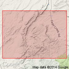
Summary:
Divided into a lower 2,300 ft thick shale sequence that has a few lenticular sandstones, the Cow Creek member (460 ft thick), shale (350 ft thick), and Espy tongue (250 ft thick). Cow Creek and Espy are newly named. Contains several different ammonites of Claggett and Eagle ages. Considered Late Cretaceous, Santonian and Campanian age. Contact with overlying Mesaverde formation placed at base of lowest prominent sandstone, named Deep Creek sandstone [but unranked] of Mesaverde formation. Directly above Deep Creek is newly named Espy tongue of Steele shale. Espy is overlain by Hatfield sandstone member (new) of Mesaverde. Report area lies in Greater Green River basin.
Source: GNU records (USGS DDS-6; Denver GNULEX).

- Usage in publication:
-
- Steele Shale*
- Modifications:
-
- Revised
- Dominant lithology:
-
- Shale
- AAPG geologic province:
-
- Green River basin
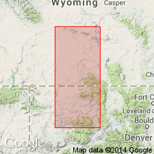
Summary:
Recognized throughout south-central and southeast WY in the Hanna and Laramie basins of Greater Green River basin, and in the western part of the Powder River basin in northeast WY. Underlies Mesaverde Group (new stratigraphic rank) in Hanna and Laramie basins; underlies Mesaverde Formation in the Powder River basin. Is a dark-gray shale with layers of gray-weathering limestone, thin beds of very fine grained sandstone and siltstone, and several persistent bentonite beds. Contact with Niobrara is gradational (gray shale of Steele with yellowish-orange-weathering calcareous shale of Niobrara). Contact with overlying Haystack Mountains Formation (new) of Mesaverde Group (new rank) placed at base of first persistent marine sandstone. Is fossiliferous (ammonites). Lower and upper contacts rise stratigraphically to east. Is Late Cretaceous in age ranging from latest Santonian to Campanian. Correlation with other units of Campanian age shown on Table 1.
Source: GNU records (USGS DDS-6; Denver GNULEX).
- Usage in publication:
-
- Steele Shale*
- Modifications:
-
- Revised
- Biostratigraphic dating
- AAPG geologic province:
-
- Green River basin
Summary:
Is of Late Cretaceous, Campanian age. Ranges from SCAPHITES HIPPOCREPIS I up to BACULITES ASPERIFORMIS zones. Recognized from Rawlins Draw, Fremont Co south to Wild Cow Creek, Carbon Co, WY in Greater Green River basin. Correlation with Mancos Shale of CO shown. Espy Tongue in upper part. Espy lies between Deep Creek Sandstone Member (revised) of Haystack Mountains Formation of Mesaverde Group, below and Hatfield Sandstone Member of Haystack Mountains, above.
Source: GNU records (USGS DDS-6; Denver GNULEX).
- Usage in publication:
-
- Steele Member*
- Modifications:
-
- Revised
- AAPG geologic province:
-
- Powder River basin
Summary:
Reduced in rank and assigned as upper member of Cody Shale (revised). Shown on stratigraphic chart of Upper Cretaceous rocks in subsurface of western part of Powder River basin, WY (fig 3). Divided into (ascending): informal Fishtooth sandstone, Shannon Sandstone Beds (revised), and Sussex Sandstone Bed (revised); each of these units is bounded by shales of the Steele. Overlies Niobrara Member of Cody; underlies Parkman Sandstone Member of Mesaverde Formation. Assigned Campanian age. [Author provides no discussion of stratigraphic reassignments.]
Source: GNU records (USGS DDS-6; Denver GNULEX).

- Usage in publication:
-
- Steele Shale*
- Modifications:
-
- Areal extent
- Overview
- AAPG geologic province:
-
- Powder River basin
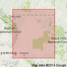
Summary:
Identified in subsurface of Converse, western Niobrara, Campbell, Sheridan, and Johnson Cos, WY and Big Horn Co, MT on western side of Powder River basin where it can be divided into (ascending): unnamed part, Shannon Sandstone Member, unnamed part, Sussex Sandstone Member, and unnamed part. Ardmore Bentonite Bed newly recognized in lower part of upper unnamed part. Overlies Niobrara Formation. Underlies Parkman Sandstone Member of Mesaverde Formation. Is equivalent to the Gammon Ferruginous and Mitten Members of Pierre Shale on east side of basin. The Ardmore extends eastward where it is assigned as a bed at or near the base of the Mitten. Late Cretaceous age. [Shown on 22 cross sections in this OC series.]
Source: GNU records (USGS DDS-6; Denver GNULEX).
- Usage in publication:
-
- Steele Member*
- Modifications:
-
- Overview
- AAPG geologic province:
-
- Powder River basin
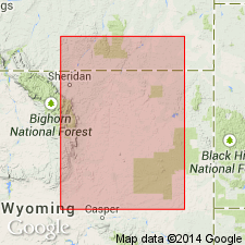
Summary:
Upper member of Cody Shale in western part of Powder River basin, WY and MT. Divided into a lower part that includes (ascending) unnamed lower part, Shannon Sandstone Bed, unnamed middle part, and Sussex Sandstone Bed and an upper part that includes Ardmore Bentonite Bed and an unnamed upper part. Lower part thins eastward from 2021 ft in Johnson Co, WY to less than 100 ft in Weston and Niobrara Cos. Lower part in southwest basin grades westward outside of basin into uppermost part of Cody and lower part of overlying Mesaverde Formation and possibly grades eastward into (ascending) uppermost part of Niobrara Formation and Gammon Member of Pierre Shale on southeast flank of basin. Upper part in outcrop thickens to south from 360 ft in Big Horn Co, MT to 940 ft in Natrona Co; in subsurface ranges from 440 ft in Sheridan Co to 785 ft in Natrona Co. Upper part grades eastward into Sharon Springs and Mitten Members of Pierre in eastern part of basin and grades northward into Claggett Member of Cody in northwest part of basin; grades into Mesaverde Formation to west of basin. Figures showing outcrop section and geophysical logs. Conformably overlies Niobrara Member of Cody; conformably underlies Parkman Sandstone Member of Mesaverde. Fossils (bivalves, ammonites, gastropods, bryozoans, foraminifers, ostracods, brachiopods, and fish remains) indicate early to early late Campanian (zones 39-48 of fig. 7) age.
Source: GNU records (USGS DDS-6; Denver GNULEX).
For more information, please contact Nancy Stamm, Geologic Names Committee Secretary.
Asterisk (*) indicates published by U.S. Geological Survey authors.
"No current usage" (†) implies that a name has been abandoned or has fallen into disuse. Former usage and, if known, replacement name given in parentheses ( ).
Slash (/) indicates name conflicts with nomenclatural guidelines (CSN, 1933; ACSN, 1961, 1970; NACSN, 1983, 2005, 2021). May be explained within brackets ([ ]).