The National Geologic Map Database is migrating to a new infrastructure. We apologize for any service disruptions during this process.
|
|---|


- Usage in publication:
-
- Snowy Range member
- Modifications:
-
- Areal extent
- AAPG geologic province:
-
- Bighorn basin
- Wind River basin
Summary:
Pg. 1093-1094, 1101 (fig. 3), 1105. Snowy Range member of Boysen formation. [Snowy Range formation of Dorf and Lochman, 1938 (abs.) and 1940; see 1940 entry] reduced to member status in Boysen formation (new) in Wind River area, Wyoming. Underlies Grove Creek member; overlies Maurice member. Thickness 308 feet in type section of Boysen. [Age is Late Cambrian (Franconia) based on trilobites.]
Source: US geologic names lexicon (USGS Bull. 1200, p. 3647-3648).
- Usage in publication:
-
- Snowy Range formation
- Modifications:
-
- Principal reference
- Dominant lithology:
-
- Shale
- Conglomerate
- Sandstone
- AAPG geologic province:
-
- Bighorn basin
- Central Montana uplift
- Montana folded belt
- Yellowstone province
Summary:
Pg. 545-547; 1938 [abs.], GSA Proc. 1937, p. 276. Snowy Range formation. Comprises: lower member of thin sandstones and gray-green fissile shales (average 75 feet thick) with, at top, a few limestone pebble conglomerates and thin persistent horizon (about 10 feet thick) of dense light-gray limestone with distinctive columnar structure; upper member of intercalated gray-green fissile shales and innumerable beds and lenses of glauconitic limestone flat pebble conglomerates (average 150 feet thick). Thickness at type locality 259 feet. Underlies Grove Creek formation (new); overlies Maurice formation (new). Franconia equivalent [Late Cambrian]. Term Gallatin formation not applicable in this area [southern Montana].
Type locality: on south slope of Castle Rock about 2 mi downstream from Snowy Range Ranch at junction of the East Fork with Mill Creek, Park Co., southern MT. Section measured in N/2 SE/4 sec. 13, T. 6 S., R. 9 E.
Source: US geologic names lexicon (USGS Bull. 1200, p. 3647-3648).
- Usage in publication:
-
- Snowy Range limestone member
- Modifications:
-
- Revised
- AAPG geologic province:
-
- Central Western Overthrust
- Green River basin
- Yellowstone province
Summary:
Pg. 145 (fig. 2). Snowy Range limestone member of Gallatin limestone. Stratigraphic chart of Gros Ventre and northern Hoback Ranges, northwestern Wyoming (in Gros Ventre and Jackson quadrangles), shows Snowy Range as upper member of Gallatin limestone. [Age is Late Cambrian.]
Source: US geologic names lexicon (USGS Bull. 1200, p. 3647-3648).
- Usage in publication:
-
- Snowy Range formation
- Modifications:
-
- Revised
- AAPG geologic province:
-
- Montana folded belt
Summary:
Pg. 2202 (fig. 1), 2212, 2214 (fig. 2). Snowy Range formation. Includes (ascending) Dry Creek shale member aud Sage pebble conglomerate member (new). In area of this report [central Montana], overlies Maurice formation and underlies Maywood formation. Thickness 15 to 130 feet. [Age is Late Cambrian.]
Source: US geologic names lexicon (USGS Bull. 1200, p. 3647-3648).
- Usage in publication:
-
- Snowy Range formation
- Modifications:
-
- Areal extent
- AAPG geologic province:
-
- Bighorn basin
- Central Montana uplift
- Montana folded belt
- Sweetgrass arch
Summary:
Pg. 19. Snowy Range formation. In part of Montana adjacent to and northeast of Yellowstone Park, strata of same age as Red Lion formation consist of interbedded greenish-gray shales and limestones and lime-pebble conglomerates. This unit has been named Snowy Range by Dorf and Lochman. [Age is Late Cambrian (Franconia).]
[Recognized in area btw. Big Snowy Mountains and Madison Range, central and southwestern MT.]
Source: US geologic names lexicon (USGS Bull. 1200, p. 3647-3648); supplemental information from GNU records (USGS DDS-6; Denver GNULEX).
- Usage in publication:
-
- Snowy Range formation
- Modifications:
-
- Areal extent
- Age modified
- AAPG geologic province:
-
- Montana folded belt
Summary:
Pg. 1388-1390 (table 1), 1397. Snowy Range formation. In Bridger Range, Gallatin County, Montana, includes (ascending): Dry Creek shale member, shale with interbedded siltstone and sandstone, 42 to 76 feet; and Sage pebble-conglomerate member, limestone and conglomerate with interbedded shale, 121 to 204 feet. Overlies Maurice formation; contact placed between massive limestone and shale. Fossils identified by A.R. Palmer indicate age ranges from early Franconian (medial Late Cambrian) to late Trempealeauan (late Late Cambrian).
Source: Publication.
- Usage in publication:
-
- Snowy Range formation
- Modifications:
-
- Revised
- AAPG geologic province:
-
- Bighorn basin
- Montana folded belt
- Wind River basin
- Yellowstone province
Summary:
Redescribed as Grove Creek limestone and pebble conglomerate member and assigned to Snowy Range formation as uppermost member (of 3). Snowy Range now divided into (ascending) Dry Creek shale, Sage pebble conglomerate, and Grove Creek limestone and pebble conglomerate members. Occurs in northwest Montana, Montana folded belt province, and northwest Wyoming, Yellowstone province, Bighorn basin, and Wind River basin. Age is Late Cambrian.
Source: GNU records (USGS DDS-6; Denver GNULEX).
- Usage in publication:
-
- Snowy Range formation*
- Modifications:
-
- Overview
- AAPG geologic province:
-
- Montana folded belt
Summary:
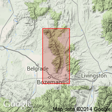
Mapped with Grove Creek formation in area of Livingston, Park Co, MT, Montana folded belt province. Is 175 ft thick in report area where it can be divided into a lower greenish-gray shale, middle flat-pebble limestone conglomerate and an upper poorly exposed greenish-gray shale and light-gray dense and crystalline limestone. Replaces use of Dry Creek shale in report area. Geologic map; columnar section; measured section. Overlies Pilgrim limestone; underlies Grove Creek formation. Late Cambrian age.
Source: GNU records (USGS DDS-6; Denver GNULEX).
- Usage in publication:
-
- Snowy Range Formation
- Modifications:
-
- Overview
- Age modified
- AAPG geologic province:
-
- Bighorn basin
- Central Montana uplift
- Montana folded belt
- Yellowstone province
Summary:
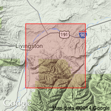
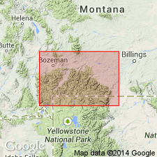
Measured at 24 locations in Horseshoe Hills and Bridger Mountains, MT and at 8 locations elsewhere in MT and WY near Yellowstone National Park within Gallatin, Park, and Carbon Cos, MT, and Park Co, WY in Montana folded belt province, Central Montana uplift, Bighorn basin, and Yellowstone province. Divided into, in ascending order: Dry Creek, Sage, and Grove Creek Members. In Horseshoe Hills, thickness ranges from 50-265 ft; in Bridger Mountains, is 140-325 ft thick; between Bridger Mountains and Yellowstone, is 60-80 ft thick; from Mill Creek eastward to Swamp Lake and North Grove Creek, thickness averages 300 ft. Western limit is in vicinity of Three Forks, MT (farther north and west changes to dark shale and reddish-purple limestone of Red Lion Formation); in Big Snowy Mountains and Little Rocky Mountains, rocks of same age belong to Zortman Member of Emerson Formation; in northern WY, extends eastward to Powder River basin (farther eastward changes to Deadwood Formation); west of Yellowstone, in MT and ID, unit not present due to pre-Late Devonian erosion. Overlies Pilgrim Formation with sharp contact; unconformably underlies Maywood or Bighorn Formations. Bighorn is overlying unit from Mill Creek eastward; Maywood is overlying unit west of Mill Creek. Petrographic descriptions; fossil lists and descriptions; cross sections showing trilobite zones. Contains faunas of Dresbachian, Franconian and Trempealeauan (Late Cambrian) age.
Source: GNU records (USGS DDS-6; Denver GNULEX).
- Usage in publication:
-
- Snowy Range Formation*
- Modifications:
-
- Revised
- AAPG geologic province:
-
- Bighorn basin
Summary:
Assigned as middle formation of Gallatin Group (rank raised). Mapped with overlying Grove Creek Formation of Gallatin. Map covers part of Beartooth Mountains in northwest WY within Bighorn basin. Unit is about 300 ft. Overlies Pilgrim Limestone of Gallatin. Late Cambrian age.
Source: GNU records (USGS DDS-6; Denver GNULEX).
- Usage in publication:
-
- Snowy Range Formation*
- Modifications:
-
- Revised
- AAPG geologic province:
-
- Bighorn basin
Summary:
Revised in that Grove Creek is assigned as member (rank reduced) in upper part of Snowy Range (no additional subdivisions of Snowy Range are made). Snowy Range is upper of two formations of Gallatin Group. Map includes part of Beartooth Mountains in northwest WY, Bighorn basin. Thickness is about 300 ft. Overlies Pilgrim Limestone of Gallatin; underlies Bighorn Dolomite. Late Cambrian age.
Source: GNU records (USGS DDS-6; Denver GNULEX).
- Usage in publication:
-
- Snowy Range Formation*
- Modifications:
-
- Reference
- AAPG geologic province:
-
- Montana folded belt
- Yellowstone province
Summary:
Mapped in northern part of Yellowstone National Park, Park Co, WY, Yellowstone province, and Park Co, MT, Montana folded belt province. Divided into Dry Creek Shale (base), Sage Limestone, and Grove Creek Limestone (top) Members. Thickness ranges from 110-200 ft. Reference section designated at Three Rivers Peak, at head of Gallatin River, in Gallatin Range. At reference, Snowy Range is 124 ft. Also occurs on Buffalo Plateau and on Meridian Peak. Stratigraphic chart. Conformably overlies Pilgrim Limestone; unconformably underlies Bighorn Dolomite. Late Cambrian age.
Source: GNU records (USGS DDS-6; Denver GNULEX).
- Usage in publication:
-
- Snowy Range(?) Formation*
- Modifications:
-
- Areal extent
- AAPG geologic province:
-
- Montana folded belt
- Snake River basin
Summary:
Mapped undivided with Bighorn(?) Dolomite and Pilgrim(?) Limestone in Henrys Lake Mountains, Gallatin County, Montana (Montana folded belt province), and Fremont County, Idaho (Snake River basin). Combined thickness of Snowy Range(?) and Pilgrim is 250 to 400 feet. Middle part of undivided unit may be correlative with Dry Creek Shale Member of Snowy Range. Age is Late Cambrian.
Source: GNU records (USGS DDS-6; Denver GNULEX).
- Usage in publication:
-
- Snowy Range Formation*
- Modifications:
-
- Areal extent
- AAPG geologic province:
-
- Bighorn basin
- Montana folded belt
- Yellowstone province
Summary:
Extended as upper of two formations of Gallatin Group into area around northeast boundary of Yellowstone National Park, Park Co, WY and Park Co, MT, Yellowstone province, Bighorn basin and Montana folded belt province. Thickness is about 300 ft. Overlies Pilgrim Limestone of Gallatin; underlies Bighorn Dolomite. Late Cambrian age.
Source: GNU records (USGS DDS-6; Denver GNULEX).
- Usage in publication:
-
- Snowy Range Formation*
- Modifications:
-
- Age modified
- AAPG geologic province:
-
- Central Montana uplift
Summary:
Upper part mapped in Big Snowy Mountains where it consists of 80-90 m of limestone and shale. Conformably overlies Dry Creek(?) Shale Member of Snowy Range with transitional contact; disconformably underlies Jefferson Formation with sharp contact. Upper part of Snowy Range with transitional contact; disconformably underlies Jefferson Formation with sharp contact. Upper part of Snowy Range in Big Snowy Mountains most closely resembles Sage Member of Snowy Range in type area, except no algal stromatolites are present in Big Snowy Mountains. Rocks here mapped as Snowy Range have been previously assigned to Middle Cambrian Meagher Limestone (Reeves, 1931, U.S.G.S. Professional Paper 165-D) and Upper Cambrian Pilgrim Limestone (Deiss, 1936, G.S.A. Bull., v. 47, p. 1257-1342). In Little Rocky Mountains, Lochman recognized Ordovician trilobites in these rocks and assigned them to Zortman Member of Emerson Formation (not used) (Lochman-Balk, 1956). At its type area, Snowy Range is entirely Late Cambrian age. In Big Snowy Mountains, Snowy range is as young as Early Ordovician age. Trilobites from top half of upper part of Snowy Range at Greathouse Peak, identified by M. E. Taylor (written commun., 1979) belong to upper part of Lower Ordovician SYMPHYSURINA Zone. Conodonts from the same strata, identified by J. E. Repetski and A. G. Harris (written commun., 1978, 1979) belong to Lower Ordovician conodont Fauna C. Upper part assigned Late Cambrian? and Early Ordovician age.
Source: GNU records (USGS DDS-6; Denver GNULEX).
For more information, please contact Nancy Stamm, Geologic Names Committee Secretary.
Asterisk (*) indicates published by U.S. Geological Survey authors.
"No current usage" (†) implies that a name has been abandoned or has fallen into disuse. Former usage and, if known, replacement name given in parentheses ( ).
Slash (/) indicates name conflicts with nomenclatural guidelines (CSN, 1933; ACSN, 1961, 1970; NACSN, 1983, 2005, 2021). May be explained within brackets ([ ]).