

- Usage in publication:
-
- Shannon sandstone lentil*
- Modifications:
-
- Named
- Dominant lithology:
-
- Sandstone
- AAPG geologic province:
-
- Wind River basin
Summary:
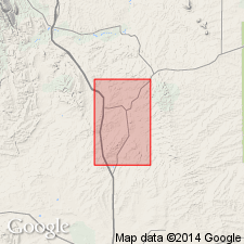
Named as lentil in the Pierre formation of the Montana group for the town of Shannon near the Shannon oil field in Ts38 to 41N, Rs78 and 79W, Natrona Co, WY in Wind River basin. No type locality designated. Lies about 1,025 ft above base of Pierre and 2,450 ft below top of Pierre. Composed of two resistant sandstone beds about 100 ft apart and intermediate mass of softer sandstone. Is about 175 ft thick and forms the rim of Salt Creek dome. Of Late Cretaceous age.
Source: GNU records (USGS DDS-6; Denver GNULEX).

- Usage in publication:
-
- Shannon Sandstone Member*
- Modifications:
-
- Revised
- AAPG geologic province:
-
- Powder River basin
Summary:
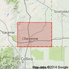
Divided into 9 units in the Powder River basin. Two of these units are formal. The Shannon Sandstone Member contains a baculite restricted to rocks of late Eagle age. The Sussex Sandstone Member has a baculite of very late Eagle age. Steele ranges in age from late Santonian to early Campanian at the base to early Campanian to late Campanian at the top. Correlation of Shannon and Sussex Members with other units in south-central WY shown on Table 1.
Source: GNU records (USGS DDS-6; Denver GNULEX).
- Usage in publication:
-
- Shannon Sandstone Member*
- Modifications:
-
- Not used
Summary:
Nomenclature applied to divisions of the Pierre Shale in exposures at Francis Ranch, secs 7-10 and 15-16, T14N, R69W and in subsurface in Apache Corp. 1 Polo Ranch, sec 14, T14N, R68W, Laramie Co, WY, Denver basin modified. Term: 1) Gammon Ferruginous Member replaces use of lower transition zone; 2) Mitten Black Shale Member replaces use of rusty zone; 3) Hygiene replaces use of the subsurface Sussex; 4) Rocky Ridge, Larimer, and Richard Sandstone Members replace use of the subsurface Parkman. Terry Sandstone Member of Pierre in the Fort Collins, CO area is equivalent to the subsurface Sussex and is not present at Francis Ranch or in the Apache Corp. well. Use of Shannon, Sussex, and Parkman is discontinued in the Denver basin because the sandstones of the Denver basin are not time-equivalents or time-transgressive facies of the Shannon, Sussex, or Parkman of the Powder River basin. As modified, divisions of Pierre are (ascending): Gammon, Sharon Springs, Mitten, Hygiene Members, unnamed interval, Rocky Ridge Sandstone Member, unnamed interval, Larimer Sandstone Member, unnamed interval, Richard Sandstone Member, unnamed interval, units A, B, C, unnamed interval. Pierre overlies Niobrara Formation and underlies Fox Hills Sandstone. Of Campanian age. Measured section; nomenclature chart.
Source: GNU records (USGS DDS-6; Denver GNULEX).
- Usage in publication:
-
- Shannon Sandstone Member*
- Modifications:
-
- Areal extent
- AAPG geologic province:
-
- Williston basin
Summary:
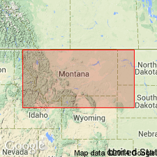
Is areally extended from WY to the subsurface of east-central MT and northwestern SD in the Williston basin as a member of the Gammon Shale (raised to rank of formation) and name Shannon is applied to sandstone equivalent to the Groat Sandstone Bed (restricted to outcrop) in the subsurface. Sandstone in the subsurface of MT and SD correlates with the type Shannon of WY and lies within the same ammonite zones. Is restricted in MT and SD to discontinuous but widespread sandstone bodies that are equivalent to and lie eastward (seaward) of more continuous sandstone beds in the Eagle Sandstone. Shannon, as thus used, was deposited in the same depositional environment as the Groat. Areal distribution of Shannon and Groat in MT and SD is shown in fig. 23. Where the term Shannon Sandstone Member is used in MT and SD, the Gammon Ferruginous Member of the Pierre Shale is raised to the rank of formation and called the Gammon Shale. Shannon remains a member of the Cody and Steele Shales in the Bighorn and Powder River basins of WY, respectively. Age is Campanian (Late Cretaceous).
Source: GNU records (USGS DDS-6; Denver GNULEX).
- Usage in publication:
-
- Shannon Sandstone Beds*
- Modifications:
-
- Revised
- Overview
- Geochronologic dating
- AAPG geologic province:
-
- Powder River basin
Summary:
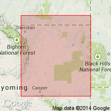
Reduced in rank and assigned to Steele Member (revised) of Cody Shale (revised). Shannon Beds form linear north-south trending sandstone ridges in west-central part of Powder River basin. Shannon crops out around Salt Creek anticline in southwestern part of basin where it consists of two stacked sand ridges; also outcrops at a few localitites in Johnson Co, north of Salt Creek area. In subsurface, Shannon sand bodies are encased in shale which provides a seal for stratigraphic traps from which oil is produced at several oil fields including Heldt Draw, Hartzog Draw, and Teapot Dome. Equivalent to Groat Sandstone Bed of Gammon Ferruginous Member of Pierre Shale in eastern part of basin. Thickness of Shannon reservoirs are 2-20 m. Stratigraphic chart; core descriptions; petrographic data. Underlying the shale below Shannon is informal Fishtooth sandstone; overlying the shale above Shannon is Sussex Sandstone Bed (revised) of Steele. Assigned early Campanian age based on K-Ar date of 81 Ma on associated bentonite beds (J. D. Obradovich, U.S.G.S., oral commun., 1989). [Author provides no discussion of stratigraphic reassignments.]
Source: GNU records (USGS DDS-6; Denver GNULEX).

- Usage in publication:
-
- Shannon Sandstone Member*, Bed*
- Modifications:
-
- Areal extent
- Revised
- AAPG geologic province:
-
- Powder River basin
Summary:
Pierre Shale identified in subsurface of eastern Powder River basin in WY in Niobrara, Weston, eastern Campbell, and Crook Cos, and in MT in Powder River and eastern Big Horn Cos. Pierre divided (ascending) into Gammon Ferruginous, Mitten and Red Bird Silty Members, and an unnamed upper part. Pierre overlies Niobrara Formation and underlies Fox Hills Sandstone. To west, name Pierre replaced by (ascending) Steele Shale (and its Ardmore Bentonite-newly assigned--in lower part, Sussex and Shannon Sandstone Members which are separated by, overlain and underlain by unnamed parts of Steele), Mesaverde Formation (and its Parkman Sandstone Member, at base, unnamed middle part, Teapot Sandstone Member at top), and Lewis Shale (and its unnamed upper and lower parts separated by Teckla Sandstone Member). Sussex and Shannon Members of Steele continue eastward under basin, and they become (new assignment) Sussex and Shannon Sandstone Beds of Gammon Member. Ardmore also continues eastward where it becomes (new assignment) a bed at or near base of Mitten. Red Bird is equivalent to Parkman, basal member of Mesaverde to west. Of Late Cretaceous age. [This nomenclature shown on 22 cross sections in this OC series.]
Source: GNU records (USGS DDS-6; Denver GNULEX).
For more information, please contact Nancy Stamm, Geologic Names Committee Secretary.
Asterisk (*) indicates published by U.S. Geological Survey authors.
"No current usage" (†) implies that a name has been abandoned or has fallen into disuse. Former usage and, if known, replacement name given in parentheses ( ).
Slash (/) indicates name conflicts with nomenclatural guidelines (CSN, 1933; ACSN, 1961, 1970; NACSN, 1983, 2005, 2021). May be explained within brackets ([ ]).