

- Usage in publication:
-
- Scherrer formation*
- Modifications:
-
- Named
- Dominant lithology:
-
- Limestone
- Sandstone
- AAPG geologic province:
-
- Pedregosa basin
Summary:
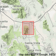
Named as a formation of Naco group (raised in rank). Type section measured on Scherrer Ridge and Concha Ridge, Gunnison Hills, Cochise Co, AZ in SW1/4 NW1/4 sec 28, T15S, R23E, in the Pedregosa basin. Consists of (ascending): red, thin-bedded siltstone; fine-grained, gray limestone; white to rusty-brown, fine-grained, cross-bedded, limy, cemented sandstone containing a few beds of limestone in the lower part; gray limestone; and brown, fine-grained sandstone. Overlies Colina limestone (new); overlain by Concha limestone (new) at type. Is 687 ft thick at type. Is of Permian age. Contains abundant echinoid spines. Stratigraphic sections; measured sections.
Source: GNU records (USGS DDS-6; Denver GNULEX).
- Usage in publication:
-
- Scherrer formation
- Modifications:
-
- Areal extent
- AAPG geologic province:
-
- Pedregosa basin
Summary:
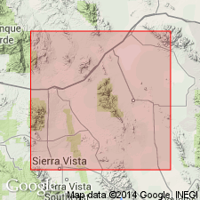
Scherrer formation of Naco group. Present in the Chiricahua Mountains, Cochise County, southeastern Arizona. Overlies Colina limestone and underlies Concha limestone, both of Naco group. Correlated with Coconino sandstone. Nonfossiliferous. Age is Permian (Leonard), based on stratigraphic position.
Measured sections: (1) in SW/4 sec. 14, T. 15 S., R. 30 E., about 150 ft; (2) in NW/4 sec. 27, T. 15 S., R. 30 E., 100+ ft; and (3) in SW/4 sec. 18, T. 16 S., R. 30 E., 100+ ft.
Source: Modified from GNU records (USGS DDS-6; Denver GNULEX).
- Usage in publication:
-
- Scherrer formation
- Modifications:
-
- Areal extent
- AAPG geologic province:
-
- Pedregosa basin
Summary:
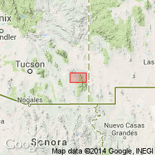
Extended to central Peloncillo Mountains, Hidalgo Co, NM in Pedregosa basin. Geologic map included. Overlies Colina limestone and overlain by Chiricahua limestone, both of Naco group. No fossils found but position between Permian bed fixes age as Permian.
Source: GNU records (USGS DDS-6; Denver GNULEX).

- Usage in publication:
-
- Scherrer formation*
- Modifications:
-
- Overview
- Dominant lithology:
-
- Limestone
- Siltstone
- Sandstone
- AAPG geologic province:
-
- Pedregosa basin
Summary:
Measurement and description of Scherrer at its type section [measured by author?] along crest of Concha Ridge in SW1/4 NW1/4 sec 28 and 29, T15S, R23E on east side of quad. Composed of limestone that may be tan, white, or gray, fine- to medium-grained, has irregular chert nodules, and sandstone that is white to brown, fine-grained, quartzitic, locally cross-bedded, and siltstone, red to pink. Is 687 ft thick at type where it overlies Colina limestone and underlies Concha limestone. Assigned an Early Permian age in report area, Pedregosa basin. Echinoid plates and spines identified. Geologic map.
Source: GNU records (USGS DDS-6; Denver GNULEX).
- Usage in publication:
-
- Scherrer Formation
- Modifications:
-
- Areal extent
- Overview
- AAPG geologic province:
-
- Pedregosa basin
Summary:
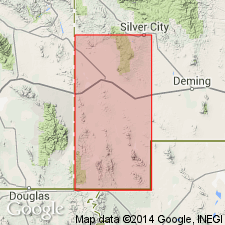
Extended without query as a formation of Naco Group to Big Hatchet Mountains, NM (see Zeller, 1958), Pedregosa basin. Not thick enough (5-20 ft in area) to be properly classed as a formation but is called a formation, nevertheless. Section 14 ft thick measured in SW1/4 sec 6, T32S, R14W where it overlies Epitaph Dolomite concordantly and underlies Concha Limestone conformably. May correlate with the Coconino and the Glorieta Sandstones. Is of Permian (Leonard) age.
Source: GNU records (USGS DDS-6; Denver GNULEX).
- Usage in publication:
-
- Scherrer Formation*
- Modifications:
-
- Areal extent
- Overview
- AAPG geologic province:
-
- Basin-and-Range province
- Pedregosa basin
Summary:
Used in Whetstone Mountains, AZ in the Pedregosa basin and Basin-and-Range province. Overlies Epitaph Formation and overlain by Concha Limestone, both of Naco Group. Measured sections in SE1/4 sec 14, T18S, R18E, Pima Co, 722 ft thick, and in sec 27, T19S, R19E, Cochise Co, 560 ft thick described. Is of Early Permian age.
Source: GNU records (USGS DDS-6; Denver GNULEX).
- Usage in publication:
-
- Scherrer Formation*
- Modifications:
-
- Areal extent
- AAPG geologic province:
-
- Pedregosa basin
- Basin-and-Range province
Summary:
Extended as a formation of Naco Group in the Huachuca Mountains, Cochise Co, AZ in the Pedregosa basin and in the Mustang Mountains, Santa Cruz Co, in the Basin-and-Range province. Locally lumped with underlying Epitaph Dolomite for mapping in Huachuca Mountains. Overlain by Concha Limestone. Is of Early Permian age.
Source: GNU records (USGS DDS-6; Denver GNULEX).
- Usage in publication:
-
- Scherrer Formation
- Modifications:
-
- Overview
- AAPG geologic province:
-
- Pedregosa basin
- Basin-and-Range province
Summary:
Was deposited in a high intertidal littoral environment. Is in the Pedregosa basin and Basin-and-Range province. Is of Permian (early to middle Leonardian) age.
Source: GNU records (USGS DDS-6; Denver GNULEX).
- Usage in publication:
-
- Scherrer Formation*
- Modifications:
-
- Areal extent
- AAPG geologic province:
-
- Basin-and-Range province
Summary:
Extended to Santa Rita Mountains, Pima Co, AZ in Basin-and-Range province. Is of Early Permian age.
Source: GNU records (USGS DDS-6; Denver GNULEX).
- Usage in publication:
-
- Scherrer Formation
- Modifications:
-
- Overview
- AAPG geologic province:
-
- Pedregosa basin
Summary:
Type section is re-examined with new methods of study and better exposures due to very recent erosion. Basal red bed member is probably of deltaic origin. Sandstone members could have been beach or dune sands reworked by shallow marine waters or may have been shallow marine sands subjected to wind and wave action on or near a beach. Middle carbonate member represents a transgression of the sea. Is in the Pedregosa basin. Is of Permian age.
Source: GNU records (USGS DDS-6; Denver GNULEX).
- Usage in publication:
-
- Scherrer Formation*
- Modifications:
-
- Areal extent
- AAPG geologic province:
-
- Basin-and-Range province
Summary:
Extended as a formation of Naco Group to Sierrita Mountains, Pima Co, AZ in the Basin-and-Range province. Is of Early Permian age.
Source: GNU records (USGS DDS-6; Denver GNULEX).
- Usage in publication:
-
- Scherrer Formation*
- Modifications:
-
- Areal extent
- AAPG geologic province:
-
- Basin-and-Range province
Summary:
Extended as a formation of Naco Group to Patagonia Mountains, Santa Cruz Co, AZ in Basin-and-Range province. Overlies Epitaph Dolomite and overlain by Concha Limestone, both of Naco Group. Is of Early Permian age.
Source: GNU records (USGS DDS-6; Denver GNULEX).
- Usage in publication:
-
- Scherrer Formation*
- Modifications:
-
- Areal extent
- AAPG geologic province:
-
- Pedregosa basin
Summary:
Extended as a formation of Naco Group to Rincon Mountains, Cochise Co, AZ in Pedregosa basin. Is of Early Permian age.
Source: GNU records (USGS DDS-6; Denver GNULEX).
- Usage in publication:
-
- Scherrer Formation*
- Modifications:
-
- Areal extent
- AAPG geologic province:
-
- Pedregosa basin
Summary:
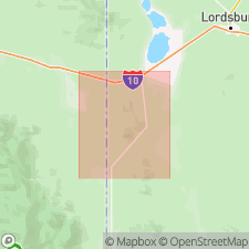
Mapped as formation of Naco Group in central Peloncillo Mountains, Hidalgo Co, NM in the Pedregosa basin. Overlies Colina Limestone of Naco Group. Underlies Concha Limestone of Naco Group. Is 30-35 m thick. Is Early Permian age; [apparently following previous work].
Source: GNU records (USGS DDS-6; Denver GNULEX).
- Usage in publication:
-
- Scherrer Formation*
- Modifications:
-
- Mapped 1:24k
- Dominant lithology:
-
- Sandstone
- AAPG geologic province:
-
- Pedregosa basin
Summary:
Scherrer Formation, top formation of Naco Group. Very light-gray to pale-pinkish-gray, fine-grained, massive, quartzitic sandstone. Thickness about 150 m (partial; top is faulted). Correlation uncertain. Age is Early Permian.
Source: Publication.

- Usage in publication:
-
- Scherrer Formation*
- Modifications:
-
- Mapped 1:24k
- Dominant lithology:
-
- Sandstone
- Dolomite
- AAPG geologic province:
-
- Pedregosa basin
Summary:
Scherrer Formation. Mapped in Big Hatchet Mountains, Hidalgo County, southwestern New Mexico. Very pale yellowish gray to nearly white quartz sandstone with some interbedded dolomite. Thickness mostly 3 to 20 feet (1 to 6 m); locally may be absent due to pre-Concha erosion. Gradational contact with underlying Epitaph Dolomite (Lower Permian); probably disconformably underlies Concha Limestone (Lower Permian). Age is Early Permian.
Source: Publication.
For more information, please contact Nancy Stamm, Geologic Names Committee Secretary.
Asterisk (*) indicates published by U.S. Geological Survey authors.
"No current usage" (†) implies that a name has been abandoned or has fallen into disuse. Former usage and, if known, replacement name given in parentheses ( ).
Slash (/) indicates name conflicts with nomenclatural guidelines (CSN, 1933; ACSN, 1961, 1970; NACSN, 1983, 2005, 2021). May be explained within brackets ([ ]).