

- Usage in publication:
-
- Sapinero Mesa Tuff*
- Modifications:
-
- Named
- Dominant lithology:
-
- Tuff
- AAPG geologic province:
-
- Piceance basin
- Paradox basin
Summary:
Named for Sapinero Mesa in Sapinero quad, Gunnison Co, CO in Piceance basin. Type locality is at Tenmile Spring in Cebolla quad to the east. Mapped west into Montrose Co in Paradox basin at west end of Black Mesa. Called by Larsen and Cross (1958) part of the lower member of Alboroto Rhyolite of Potosi Volcanic Series. Is a persistent widespread welded tuff. Has a black vitrophyre near the base that is in turn underlain in many places by 10 ft of gravel. Was deposited on an irregular surface. Is 80 to 140 ft thick. Overlies Dillon Mesa Tuff (new unit); underlies Fish Canyon Tuff (new unit). Assigned to late Oligocene.
Source: GNU records (USGS DDS-6; Denver GNULEX).
- Usage in publication:
-
- Sapinero Mesa Tuff*
- Modifications:
-
- Revised
- AAPG geologic province:
-
- San Juan Mountains province
Summary:
Definition revised to include in the Lake City area, Hinsdale Co, in the San Juan Mountain province an intracaldera unit formerly called Eureka Tuff of Silverton Volcanic Group. Eureka is reduced in rank and assigned to Sapinero Mesa as its Eureka Member. Occurs as erosional remnants over at least 15,000 sq km. Had an original volume of 1,000 cubic km. Averages 50 m thick. Has a maximum thickness of 100 km. Its Eureka is at least 700 m thick, perhaps due to concurrent subsidence and eruption. Derived from San Juan and Uncompahgre calderas. Has reverse magnetic polarity. Assigned to the Oligocene.
Source: GNU records (USGS DDS-6; Denver GNULEX).
- Usage in publication:
-
- Sapinero Mesa Tuff*
- Modifications:
-
- Revised
- AAPG geologic province:
-
- San Juan Mountains province
Summary:
Revised in that Picayune Megabreccia Member (rank reduced) assigned to lower part. Picayune redescribed as chaotic megabreccia intricately intermixed with variable amounts of ash-flow matrix indistinguishable from overlying Eureka Member of Sapinero Mesa with which it interfingers. Picayune occurs deep within San Juan caldera. San Juan and Uncompahgre calderas collapsed about 28 m.y. ago as a result of eruption of Sapinero Mesa. Figure 7 shows occurrence of Picayune Megabreccia and Eureka Members on northeast side of San Juan caldera; fig 10 shows their occurrence within Uncompahgre caldera; both within San Juan volcanic field, southwest CO, San Juan Mountain province. Approximately same age as Dillon Mesa Tuff; slightly older than Fish Canyon Tuff.
Source: GNU records (USGS DDS-6; Denver GNULEX).
- Usage in publication:
-
- Sapinero Mesa Tuff*
- Modifications:
-
- Areal extent
- Overview
- AAPG geologic province:
-
- Piceance basin
- San Luis basin
- San Juan Mountains province
Summary:
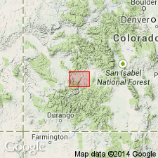
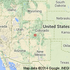
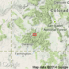
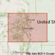
Sapinero Mesa Tuff. Areal extent of Sapinero Mesa in southwestern Colorado shown on distribution map; present in Mineral, Hinsdale, San Juan, and Ouray Counties (San Juan Mountain province), Gunnison County (Piceance basin), and Saguache County (San Luis basin). Western flank of pile removed by erosion. Is primarily rhyolite in composition. Related to Uncompahgre and San Juan calderas. Had an estimated volume of more than 1,000 cubic km. Age is more than 27.8 m.y. and less than 28.4 m.y.
Source: Modified from GNU records (USGS DDS-6; Denver GNULEX).
For more information, please contact Nancy Stamm, Geologic Names Committee Secretary.
Asterisk (*) indicates published by U.S. Geological Survey authors.
"No current usage" (†) implies that a name has been abandoned or has fallen into disuse. Former usage and, if known, replacement name given in parentheses ( ).
Slash (/) indicates name conflicts with nomenclatural guidelines (CSN, 1933; ACSN, 1961, 1970; NACSN, 1983, 2005, 2021). May be explained within brackets ([ ]).