- Usage in publication:
-
- Rockcastle conglomerate lentil*
- Modifications:
-
- Original reference
- Dominant lithology:
-
- Conglomerate
- AAPG geologic province:
-
- Appalachian basin
Summary:
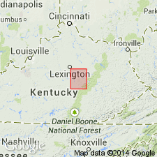
Pg. 3. Rockcastle conglomerate lentil of Lee formation. Coarse conglomerate, 0 to 175 feet thick, forming basal member of Lee formation in Richmond quadrangle, east-central Kentucky. Underlain unconformably by Pennington shale (Mississippian). [Age is Pennsylvanian.]
Source: US geologic names lexicon (USGS Bull. 896, p. 1826-1827).

- Usage in publication:
-
- Rockcastle sandstone*
- Rockcastle conglomerate member*
- Modifications:
-
- Overview
- AAPG geologic province:
-
- Appalachian basin
Summary:
Rockcastle sandstone adopted by the USGS for topmost formation of Lee group in central Tennessee, where it consists of 200 to 300 feet of coarse quartzite or conglomeratic sandstone, underlain by five formations, aggregating 840 feet, belonging to Lee group. In some parts of eastern Kentucky this sandstone represents all of Lee group that is present; in other places the Rockcastle conglomerate member is top member of Lee formation. Age is Pennsylvanian.
Named from exposures along Rockcastle River, [Rockcastle and Laurel Cos.], east-central KY.
Has also been called "Rockcastle series." (A.M. Miller, 1910, Kentucky Geol. Survey Bull., no. 12.)
Source: US geologic names lexicon (USGS Bull. 896, p. 1826-1827).
- Usage in publication:
-
- Rockcastle sandstone*
- Modifications:
-
- Areal extent
- AAPG geologic province:
-
- Appalachian basin
Summary:
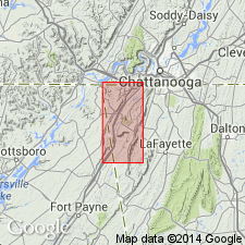
[Rockcastle sandstone.] Geographically extended into northern Georgia where it is exposed on Lookout Mountain and overlies Vendever shale. [Age is Early Pennsylvanian.]
Source: US geologic names lexicon (USGS Bull. 1200, p. 3305-3306).
- Usage in publication:
-
- Rockcastle conglomerate*
- Modifications:
-
- Revised
- Redescribed
- AAPG geologic province:
-
- Appalachian basin
Summary:
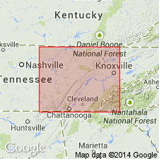
Pg. 4, 19, pls. 2, 3, 4, 12-A. Rockcastle conglomerate of Crab Orchard Mountains group. Youngest unit in Crab Orchard Mountains group (new). Term conglomerate considered more appropriate than sandstone in this area. In type area (as used in this report), conglomerate is 160 feet thick; maximum thickness 300 feet; in general, greatest thickness is along Eastern Escarpment; thins progressively southward. Along Piney River in Rhea County, the massive conglomeratic sandstone splits eastward to form a sequence of thin sandstones and shales. Contains Nemo coal. Overlies Vandever formation; underlies Dorton shale (new). Age is Early Pennsylvanian (Pottsville).
[Type locality: Rockcastle Cove, near Jamestown, Fentress Co., northern TN.]
Source: US geologic names lexicon (USGS Bull. 1200, p. 3305-3306).
- Usage in publication:
-
- Rockcastle Conglomerate
- Modifications:
-
- Mapped
- AAPG geologic province:
-
- Appalachian basin
Summary:
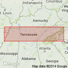
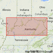
(East-central sheet.) Rockcastle Conglomerate of Crab Orchard Mountains Group. Gray to brown, fine- to coarse-grained, conglomeratic sandstone and sandstone. Thin coal-bearing shale locally present near middle. Thickness 150 to 220 feet. Top formation of Crab Orchard Mountains Group. Lies below Dorton Shale of Crooked Fork Group and above Vandever Formation of Crab Orchard Mountains Group. Age is Pennsylvanian.
Source: Publication.
- Usage in publication:
-
- Rockcastle Sandstone Member
- Modifications:
-
- Revised
- AAPG geologic province:
-
- Appalachian basin
Summary:
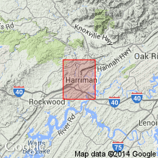
The Rockcastle Sandstone and the Livingston Conglomerate, as mapped in KY, are here designated formal members of the Bee Rock Sandstone. The Bee Rock is raised in rank and assigned to the Breathitt Group. The Lee Formation is "dropped" from usage. The Rockcastle of TN in most places is equivalent to both the Rockcastle and an overlying unnamed sandstone member in KY. Author suggests in order to avoid confusion, that when name is used, the unit be identified as either the "Rockcastle of Kentucky" or the "Rockcastle of Tennessee."
Source: GNU records (USGS DDS-6; Reston GNULEX).
- Usage in publication:
-
- Rockcastle Conglomerate
- Modifications:
-
- Overview
- AAPG geologic province:
-
- Appalachian basin
Summary:
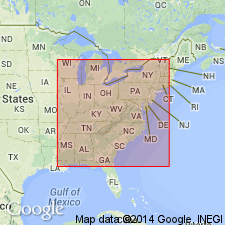
Rockcastle Conglomerate of Crab Orchard Mountains Group mapped in Roane and Morgan Cos., eastern TN. Consists of light-gray, fine- to medium-grained, medium- to thick-bedded, generally cross-bedded, locally conglomeratic sandstone, which predominates in the lower part. Unit is locally interbedded with partings and thin beds of medium dark-gray shale. Upper part in western part of quad. is silty, dark-gray shale interbedded with medium light-gray, very fine to fine-grained sandstone. Top of formation marked by persistent thin bed of sandstone and/or seat earth seen only in core logs. To the east, upper shale facies is replaced by sandstone similar to unit at base of formation to west. Persistent Nemo coal near base of upper shale unit. Interval between Rex coal in the Dorton Shale and Nemo coal consistently 140+/5 ft throughout quad. Thickness of Rockcastle, however, ranges from 160 to 290 ft in the study area. Overlies Vandever Formation of Crab Orchard Mountains and underlies Dorton Shale of Crooked Fork Group. Age is Early Pennsylvanian.
Source: GNU records (USGS DDS-6; Reston GNULEX).
- Usage in publication:
-
- Rockcastle Conglomerate*
- Rockcastle Sandstone*
- Rockcastle Member*
- Rockcastle Tongue*
- Modifications:
-
- Revised
- AAPG geologic province:
-
- Appalachian basin
Summary:
In KY, used as Rockcastle Member or Rockcastle Tongue of Lee Formation. Best exposed at Cumberland Falls, Whitley Co., KY. In TN, used as Rockcastle Conglomerate or Sandstone, top formation of Crab Orchard Mountains Group and is applied to Lower Pennsylvanian conglomerate capping broad areas of Cumberland Plateau, mainly in Cumberland, Fentress, Overton, and Putnam Cos. Rockcastle Conglomerate in TN is typically exposed at Rockcastle Cove southwest of Jamestown, Fentress Co. Probably includes shale and siltstone previously assigned to Duskin Creek Formation (abandoned herein).
Source: GNU records (USGS DDS-6; Reston GNULEX).
For more information, please contact Nancy Stamm, Geologic Names Committee Secretary.
Asterisk (*) indicates published by U.S. Geological Survey authors.
"No current usage" (†) implies that a name has been abandoned or has fallen into disuse. Former usage and, if known, replacement name given in parentheses ( ).
Slash (/) indicates name conflicts with nomenclatural guidelines (CSN, 1933; ACSN, 1961, 1970; NACSN, 1983, 2005, 2021). May be explained within brackets ([ ]).

