


- Usage in publication:
-
- Renault formation*
- Modifications:
-
- Named
- Dominant lithology:
-
- Sandstone
- Shale
- Limestone
- AAPG geologic province:
-
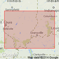
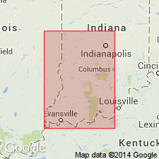
- Illinois basin
Summary:
Named Renault formation. Consists of a complex sequence of strata that changes rapidly horizontally and vertically. Includes sandstones, arenaceous shales, variegated green, blue, and purple shales, calcareous shales some with thin platy limestone layers, dense cross-bedded arenaceous limestones, nearly pure crystalline limestones, and oolitic limestones. Maximum thickness is 80 to 100 ft. Unconformably overlies Brewerville sandstone (abandoned by USGS, 1915, now designated Aux Vases Sandstone); probably unconformably underlies Yankee formation.
Source: GNU records (USGS DDS-6; Reston GNULEX).

- Usage in publication:
-
- Renault formation
- Modifications:
-
- Overview
- AAPG geologic province:
-
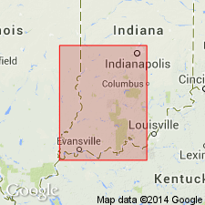
- Illinois basin
Summary:
Includes a variety of rock types, not well exposed. Basal conglomerate consisting of limestone, chert, and sandstone fragments, is overlain with sandstone, shale, and sandy limestone. Upper part is a thin bluish-gray to light gray or green fissile shale. Thickness varies from 46 to 90 ft in and near the Mississippi River bluffs from the Aux Vases River in Ste. Genevieve Co. to a few mi south of the Perry Co. line. Plant fragments of Lepidodendron commonly are present in the lower sandy beds. The crinoid Talarocrinus and the bryozoan Lyropora are widespread marker fossils. Overlies Aux Vases formation; underlies Yankeetown formation.
Source: GNU records (USGS DDS-6; Reston GNULEX).
- Usage in publication:
-
- Renault Limestone
- Modifications:
-
- Overview
- Reference
- AAPG geologic province:
-
- Illinois basin
Summary:
Designated Renault Limestone; includes limestone, shale, sandstone. Divided ascending into Levias Limestone Member (Meramecian) and Shetlerville Limestone Member (Chesterian). Levias is a relatively pure light-colored limestone, contains dark lithographic limestone and white or pink spherical oolites. Upper brecciated part (few inches to ft) of Levias forms Bryantsville Brecciated Bed. Overlying Shetlerville is pure limestone; a basal sandy or silty zone (few inches to ft) is here named Popcorn Sandstone Bed. In eastern Illinois thickness of Renault varies from 10 to 15 ft in the north and 30 to 40 ft in the south. In western IL Levias generally can't be recognized and thickness of Shetlerville ranges from 0 to 80 ft and includes 3 or 4 alternating sandstone and limestone units. Renault overlies Aux Vases Sandstone; underlies Yankeetown Sandstone. Typical exposure, later accepted as the type section, is the lowest gully on the south side of Dry Fork, SE1/4, SW1/4, sec 23, T4S, R9W, Renault quad, Monroe Co, IL.
Source: GNU records (USGS DDS-6; Reston GNULEX).
- Usage in publication:
-
- Renault Limestone*
- Modifications:
-
- Overview
- AAPG geologic province:
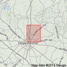
-
- Illinois basin
Summary:
Renault Limestone, the base of the Chesterian, used in the Hopkinsville area, Christian Co. Consists of 90 to 100 ft of limestone, light to dark gray sublithographic to medium grained, thick bedded, oolitic in places, black nodular chert and calcite and fluorite filled geodes near the base. Greenish gray calcareous shale, 5 to 10 ft thick, is about 30 ft from the top but is rarely exposed. Overlies Ste. Genevieve Limestone; underlies Bethel Limestone.
Source: GNU records (USGS DDS-6; Reston GNULEX).
- Usage in publication:
-
- Renault Formation*
- Modifications:
-
- Overview
- AAPG geologic province:
-
- Illinois basin
Summary:
Renault Formation, base of Chesterian, divided into three parts ascending: Lower part is limestone, medium to light gray, finely crystalline, includes a basal part that is a conglomerate consisting of limestone clasts in a sandy or silty matrix, 10 to 20 ft thick; middle part is shale and limestone, shale is pale olive, calcareous, very fossiliferous, limestone is medium to light gray, argillaceous, 20 to 30 ft thick; upper part is limestone and shale, limestone is light to medium gray, finely to medium crystalline, partly oolitic, minor interbedded shale is pale olive, calcareous, fossiliferous, 30 to 40 ft thick. Overlies Levias Limestone Member of Ste. Genevieve Limestone; underlies Bethel Sandstone.
Source: GNU records (USGS DDS-6; Reston GNULEX).

- Usage in publication:
-
- Renault Limestone
- Modifications:
-
- Overview
- AAPG geologic province:
-
- Illinois basin
Summary:
Current (1975) usage of the Illinois State Geological Survey is Renault Limestone of the Cedar Bluff Group in southern IL. Divided into ascending the Meramecian Levias Limestone Member and Chesterian Shetlerville Limestone Member that includes the persistent sandstone bed, Popcorn Sandstone Bed, at its base. Levias is a relatively pure cross bedded, medium to coarse grained, oolitic limestone, 10 to 25 ft thick in Hardin Co. Contains Platycrinites penicillus. The Shetlerville is dark greenish gray, sandy oolitic limestone, l5 ft thick. Contains the crinoid Talarocrinus. Renault is widespread and stands out as a high resistive unit in elective logs. Overlies Aux Vases Sandstone; underlies Yankeetown Sandstone.
Source: GNU records (USGS DDS-6; Reston GNULEX).

- Usage in publication:
-
- Renault Formation
- Modifications:
-
- Overview
- AAPG geologic province:
-
- Illinois basin
Summary:
Current (l986) usage of Indiana Geological Survey is Renault Formation of Meramecian and Chesterian age at the top of the Blue River Group. Recognized only in the subsurface. In places is divided into three parts; lower part is tan to gray-tan, medium grained limestone and light tan crystalline to oolitic limestone, middle part is a green calcareous shale that contains quartz sand and limestone lenses, upper part is tan fine to medium grained limestone. Thickness is a few feet to more than 90 ft. Widely recognized in the petroleum producing part of southwestern Indiana. Overlies Aux Vases Formation; underlies Bethel Formation. Is equivalent to the Levias Member at the top of the Ste. Genevieve Limestone and overlying Paoli Limestone of outcrop usage.
Source: GNU records (USGS DDS-6; Reston GNULEX).
- Usage in publication:
-
- Renault Formation
- Modifications:
-
- Reference
- AAPG geologic province:
-
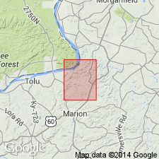
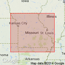
- Ozark uplift
Summary:
Current (1986) usage of the Missouri Geological Survey is Chesterian Renault Formation in southeastern MO. Excellent overview and history of nomenclature in MO; quotes from other references (Swann, 1963; Spreng,1961). Overlies Meramecian Aux Vases Sandstone; underlies Chesterian Yankeetown Sandstone or Paint Creek Formation where Yankeetown is absent. Reference section in southeastern MO is designated in a small valley that extends southwest from the bank of the Mississippi River about 3/4 mi southeast of Red Rock Landing, NW1/4NE1/4 sec. 13, T35N, R12E, Crosstown 7.5-min quad, Perry County.
Source: GNU records (USGS DDS-6; Reston GNULEX).
- Usage in publication:
-
- Renault Member
- Modifications:
-
- Revised
- Overview
- AAPG geologic province:
-
- Illinois basin
Summary:
Blue River Group of IN revised in this report. Supersedes State nomenclature established by Shaver and others (1986). Both in the subsurface and in outcrop, Blue River divided into (ascending) St. Louis, Ste. Genevieve, and Paoli Limestones. Aux Vases and Renault, previously regarded as formations in the subsurface, now treated as members of Paoli Limestone, both in the subsurface and in outcrop, replacing Popcorn and Shetlerville Members, which are here abandoned in Indiana. Renault ranges in thickness from less than 10 ft in the north to a maximum of 26 ft in Posey Co.
Source: GNU records (USGS DDS-6; Reston GNULEX).
- Usage in publication:
-
- Renault Member*
- Modifications:
-
- Overview
- AAPG geologic province:
-
- Illinois basin
Summary:
Used as Mississippian (Chesterian) Renault Member of Paoli Limestone in IN. Authors follow usage of Droste and Carpenter (1990).
Source: GNU records (USGS DDS-6; Reston GNULEX).

- Usage in publication:
-
- Renault Limestone*
- Modifications:
-
- Overview
- AAPG geologic province:
-
- Illinois basin
Summary:
Upper Mississippian (Meramecian and Chesterian) Renault Limestone is mapped undivided with Yankeetown Sandstone and Aux Vases Sandstone. Includes Levias Member. Mapped only in IL in this quadrangle.
Source: GNU records (USGS DDS-6; Reston GNULEX).
For more information, please contact Nancy Stamm, Geologic Names Committee Secretary.
Asterisk (*) indicates published by U.S. Geological Survey authors.
"No current usage" (†) implies that a name has been abandoned or has fallen into disuse. Former usage and, if known, replacement name given in parentheses ( ).
Slash (/) indicates name conflicts with nomenclatural guidelines (CSN, 1933; ACSN, 1961, 1970; NACSN, 1983, 2005, 2021). May be explained within brackets ([ ]).