

- Usage in publication:
-
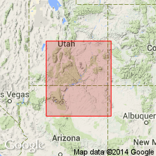
- Recapture shale member*
- Modifications:
-
- Named
- Dominant lithology:
-
- Shale
- Sandstone
- AAPG geologic province:
-
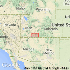
- Paradox basin
Summary:
Name derived from Recapture Creek in Ts 39 to 36S, Rs 22 and 23E, San Juan Co., UT in the Paradox basin. Is well-exposed near mouth of creek in T39S, R22E. Is a member of the Morrison formation that lies between the Bluff sandstone member (below) and the Westwater Canyon sandstone member (above). Is composed of dark red, variegated (pink, brown-ash, and gray) shale, and white quartz cemented by lime sandstone. Some of the shale beds are calcareous slabby. Has imbricated gypsiferous beds. Is 100 to 300 ft thick. Is of Late Jurassic age.
Source: GNU records (USGS DDS-6; Denver GNULEX).
- Usage in publication:
-
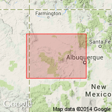
- Recapture member*
- Modifications:
-
- Areal extent
- AAPG geologic province:
-
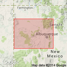
- San Juan basin
Summary:
Pg. 313-314, 315 (fig. 60), 322, 325, 327, 328-329, 330-331, 33-334. Recapture member of Morrison formation. In Gallup-Albuquerque area, northwestern New Mexico, member ranges from about 20 to as much as 276 feet in thickness, in general thinning southward. Consists largely of grayish-red sandy claystone and clayey sandstone with limy nodules and white clean fine- to medium-grained sandstone in alternating units 5 to 10 feet thick; the clean sandstone beds are most common in western part of area and probably represent tongues of Cow Springs sandstone. Clayey sandstone is dominant rock in eastern and southern parts of area. In most of area, conformable with underlying Bluff sandstone; to the north near Ysidro, rests directly on Summerville formation. Overlain by Westwater Canyon member. [Age is Late Jurassic.]
Source: US geologic names lexicon (USGS Bull. 1200, p. 3212-3213).
- Usage in publication:
-
- Recapture Member*
- Modifications:
-
- Overview
- AAPG geologic province:
-
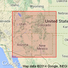
- Black Mesa basin
Summary:
Some problems have been in recognizing Recapture as a distinguishable unit from other members of the Morrison Formation. May be distinguishable in Black Mesa basin, AZ from Salt Wash Member of Morrison by its abundant (up to 19% at Black Mesa) feldspar and by presence of pink potassium feldspar granules and pebbles as much as an in long. Is distinguishable from Westwater Canyon Member of Morrison by scarcity of volcanic clasts and by its light gray color. Of Late Jurassic age.
Source: GNU records (USGS DDS-6; Denver GNULEX).
- Usage in publication:
-
- Recapture Member*
- Modifications:
-
- Revised
- AAPG geologic province:
-
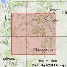
- San Juan basin
Summary:
Is a member of the Upper Jurassic Morrison Formation that overlies Horse Mesa Member (new name) of Wanakah Formation in Toadlena area, San Juan Co, NM in the San Juan basin. The Recapture-Horse Mesa contact is sharp and erosional. From Todilto Park south it overlies the Cow Springs Sandstone.
Source: GNU records (USGS DDS-6; Denver GNULEX).
- Usage in publication:
-
- Recapture Member*
- Modifications:
-
- Revised
- AAPG geologic province:
-
- Black Mesa basin
Summary:
Is one of four members of Morrison Formation in northern AZ, Black Mesa basin. Overlies Cow Springs Member (new rank) of Entrada Sandstone unconformably (the J-5). Intertongues with Tidwell Member (new) of Morrison. Intertongues with and overlies Salt Wash Member of Morrison. Some of the eolian strata in Recapture dip southeast suggesting that cross-bed dip vectors may not be helpful for separating Recapture from Cow Springs. However, Recapture and Cow Springs have different lithologies. Of Late Jurassic age. Correlation chart.
Source: GNU records (USGS DDS-6; Denver GNULEX).
- Usage in publication:
-
- Recapture Member*
- Modifications:
-
- Areal extent
- Revised
- Overview
- AAPG geologic province:
-
- San Juan basin
Summary:
An eolian sandstone facies at the base of the Recapture Member of the Upper Jurassic Morrison Formation overlies the newly named Mesita Member of the Wanakah Formation in the southeast part of the San Juan basin. A 10 ft thick mottled sandstone at top of Mesita at one locality interpreted to be a paleosol. The eolian facies is a 210+ ft thick yellowish-gray, grayish-red, and greenish-gray, subangular to round, thin to very thick bedded, fine- to medium-grained, moderately to well sorted sandstone that has very large-scale, high-angle eolian cross-bed sets interbedded and gradational laterally into flat-bedded interdune deposits. Transport direction was to the northeast. Thins to about 55 ft west-southwest of the Narrows. Eolian facies assigned to the sandstone at Mesita, the Bluff, Cow Springs, or Zuni Sandstones in earlier reports. The contact with the overlying fluvial facies of Recapture is conformable to gradational. Considered to be equivalent to the Bluff Sandstone Member of the Morrison Formation and to the Junction Creek Sandstone. Nomenclature chart; cross section.
Source: GNU records (USGS DDS-6; Denver GNULEX).
For more information, please contact Nancy Stamm, Geologic Names Committee Secretary.
Asterisk (*) indicates published by U.S. Geological Survey authors.
"No current usage" (†) implies that a name has been abandoned or has fallen into disuse. Former usage and, if known, replacement name given in parentheses ( ).
Slash (/) indicates name conflicts with nomenclatural guidelines (CSN, 1933; ACSN, 1961, 1970; NACSN, 1983, 2005, 2021). May be explained within brackets ([ ]).