

- Usage in publication:
-
- Raysor marl*
- Modifications:
-
- Named
- Dominant lithology:
-
- Marl
- AAPG geologic province:
-
- Atlantic Coast basin
Summary:
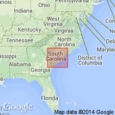
Named Raysor marl for deposits of upper Miocene older than Duplin marl in SC. Named for Raysor Bridge, Colleton Co. Type section was on Edisto River about 1200 feet downriver from the Raysor Bridge, 8 miles southwest of St. George, SC. Unit is 3-1/4 feet thick and consists of shells in a dark-blue soft matrix. Underlies Wicomico formation and overlies Cooper marl. The Raysor is believed to be correlative to the lower part of the Yorktown formation of NC and VA.
Source: GNU records (USGS DDS-6; Reston GNULEX).

- Usage in publication:
-
- Raysor Formation*
- Modifications:
-
- Reinstated
- Revised
- Age modified
- Reference
- AAPG geologic province:
-
- Atlantic Coast basin
Summary:
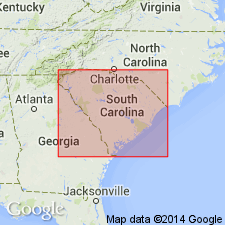
Reinstated Raysor and revised it to the Raysor Formation. A neostratotype is described because the type section is overgrown and inaccessible. Formation is recognized from southern South Carolina, to southeastern GA. It grades into the Yorktown Formation to the north and west and is considered of early Pliocene age.
Source: GNU records (USGS DDS-6; Reston GNULEX).
- Usage in publication:
-
- Raysor Formation*
- Modifications:
-
- Age modified
- Biostratigraphic dating
- AAPG geologic province:
-
- Atlantic Coast basin
Summary:
Molluscan data and planktic Foraminifera assemblage suggest that the Raysor Formation is of late Pliocene age. Paleoenvironment is considered subtropical, open-marine, shallow shelf.
Source: GNU records (USGS DDS-6; Reston GNULEX).
- Usage in publication:
-
- Raysor Formation*
- Modifications:
-
- Age modified
- Biostratigraphic dating
- AAPG geologic province:
-
- Atlantic Coast basin
Summary:
Samples from outcrops of Raysor Formation on the Savannah River, GA, contain planktonic foraminifers equivalent to zone PL-3 of Berggren (1983) and zone N20 of Blau (1960) according to Huddleston (1988). Samples from the Duplin Formation in NC are dated by planktonic foraminifers and calcareous nannofossils as 3.5 to 3.0 Ma. The Raysor and Duplin correlate with each other and represent a marine transgression that occupied the Orangeburg scarp. Both formations are shown in correlation chart as early and late Pliocene.
Source: GNU records (USGS DDS-6; Reston GNULEX).
- Usage in publication:
-
- Raysor Formation
- Modifications:
-
- Overview
- Areal extent
- AAPG geologic province:
-
- Atlantic Coast basin
Summary:
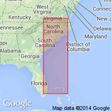
Raysor Formation interfingers with the correlative Duplin Formation in SC and extends southward into GA. (Fig. 16-3 indicates that Raysor is also present as far north as Cape Fear, NC.) It is a shallow-shelf, calcareous lithofacies, while the Duplin is nearer-shore, clastic-rich, and shelly. It correlates with the Rushmere and Morgarts Beach Members of the Yorktown Formation and is late Pliocene in age.
Source: GNU records (USGS DDS-6; Reston GNULEX).
- Usage in publication:
-
- Raysor Marl
- Modifications:
-
- Revised
- AAPG geologic province:
-
- Atlantic Coast basin
Summary:
"Term Raysor Marl is presently applied to the silty sand with aragonitic shells at the Martin Marietta Berkeley Quarry near Cross, SC. This is the only known exposure of this unit which matches Earle Sloans' original lithologic description." Sloan's original type locality has never been relocated and is probably hidden under slumped stream bank deposits.
Source: GNU records (USGS DDS-6; Reston GNULEX).
- Usage in publication:
-
- Raysor Formation*
- Modifications:
-
- Overview
- AAPG geologic province:
-
- Atlantic Coast basin
Summary:
The Yorktown in southeastern VA contains a diverse and abundant planktonic foraminiferal assemblage and is dated at between 3.0 and 4.0 Ma based on the presence of DENTOGLOBIGERINA ALTISPIRA, SPHAEROIDINELLOPSIS, and GLOBOROTALIA PUNCTICULATA. This confirms correlation with the Duplin and Raysor Formation of SC and provides supporting evidence for an extensive middle Pliocene marine transgression on the Atlantic Coastal Plain.
Source: GNU records (USGS DDS-6; Reston GNULEX).
- Usage in publication:
-
- Raysor Formation*
- Modifications:
-
- Biostratigraphic dating
- Overview
- AAPG geologic province:
-
- South Georgia sedimentary province
Summary:
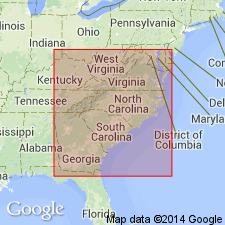
Although Duplin and Raysor Formations probably include sediments deposited during several cycles, the cycles presently cannot be differentiated either by paleontologic analysis or stratigraphic position. In southeastern GA, fossils consistent with Zone PL3 of Berggren (1973) are equivalent wholly or in part to Duplin and Raysor Formations, to Rushmere Member of upper part of Yorktown Formation in southeastern VA and northeastern NC (numerous references and L.W. Ward, Virginia Museum of Natural History, 1990, written commun.), and to Jackson Bluff Formation of extreme northern FL. Figure 6 shows these equivalent relationships. Duplin Formation, used in southeastern NC and northeastern SC, is assigned late early and late Pliocene age. Raysor Formation, used in southeastern SC and all of GA, is assigned late Pliocene age. Jackson Bluff Formation, and Rushmere and Morgarts Beach Members of Yorktown Formation are assigned late Pliocene age.
Source: GNU records (USGS DDS-6; Reston GNULEX).

- Usage in publication:
-
- Raysor Marl
- Modifications:
-
- Age modified
- AAPG geologic province:
-
- Atlantic Coast basin
Summary:
The Raysor Marl unconformably overlies the lower Goose Creek Limestone and is equivalent to the upper Goose Creek. Both are younger than the unconformably overlying Duplin Formation. According to figure 1, the Raysor is approximately 3.6 Ma.
Source: GNU records (USGS DDS-6; Reston GNULEX).
For more information, please contact Nancy Stamm, Geologic Names Committee Secretary.
Asterisk (*) indicates published by U.S. Geological Survey authors.
"No current usage" (†) implies that a name has been abandoned or has fallen into disuse. Former usage and, if known, replacement name given in parentheses ( ).
Slash (/) indicates name conflicts with nomenclatural guidelines (CSN, 1933; ACSN, 1961, 1970; NACSN, 1983, 2005, 2021). May be explained within brackets ([ ]).