

- Usage in publication:
-
- Brownwood-Ranger series
- Brownwood-Canyon series
- Modifications:
-
- Overview
- Dominant lithology:
-
- Limestone
- Sandstone
- AAPG geologic province:
-
- Bend arch
- Llano uplift
Summary:
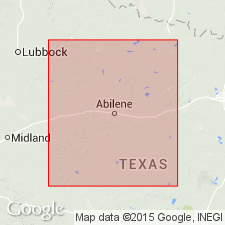
Pl. 3, p. lxvii. [Brownwood-Ranger series on p. lxvii and Brownwood-Canyon on pl. 3.] Limestones and sandstones containing considerable salt and some oil and gas. Overlies Milburn-Strawn series and underlies Waldrip-Cisco series. Study area in central basin, approximately from Colorado River north to Red River, north-central Texas. Age is Carboniferous (Coal Measures).
Named from exposures in vicinity of Ranger, Eastland Co., central northern TX.
Source: US geologic names lexicon (USGS Bull. 896, p. 1771-1772, Brownwood entry p. 277-278); supplemental information from GNU records (USGS DDS-6; Denver GNULEX).
- Usage in publication:
-
- Ranger formation
- Modifications:
-
- Original reference
- Dominant lithology:
-
- Limestone
- Chert
- AAPG geologic province:
-
- Bend arch
Summary:
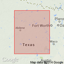
Pg. 133-145. Ranger formation, 2nd from top of 4 formations in Canyon division. Approximately 215 feet thick, includes all strata between top of Graford limestone member of Graford formation and top of heavy Ranger limestone (top member of Ranger formation). The abundance of chert nodules and brown iron-stained layers in the Ranger distinguishes it from other formations of Canyon division. Underlies Eastland formation and overlies Graford formation. Age is Late Pennsylvanian. Report area in Brazos River Valley, north-central Texas.
Named from exposures in vicinity of Ranger, Eastland Co., north-central TX. Forms scarp that can be seen west of Ranger and is responsible for the wild and beautiful topography in western Palo Pinto County where Brazos River has cut deep canyons into the scarp.
[GNC remark (ca. 1938, US geologic names lexicon (USGS Bull. 896, p. 1772): Replaced by Brad formation by F.B. Plummer and R.C. Moore, 1922.]
Source: US geologic names lexicon (USGS Bull. 896, p. 1771-1772); supplemental information from GNU records (USGS DDS-6; Denver GNULEX).
- Usage in publication:
-
- Ranger limestone member*
- Modifications:
-
- Revised
- AAPG geologic province:
-
- Bend arch
Summary:
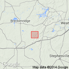
Ranger revised in that it is called Ranger limestone member of Canyon formation (rank changed from division) in Lacasa area, Stephens Co, TX on Bend arch. Underlies Home Creek limestone member of Canyon. Home Creek is here correlated with Eastland limestone [member] of Plummer (1919). Ranger occurs in the southeastern part of the Lacasa area, where it is the lowest bed occurring at the surface. The main bench of the Ranger is a light-gray massive limestone 50 ft thick, forming a distinct and easily traceable scarp. The topmost ledge is a thin-bedded buff limestone 4 ft thick lying 16 ft above the main bench, from which it is separated by 12 ft of shale. Pennsylvanian age. Columnar section.
Source: GNU records (USGS DDS-6; Denver GNULEX).

- Usage in publication:
-
- Ranger limestone [member]
- Modifications:
-
- Revised
- AAPG geologic province:
-
- Bend arch
- Fort Worth syncline
Summary:
Revised--assigned as topmost [member] of Brad formation of Canyon group (both revised) in north-central TX, on Bend arch. In Colorado River Valley area Brad formation consists of (ascending): Cedarton shale, Clear Creek limestone, Placid shale, and Ranger limestone [members]. In Brazos River Valley (to north) Brad formation consists of (ascending): Seaman Ranch beds [or member], and Ranger limestone [member]. The limestone bed above Placid shale was called the "cherty limestone bed" by Drake (1893); it has now been definitely correlated with a continuous limestone bed in Brazos River Valley named Ranger limestone. Name Ranger is retained rather than the undesirable term "cherty." In Colorado River Valley limestone of Ranger forms a continuous escarpment from Brady Mountains northward to Hog Creek on Cisco-Brownwood road. The bed is made up of massive, rough, gray and yellowish-gray limestone containing chert nodules which are for the most part evenly distributed throughout the bed, but in places are confined to layers near middle. In Brazos River area Ranger is everywhere a persistent ledge at top of formation, from Stewarton in Jack Co (Fort Worth syncline) to Brady in McCulloch Co (Bend arch). Here Ranger consists of 2 layers: an upper thin limestone separated by 5-10 ft of yellow shale from a lower thick and massive limestone; has chert. Is Pennsylvanian in age. Measured sections. Correlation chart.
Source: GNU records (USGS DDS-6; Denver GNULEX).

- Usage in publication:
-
- Ranger limestone member
- Modifications:
-
- Revised
- AAPG geologic province:
-
- Bend arch
Summary:
Revised--assigned as topmost member of Brad formation (revised) of Canyon group. As here restricted, Brad formation consists of Ranger limestone member, at top, and an unnamed shale member (including the cherty limestone of Drake, 1893), at base. The Cedarton shale member and newly named Winchell member (including the Clear Creek limestone of Drake and the lower, limestone-bearing part of the Placid shale of Plummer and Moore, [1922]) are removed from Brad and assigned to the underlying Graford formation (revised). The term Placid shale member is not used in this report. The Ranger limestone member appears to be the equivalent of Drake's Home Creek limestone at the "type locality" [the Colorado River Valley]. Ranger underlies Caddo Creek formation of Canyon group. Measured sections. Of Pennsylvanian age.
Source: GNU records (USGS DDS-6; Denver GNULEX).
- Usage in publication:
-
- Ranger limestone
- Modifications:
-
- Revised
- AAPG geologic province:
-
- Bend arch
Summary:
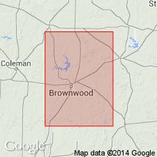
Ranger revised--removed as a member of Brad formation and rank raised to formational status. Name Brad formation, as defined by the USGS in 1960--with Placid shale member (at base), and Ranger limestone member (at top)--not used. Placid shale and Ranger limestone used as formations in this report. Area of report is the Colorado River Valley area, Brown Co, TX on Bend arch. Ranger limestone overlies Placid shale; underlies Colony Creek shale member of "Caddo Creek" [Caddo Creek Formation]. Ranger consists of an upper unnamed limestone member and lower clastics. Stratigraphic chart. Of Canyon [Pennsylvanian] age. [Author does not capitalize rank terms; however, units are considered to be formal.]
Source: GNU records (USGS DDS-6; Denver GNULEX).

- Usage in publication:
-
- Ranger Limestone
- Modifications:
-
- Areal extent
- Mapped 1:250k
- Dominant lithology:
-
- Limestone
- Shale
- AAPG geologic province:
-
- Bend arch
- Fort Worth syncline
Summary:
Mapped as a formation of Canyon Group in the southeastern part of the mapped area, north-central TX (ascending): Palo Pinto Formation, Wolf Mountain Shale, Winchell Limestone, Placid Shale, Ranger Limestone, Colony Creek Shale, and Home Creek Limestone. Farther east, Canyon is divided into (ascending): Willow Point Formation, Jasper Creek Formation and its Chico Ridge Limestone [unranked], Ventioner Formation, Ranger Limestone, and Colony Creek Shale. Ranger is present in northwesternmost Palo Pinto Co (Bend arch) and Jack Co (Fort Worth syncline); extends onto adjacent Sherman sheet. Consists of two limestone units separated by shale. Upper limestone bed: gray and tan, fine to coarse grained, bioclastic, planar and irregular, thin to medium beds, weathers to hard angular blocks; thickness 2-8 ft. Lower limestone bed: tan, gray, yellow, fine- to coarse-grained, locally sandy and conglomeratic with clasts of angular limestone and fossil fragments, massive, thin bedded, nodular, sparse chert nodules, locally fossiliferous with abundant brachiopods and bryozoans; thickness 2-25 ft. Both limestone beds thicken and form broad dip slope near U.S. Hwy 281. In southwestern Jack Co, Ranger comprises a single limestone unit 50-60 ft thick, light gray, fine to medium grained, nodular, unevenly bedded, with marine megafossils; forms prominent escarpment and dip slope. Ranger is 30-60 ft thick. Missouri (Late Pennsylvanian) age. Geologic map.
Source: GNU records (USGS DDS-6; Denver GNULEX).

- Usage in publication:
-
- Ranger Limestone
- Modifications:
-
- Mapped 1:250k
- Dominant lithology:
-
- Limestone
- AAPG geologic province:
-
- Fort Worth syncline
Summary:
Pamphlet [p. 12]. Ranger Limestone of Canyon Group. Limestone and shale; mostly limestone, gray, weathers to yellowish-white and tan, fine- to coarse-grained, locally intraclastic and brecciated, thin- to thick-bedded, wavy-nodular, massive, sparse chert nodules, locally interbedded thin ferruginous shale beds bearing abundant bryozoans and brachiopods, similar low-diversity fauna in lower concentration in limestone, forms moderately prominent bench and broad dip slope; equivalent to the lower of two limestone units that compose the Ranger Limestone in the Brazos River drainage area depicted on the adjacent Wichita Falls-Lawton Sheet. Thickness 10 to 25 feet. Lies above Ventioner Formation and below Colony Creek Shale; both of Canyon Group. Age is Late Pennsylvanian (Missourian).
[Mapped in Jack and Wise Cos., central northern TX; western edge of map sheet. Rocks previously (1967 ed. of map) included in "Brad Formation" and "Graham and Caddo Creek Formations, undivided." See also adjacent Wichita Falls-Lawton sheet, Texas Geol. Atlas, 1987.]
Source: Publication.
For more information, please contact Nancy Stamm, Geologic Names Committee Secretary.
Asterisk (*) indicates published by U.S. Geological Survey authors.
"No current usage" (†) implies that a name has been abandoned or has fallen into disuse. Former usage and, if known, replacement name given in parentheses ( ).
Slash (/) indicates name conflicts with nomenclatural guidelines (CSN, 1933; ACSN, 1961, 1970; NACSN, 1983, 2005, 2021). May be explained within brackets ([ ]).