- Usage in publication:
-
- Princeton conglomerate*
- Modifications:
-
- Named
- Dominant lithology:
-
- Conglomerate
- Sandstone
- AAPG geologic province:
-
- Appalachian basin
Summary:
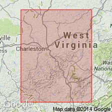
Named Princeton conglomerate for Princeton, Mercer Co., WV. This unit is one of the most variable beds of a variable series. It first appears in section 1100 ft above railroad grade at Hinton, WV, where it consists of 15-20 ft of loosely cemented sand containing many well-rounded quartz pebbles. On crest of hill below Sandstone, WV, 1050 ft above railroad, is 30 ft of sandstone, very hard when unweathered but yielding quickly to disintegrating agencies, and so far as seen contains no pebbles. At Meadow Creek, WV, this sandstone is 60 ft thick, conglomeratic, and is 820 ft above railroad. Two and one-half mi below it is 600 ft above railroad grade and is 80 ft thick, which is maximum thickness in New River. Opposite mouth of Mill Creek the Princeton is 180 ft above railroad grade while at Quinnimont it is 200 ft above grade and is 20 ft thick, lying unconformably above shales. It is absent in section up Laurel Creek, but comes in again and is present along road from Quinnimont to Prince. The Princeton overlies the Hinton formation and underlies the Royal formation and is considered to be of Mississippian age.
Source: GNU records (USGS DDS-6; Reston GNULEX).

- Usage in publication:
-
- Princeton Sandstone*
- Modifications:
-
- Revised
- AAPG geologic province:
-
- Appalachian basin
Summary:
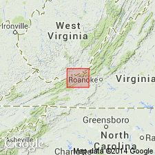
Use of Mauch Chunk Group extended into Giles Co, VA, and bordering areas of Mercer, Summer, and Monroe Cos, WV. Mauch Chunk Group is divided into Bluefield Formation, Hinton Formation, Princeton Sandstone, and Bluestone Formation, ascending.
Source: GNU records (USGS DDS-6; Reston GNULEX).

- Usage in publication:
-
- Princeton Sandstone
- Modifications:
-
- Revised
- AAPG geologic province:
-
- Appalachian basin
Summary:
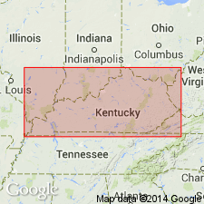
Pennington Group in KY is divided into (ascending) Bluefield Formation, Hinton Formation, Princeton Sandstone, and Bluestone Formation, which author states are "informally projected" into KY. The Princeton varies from a siliceous to calcareous sandstone, and in places is interbedded with shale. Similar lithologically to the Stony Gap Sandstone Member of the Hinton Formation. Commonly called the "Ravencliff sand" by drillers. May be equivalent to the Pinnacle Overlook Sandstone Member of the Lee Formation, which is here removed from the Lee and formally designated a formation of the Pennington Group. Age is Late Mississippian.
Source: GNU records (USGS DDS-6; Reston GNULEX).

- Usage in publication:
-
- Princeton Sandstone
- Modifications:
-
- Overview
- AAPG geologic province:
-
- Appalachian basin
Summary:
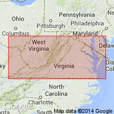
The Princeton Sandstone crops out from Bramwell southwestward to Big A Mountain along the southeast edge of the Appalachian plateaus. Averages 80 ft in thickness in outcrop. Appears to be absent throughout the subsurface area of the VA portion of the Appalachian plateaus. Varies from polymictic conglomerate to coarse-conglomeratic-lithic sandstone. Consists of light-gray, fine- to coarse-grained, thick-bedded to massive, calcite- or silica-cemented sandstone. Clasts present in the sandstone consist of angular fragments of quartz, shale, siltstone, limestone, chert, and ironstone. Northwestward from Tazewell Co., in the subsurface, the Princeton becomes less conglomeratic, thinner, and eventually grades into very fine grained sandstone before grading into the siltstone of the Pride Shale Member of the overlying Bluestone Formation in eastern Buchanan Co. Overlies the upper shale member of the Hinton Formation in Tazewell Co. and the Pratter Shale Member of the Hinton elsewhere. Age is Late Mississippian (Chesterian).
Source: GNU records (USGS DDS-6; Reston GNULEX).
For more information, please contact Nancy Stamm, Geologic Names Committee Secretary.
Asterisk (*) indicates published by U.S. Geological Survey authors.
"No current usage" (†) implies that a name has been abandoned or has fallen into disuse. Former usage and, if known, replacement name given in parentheses ( ).
Slash (/) indicates name conflicts with nomenclatural guidelines (CSN, 1933; ACSN, 1961, 1970; NACSN, 1983, 2005, 2021). May be explained within brackets ([ ]).

