- Usage in publication:
-
- Pocahontas Formation*
- Modifications:
-
- Revised
- AAPG geologic province:
-
- Appalachian basin
Summary:
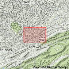
Coal-bearing strata previously assigned to the Lee Formation in this area are reassigned to the Pocahontas and New River Formations in this map area. Conglomeratic sandstone of the Lee Formation wedges out and Pocahontas is recognized here. Strata include subgraywacke sandstone.
Source: GNU records (USGS DDS-6; Reston GNULEX).
- Usage in publication:
-
- Pocahontas Formation
- Modifications:
-
- Revised
- AAPG geologic province:
-
- Appalachian basin
Summary:
Pocahontas Formation assigned to Breathitt Group, raised in rank in this report. Occurs only in VA and WV, where it contains most of the Pocahontas coals. Reaches a maximum thickness of 200 m. Overlies and intertongues with Bluestone Formation of Pennington Group. Conformably underlies Bottom Creek formation (new, informal) in the extreme southeastern part of the study area. Elsewhere to the north and west it underlies the Warren Point Sandstone and is progressively truncated.
Source: GNU records (USGS DDS-6; Reston GNULEX).
- Usage in publication:
-
- Pocahontas Formation*
- Modifications:
-
- Overview
- AAPG geologic province:
-
- Appalachian basin
Summary:
The Mississippian-Pennsylvanian boundary may fall within the lower part of the Pocahontas Formation (not at its base) based on (1) the absence of RHACHISTOGNATHUS MURICATUS in the Bramwell Member of the Bluestone Formation, (2) the lack of diagnostic marine invertebrates, including conodonts, in the upper member of the Bluestone Formation and in the lower strata of the Pocahontas Formation of the eastern Appalachians, (3) the assumption that the RH. MURCATUS Zone is a viable biostratigraphic entity, and (4) the acceptance of the recommended IUGS "standard" (first occurrence of DECLINOGNATHUS NODULIFERUS, conodont).
Source: GNU records (USGS DDS-6; Reston GNULEX).
- Usage in publication:
-
- Pocahontas Formation
- Modifications:
-
- Overview
- AAPG geologic province:
-
- Appalachian basin
Summary:
Rocks of the upper part of the Pocahontas Formation have been divided into two general facies assemblages: a channel-belt sandstone and a coal-bearing overbank-floodplain complex. Study interval lies between the base of the Pocahontas No. 6 coal bed and the Pocahontas No. 8 coal bed at the base of the New River Formation. Facies assemblages comprise six lithofacies: A) fluvial channel sandstone; B) crevasse-splay sandstones and siltstones; C) backswamp-floodplain mudstones and siltstones; D) levee-overbank and distal crevasse-splay deposits consisting of interlaminated sandstone, siltstone, and mudstone; E) rooted mudstone paleosols; and F) coal and carbonaceous black mudstone deposited in peat swamps. Flattop Mountain Sandstone Member is typical of lithofacies A. Previous work has suggested a deltaic environment for Pocahontas Formation. Sediments of the upper Pocahontas were deposited on a transitional mid- to upper-delta plain locally discharging to the west.
Source: GNU records (USGS DDS-6; Reston GNULEX).
- Usage in publication:
-
- Pocahontas Formation
- Modifications:
-
- Overview
- AAPG geologic province:
-
- Appalachian basin
Summary:
Pocahontas in the type area is 700 ft thick. Reaches a maximum thickness of about 800 ft in Tazewell Co. and thins northwesterly across Buchanan Co. Unit includes the Squire Jim coal bed at its base, a lower sandstone, Pocahontas coals Nos. 1 through 7, and the Flattop Mountain Sandstone Member. To the southeast, the basal units of the Pocahontas intertongue and laterally grade into the upper part of the Bluestone Formation. To the northwest the Pocahontas intertongues with the Lee Formation and the lower quartzarenite of the Middlesboro Member is found between Pocahontas coals 6 and 7. Upper contact with the New River Formation is conformable. Age is Early Pennsylvanian (Morrowan).
Source: GNU records (USGS DDS-6; Reston GNULEX).
- Usage in publication:
-
- Pocahontas Formation*
- Modifications:
-
- Revised
- AAPG geologic province:
-
- Appalachian basin
Summary:
Pocahontas Formation of VA and WV is no longer part of Pottsville Group as Pottsville is restricted from WV. Extends from base of Pennsylvanian System to base of No. 8 Pocahontas coal or unconformity at base of Pineville Sandstone Member of New River Formation.
Source: GNU records (USGS DDS-6; Reston GNULEX).
For more information, please contact Nancy Stamm, Geologic Names Committee Secretary.
Asterisk (*) indicates published by U.S. Geological Survey authors.
"No current usage" (†) implies that a name has been abandoned or has fallen into disuse. Former usage and, if known, replacement name given in parentheses ( ).
Slash (/) indicates name conflicts with nomenclatural guidelines (CSN, 1933; ACSN, 1961, 1970; NACSN, 1983, 2005, 2021). May be explained within brackets ([ ]).

