- Usage in publication:
-
- Pinyon Peak limestone*
- Modifications:
-
- Named
- Dominant lithology:
-
- Limestone
- AAPG geologic province:
-
- Wasatch uplift
Summary:
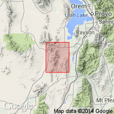
Named for exposures on upper east slope of Pinyon Peak, T9S, R2W, Utah Co, UT on the Wasatch uplift. Included as part of Godiva limestone by Smith and Tower (1899). Recognized only in Pinyon Peak area. Rests unconformably on Bluebell dolomite (named). Unconformably underlies Victoria quartzite (named). Consists of shaly limestone about 150 ft thick. Has mud cracks, worm trails, abundant fossil fragments (brachiopods, gastropods, bryozoans) which indicate a Threeforks? age. Assigned to the Late Devonian.
Source: GNU records (USGS DDS-6; Denver GNULEX).

- Usage in publication:
-
- Pinyon Peak limestone*
- Modifications:
-
- Areal extent
- Overview
- AAPG geologic province:
-
- Wasatch uplift
- Great Basin province
Summary:
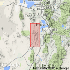
Recognized throughout East Tintic Mountains, Ts9, 10, 11S, Rs2 and 3W, Utah, Juab, Tooele Cos, UT on Wasatch uplift and Great Basin province. Was recognized previously only at its type locality by Loughlin (1919) who mapped most of the rocks assigned to Pinyon Peak in this report to Gardner dolomite [also called formation in report]. Gardner abandoned. Two sections measured and described: 1) SE1/4 sec 33 and W1/2 W1/2 sec 34, T9S, R2W, Utah Co, on ridge near crest of Pinyon Peak where 70 ft remain; 2) NW1/4 SE1/4 sec 17, T9S, R3W, Utah Co in Black Rock Canyon, where 85 ft are present. Overlies Victoria formation; underlies Fitchville formation (new). Contains fossils of Late Devonian age. Cross sections. Geologic map.
Source: GNU records (USGS DDS-6; Denver GNULEX).

- Usage in publication:
-
- Pinyon Peak Limestone*
- Modifications:
-
- Areal extent
- AAPG geologic province:
-
- Great Basin province
Summary:
Red Warrior Limestone abandoned. Its rocks reassigned, in the Star Range, Beaver Co, UT in the Great Basin province, to the lower part of the Upper Devonian Pinyon Peak Limestone, the Devonian Sevy Dolomite, Simonson Dolomite, and Guilmette Formation, and to the Silurian Laketown Dolomite. Mowitza Shale abandoned. Rocks formerly assigned to Mowitza form a small part of the Pinyon Peak. Lithofacies maps. Stratigraphic section 115 m thick measured at the Mowitza mine where Pinyon Peak: overlies Guilmette Formation; underlies Fitchville Formation; divided into lower and upper members; lower member has a polygnathid-icriodid and middle? Scaphignathus velifer conodont zone in the lower member, and an upper Polygnathus styriacus conodont zone in the upper member. Assigned a Famennian age.
Source: GNU records (USGS DDS-6; Denver GNULEX).
For more information, please contact Nancy Stamm, Geologic Names Committee Secretary.
Asterisk (*) indicates published by U.S. Geological Survey authors.
"No current usage" (†) implies that a name has been abandoned or has fallen into disuse. Former usage and, if known, replacement name given in parentheses ( ).
Slash (/) indicates name conflicts with nomenclatural guidelines (CSN, 1933; ACSN, 1961, 1970; NACSN, 1983, 2005, 2021). May be explained within brackets ([ ]).

