- Usage in publication:
-
- Pilgrim limestone*
- Modifications:
-
- First used
- Dominant lithology:
-
- Limestone
- AAPG geologic province:
-
- Sweetgrass arch
Summary:
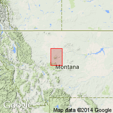
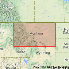
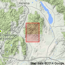
Pilgrim limestone. Dense gray cliff-forming limestone, massively bedded, containing shaly layers, often spotted with green glauconite remains; frequently carrying fossils on the surface. The layers are often conglomerates formed of flat pebbles of green or buff limestones showing no definite arrangement. Thickness 140 feet in Fort Benton quadrangle. Is 3rd from top (of 7) of the Cambrian units collectively referred to as Barker formation in the Fort Benton quadrangle. Barker includes (ascending): Flathead sandstone, Wolsey shale, Meagher limestones, Park shales and limestone conglomerates, Pilgrim limestone, Dry Creek shale, and Yogo limestone. Individual units could not be mapped at scale used on these sheets; Barker probably not intended to be of group rank. Mapped in southwest part of quadrangle in Little Belt Mountains, Cascade County, Montana (Sweetgrass arch). Overlies Park shales and limestone conglomerates. Underlies Dry Creek shale. Barker contains middle Cambrian fossils.
Type locality not stated. Exposed in broad valley of Pilgrim Creek [southwest corner of Fort Benton quadrangle, Cascade Co., MT (Sweetgrass arch)]. Derivation of name not stated; presumably named from Pilgrim Creek.
See also USGS Geol. Atlas of the US, Little Belt Mountains folio, no. 56.
Source: Publication; US geologic names lexicon (USGS Bull. 896, p. 1659); supplemental information from GNU records (USGS DDS-6; Denver GNULEX).
- Usage in publication:
-
- Pilgrim limestone*
- Modifications:
-
- Revised
- AAPG geologic province:
-
- Sweetgrass arch
Summary:
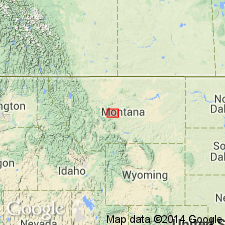
Removed from Barker formation and raised to formation rank (though mapped as one of seven units of Barker). Study area is in Little Belt Mountains, MT, Sweetgrass arch where unit forms low cliffs or caps mesas. Consists of somewhat massively bedded, gray limestone; basal beds are limestone conglomerates separated by thin layers of shale. Overlies Park shale (revised); underlies Dry Creek shale (revised). Correlation of measured sections. Middle Cambrian trilobite PTYCHOPARIA GALLATINENSIS identified by Walcott.
Source: GNU records (USGS DDS-6; Denver GNULEX).
- Usage in publication:
-
- Pilgrim limestone
- Modifications:
-
- Revised
- Dominant lithology:
-
- Limestone
- Conglomerate
- AAPG geologic province:
-
- Central Montana uplift
- Montana folded belt
- Sweetgrass arch
- Yellowstone province
Summary:
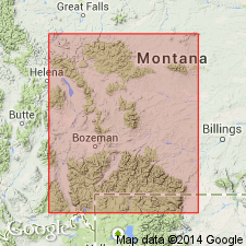
Exposure described by Weed (1900) at Dry Wolf Creek (Weed's Big Park), Judith Basin Co, MT, is reexamined and remeasured as are other sections in Little Belt Mountains, Sweetgrass arch. As Weed did not designate a type locality and because Pilgrim is better exposed at Dry Wolf Creek than elsewhere in Little Belt Mountains, Dry Wolf Creek is designated as type section. At type, in sec 14, T14N, R9E, Pilgrim is 280 ft thick (lower part covered); Weed's original section is 70 ft. Thickness ranges from 661 ft in Big Snowy Mountains thinning westward to 175 ft at Beaver Creek in Big Belt Mountains and southwestward to 172 feet at Crowfoot Ridge in Yellowstone National Park; average thickness is 310 ft. At type, Pilgrim consists of thick- and thin-bedded light- and dark-gray, crystalline to fine-grained, irregularly bedded limestone; variable amounts of tan and buff clay disseminated as flakes and nodules; and thin, green-gray and buff shale partings; intraformational flat-pebble conglomerates are interbedded with limestone. Overlies Park shale (revised); underlies Dry Creek shale (revised). Additional sections remeasured in central and southern MT within Montana folded belt province, Central Montana uplift and Yellowstone Park, Yellowstone province. Fossil list. Plate 2 shows tentative correlation of revised Cambrian units at type sections. Unit is lowermost Upper Cambrian unit in study area.
Source: GNU records (USGS DDS-6; Denver GNULEX).
- Usage in publication:
-
- Pilgrim limestone
- Modifications:
-
- Not used
Summary:
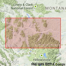
At Deiss' (1936) Crowfoot Ridge section, located in southern part of Gallatin Range within Yellowstone National Park, WY, Yellowstone province, unit called Pilgrim limestone is not used and is replaced by Maurice formation (new).
Source: GNU records (USGS DDS-6; Denver GNULEX).
- Usage in publication:
-
- Pilgrim formation
- Modifications:
-
- Areal extent
- Revised
- Biostratigraphic dating
- Age modified
- AAPG geologic province:
-
- Montana folded belt
- Central Montana uplift
- Sweetgrass arch
- Williston basin
Summary:
Pilgrim formation areally restricted. Recognized in Big Belt Mountains and Bridger Range area on west, Big Snowy Mountains on east, and as far north as Little Rocky Mountains [in Montana folded belt province, Central Montana uplift, Sweetgrass arch, and Williston basin], central Montana. At Nixon Gulch, Three Forks quadrangle, Gallatin County, Montana, a latest Middle Cambrian trilobite fauna was identified from near base of Pilgrim formation of Deiss (1936). Lower contact of Pilgrim formation raised to exclude Middle Cambrian age rocks; these are reallocated to underlying Park formation. Park-Pilgrim contact marks Middle-Upper Cambrian boundary. Outcrop at Lodge Pole Creek in Little Rocky Mountains is most northern and eastern exposure of Upper Cambrian rocks in Montana. Lower Upper Cambrian CEDARIA, CREPICEPHALUS and APHELASPIS zones identified from Pilgrim correlate with Eau Claire member of Dresbach formation in Wisconsin; Maurice formation of southern Montana; Maurice member of Boysen formation of central Wyoming; and lower third of Deadwood formation of Bighorn Mountains, Wyoming and Montana, and Black Hills, South Dakota. Describes lower Upper Cambrian fauna. Upper contact of Pilgrim formation revised to include the limestone pebble conglomerates formerly assigned to overlying Dry Creek shale by Deiss (1936); referred to as transition zone (this report). At Half Moon Pass section, Big Snowy Mountains, upper part of Pilgrim is lowest Ordovician. Pilgrim formation (revised) ranges in thickness from 150 to 685 feet (thickens from west to east). Age of Pilgrim formation is Late Cambrian (Dresbach to Trempealeau) to earliest Ordovician; top becomes younger from west to east. Age is based on trilobites and brachiopods.
Source: Modified from GNU records (USGS DDS-6; Denver GNULEX).
- Usage in publication:
-
- Pilgrim limestone
- Modifications:
-
- Not used
Summary:
Author re-examines key sections in Horseshoe Hills between Logan and Dry Creek, Gallatin County, Montana, Montana folded belt province. Lithology of Upper Cambrian rocks in this area is more like that in southern Montana than in central Montana, hence southern Montana nomenclature is used. Thus, Maurice formation is extended into Horseshoe Hills, replacing Pilgrim limestone of other workers. Use of Pilgrim limestone is restricted to central and northeast Montana. Report includes chart showing comparison of published sections from Horseshoe Hills by various authors.
Source: Modified from GNU records (USGS DDS-6; Denver GNULEX).
- Usage in publication:
-
- Pilgrim formation
- Modifications:
-
- Areal extent
- Biostratigraphic dating
- AAPG geologic province:
-
- Williston basin
Summary:
Pilgrim formation extended into Little Rocky Mountains, Blaine and Phillips Counties, Montana, in Williston basin. Consists of intercalated green shale, thin gray limestone, and gray-green limestone pebble conglomerate, with the upper 100 feet characterized by a reddish-buff coloration. Thickness 538 feet in a section measured on Lodge Pole Creek, Phillips County, Montana. Occurs above Park formation; separated by 103 feet thick covered interval that is not assigned to either formation. Underlies Bighorn formation. Contains a fauna of Late Cambrian age (Dresbachian, Franconian and probable Trempealeauan).
Source: Modified from GNU records (USGS DDS-6; Denver GNULEX).
- Usage in publication:
-
- Pilgrim limestone*
- Modifications:
-
- Not used
Summary:
Not used in southwestern Montana, in Madison and Beaverhead Counties, Montana folded belt province. Pilgrim of central Montana correlates with Hasmark and Red Lion formations of this report and correlates with Devils Glen dolomite of northwest Montana.
Source: GNU records (USGS DDS-6; Denver GNULEX).
- Usage in publication:
-
- Pilgrim formation
- Modifications:
-
- Revised
- Age modified
- Overview
- Areal extent
- AAPG geologic province:
-
- Bighorn basin
- Central Montana uplift
- Sweetgrass arch
- Montana folded belt
Summary:
Extends throughout southwest MT from Fergus and Carbon Cos on east to Mineral and Beaverhead Cos on west, which includes Bighorn basin, Central Montana uplift, Sweetgrass arch, and Montana folded belt province. Thickness ranges to more than 500 ft; from isopach map, is thickest in northwest part of area (Orvando area). Correlates with Devils Glen dolomite in northwest MT; upper part of Hasmark formation in Phillipsburg quad; Maurice formation in north-central MT; lower part of Gallatin formation in northwest WY; and Nounan formation in northeast UT. Retains use of Hasmark from Phillipsburg to Armstead in western part of study area. Pilgrim used in preference to Maurice in Yellowstone Park and Logan, MT areas. Conformably overlies Park shale; conformably underlies Red Lion or Snowy Range formations or is in unconformable contact with overlying Maywood or Jefferson formations if Red Lion has been removed by post-Cambrian erosion. Many measured sections. Cross section. Correlation chart. Isopach and lithofacies map. Places the Park-Pilgrim boundary to coincide with lithologic change from shale to limestone rather than to coincide with Middle-Upper [Late] Cambrian time boundary of Lochman and Duncan (1944). Age assigned is late Middle to early Upper [Late] Cambrian (Dresbachian).
Source: GNU records (USGS DDS-6; Denver GNULEX).
- Usage in publication:
-
- Pilgrim formation
- Modifications:
-
- Not used
Summary:
Substitutes newly named Zortman member of the Emerson formation for rocks previously called the Pilgrim formation (Lochman, 1950) in the Little Rocky Mountains, Blaine and Phillips Counties, Montana, in the Williston basin. Is neither the lithic nor the age equivalent of the Pilgrim formation of accepted usage in southern and central Montana.
Source: GNU records (USGS DDS-6; Denver GNULEX).
- Usage in publication:
-
- Pilgrim dolomite*
- Modifications:
-
- Overview
- AAPG geologic province:
-
- Montana folded belt
Summary:
Well exposed around north half of anticline and adjacent structures in Devils Fence quad, Jefferson and Broadwater Cos, MT, Montana folded belt province. Subdivided into three units: lower unit is principally mottled light-gray and dark-gray crystalline and oolitic dolomite; middle unit light-gray and medium-gray, crystalline limestone with irregular ribbons of yellowish-gray silty dolomite; upper unit is light-gray medium-crystalline to sugary dolomite that weathers to rough cuspate surface of about same color. Middle unit contains fauna of middle CEDARIA subzone (fossils listed). Conformably overlies Park shale; conformably underlies Red Lion formation. Thickness ranges from 380-510 ft. Geologic maps; measured sections; generalized stratigraphic section. Late Cambrian age.
Source: GNU records (USGS DDS-6; Denver GNULEX).
- Usage in publication:
-
- Pilgrim limestone*
- Modifications:
-
- Overview
- AAPG geologic province:
-
- Montana folded belt
Summary:
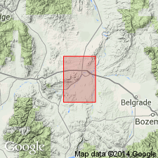
Complete sections occur in Milligan Creek and Willow Creek areas, Jefferson and Broadwater Cos, MT, Montana folded belt province. Section measured in sec 10, T1N, R1W, 450 ft thick and in sec 9, T1S, R1W, 400 ft thick. Lies between the Park shale below and Maywood formation above. Is of Late Cambrian age. Trilobites identified. Presumably deposited in part in shallow disturbed and in part in deeper quiet water. Geologic map. [Compare with Peale, 1893, 1896 and Berry, 1943.]
Source: GNU records (USGS DDS-6; Denver GNULEX).
- Usage in publication:
-
- Pilgrim Limestone
- Modifications:
-
- Overview
- AAPG geologic province:
-
- Montana folded belt
Summary:
Within mapped area, thickness ranges from 170 ft in southwestern part to 255 ft in northern part. Quad is in Montana folded belt province. Conformably overlies Park Shale with sharp contact; underlies Red Lion Formation. Mapped undivided with Red Lion. Late Cambrian age.
Source: GNU records (USGS DDS-6; Denver GNULEX).
- Usage in publication:
-
- Pilgrim? Dolomite*
- Modifications:
-
- Areal extent
- Redescribed
- AAPG geologic province:
-
- Montana folded belt
Summary:
Tentatively mapped in central Beaverhead Co, MT, Montana folded belt province. Consists of 200-ft thick mostly yellowish-gray and very pale orange, massive- to thick-bedded crystalline dolomite; two siltstone beds, each several feet thick, occur near top. Siltstone-bearing part of unit may be what other workers have assigned to Red Lion or Snowy Range Formations in nearby areas. Disconformably overlies Wolsey Shale (Meagher Limestone and Park Shale not present); disconformably underlies Jefferson Formation. Late Cambrian age.
Source: GNU records (USGS DDS-6; Denver GNULEX).
- Usage in publication:
-
- Pilgrim Limestone*
- Modifications:
-
- Revised
- AAPG geologic province:
-
- Bighorn basin
Summary:
Assigned to Gallatin Group (rank raised) as lowermost of three formations. Map covers part of Beartooth Mountains in northwest WY within Bighorn basin. Unit is 100-125 ft thick. Underlies Snowy Range Formation of Gallatin; overlies Gros Ventre Formation. Late Cambrian age.
Source: GNU records (USGS DDS-6; Denver GNULEX).
- Usage in publication:
-
- Pilgrim Limestone*
- Modifications:
-
- Mapped
- AAPG geologic province:
-
- Sweetgrass arch
Summary:
Pilgrim Limestone. Light-gray to gray, thin- to medium-bedded; contains many intra-formational conglomerate beds; thin shale seams. Forms steep cliffs. About 115 feet thick. Lies above Park Shale; unconformably lies below Middle Devonian Maywood Formation. Age is Late Cambrian.
Source: Publication.
- Usage in publication:
-
- Pilgrim Formation
- Modifications:
-
- Biostratigraphic dating
- AAPG geologic province:
-
- Montana folded belt
- Bighorn basin
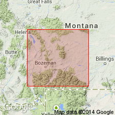
Summary:
Contains Dresbachian (lower Upper Cambrian) faunas from APHELASPIS, CREPICEPHALUS and CEDARIA Zones. Fossil list from collections made at Wolf Creek near Red Lodge, Carbon Co, MT, Bighorn basin, and Mill Creek south of Livingston, Park Co, MT and Beaver Creek near Helena, Lewis and Clark Co, MT, both in Montana folded belt province. Overlies Park Shale; underlies Red Lion or Snowy Range Formations. [Though formation used as rank term, unit as described consists primarily of limestone.]
Source: GNU records (USGS DDS-6; Denver GNULEX).
- Usage in publication:
-
- Pilgrim? Limestone*
- Modifications:
-
- Areal extent
- AAPG geologic province:
-
- Montana folded belt
- Snake River basin
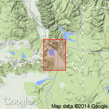
Summary:
Mapped undivided with Bighorn? Dolomite and Snowy Range? Formation in Henrys Lake Mountains, Gallatin Co, MT, Montana folded belt province and Fremont Co, ID, Snake River basin. Combined thickness of Pilgrim? and Snowy Range? is 250-400 ft. Overlies Park Shale. Late Cambrian age.
Source: GNU records (USGS DDS-6; Denver GNULEX).
- Usage in publication:
-
- Pilgrim Limestone*
- Modifications:
-
- Areal extent
- AAPG geologic province:
-
- Bighorn basin
- Yellowstone province
- Montana folded belt
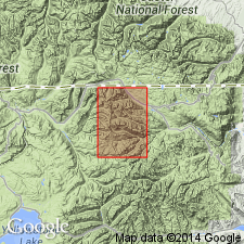
Summary:
Extended as lower of two formations of Gallatin Group into area around northeast boundary of Yellowstone National Park, Park Co, WY and Park Co, MT, Yellowstone province, Bighorn basin and Montana folded belt province. Thickness is about 120 ft. Forms a prominent ledge locally called "The Reef." Underlies Snowy Range Formation of Gallatin; overlies Gros Ventre Formation. Late Cambrian age.
Source: GNU records (USGS DDS-6; Denver GNULEX).
- Usage in publication:
-
- Pilgrim Dolostone*
- Modifications:
-
- Overview
- Redescribed
- Dominant lithology:
-
- Dolostone
- AAPG geologic province:
-
- Montana folded belt
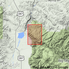
Summary:
Redescribed as a gray, light-gray, and brownish-gray, medium to massive-bedded, locally oolitic, medium-crystalline dolostone. Mapped undivided with overlying Red Lion Formation in central and north-central parts of quad, Madison Co, MT, Montana folded belt province. Conformably overlies Park Shale. Forms conspicuous crags. Thickness is about 30 m which is unusually thin. Late Cambrian age.
Source: GNU records (USGS DDS-6; Denver GNULEX).
- Usage in publication:
-
- Pilgrim Formation*
- Modifications:
-
- Overview
- AAPG geologic province:
-
- Montana folded belt
Summary:
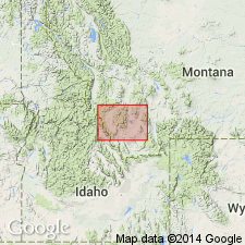
Term Pilgrim Formation of Late Cambrian age used in Dillon quad, MT, Montana folded belt province. Formation consists of gray, fine-, medium- to thick-bedded dolomite beds of fine- to medium-grained sandstone at top. Is 12-13 m thick in west part of mapped area and 90-120 m thick in east and central parts of mapped area. Is younger than Park Shale and older than Snowy Range (or Red Lion) Formation.
Source: GNU records (USGS DDS-6; Denver GNULEX).
For more information, please contact Nancy Stamm, Geologic Names Committee Secretary.
Asterisk (*) indicates published by U.S. Geological Survey authors.
"No current usage" (†) implies that a name has been abandoned or has fallen into disuse. Former usage and, if known, replacement name given in parentheses ( ).
Slash (/) indicates name conflicts with nomenclatural guidelines (CSN, 1933; ACSN, 1961, 1970; NACSN, 1983, 2005, 2021). May be explained within brackets ([ ]).

