The National Geologic Map Database is migrating to a new infrastructure. We apologize for any service disruptions during this process.
|
|---|


- Usage in publication:
-
- Pilcher quartzite*
- Modifications:
-
- Named
- Dominant lithology:
-
- Quartzite
- AAPG geologic province:
-
- Northern Rocky Mountain region
Summary:
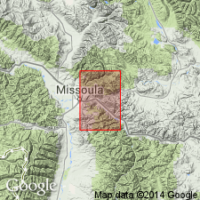
Named as the upper formation of Missoula group of Belt series for exposures on Pilcher Creek, T14N, R18W, Missoula Co, MT in the Northern Rocky Mountain region. Replaces name Sheep Mountain formation, a new name that had been applied to another formation. No type locality designated. Crops out in northwest part of quad. Made up mostly of pale-orange-pink to moderate-red cross-bedded quartzite. Beds range from 1 in to 10 ft thick. Some of the rocks have bleached spots or streaks. Is about 90 percent well-sorted, subround, sand-sized grains with a matrix that has fine-grained, intergrown chlorite and sericite. Is mostly quartz but some grains are quartzite, metasiltstone, argillite or silty argillite and detrital muscovite. No feldspar seen. No evidence of recrystallization of quartz. Red color from disseminated hematite dust. Is 1,000 ft thick. Complete section present in SE1/4 sec 6, T14N, R18W. Overlies Garnet Range quartzite (redefined and revised) of Missoula; underlies unnamed Cambrian? shale. Authors believe upper contact is gradational. Usually the top of Belt is represented by an unconformity. Of Precambrian age. Geologic map, stratigraphic chart.
Source: GNU records (USGS DDS-6; Denver GNULEX).

- Usage in publication:
-
- Pilcher Quartzite*
- Modifications:
-
- Overview
- AAPG geologic province:
-
- Northern Rocky Mountain region
Summary:
Used in the St. Regis, Alberton, Missoula area, Northern Rocky Mountain region, as uppermost formation of Missoula Group of the Precambrian Belt Supergroup. Stratigraphic position and correlation with other formations of the Belt of the U.S. in the Northern Rocky Mountain region, and of the Purcell Supergroup of Alberta and British Columbia, Canada shown on figures 4, 5, 7, and 13.
Source: GNU records (USGS DDS-6; Denver GNULEX).
- Usage in publication:
-
- Pilcher Quartzite*
- Modifications:
-
- Age modified
- Overview
- AAPG geologic province:
-
- Northern Rocky Mountain region
Summary:
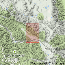
Is the upper formation, one of eleven formations of the Belt Supergroup mapped in report area. Age changed from Precambrian to Precambrian Y, the age term used for rocks that range in age from 1,600 to 800 m.y. old. Maximum exposed thickness about 1,175 ft; no section is complete. Overlies Garnet Range Formation of Belt. Distinguished from unconformably overlying Flathead Quartzite by presence of mud chips, detrital mica, both of which are ubiquitous, and feldspar. Is gradational with underlying Garnet Range Formation of Belt through about 50 ft of interbedded red and green beds that are mapped with the Garnet Range. Pre-Flathead erosion has removed all of the Pilcher in places. Mapped near south edge of map in Missoula and Mineral Cos, MT in the Northern Rocky Mountain region.
Source: GNU records (USGS DDS-6; Denver GNULEX).
- Usage in publication:
-
- Pilcher Quartzite*
- Modifications:
-
- Paleomagnetics
- AAPG geologic province:
-
- Northern Rocky Mountain region
Summary:
The only permissible paleomagnetic correlation and temporal overlap of Grand Canyon Supergroup with Belt Supergroup is between uppermost normal polarity part of Pilcher Quartzite at top of Belt and upper part of Bass Limestone in Unkar Group near base of Grand Canyon Supergroup. Pilcher is a Middle Proterozoic unit used in the Northern Rocky Mountain region area of MT.
Source: GNU records (USGS DDS-6; Denver GNULEX).
- Usage in publication:
-
- Pilcher Formation*
- Modifications:
-
- Areal extent
- AAPG geologic province:
-
- Northern Rocky Mountain region
Summary:
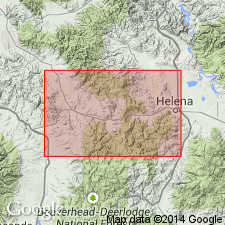
The Garnet Range and Pilcher Formations, at the top of the Missoula Group are present 80 km west of the map area, but they were eroded from the map area (Northern Rocky Mountain region) prior to the deposition of the Middle Cambrian Flathead Quartzite. A minimum of 2,500 m of Middle Proterozoic rocks were eroded over a lateral distance of about 30 km. In report area Flathead rests on the McNamara Formation, of the Missoula Group.
Source: GNU records (USGS DDS-6; Denver GNULEX).
For more information, please contact Nancy Stamm, Geologic Names Committee Secretary.
Asterisk (*) indicates published by U.S. Geological Survey authors.
"No current usage" (†) implies that a name has been abandoned or has fallen into disuse. Former usage and, if known, replacement name given in parentheses ( ).
Slash (/) indicates name conflicts with nomenclatural guidelines (CSN, 1933; ACSN, 1961, 1970; NACSN, 1983, 2005, 2021). May be explained within brackets ([ ]).