- Usage in publication:
-
- Park shale*
- Modifications:
-
- Areal extent
- AAPG geologic province:
-
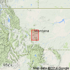
- Sweetgrass arch
Summary:
Park shale. Very thin-bedded soft, crumbly rock, often containing glistening grains of mica, mostly of greenish-gray color, but also showing various shades of red and purple. Overlies Meagher limestone and underlies Pilgrim limestone; all included in Barker formation. [Age is Middle Cambrian.]
[Origin of name not stated, but Barker formation is mapped over large part of Belt Park, in northwestern corner of Little Belt Mountains quadrangle and southwestern corner of Fort Benton quadrangle, and is also mapped on east and west sides of Big Park, same quadrangle.]
Source: US geologic names lexicon (USGS Bull. 896, p. 1602-1603).
- Usage in publication:
-
- Park shales and limestone conglomerates*
- Modifications:
-
- Areal extent
- Dominant lithology:
-
- Shale
- Conglomerate
- AAPG geologic province:
-
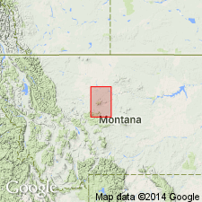
- Sweetgrass arch
Summary:
Park shales and limestone conglomerates. Several hundred feet thick, overlie Meagher limestone and underlie Pilgrim limestone; all included in Barker formation. [Age is Middle Cambrian.]
Source: US geologic names lexicon (USGS Bull. 896, p. 1602-1603).
- Usage in publication:
-
- Park shale*
- Modifications:
-
- Revised
- AAPG geologic province:
-
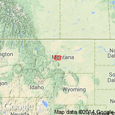
- Sweetgrass arch
Summary:
Pg. 286. Park shale. Greater part of Cambrian rocks seen in mountain area of Little Belt Mountains probably belong to Park shale. Lower strata are gray or greenish micaceous shales. Higher up these contain intercalated thin layers of impure limestones, which often consist of lat limestone pebbles -a true intraformational conglomerate. Well exposed in road cuttings at head of Sheep Creek, in valleys of Dry Wolf, Pilgram, and Tenderfoot Creeks, and near Barker. Estimated thickness 800 feet. Age is Middle Cambrian.
Source: US geologic names lexicon (USGS Bull. 896, p. 1602-1603).
- Usage in publication:
-
- Park shale
- Modifications:
-
- Revised
- Dominant lithology:
-
- Shale
- Sandstone
- AAPG geologic province:
-
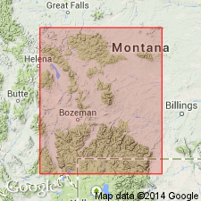
- Central Montana uplift
- Montana folded belt
- Sweetgrass arch
- Yellowstone province
Summary:
Exposure described by Weed (1900) at Dry Wolf Creek, Judith Basin Co, MT, is reexamined and remeasured as are other sections in Little Belt Mountains, Sweetgrass arch. Weed referred to Dry Wolf Creek section as north wall of Big Park (name unknown to inhabitants of Dry Wolf Creek Valley) which is probable source of name of Park and Weed described Big Park, among others, as a typical exposure. In this report, Dry Wolf Creek is designated as type section for Park and Pilgrim shales. At emended Dry Wolf Creek section, in sec 14, T14N, R9E, Park is 212 ft thick (base covered); Weed's original section is 115 ft thick. Thickness ranges from 330 ft on Keegan Butte, Cascade Co, in Little Belt Mountains to 120 ft on Crowfoot Ridge, Yellowstone National Park; average thickness is 200 ft, whereas Weed assigned 800 ft to Park. Overlies Meagher limestone (revised); underlies Pilgrim limestone (revised). Shale is uniformly very fissile, slightly micaceous, and dominantly green-gray color; thin-bedded, gray, crystalline, micaceous sandstones are irregularly intercalated with shales. Additional sections remeasured in central and southern MT within Montana folded belt province, Central Montana uplift and Yellowstone Park, Yellowstone province. Only LINGUELLA HELENA found. Plate 2 shows tentative correlation of revised Cambrian units at type sections. Park tentatively considered youngest Middle Cambrian formation in study area.
Source: GNU records (USGS DDS-6; Denver GNULEX).
- Usage in publication:
-
- Park shale
- Modifications:
-
- Revised
- AAPG geologic province:
-
- Bighorn basin
Summary:
Revised in that Park underlies, most likely conformably, newly named Upper Cambrian Maurice formation in southern Carbon Co, MT in Beartooth Mountains, Bighorn basin. Contact between Park and Maurice marks Middle-Upper Cambrian boundary.
Source: GNU records (USGS DDS-6; Denver GNULEX).
- Usage in publication:
-
- Park formation
- Modifications:
-
- Revised
- AAPG geologic province:
-
- Montana folded belt
Summary:
Park formation revised to include Middle Cambrian age rocks formerly assigned to Pilgrim formation. At Nixon Gulch, Three Forks quadrangle, Gallatin County, Montana, a latest Middle Cambrian trilobite fauna was identified from near base of Pilgrim formation of Deiss (1936). Lower contact of Pilgrim formation raised to exclude Middle Cambrian age rocks; these are reallocated to underlying Park formation. Park-Pilgrim contact marks Middle-Upper Cambrian boundary.
Source: Modified from GNU records (USGS DDS-6; Denver GNULEX).
- Usage in publication:
-
- Park shale
- Modifications:
-
- Revised
- AAPG geologic province:
-
- Montana folded belt
Summary:
Lower contact of Park shale revised in that it now underlies Maurice formation. Author re-examines key sections in Horseshoe Hills between Logan and Dry Creek, Gallatin County, Montana, Montana folded belt province. Lithology of Upper Cambrian rocks in this area is more like that in southern Montana than in central Montana, hence southern Montana nomenclature is used. Thus, Maurice formation is extended into Horseshoe Hills, replacing Pilgrim limestone of other workers. Chart showing comparison of published sections from Horseshoe Hills by various authors.
Source: Modified from GNU records (USGS DDS-6; Denver GNULEX).
- Usage in publication:
-
- Park formation
- Modifications:
-
- Areal extent
- Biostratigraphic dating
- AAPG geologic province:
-
- Williston basin
Summary:
Park formation extended into Little Rocky Mountains, Blaine and Phillips Counties, Montana, in Williston basin. Consists of shale and gray limestone pebble conglomerate. In a section measured along Lodgepole Creek, Phillips County, Montana, Park contains a fauna of Middle Cambrian age. Thickness of formation not given. Occurs below Pilgrim formation; separated by 103 feet thick covered interval that is not assigned to either formation. Basal contact and underlying formations not discussed.
Source: Modified from GNU records (USGS DDS-6; Denver GNULEX).
- Usage in publication:
-
- Park shale
- Modifications:
-
- Areal extent
- Overview
- AAPG geologic province:
-
- Montana folded belt
Summary:
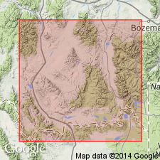
Extends into extreme southwest MT south of Boulder batholith and west of Yellowstone National Park within parts of Beaverhead, Madison, and Gallatin Cos, MT, Montana folded belt province. Conformably and transitionally overlies Meagher limestone. In places is in transitional contact with overlying Hasmark formation; where pre-Hasmark erosion has occurred is in disconformable contact with Hasmark. Where not eroded, thickness ranges from 100-150 ft. Correlates with upper part of Bloomington formation in southeast ID, upper part of Bayhorse dolomite in central ID, Switchback shale in northwest MT, and upper shale member of Gros Ventre formation in northern WY. Isopach map of Cambrian. Correlation chart. Cross section. Measured section. Middle Cambrian age.
Source: GNU records (USGS DDS-6; Denver GNULEX).
- Usage in publication:
-
- Park shale
- Modifications:
-
- Revised
- Age modified
- Areal extent
- AAPG geologic province:
-
- Bighorn basin
- Central Montana uplift
- Sweetgrass arch
- Montana folded belt
Summary:
Extends throughout southwest MT from Fergus and Carbon Cos on east to Mineral and Beaverhead Cos on west, which includes Bighorn basin, Central Montana uplift, Sweetgrass arch, and Montana folded belt province. Thickness ranges from less than 50 ft to about 500 ft; is thickest in southeast part of area. Conformably overlies Meagher formation; conformably underlies Pilgrim formation; both upper and lower contacts are gradational. Correlates in part with Steamboat limestone and Switchback formation of northwest MT; in part with Hasmark formation in Phillipsburg quad; upper part of Gros Ventre formation in northwest WY; and Bloomington formation in northeast UT. Retains use of Hasmark from Phillipsburg to Armstead in western part of study area. Many measured sections. Cross section. Correlation chart. Isopach map. Places Park-Pilgrim boundary to coincide with lithologic change from shale to limestone rather than to coincide with Middle-Upper [Late] Cambrian time boundary of Lochman and Duncan (1944). Late Middle Cambrian to early Upper [Late] Cambrian age. Age assignment based on fossils described by other workers in Three Forks, MT area (late Middle Cambrian) and by presence of ARAPAHOIA in upper part of Park equivalent (upper part of Gros Ventre) in western WY (early Upper [Late] Cambrian).
Source: GNU records (USGS DDS-6; Denver GNULEX).
- Usage in publication:
-
- Park shale
- Modifications:
-
- Revised
- AAPG geologic province:
-
- Yellowstone province
- Green River basin
- Bighorn basin
- Wind River basin
Summary:
Gros Ventre formation raised to group rank and its members raised to formation rank in a footnote on Chart II. Includes (ascending): Wolsey shale, Death Canyon limestone, and Park shale. The lower two formations are of Albertan age; the Park is mostly Albertan and at top early Dresbachian age. Gros Ventre overlies Flathead sandstone and underlies Dunoir limestone (rank raised) of Gallatin group (rank raised). This nomenclature is used from the Yellowstone province and Greater Green River basin of western WY east to the western Bighorn basin. The equivalent of the Gros Ventre in the Wind River basin is the newly named Buck Spring formation. In the eastern Bighorn and western Powder River basin, Gros Ventre is designated as an undivided formation. Gros Ventre apparently not divisible east of Death Canyon pinchout in the Bighorn basin.
Source: GNU records (USGS DDS-6; Denver GNULEX).
- Usage in publication:
-
- Park formation
- Modifications:
-
- Areal extent
- AAPG geologic province:
-
- Montana folded belt
Summary:
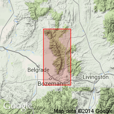
Pg. 1388-1390 (table 1), 1394. Park formation. In Bridger Range, Gallatin County, Montana, consists of green and maroon fissile shale, with thin-bedded limestone unit at top and, locally, intercalated conglomeratic, arkosic limestone and arkose beds in lower portion. Thickness about 190 feet. Overlies Meagher formation; contact is arbitrarily placed at top of uppermost Meagher-type limestone. Underlies Maurice formation. Age is considered late Middle Cambrian, based on fossils (inarticulate brachiopods, trilobites; identified by A.R. Palmer and B.F. Howell).
Source: Publication.
- Usage in publication:
-
- Park member
- Modifications:
-
- Revised
- Biostratigraphic dating
- Overview
- AAPG geologic province:
-
- Williston basin
Summary:
Revised to Park member of Emerson formation in the Little Rocky Mountains, Blaine and Phillips Counties, Montana, in the Williston basin. Consists of dark-green, fissile, fossiliferous shale which becomes light-green and calcareous in upper portion. Thin beds of small limestone pebble conglomerates and layers of small white limestone nodules of a coquina of trilobite fragments become noticeable in top beds. Thickness 300 to 350 feet. In gradational contact with overlying Zortman member (new) of Emerson; contact is 75 feet of predominantly shale beds [These beds not assigned to either member]. Underlain by Meagher member of Emerson. Age is Middle Cambrian.
Source: Modified from GNU records (USGS DDS-6; Denver GNULEX).
- Usage in publication:
-
- Park shale*
- Modifications:
-
- Overview
- AAPG geologic province:
-
- Montana folded belt
Summary:
Best exposed along flanks of north half of anticline in Devils Fence quad, Jefferson and Broadwater Cos, MT, Montana folded belt province. Conformably overlies Meagher limestone; conformably underlies Pilgrim dolomite. Though upper and lower contacts are almost always concealed, both must be either sharp or gradational over only a few feet. Thickness ranges from 200-290 ft. Geologic maps; measured section; generalized stratigraphic section. In places is intruded by sills of andesite or diorite. Middle Cambrian age.
Source: GNU records (USGS DDS-6; Denver GNULEX).
- Usage in publication:
-
- Park shale
- Modifications:
-
- Overview
- AAPG geologic province:
-
- Wind River basin
Summary:
Recognition of Park shale in report area, Fremont and Natrona Cos, WY in the Wind River basin, is dependent on presence of underlying Death Canyon limestone. Is the upper formation of the Gros Ventre group. Where Death Canyon is missing, Park is not separable from the Wolsey shale. Averages about 400 ft thick in area. Underlies Dunoir (spelled Du Noir by Shaw in earlier reports). Cross sections. Upper part has CEDARIA zone fauna, a representative Upper Cambrian fauna. Lower Park representative of a deeper water deposit just beyond edge of coarse clastic deposition. Upper Park probably a very shallow water deposit that had restricted circulation.
Source: GNU records (USGS DDS-6; Denver GNULEX).
- Usage in publication:
-
- Park Argillite*
- Modifications:
-
- Redescribed
- Areal extent
- Dominant lithology:
-
- Argillite
- AAPG geologic province:
-
- Montana folded belt
Summary:
Maps unit in northern Boulder batholith area in Lewis and Clark and Jefferson Cos, MT in Montana folded belt province. Outcrop trends northwest-southeast from northwestern to central part of mapped area, then trends easterly to southwestern edge of map. Unit is 180-200 ft thick. Because of rock's high density (2.76) and lack of fissility, use of argillite rather than shale as part of unit's name is more appropriate. Conformably overlies Middle Cambrian Meagher Limestone; conformably underlies Upper Cambrian Hasmark Dolomite. Fossils include Middle Cambrian LINGUELLA. Geologic map.
Source: GNU records (USGS DDS-6; Denver GNULEX).
- Usage in publication:
-
- Park shale*
- Modifications:
-
- Overview
- AAPG geologic province:
-
- Montana folded belt
Summary:
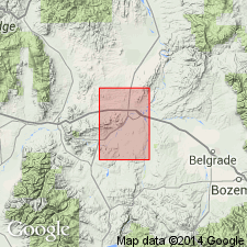
Good exposures east of Milligan Creek, west of Willow Creek, and on north bank of creek along the Madison-Gallatin Co line, MT, Montana folded belt province. Is generally described (partly covered) in two measured sections. The first section measured in sec 10, T1N, R1W where it is 150 ft thick and the other in NE1/4 NE1/4 sec 1, T2N, R1E where it is 100 ft thick. Lies between Meagher limestone beneath and Pilgrim limestone above. Is a marine shale; no fossils found in quad. Assigned to the Middle Cambrian. Geologic map. [Compare with Peale, 1893, 1896 and Berry, 1943.]
Source: GNU records (USGS DDS-6; Denver GNULEX).
- Usage in publication:
-
- Park Shale
- Modifications:
-
- Overview
- AAPG geologic province:
-
- Montana folded belt
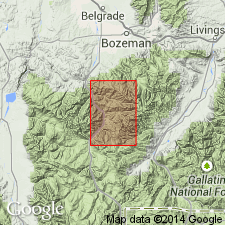
Summary:
Within mapped area, thickness ranges from 175 ft in southwest to 241 ft in northwest; it is 217 ft thick in northeast part of area. Quad is in Montana folded belt province. Conformably overlies Meagher Limestone; conformably underlies Pilgrim Limestone. Mapped undivided with other Middle Cambrian units including Flathead Quartzite, Wolsey Shale and Meagher. Top of Park is approximate Middle-Upper Cambrian faunal boundary.
Source: GNU records (USGS DDS-6; Denver GNULEX).
- Usage in publication:
-
- Park Shale*
- Modifications:
-
- Areal extent
- AAPG geologic province:
-
- Montana folded belt
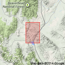
Summary:
Not present in mapped area in central Beaverhead Co, MT, Montana folded belt province. Park and Meagher Limestone probably eroded during local deformation. Wolsey Shale disconformably underlies Pilgrim? Dolomite.
Source: GNU records (USGS DDS-6; Denver GNULEX).
- Usage in publication:
-
- Park Shale Member*
- Modifications:
-
- Areal extent
- AAPG geologic province:
-
- Wind River basin
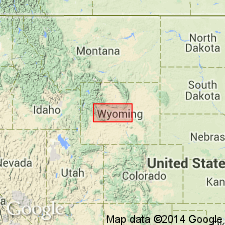
Summary:
Geographically extended into the northwestern part of the Wind River basin of WY as the upper member of the Gros Ventre Formation. Consists of 421 ft of gray micaceous shale with varying amounts of limestone that increases in abundance near top. The limestone commonly contains flat-pebble conglomerate of disk-shaped limestone oriented parallel to the bedding planes in a dense to granular limestone matrix. The flat pebbles are conspicuous on weathered surfaces. Overlies Death Canyon Limestone Member of Gros Ventre. Underlies Gallatin Limestone. Presence of Death Canyon makes division of Gros Ventre into members possible. The three members can be recognized as far as Bull Lake Canyon in sec 9, T2S, R3W. Cross sections. Age of Gros Ventre is middle and late Middle Cambrian.
Source: GNU records (USGS DDS-6; Denver GNULEX).
- Usage in publication:
-
- Park Shale*
- Modifications:
-
- Mapped
- AAPG geologic province:
-
- Sweetgrass arch
Summary:
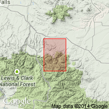
Park Shale. Green and greenish-gray to pale-red, thin-bedded, locally platy, micaceous; contains a few light-gray noular limestone layers in upper part. Altered to dary-gray hornfels near large intrusions. About 170 to 250 feet thick. Lies below Pilgrim Limestone and above Meagher Limestone. Age is Middle Cambrian.
Source: Publication.
- Usage in publication:
-
- Park Shale*
- Modifications:
-
- Areal extent
- AAPG geologic province:
-
- Montana folded belt
- Snake River basin
Summary:
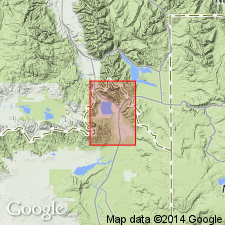
Occurs in Henrys Lake Mountains, Gallatin Co, MT, Montana folded belt province and Fremont Co, ID, Snake River basin where it forms broad saddles, grass-covered benches, and strike valleys. Thickness is 170 ft. Overlies Meagher Limestone; underlies undivided Bighorn? Dolomite, Snowy Range? Formation, and Pilgrim? Limestone. Middle Cambrian age.
Source: GNU records (USGS DDS-6; Denver GNULEX).
For more information, please contact Nancy Stamm, Geologic Names Committee Secretary.
Asterisk (*) indicates published by U.S. Geological Survey authors.
"No current usage" (†) implies that a name has been abandoned or has fallen into disuse. Former usage and, if known, replacement name given in parentheses ( ).
Slash (/) indicates name conflicts with nomenclatural guidelines (CSN, 1933; ACSN, 1961, 1970; NACSN, 1983, 2005, 2021). May be explained within brackets ([ ]).

