

- Usage in publication:
-
- Paradise formation
- Modifications:
-
- Named
- Dominant lithology:
-
- Limestone
- Sandstone
- Shale
- AAPG geologic province:
-
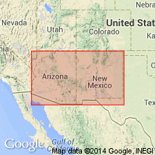
- Pedregosa basin
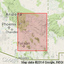
Summary:
Named for Paradise, AZ in Chiricahua Mountains in the Pedregosa basin. Composed of black and gray, moderately thick- and thin-bedded, crystalline limestone alternating with sandstone, shale, oolite, cross-bedded, calcareous sandstone, and arenaceous limestone. Thickness is 134 feet. Overlies what seems to be an equivalent of the Escabrosa limestone (Lower Mississippian) and superjacent Naco (Pennsylvanian).
Source: GNU records (USGS DDS-6; Denver GNULEX).
- Usage in publication:
-
- Paradise formation*
- Modifications:
-
- Biostratigraphic dating
- AAPG geologic province:
-
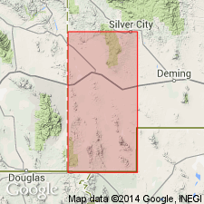
- Pedregosa basin
Summary:
Is known to be present only in Chiricahua Mountains of AZ in the Pedregosa basin, but is probably present to the east in NM. Apparently conformable on Escabrosa limestone, but unconformably overlain by Naco limestone. Divided into 8 numbered members. Report contains detailed analysis of fauna. Is of Late Mississippian (Tennesseean) age.
Source: GNU records (USGS DDS-6; Denver GNULEX).
- Usage in publication:
-
- Paradise formation
- Modifications:
-
- Areal extent
- AAPG geologic province:
-
- Pedregosa basin
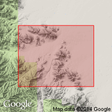
Summary:
Paradise formation. Present in the Chiricahua Mountains, Cochise County, southeastern Arizona. Gray limestone and brown to olive-black calcareous shale. Conformably overlies Escabrosa limestone and disconformably underlies Horquilla limestone of Naco group. Age is Late Mississippian.
Measured section: east end of Blue Mountain, in SE/4 SW/4 sec. 20, T. 16 S., R. 30 E., 155 feet thick.
Source: Modified from GNU records (USGS DDS-6; Denver GNULEX).
- Usage in publication:
-
- Paradise formation
- Modifications:
-
- Areal extent
- Overview
- AAPG geologic province:
-
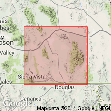
- Pedregosa basin
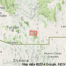
Summary:
Extended to central Peloncillo Mountains, NM in Pedregosa basin. Conformably overlies Escabrosa limestone. Disconformably overlain by Horquilla limestone. Is 217 ft thick. Sections measured in SE1/4 SE1/4 sec 22, T25S, R21W and in SE1/4 sec 16, T25S, R21W. Fossils are abundant throughout report area but preservation is poor. Brachiopods identified indicate a Chester age for most of the Paradise, but may be late Meramec age at base. Geologic map included. Is of late Mississippian (Meramecian to Chesterian) age.
Source: GNU records (USGS DDS-6; Denver GNULEX).
- Usage in publication:
-
- Paradise Formation
- Modifications:
-
- Revised
- Overview
- AAPG geologic province:
-
- Pedregosa basin
Summary:
Base of Paradise Formation as defined by Hernon (1935) raised [an undesignated amount]. Transitional contact with underlying Hachita Formation (new) is an arbitrary plane; defined at Blue Mountain and exposures in southwestern NM as the base of the first 18-inch shale zone that occurs on top of massive limestone of Hachita Formation. Fossils listed; part of brachiopod fauna described. Maximum thickness is 220 ft in Big Hatchet Mountains; thins rapidly north and west; is about 80 ft thick in eastern Chiricahua Mountains of AZ. Is in the Pedregosa basin. Is of Mississippian (late Meramecian to middle Chesterian) age.
Source: GNU records (USGS DDS-6; Denver GNULEX).
- Usage in publication:
-
- Paradise Formation
- Modifications:
-
- Areal extent
- Overview
- AAPG geologic province:
-
- Pedregosa basin
Summary:
Extended to the Animas Mountains and Sierra Rica, NM in the Pedregosa basin. Is limited to southeast AZ, southwest NM, and northwest Chihuahua. Is not known west of Chiricahua Mountains. Measured section in Mescal Canyon, secs 29, 30, 31, 32, T30S, R15W where Paradise is 318 ft thick and conformably overlies Escabrosa Limestone, and is unconformably overlain by Horquilla Limestone. Is 282 ft thick in Big Hatchet Mountains. Is of Mississippian (Meramec and Chester) age. Contains marine invertebrate fossils--corals, bryozoans, crinoids, brachiopods, pelecypods, scaphopods, gastropods, aphalopods, and trilobites, and some plant fossils near top.
Source: GNU records (USGS DDS-6; Denver GNULEX).
- Usage in publication:
-
- Paradise Formation*
- Modifications:
-
- Overview
- AAPG geologic province:
-
- Basin-and-Range province
Summary:
Is 220 ft thick in the Klondike Hills, Grant and Luna Cos, NM in southeastern part of Basin-and-Range province. Overlies Hachita Formation of Escabrosa Group with gradational contact. Underlies Horquilla Limestone with sharp to undulating unconformable contact. Relatively abundant megafossil fauna is inadequately studied; fairly abundant, smaller Foraminifera microfauna also present. Very tentative and preliminary analysis of microfauna in lower part of formation and brachiopods in upper part indicate a Meramec and Chester (Late Mississippian) age, respectively.
Source: GNU records (USGS DDS-6; Denver GNULEX).
- Usage in publication:
-
- Paradise Formation
- Modifications:
-
- Age modified
- Biostratigraphic dating
- AAPG geologic province:
-
- Pedregosa basin
Summary:
Based on conodont studies, is middle Chesterian in age. It is separated by unconformities at both base and top. Is in the Pedregosa basin.
Source: GNU records (USGS DDS-6; Denver GNULEX).
- Usage in publication:
-
- Paradise Formation*
- Modifications:
-
- Areal extent
- AAPG geologic province:
-
- Pedregosa basin
Summary:
Mapped in central Peloncillo Mountains, Hidalgo Co, NM in Pedregosa basin. Overlies Hachita Formation (Lower and Upper Mississippian) of Escabrosa Group. Unconformably underlies Horquilla Limestone (Pennsylvanian) of Naco Group. Is 13-37 m thick. Is Late Mississippian age [apparently on basis of previous work].
Source: GNU records (USGS DDS-6; Denver GNULEX).
- Usage in publication:
-
- Paradise Formation*
- Modifications:
-
- Areal extent
- AAPG geologic province:
-
- Pedregosa basin
Summary:
Extended to Chiricahua Mountains, AZ in the Pedregosa basin. Correlation chart. Is of Late Mississippian age.
Source: GNU records (USGS DDS-6; Denver GNULEX).

- Usage in publication:
-
- Paradise Formation*
- Modifications:
-
- Mapped 1:24k
- Dominant lithology:
-
- Shale
- Mudstone
- Siltstone
- Limestone
- Sandstone
- AAPG geologic province:
-
- Pedregosa basin
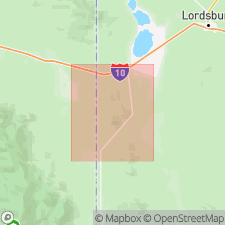
Summary:
Paradise Formation. Mapped in Big Hatchet Mountains, Hidalgo County, southwestern New Mexico. Mostly yellowish-gray shale, mudstone, and siltstone. Near top and base beds of limestone alternate with shale. South of mouth of Chaney Canyon, includes quartz sandstone lentil, 16.5 to 33 feet (5 to 10 m), and carrying CALAMITES. Thickness about 318 feet (95 m). Conformably overlies Escabrosa Limestone (Upper and Lower Mississippian); disconformably underlies Horquilla Limestone (Lower Permian and Pennsylvanian). Fossiliferous (brachiopods, bryozoans, plants). Age is Late Mississippian.
Source: Publication.
For more information, please contact Nancy Stamm, Geologic Names Committee Secretary.
Asterisk (*) indicates published by U.S. Geological Survey authors.
"No current usage" (†) implies that a name has been abandoned or has fallen into disuse. Former usage and, if known, replacement name given in parentheses ( ).
Slash (/) indicates name conflicts with nomenclatural guidelines (CSN, 1933; ACSN, 1961, 1970; NACSN, 1983, 2005, 2021). May be explained within brackets ([ ]).