- Usage in publication:
-
- Palo Pinto formation
- Modifications:
-
- Original reference
- Dominant lithology:
-
- Limestone
- AAPG geologic province:
-
- Bend arch
Summary:
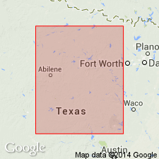
Pg. 133-145. Palo Pinto formation, basal formation of Canyon division [group]. Everywhere easily recognized in well logs and in field, because it forms lowermost series of thick limestones in section above Strawn sands. The lower member is a massive limestone that forms a prominent scarp dividing the Strawn area from the Canyon. Approximately equivalent to (ascending): "Coral" limestone, Rochelle conglomerate, and Brownwood bed of Drake's (1893) Colorado River section. Overlies Strawn division and underlies Graford formation. Age is Late Pennsylvanian. Report area in Brazos River Valley, north-central Texas.
Source: US geologic names lexicon (USGS Bull. 896, p. 1593); supplemental information from GNU records (USGS DDS-6; Denver GNULEX).

- Usage in publication:
-
- Palo Pinto limestone
- Modifications:
-
- Revised
- Areal extent
- AAPG geologic province:
-
- Bend arch
- Fort Worth syncline
Summary:
Palo Pinto limestone of Canyon group (revised) not present south of Gorman, Comanche Co, TX, Bend arch; in the area of the present Colorado River Valley the sea was apparently absent at the beginning of the Canyon epoch of the Pennsylvanian, or at least was too shallow and disturbed to be favorable for deposition of the Palo Pinto limestone. In Brazos River Valley to north, Palo Pinto underlies Graford formation (named) of Canyon and conformably overlies Mineral Wells formation (revised) of Strawn group. Outcrop extends from town of Whitt in Parker Co (Fort Worth syncline) to the Strawn oil field in Palo Pinto Co (Bend arch), and thence across Allen Ranch to the Cretaceous sand area. Palo Pinto is a thick, crystalline, dark-gray limestone weathering white or grayish yellow. In many places the lower part is made up of many thin beds from 2-6 inches thick, separated by partings of gray marl so that in weathering the rock shelves off into great piles of slabs, chips, and chunks. Upper layers are thicker, dark gray, fine grained, even-textured, more fossiliferous, and purer than the lower beds. Upon weathering these beds break into large blocks and irregular chunks. Has a predominantly molluscoid fauna. Fossils listed. Measured sections. Generalized correlation chart. Pennsylvanian age.
Source: GNU records (USGS DDS-6; Denver GNULEX).

- Usage in publication:
-
- Palo Pinto Formation
- Modifications:
-
- Areal extent
- Mapped 1:250k
- Dominant lithology:
-
- Sandstone
- Shale
- Limestone
- AAPG geologic province:
-
- Fort Worth syncline
Summary:
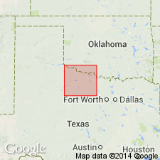
Mapped as a formation of Canyon Group in the southeastern part of mapped area, north-central TX (ascending): Palo Pinto Formation, Wolf Mountain Shale, Winchell Limestone, Placid Shale, Ranger Limestone, Colony Creek Shale, and Home Creek Limestone. Farther east, Canyon is divided into (ascending): Willow Point Formation, Jasper Creek Formation with its Chico Ridge Limestone [unranked], Ventioner Formation, Ranger Limestone, and Colony Creek Shale. Present in southeastern Jack Co, on Fort Worth syncline. Consists of sandstone, shale, and limestone. Separately mapped as a single line at top is Wiles limestone [unranked], 1-4 ft thick. Oran Limestone [unranked], thickness to 30 ft, also separately mapped. Only upper part of Palo Pinto crops out in map area. Thickness of Palo Pinto within map area 70-100 ft. Age is Missouri (Late Pennsylvanian). Geologic map.
Source: GNU records (USGS DDS-6; Denver GNULEX).

- Usage in publication:
-
- Palo Pinto Formation
- Modifications:
-
- Not used
- AAPG geologic province:
-
- Fort Worth syncline
Summary:
[Rocks previously (1967 ed. of map) mapped as Palo Pinto Formation, along western edge of map sheet, Lake Bridgeport area, Jack and Wise Cos., central and northern TX, are reallocated to /Willow Point Formation of Canyon Group (1991 ed. of map). See entry under Willow Point. See also adjacent Wichita Falls-Lawton sheet, Texas Geol. Atlas, 1987.]
Source: Publication.
For more information, please contact Nancy Stamm, Geologic Names Committee Secretary.
Asterisk (*) indicates published by U.S. Geological Survey authors.
"No current usage" (†) implies that a name has been abandoned or has fallen into disuse. Former usage and, if known, replacement name given in parentheses ( ).
Slash (/) indicates name conflicts with nomenclatural guidelines (CSN, 1933; ACSN, 1961, 1970; NACSN, 1983, 2005, 2021). May be explained within brackets ([ ]).

