

- Usage in publication:
-
- Osgood phase
- Modifications:
-
- Named
- Dominant lithology:
-
- Limestone
- Chert
- AAPG geologic province:
-
- Cincinnati arch
Summary:
Named Osgood phase of the Laurel bed. The Laurel is composed of limestone with chert layers in the upper part. The Osgood phase is the basal richly fossiliferous part of the Laurel.
Source: GNU records (USGS DDS-6; Reston GNULEX).
- Usage in publication:
-
- Osgood beds
- Modifications:
-
- Revised
- AAPG geologic province:
-
- Cincinnati arch
Summary:
Osgood is separated from the Laurel limestone and treated as a separate unit called Osgood beds. Commonly composed of a lower clayey shale bed 11 to 16 feet thick, a medial limestone bed 1 to 5 ft thick, and an upper clayey shale a few in. to 5 ft thick. Osgood commonly overlies a thin unit called the basal Niagara limestone, which in turn overlies a unit called Clinton [Brassfield of modern usage]. Overlain by the Laurel limestone (Foerste, 1896) after the Osgood is removed.
Source: GNU records (USGS DDS-6; Reston GNULEX).
- Usage in publication:
-
- Osgood formation
- Modifications:
-
- Revised
- AAPG geologic province:
-
- Cincinnati arch
Summary:
Designated Osgood formation. The maximum and prevailing thickness is about 30 feet. Formation is composed of shale and limestone in four separate divisions, which are remarkably persistent in thickness and lithic character. Bottom is a reddish fine grained limestone about 2 feet thick. Lower shale of the Osgood makes up about two-thirds of the thickness of the formation. It is mostly coarse, lumpy, gray, calcareous, and magnesian shale or mudrock that weathers to clay and varies in thickness from 12 to 20 feet. The upper limestone of the Osgood is divided into layers from one foot in thickness down. It is mostly fine grained and reddish and is strongly magnesian; it is persistent throughout the county with a thickness of 5 to 8 ft. The upper shale of the Osgood is a thin but persistent; it is rather soft, somewhat coarse, fairly fissile, greenish gray, and is 2 to 3 ft thick. The Osgood is sparsely fossiliferous in this region. It unconformably overlies the Brassfield limestone; conformably underlies the Laurel dolomite. Age is Niagaran.
Source: GNU records (USGS DDS-6; Reston GNULEX).
- Usage in publication:
-
- Osgood member
- Modifications:
-
- Overview
- AAPG geologic province:
-
- Cincinnati arch
Summary:
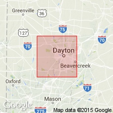
Designated Osgood member of Alger formation; lower member of two. Primarily a soft calcareous clay shale with a few thin flaky layers of dolomite, mainly in the upper portion; bluish gray, light green, pale pink, and mottled. In southwestern OH it varies from 10 to 80 ft in thickness but averages about 45 ft. It carries a fauna of poorly preserved forms. Unit is underlain by Dayton formation; overlain by Laurel member of Alger formation.
Source: GNU records (USGS DDS-6; Reston GNULEX).
- Usage in publication:
-
- Osgood formation*
- Modifications:
-
- Revised
- AAPG geologic province:
-
- Cincinnati arch
Summary:
Designated Osgood formation. Consists of a gray calcareous clay shale in its lower part, and contains beds and lenses of shaly limestone towards the top. Average thickness is 15 ft. Overlies Dayton limestone; underlies Laurel dolomite. Unit is of Niagaran age.
Source: GNU records (USGS DDS-6; Reston GNULEX).
- Usage in publication:
-
- Osgood formation
- Modifications:
-
- Revised
- AAPG geologic province:
-
- Cincinnati arch
Summary:
Pg. 244-248. Osgood formation of Wayne group. Included in Wayne group. Unconformably overlies Brassfield limestone and conformably grades into overlying Laurel limestone. Composed largely of gray sometimes bluish and sometimes greenish calcareous shale; locally may contain one or more beds of almost silt-free limestone; in western valley, basal few feet are red, and locally entire formation is red. Thickness 10 to 20 feet. [Age is Middle Silurian.]
Source: US geologic names lexicon (USGS Bull. 1200, p. 2863-2864).
- Usage in publication:
-
- Osgood shale*
- Modifications:
-
- Revised
- AAPG geologic province:
-
- Cincinnati arch
Summary:
Designated Osgood shale. Composed of a hard, blocky shale, about 25 ft thick. Overlies Dayton limestone; underlies Laurel dolomite. Niagaran age.
Source: GNU records (USGS DDS-6; Reston GNULEX).
- Usage in publication:
-
- Osgood Member
- Modifications:
-
- Revised
- AAPG geologic province:
-
- Cincinnati arch
Summary:
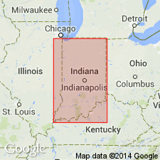
Osgood Formation is reduced in rank to Osgood Member of Salamonie Dolomite in southeastern IN. Osgood is lowest of two members. Unconformably overlies Brassfield Limestone, Saluda Limestone, or Whitewater Formation. Conformably overlain by Laurel Member of Salamonie. Osgood is a series of intercalated dolomitic limestone or dolomite and shale beds totaling 10 to 30 ft thick.
Source: GNU records (USGS DDS-6; Reston GNULEX).

- Usage in publication:
-
- Osgood Member
- Modifications:
-
- Overview
- AAPG geologic province:
-
- Cincinnati arch
Summary:
Designated Osgood Member of Salamonie Dolomite by Indiana Geological Survey. Lower member of two. Composed of dolomitic or calcareous shale and argillaceous dolomitic limestone and dolomite, all lithologies are gradational. Shale generally more prominent to the south. In Franklin Co., IN, and northward carbonate rocks are dominant and the Osgood is not readily differentiated from overlying Laurel Member. Thickness ranges from 10 to 30 ft, but averages about 15 ft. Crops out in southeastern part of IN.
Source: GNU records (USGS DDS-6; Reston GNULEX).
- Usage in publication:
-
- Osgood Formation*
- Modifications:
-
- Overview
- AAPG geologic province:
-
- Cincinnati arch
Summary:
Comprehensive description of the Osgood Formation in outcrop on the west side of the Cincinnati Arch in KY.
Source: GNU records (USGS DDS-6; Reston GNULEX).
- Usage in publication:
-
- Osgood Formation*
- Modifications:
-
- Revised
- Biostratigraphic dating
- AAPG geologic province:
-
- Cincinnati arch
Summary:
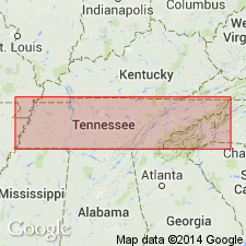
Used as Osgood Formation of Wayne Group in du Pont Geohydrological Survey Well near Waverly, Humphreys Co., central TN. The conodont PSEUDOONEOTODUS BICORNIS first appears in the core AT 785.5 to 786.1 ft, in the Osgood Formation, indicating an age no older than late Llandoverian C3 or C4 (Fordham, 1991). Age is Silurian, late Llandoverian to early Wenlockian.
Source: GNU records (USGS DDS-6; Reston GNULEX).
For more information, please contact Nancy Stamm, Geologic Names Committee Secretary.
Asterisk (*) indicates published by U.S. Geological Survey authors.
"No current usage" (†) implies that a name has been abandoned or has fallen into disuse. Former usage and, if known, replacement name given in parentheses ( ).
Slash (/) indicates name conflicts with nomenclatural guidelines (CSN, 1933; ACSN, 1961, 1970; NACSN, 1983, 2005, 2021). May be explained within brackets ([ ]).