The National Geologic Map Database is migrating to a new infrastructure. We apologize for any service disruptions during this process.
|
|---|


- Usage in publication:
-
- Opohonga limestone*
- Modifications:
-
- Named
- Dominant lithology:
-
- Limestone
- AAPG geologic province:
-
- Wasatch uplift
Summary:
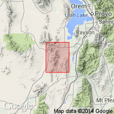
Named for the Opohonga mine, is exposed from the northern boundary of the Tintic mining district southward to Mammoth [Eureka 7.5' quad], T10S, R2W, Utah Co, UT, Wasatch uplift. No type locality designated. Is persistent and thick; characterized by mottled gray limestone that alternates with bands of yellow to red argillaceous beds. Colors due to surface weathering. Eye-shaped bodies or short lenses 1 to 3 inches long separate the red and shaly layers. Has a number of thin intraformational conglomerate beds. Conglomerate has flakes of gray limestone, rounded pebbles (as much as 4 inches) from older Paleozoic formations. Ranges from 740 ft thick, at Sioux Ajax tunnel, to 825 ft thick at Eureka Peak, and at least 1,000 ft thick at north boundary of Tintic district. Overlies Ajax limestone (named). Contact placed at base of a shaly limestone. Underlies Bluebell dolomite (named). Age is Early Ordovician based on stratigraphic relationships and poorly preserved fossils [trilobites] identified by Edwin Kirk.
Source: GNU records (USGS DDS-6; Denver GNULEX).

- Usage in publication:
-
- Opohonga limestone*
- Modifications:
-
- Overview
- AAPG geologic province:
-
- Wasatch uplift
- Great Basin province
Summary:
Crops out in the main Tintic district (T10S, R2W, Utah Co, UT, Wasatch uplift) north to Twelvemile Pass (T9S, R3W into Tooele Co, UT, Great Basin province). Ranges from about 400 ft thick (North Tintic district) to about 1,000 ft thick (East Tintic district). Is a very distinctive and easily recognized formation being thin bedded from top to bottom and having no marker units. Thin beds of flat-pebble conglomerate also characteristic of formation. Overlies Ajax dolomite conformably. Underlies Fish Haven dolomite disconformably. Of Early Ordovician age (brachiopods and trilobites). Geologic map. Correlation diagrams.
Source: GNU records (USGS DDS-6; Denver GNULEX).
For more information, please contact Nancy Stamm, Geologic Names Committee Secretary.
Asterisk (*) indicates published by U.S. Geological Survey authors.
"No current usage" (†) implies that a name has been abandoned or has fallen into disuse. Former usage and, if known, replacement name given in parentheses ( ).
Slash (/) indicates name conflicts with nomenclatural guidelines (CSN, 1933; ACSN, 1961, 1970; NACSN, 1983, 2005, 2021). May be explained within brackets ([ ]).