The National Geologic Map Database is migrating to a new infrastructure. We apologize for any service disruptions during this process.
|
|---|


- Usage in publication:
-
- Obryan Limestone Member
- Obryan member
- Modifications:
-
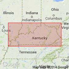
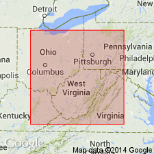
- Areal extent
- AAPG geologic province:
-
- Appalachian basin
Summary:
Breathitt Formation is informally elevated to group rank and subdivided into the following eight informal formations: Pocahontas, Bottom Creek, Alvy Creek, Grundy, Pikeville, Hyden, Four Corners, and Princess formations. The Obryan Limestone (of Rice and others, in press) [published in GSA Special Paper 294] is here assigned to the Princess formation. Unit overlies the Princess Nos. 5A and 5B coal beds and underlies the Laurel coal. Treated informally on stratigraphic column (fig. 1). Shown as latest Atokan. [Revisions made in this paper are strongly contested by C. Rice and other USGS scientists who work in this area (oral commun., 9/3/93).]
Source: GNU records (USGS DDS-6; Reston GNULEX).

- Usage in publication:
-
- Obryan Member*
- Modifications:
-
- Areal extent
- AAPG geologic province:
-
- Appalachian basin
Summary:
Obryan Member of Breathitt Formation. Marine limestone [up to 9 feet feet] near top of Breathitt Formation, above the Kilgore Flint Member or Limekiln limestone (informal, unranked). Lies below the Hitchins or Flint clay bed; lies above Princess No. 5B, Princess No. 4A, or Laurel coal bed. Correlates with Columbiana Member of Allegheny Formation [of Pennsylvania and northern Ohio]. Does not correlate with the Vanport; new paleontologic data shows the Obryan lies above the Vanport (see Rice and others, 1994, GSA Spec. Paper 294, p. 13-18; see also Rice and others, same vol., p. 140). Age is Middle Pennsylvanian.
Recognized in Princess and Licking River districts, eastern KY.
Source: Publication.
- Usage in publication:
-
- Obryan Member*
- Modifications:
-
- Principal reference
- Dominant lithology:
-
- Limestone
- AAPG geologic province:
-
- Appalachian basin
Summary:
Named as a member of the Breathitt Formation in northeastern KY and as a member of the Allegheny Formation in southeastern OH. Named for Obryan Cemetery. Previously identified as Vanport Limestone of White (1878), Vanport Limestone Member of Breathitt Formation or Vanport Limestone Member as used by Phalen (1912). Identical to informal Vanport or "Ferriferous" limestone member of Allegheny Formation (Stout, 1916). Continuous from Ashland, KY, to Zaleski, OH. Also occurs as discontinuous lenses. Medium-gray to brown, massive weathering, irregularly bedded, bioclastic limestone with micritic matrix. Upper 15 cm is ferruginous, weathers red. Locally recrystallized. At type section, up to 1.8 m thick, but pinches out northward. Lenses less than 3 ft (1 m) thick. Underlain by rooted, medium-gray, carbonaceous, silty to sandy claystone, unnamed part of Breathitt; overlain by light-gray, rooted claystone, unnamed part of Breathitt. Contains bivalves, gastropods, conodonts, and fusulinids (including diagnostic BEEDEINA ASHLANDENSIS Douglass). Correlates with Columbiana Member of Allegheny Formation in Flint Ridge area of central OH; both Obryan and Columbiana contain conodonts including new species HINDEODUS as well as a species of NEOGNATHODUS that differs from that of underlying Vanport Limestone Member. Age is Middle Pennsylvanian. Report includes geologic map, correlation diagram, and stratigraphic nomenclature chart.
Source: GNU records (USGS DDS-6; Reston GNULEX).

- Usage in publication:
-
- Obryan Member
- Obryan limestone
- Modifications:
-
- Areal extent
- AAPG geologic province:
-
- Appalachian basin
Summary:
Corr. chart. Obryan Member of Princess Formation of Breathitt Group (KY); Obryan limestone (informal, unranked) in Allegheny Group (OH). Limestone and/or chert. In eastern Kentucky [Princess and Licking River districts] is a member in middle of Princess Formation above the Kilgore Flint Member (Flint Ridge flint, Limekiln limestone); lies below Hitchins (Flint) clay bed and above Princess No. 5B (No. 4A) coal bed. In Ohio is an informal, unranked unit in upper part of Allegheny Group above the Zaleski flint (Vanport); lies below Lawrence coal bed and above Scrubgrass ("Clarion") coal bed. Carries marine fossils. Age is Middle Pennsylvanian (Westphalian; earliest Desmoinesian). [Peppers (1996, GSA Memoir 188, pl.) placed the Princess No. 5B coal bed in lower part of Westphalian D, THYMOSPORA OBSCURA-T. THIESSENII (OT) miospore assemblage zone of western Europe.]
[See also Chesnut, 1997 (revised Oct. 12, 1999), Stratigraphy of the coal-bearing strata of the Eastern Kentucky coal field, available online through the Kentucky Geol. Survey (http://www.uky.edu/KGS/coal/coalcorrel.htm).]
Source: Publication.
For more information, please contact Nancy Stamm, Geologic Names Committee Secretary.
Asterisk (*) indicates published by U.S. Geological Survey authors.
"No current usage" (†) implies that a name has been abandoned or has fallen into disuse. Former usage and, if known, replacement name given in parentheses ( ).
Slash (/) indicates name conflicts with nomenclatural guidelines (CSN, 1933; ACSN, 1961, 1970; NACSN, 1983, 2005, 2021). May be explained within brackets ([ ]).