- Usage in publication:
-
- New Providence shale
- Modifications:
-
- Named
- Dominant lithology:
-
- Shale
- AAPG geologic province:
-
- Illinois basin
Summary:
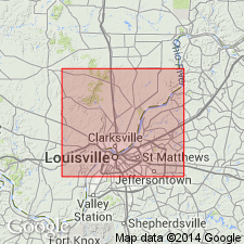
New Providence shale named. A fine greenish marly shale 80 to 120 ft thick, contains bands of carbonate of iron. Underlain by a thin bed of ferruginous limestone [Rockford Limestone], which is underlain by the New Albany black slate. Near New Albany, overlain by a thin stratum of ferruginous sandstone while in northwestern part of Clarke Co., IN, overlain by a thin fossiliferous limestone. These strata overlain by a thick sequence of bluish, friable micaceous shale.
Source: GNU records (USGS DDS-6; Reston GNULEX).
- Usage in publication:
-
- New Providence shale
- Modifications:
-
- Overview
- Dominant lithology:
-
- Clay
- Shale
- AAPG geologic province:
-
- Illinois basin
Summary:
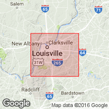
According to author, the New Providence shale, in Jefferson Co., KY, is almost wholly a soft, greenish clay shale, so loosely cemented that it readily disintegrates to a clay on weathering. In the middle part of the unit, there are locally a number of thin strata of limestone, principally made up of crinoid joints. Contains an abundance of iron carbonate concretions, practically confined to the upper half. Thickness is 150 to 160 ft. Underlain by the New Albany shale; overlain by Kenwood sandstone. Age is Mississippian (Osagean).
Source: GNU records (USGS DDS-6; Reston GNULEX).
- Usage in publication:
-
- New Providence shale
- Modifications:
-
- Areal extent
- AAPG geologic province:
-
- Illinois basin
- Cincinnati arch
- Appalachian basin
Summary:
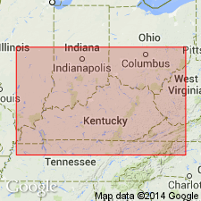
New Providence shale is extended southward along the west side of the Cincinnati Arch from southern IN and Jefferson Co., KY, into southern KY, across the Cincinnati Arch, and north along the eastern side of the arch into OH. On eastern side of arch called the New Providence group and there comprises the Cuyahoga and Logan formations. New Providence also identified along the west face of Pine Mountain in easternmost KY. Generally not present in TN, although some outliers have been located. Underlain by the New Albany shale on the west side of the Cincinnati Arch and by Ohio shale and Sunbury shale on the east side. Overlain by the Kenwood sandstone in Jefferson Co., KY.
Source: GNU records (USGS DDS-6; Reston GNULEX).
- Usage in publication:
-
- New Providence shale
- Modifications:
-
- Revised
- AAPG geologic province:
-
- Illinois basin
Summary:
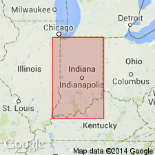
Borden group proposed as replacement for obsolete "Knobstone group". Described as a great group of shales and sandstones of the Burlington and Keokuk, well exposed about Borden [IN]. Borden group divided into (ascending) New Providence shale, Kenwood sandstone, Rosewood shale, and Riverside (or Holtsclaw) sandstone.
Source: GNU records (USGS DDS-6; Reston GNULEX).
- Usage in publication:
-
- New Providence shale
- Modifications:
-
- Revised
- AAPG geologic province:
-
- Cincinnati arch
Summary:
Both stratigraphic and paleontologic evidence indicates that the Ridgetop shale of Bassler (1912) of central TN should not be separated from the New Providence shale as a distinct formation but should be considered a phase of the New Providence. The New Providence as redefined consists mainly of drab gray shale, green shale, and crinoidal limestone. Thickness ranges up to a maximum of about 200 ft. New Providence is underlain by the Maury Member of the Chattanooga shale; overlain by the Fort Payne chert.
Source: GNU records (USGS DDS-6; Reston GNULEX).
- Usage in publication:
-
- New Providence formation
- Modifications:
-
- Overview
- AAPG geologic province:
-
- Cincinnati arch
- Illinois basin
Summary:
New Providence formation, basal unit of the Borden group, traced southward from southern IN into KY around the Jessamine dome and northward into OH. Numerous sections measured. At OH border, New Providence equated with the Cuyahoga formation (in contrast to Butts, 1922, who equated the New Providence to both the Cuyahoga and overlying Logan formations). Numerous lateral facies identified within New Providence.
Source: GNU records (USGS DDS-6; Reston GNULEX).
- Usage in publication:
-
- New Providence Formation*
- Modifications:
-
- Areal extent
- AAPG geologic province:
-
- Cincinnati arch
- Illinois basin
Summary:
New Providence Formation restricted from the top and east side of the Cincinnati Arch. Strata previously called New Providence by Butts (1922) and Stockdale (1939) included mostly in the Nancy Member (new) of the Borden Formation. New Providence as previously defined said to be unmappable.
Source: GNU records (USGS DDS-6; Reston GNULEX).
- Usage in publication:
-
- New Providence Shale
- Modifications:
-
- Overview
- Dominant lithology:
-
- Shale
- Limestone
- AAPG geologic province:
-
- Illinois basin
Summary:
New Providence Shale is composed of medium-gray and greenish-gray shale with thin zones of reddish-brown; at base is olive-gray, fine-grained limestone. Thickness is 0 to 20 ft. Underlain by Maury Shale; overlain by Fort Payne Formation. Mapped with Fort Payne Formation, and Maury and Chattanooga Shales.
Source: GNU records (USGS DDS-6; Reston GNULEX).
- Usage in publication:
-
- New Providence Shale
- Modifications:
-
- Overview
- AAPG geologic province:
-
- Illinois basin
Summary:
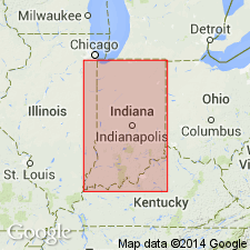
New Providence Shale of Borden Formation in Indiana is dominantly greenish-gray, blue-gray, and dark-lead-gray shale bordering on claystone. A sequence of alternating sandstones and shales occurs in the upper part in southern IN [Kenwood Siltstone Member of Kepferle, 1971]. Iron carbonate lenses and beds generally less than 1 ft thick are distributed throughout most of the formation in southern IN. Both fossiliferous and unfossiliferous limestones are present as concretionary bands, beds, and bioherm-like patches. In IN, crops out from New Albany on the Ohio River northward and northwestward to Benton Co. It is recognized in the subsurface to the west and south. Overlies Rockford Limestone; underlies Locust Point Formation.
Source: GNU records (USGS DDS-6; Reston GNULEX).
- Usage in publication:
-
- New Providence Shale Member*
- Modifications:
-
- Revised
- AAPG geologic province:
-
- Illinois basin
- Cincinnati arch
Summary:
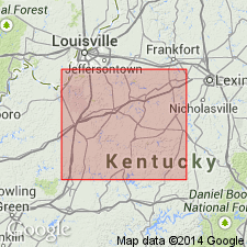
New Providence Formation of Borden Group reduced in rank to New Providence Shale Member of Borden Formation. Underlain by New Albany Shale. Overlain by Muldraugh or Nancy Member of Borden Formation except in central Jefferson Co. and northern Bullitt Co., KY, where overlain by Kenwood Siltstone Member.
Source: GNU records (USGS DDS-6; Reston GNULEX).
- Usage in publication:
-
- New Providence Shale Member*
- Modifications:
-
- Revised
- AAPG geologic province:
-
- Cincinnati arch
Summary:
New Providence Shale Member of Borden Formation reassigned as basal member of Fort Payne Formation in south-central KY. New Providence is greenish-gray clay shale and ranges in thickness from less than 1 to nearly 100 ft. Underlain by Chattanooga Shale or New Albany Shale.
Source: GNU records (USGS DDS-6; Reston GNULEX).
- Usage in publication:
-
- New Providence Shale
- Modifications:
-
- Overview
- AAPG geologic province:
-
- Cincinnati arch
Summary:
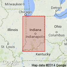
One of the best natural exposures of the unit is on the south end of Kenwood Hill in the southern part of Louisville, Jefferson Co., KY, the type section of the Kenwood Member. Though named for New Providence, IN, no typical exposures occur within 4 mi of the town. Unit is greenish-gray, blue-gray, or dark-lead-gray shale bordering on claystone and the Kenwood Member is a clayey, poorly sorted fine siltstone interbedded with shale similar to the rest of the New Providence. Contains ironstone lenses or beds in southern IN. Beds of fossiliferous and unfossiliferous limestones are common especially in KY. Dolomite beds, several ft thick are present locally in the northern areas. The Kenwood Member in Indiana is limited to Floyd Co., where its maximum thickness is approximately 50 ft. The rest of the formation ranges from about 150 to 250 ft where it outcrop. Conodont studies by Rexroad and Scott (1964) showed that the unit is time transgressive and is oldest in the northern outcrop area where the lower part is equivalent to the lower part of the Burlington Limestone or the Fern Glen Formation of the Mississippi Valley. To the south the basal part of the New Providence is younger and correlates with part of the Keokuk of IA. The upper limit of the correlation is indefinite but is within the Keokuk. Nowhere is the New Providence known to be of Kinderhookian age.
Source: GNU records (USGS DDS-6; Reston GNULEX).
For more information, please contact Nancy Stamm, Geologic Names Committee Secretary.
Asterisk (*) indicates published by U.S. Geological Survey authors.
"No current usage" (†) implies that a name has been abandoned or has fallen into disuse. Former usage and, if known, replacement name given in parentheses ( ).
Slash (/) indicates name conflicts with nomenclatural guidelines (CSN, 1933; ACSN, 1961, 1970; NACSN, 1983, 2005, 2021). May be explained within brackets ([ ]).

