

- Usage in publication:
-
- Mutual formation*
- Modifications:
-
- Named
- Dominant lithology:
-
- Quartzite
- Shale
- AAPG geologic province:
-
- Southern Rocky Mountain region
Summary:
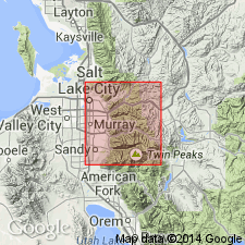
Name applied to the youngest pre-Cambrian unit mapped in area east of Salt Lake City. Source of name not explicitly stated, but inferred to be Mutual Mine near Big and Little Cottonwood Canyons, Salt Lake Co, UT, Southern Rocky Mountain region. No type locality designated. Forms a thin wedge. South edge is near divide between Big and Little Cottonwood Canyons. Thickens north to 1,200 ft between Big Cottonwood Canyon and mountain front. Consists of medium- to coarse-grained, red-purple quartzites and variegated red and green shale. Color contrasts with underlying Big Cottonwood series (new) unconformably and overlying Tintic quartzite. Rests on tillite (Mineral Fork tillite, a new name) in northern basin. Its lowest bed changes rapidly from coarse cobble to boulder conglomerate. Near the Mutual Mine where conglomerate is well exposed, it consists of cobbles and boulders of tillite, granite, gneiss, and limestone. Represents a return to shallow water deposition like the Big Cottonwood. Of pre-Cambrian age. Geologic map.
Source: GNU records (USGS DDS-6; Denver GNULEX).
- Usage in publication:
-
- Mutual quartzite
- Modifications:
-
- Revised
- Areal extent
- AAPG geologic province:
-
- Southern Rocky Mountain region
Summary:
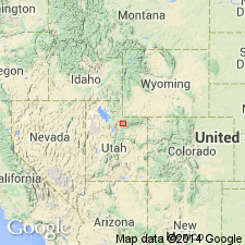
Name extended from Wasatch Mountains into the report area. Assigned as the oldest unit and lower formation of the Uinta Mountain group in western Uinta Mountains, Summit Co, UT, Southern Rocky Mountain region. Consists of reddish-purple quartzites and arkosites with lenses of dark-red and purple shale that extend 5-8 mi along strike in lower part and a buff quartzitic sandstone and brown micaceous shale at top named Box Canyon member. Some of the shale lenses are as thick as 300-400 ft. The Box Canyon member is 820 ft thick at mouth of Box Canyon. The formation in the upper part of Smith and Morehouse Canyon is 4,025 ft thick. Overlies a thick, unnamed yellow and buff quartzite and brown micaceous shale sequence of pre-Cambrian age. Underlies the newly named Red Pine shale (formerly called "Ophir" in this area), upper formation of the Uinta Mountain group. Columnar section. Geologic map. Assigned to the pre-Cambrian.
Source: GNU records (USGS DDS-6; Denver GNULEX).
- Usage in publication:
-
- Mutual Formation*
- Modifications:
-
- Areal extent
- AAPG geologic province:
-
- Northern Rocky Mountain region
Summary:
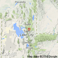
Mutual Formation. Extended into Pocatello area, Bannock County, southeastern Idaho, [on basis of its characteristic lithology, color, and position]. Overlies Inkom Formation (new); [basal contact placed at abrupt change from argillite (of Inkom) to quartzite (of Mutual)]. Underlies Camelback Mountain Formation (new). In Huntsville area (Weber County) of northern Utah only, Mutual assigned to Brigham Group (revised), overlying Inkom(?) Formation and underlying Browns Hole Formation (new), also of Brigham Group. [Is present in all basin sequences.] Age is late Precambrian; [is youngest unit that is certainly only of Precambrian age].
Source: Changes in stratigraphic nomenclature, 1971 (USGS Bull. 1372-A, p. A14-A15); supplemental information (in brackets) from GNU records (USGS DDS-6; Denver GNULEX).
- Usage in publication:
-
- Mutual Formation
- Modifications:
-
- Revised
- Areal extent
- AAPG geologic province:
-
- Great Basin region
Summary:
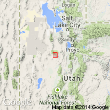
Mutual Formation. Extended into the Sheeprock Mountains of north-central Utah (Great Basin region) as 1 of 4 formations of the Brigham Group. As defined here, the Mutual Formation includes part of Cohenour's (1959) "upper Sheeprock" and the upper member of his Mutual Formation; his lower argillite member is reallocated to the upper part of the Inkom Formation of the Brigham Group, and his Mutual(?) Formation, mapped northeast of Dutch Peak, is included in the Cady Canyon Quartzite, also of the Brigham Group. Consists of grayish-red to pale purple or pink, fine- to coarse-grained, gritty, locally, pebbly, feldspathic quartzite that has abundant cross-laminated trough beds. Thickness 430 to 510 m. Overlies the Inkom and underlies Prospect Mountain Quartzite (newly assigned to the Brigham Group); both contacts are transitional. Age is Late Proterozoic. Report includes geologic map, stratigraphic sections.
Source: Modified from GNU records (USGS DDS-6; Denver GNULEX).
- Usage in publication:
-
- Mutual Formation
- Modifications:
-
- Revised
- AAPG geologic province:
-
- Northern Rocky Mountain region
Summary:
Assigned as 1 of 6 formations to the Brigham Group [group rank extended into ID] in the northern Bannock and Portneuf Ranges, and as 1 of 7 formations in the southern Portneuf and Bear River Ranges, ID in the Northern Rocky Mountain region. Cross sections. Overlies Inkom Formation of Brigham disconformably. Underlies Camelback Mountain Quartzite of Brigham conformably. Assigned to depositional sequence 3, a fluvial sequence. Of Late Proterozoic age.
Source: GNU records (USGS DDS-6; Denver GNULEX).
For more information, please contact Nancy Stamm, Geologic Names Committee Secretary.
Asterisk (*) indicates published by U.S. Geological Survey authors.
"No current usage" (†) implies that a name has been abandoned or has fallen into disuse. Former usage and, if known, replacement name given in parentheses ( ).
Slash (/) indicates name conflicts with nomenclatural guidelines (CSN, 1933; ACSN, 1961, 1970; NACSN, 1983, 2005, 2021). May be explained within brackets ([ ]).