The National Geologic Map Database is migrating to a new infrastructure. We apologize for any service disruptions during this process.
|
|---|


- Usage in publication:
-
- Monitor Butte member*
- Modifications:
-
- First used
- Dominant lithology:
-
- Claystone
- Sandstone
- AAPG geologic province:
-
- Paradox basin
Summary:
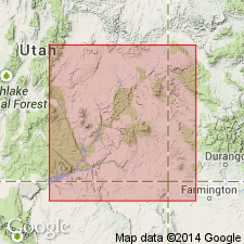
First detailed published description of one of seven members of Upper Triassic Chinle formation. Intent to name and type locality not given. Is present in southeast UT, pinching out along a line north of Monticello, San Juan Co, UT northwest to San Rafael Swell, Emery Co, UT in the Paradox basin. Formerly called division D of Chinle and lower member of Chinle. Consists of greenish-gray and red-brown claystone and clayey sandstone. Is bentonitic. Forms frothy-appearing slope. Interstratified 1-10 ft thick, very fine grained, micaceous, well-cemented, ripple-laminated, platy-splitting, rarely cross-stratified sandstone lenses make up 5 to 20 percent of member. Lenses are about 1,000 ft wide. Member ranges from 0 to 250 ft thick; is 100-150 ft thick in most places. Overlies Shinarump member of Chinle conformably in most of southeast UT. Unconformably overlies Moenkopi formation where Shinarump absent. Conformably overlies Temple Mountain member of Chinle in San Rafael Swell. Underlies Petrified Forest in southern southeast UT and Moss Back member (named) of Chinle elsewhere. Monitor Butte-Petrified Forest contact is conformable and intertonguing. Monitor Butte-Moss Back contact is an erosion surface. Nomenclature chart. Areal extent map. Cross section.
Source: GNU records (USGS DDS-6; Denver GNULEX).
- Usage in publication:
-
- Monitor Butte member*
- Modifications:
-
- Overview
- Dominant lithology:
-
- Sandstone
- Siltstone
- Claystone
- AAPG geologic province:
-
- Black Mesa basin
- Paradox basin
Summary:
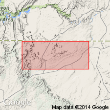
Detailed published description as a member (1 of 4 members) of the Upper Triassic Chinle formation. Is well-exposed along Monitor Butte, its type locality, which lies about 14 miles northwest of Oljato, San Juan Co, UT in the Paradox basin. Extends south into Navajo and Apache Cos, AZ in the Black Mesa basin. Formerly called Division D by Gregory (1917). Type section designated at north end of Monitor Butte in SE1/4 sec 3, T41S, R13E in San Juan Co, where it overlies Shinarump member of Chinle and underlies Petrified Forest member of Chinle. Is 107 ft thick at type. Consists of interbedded gray to purple claystone and siltstone, and orange to brown, fine- to coarse-grained conglomeratic sandstone. Some sandstone beds have ripple marks; some are cross-bedded. Forms buttes, mesas, and badlands. Is usually about 100 ft thick. Fossil wood. Deposited by northward flowing streams. Of Late Triassic age. Geologic map. Stratigraphic column.
Source: GNU records (USGS DDS-6; Denver GNULEX).
- Usage in publication:
-
- Monitor Butte Member*
- Modifications:
-
- Overview
- Areal extent
- AAPG geologic province:
-
- Black Mesa basin
- Paradox basin
- San Juan basin
Summary:
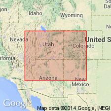
Is a member of the Chinle Formation that occurs throughout most of southeast UT, Paradox basin and adjacent parts of AZ, Black Mesa basin, and of southwest CO, San Juan basin. Areal extent map. Fence diagram. Cross section. Nomenclature chart. Cannot be separated from overlying strata locally along its northeastern and southeastern limits. Contact with underlying Shinarump placed at change from medium- to coarse-grained cross-stratified sandstone of the Shinarump to ripple-laminated sandstone or structureless claystone of Monitor Butte. Ranges from 0 to 255 ft thick. Lithologies described. Measured sections. Fossils--pelecypods, phytosaur remains, cycadophytes, conifer--listed. Its ripple-laminated strata may have been flood-plain deposits. Its claystone and clayey siltstone were probably from ash carried in streams and deposited in river basins or lakes. Of Late Triassic age.
Source: GNU records (USGS DDS-6; Denver GNULEX).
- Usage in publication:
-
- Monitor Butte Member*
- Modifications:
-
- Overview
- AAPG geologic province:
-
- Paradox basin
Summary:
Is the second member from base (of six) of Upper Triassic Chinle Formation in the study area of White and Red Canyons, San Juan Co, UT in the Paradox basin. Gradationally overlies Shinarump Member of Chinle. Is the most lithologically heterogeneous member. Purple mottled unit at base has lungfish burrows. Mottling represents a paleosol. Burrows and mottling indicate fluctuating water table due to seasonal flooding. Purple unit can be traced into a black sandstone that has abundant conchostracans, fish scales and bones, and into a gray mudstone with abundant ostracodes. These basal units represent deposit in a fluvial system that included overbank and lacustrine-marsh and bog wetland environments. The overlying thin-bedded, burrowed limestone and ostracod-bearing mudstone and bentonitic sandstone, siltstone, and mudstone are part of a fluvial and deltaic distributary lacustrine, prodelta, and deltaic sequence. Presence of bentonite indicates volcanic ash in sediments. Fossil ferns and giant horsetails indicate extensive lacustrine, marsh, and deltaic environment. Lungfish burrows and paleosols indicate seasonal change. Overlies Shinarump Member of Chinle. Underlies Moss Back Member of Chinle.
Source: GNU records (USGS DDS-6; Denver GNULEX).
- Usage in publication:
-
- Monitor Butte Member
- Modifications:
-
- Areal extent
- AAPG geologic province:
-
- Paradox basin
Summary:
Authors believe member should be restricted lithologically to the dominantly green-gray bentonitic claystone and clayey fine-grained sandstone present at Monitor Butte, San Juan Co, UT, Paradox basin. The gray-red and red-brown sandstone, silty mudstone, and sandy siltstone of the Chinle above mottled strata and beneath Petrified Forest Member that some have designated Monitor Butte Member in west-central NM are redesignated Bluewater Creek Member, a new member of the Chinle Formation.
Source: GNU records (USGS DDS-6; Denver GNULEX).
For more information, please contact Nancy Stamm, Geologic Names Committee Secretary.
Asterisk (*) indicates published by U.S. Geological Survey authors.
"No current usage" (†) implies that a name has been abandoned or has fallen into disuse. Former usage and, if known, replacement name given in parentheses ( ).
Slash (/) indicates name conflicts with nomenclatural guidelines (CSN, 1933; ACSN, 1961, 1970; NACSN, 1983, 2005, 2021). May be explained within brackets ([ ]).