

- Usage in publication:
-
- Meagher limestone
- Modifications:
-
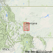
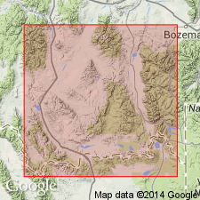
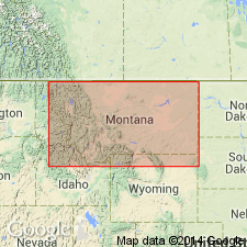
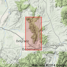
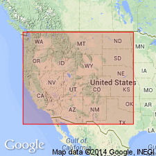
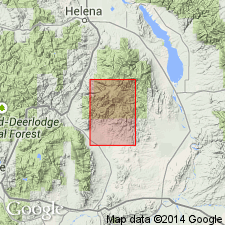
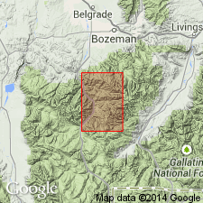
- Areal extent
- Dominant lithology:
-
- Limestone
- AAPG geologic province:
-
- Sweetgrass arch
Summary:
Meagher limestone is a thin-bedded limestone, often formed mainly of flat limestone pebbles, and carries Middle Cambrian fossils. It rests on Wolsey shale and underlies Park shale, all included in Barker formation.
[Origin of name not stated, but Barker formation is mapped over large areas in Meagher and other counties of this quadrangle.]
Source: US geologic names lexicon (USGS Bull. 896, p. 1332).
- Usage in publication:
-
- Meagher limestones*
- Modifications:
-
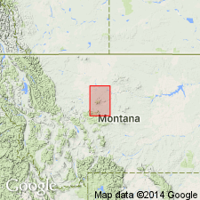
- Areal extent
- Dominant lithology:
-
- Limestone
- AAPG geologic province:
-
- Sweetgrass arch
Summary:
Wolsey shale is succeeded by the thin-bedded Meagher limestones, 110 feet thick, which are overlain by several hundred feet of Park shales and limestone conglomerates. All are included in Barker formation. [Age is Middle Cambrian.]
Source: US geologic names lexicon (USGS Bull. 896, p. 1332).
- Usage in publication:
-
- Meagher limestone*
- Modifications:
-
- Revised
- AAPG geologic province:
-
- Sweetgrass arch
Summary:
Pg. 285. Meagher limestone caps summits of Belt Park buttes. It consists of thinly and irregularly bedded pure limestones, gray, mottled with patches of buff arenaceous, clayey matter. The exposed edges of the beds show wavy, almost crinkled bedding planes. Over 60 feet exposed on Keegan Butte. Lower strata carry no distinguishable fossils and weather into very small irregular gravelly debris. Upper beds spotted with green glauconite grains and contain numerous fossil fragments. Age is Middle Cambrian.
Source: US geologic names lexicon (USGS Bull. 896, p. 1332).
- Usage in publication:
-
- Meagher limestone
- Modifications:
-
- Principal reference
- Revised
- Dominant lithology:
-
- Limestone
- Shale
- AAPG geologic province:
-
- Central Montana uplift
- Montana folded belt
- Sweetgrass arch
- Yellowstone province
Summary:
Pg. 1276, 1277, 1314, 1330-1332. Meagher limestone. Weed designated the cap of Keegan Butte as principal locality for Meagher; because that cap is Dry Creek and Pilgrim, the Meagher technically has no status; however, name has been used consistently to designate limestone between Wolsey and Park shales and for this reason should be retained. At type locality, herein designated, and on Checkerboard Creek, Meagher limestone (emended) consists of three lithologic subdivisions: (1) basal thin-bedded gray to green-gray limestone containing flakes and nodules of tan and buff sandy clay; (2) middle, green to green-gray fissile micaceous shale, interbedded with a few gray and tan-gray thin-bedded banded fine-grained limestone; and (3) upper, mixed beds of fine- and coarse-grained thick- and thin-bedded limestone, which weathers gray and, in some sections, buff. Thickness at type locality 127 feet; maximum thickness 416 feet on Beaver Creek; 50 feet on Half Moon Pass; thickens from Big Snowy Mountains westward and southward and averages approximately 258 feet. Best exposed, most completely developed, and most fossiliferous section is in vicinity Nixon Gulch, Three Forks quadrangle. This is in area of Peale's (1893) section for Flathead and Gallatin formations. Here Meagher is 347 feet thick and is correlated with Peale's "Trilobite limestone" (at base of Gallatin), for which he gave thickness of 120 feet. [Age is Middle Cambrian.]
[See Flathead Quartzite.]
Type locality: on south side and top of South Hill [now Belt Park Butte] in Belt Park, in center sec. 15, T. 14 N., R. 7 E., Little Belt Mountains quadrangle, [Cascade Co.], MT.
Source: US geologic names lexicon (USGS Bull. 1200, p. 2442-2443).
- Usage in publication:
-
- Meagher limestone
- Modifications:
-
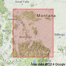
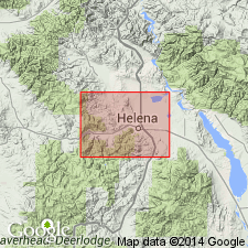
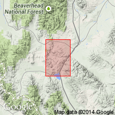
- Areal extent
- Overview
- AAPG geologic province:
-
- Montana folded belt
Summary:
Extends into extreme southwest MT south of Boulder batholith and west of Yellowstone National Park within parts of Beaverhead, Madison and Gallatin Cos, MT, Montana folded belt province. Conformably and transitionally overlies Wolsey shale; conformably and transitionally underlies Park shale. Thickness averages 500 ft. Correlates with Ute and Blacksmith limestones and in part with Bloomington formation in southeast ID, in part with Garden Creek phyllite and Bayhorse dolomite in central ID, with Damnation, Dearborn and Pagoda limestones, Pentagon shale and Steamboat limestone in northwest MT and with Death Canyon member of Gros Ventre formation in northern WY. Isopach map of Cambrian. Correlation chart. Cross section. Measured sections. Middle Cambrian age.
Source: GNU records (USGS DDS-6; Denver GNULEX).
- Usage in publication:
-
- Meagher formation
- Modifications:
-
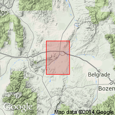
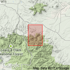
- Areal extent
- AAPG geologic province:
-
- Bighorn basin
- Central Montana uplift
- Sweetgrass arch
- Montana folded belt
Summary:
Extends throughout southwest MT from Fergus and Carbon Cos on east to Mineral and Beaverhead Cos on west, which includes Bighorn basin, Central Montana uplift, Sweetgrass arch, and Montana folded belt province. Thickness ranges from about 50 ft at Beartooth Butte, WY and Halfmoon Pass in Big Snowy Mountains to well over 500 ft in western part of study area; may be as thick as 1,000 ft in Ruby Mountains area. Consists of several lithologies; the most characteristic is mottled limestone. Also consists of oolitic limestone, limestone conglomerate, and dolomite (in western part of area). Conformably overlies Wolsey shale; conformably underlies Park shale; both upper and lower contacts are gradational. Correlates with lower part of Hasmark formation in Phillipsburg quad; upper part of Pagoda limestone, Pentagon shale, and lower part of Steamboat limestone in northwest MT; Death Canyon Member of Gros Ventre formation in northwest WY; and Blacksmith formation and lower part of Bloomington formation in northeast UT. Retains use of Hasmark from Phillipsburg to Armstead in western part of study area. KOOTENIA, EHMANIA, BATHYURISCUS and ACROTRETA found in basal part of unit; GLYPHASPIS and BRACHIASPIDA found near top. Middle Cambrian age. Many measured sections. Isopach and lithofacies map, correlation chart, cross section.
Source: GNU records (USGS DDS-6; Denver GNULEX).
- Usage in publication:
-
- Meagher formation
- Modifications:
-
- Areal extent
- AAPG geologic province:
-
- Montana folded belt
Summary:
Pg. 1388-1390 (table 1), 1393-1394. Meagher formation. In Bridger Range, Gallatin County, Montana, is a ledge-forming unit about 370 feet thick. Consists of (ascending): (1) a lower light- to dark-gray, thin and irregularly bedded, fine-grained, dense limestone with intercalated greenish, calcareous shale, 114 to 118 feet; (2) a middle ridge- or cliff-forming, dark-gray, massive, fine-grained, dense limestone, 102 to 111 feet; and (3) an upper light- to dark-gray, thin and irregularly bedded, nonresistant, fine-grained, dense limestone with shale partings and beds, 145 to 148 feet. Overlies Wolsey formation; contact is generally obscure, but in well-exposed sections contact placed at base of 10 to 15 feet-thick limestone bed. Underlies Park formation; contact is arbitrarily placed at top of uppermost Meagher-type limestone. Age is considered Middle Cambrian, based on fossils (trilobites identified by A.R. Palmer).
Source: Publication.
- Usage in publication:
-
- Meagher member
- Modifications:
-
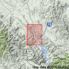
- Areal extent
- Overview
- Biostratigraphic dating
- AAPG geologic province:
-
- Williston basin
Summary:
Extends into the Little Rocky Mountains, Blaine and Phillips Counties, Montana, in Williston basin, as the Meagher member of the Emerson formation. Consists of light-gray fragmental limestone; fossiliferous. Thickness 1 to 2 feet. Believed to represent the feather edge of the Meagher lithic unit or the Meagher formation of central Montana. Overlies Walmsey member; underlies Park member, both of Emerson formation. Age is Middle Cambrian.
Source: Modified from GNU records (USGS DDS-6; Denver GNULEX).
- Usage in publication:
-
- Meagher limestone*
- Modifications:
-
- Overview
- AAPG geologic province:
-
- Montana folded belt
Summary:
Outcrops along flanks of anticline in Devils Fence quad, Jefferson and Broadwater Cos, MT, Montana folded belt province; also outcrops in vicinity of Elkhorn, Jefferson Co. Conformably overlies Wolsey shale with gradational contact; conformably underlies Park shale. Divided into three units: upper and lower units are similar thinly bedded limestone and dolomite characterized by color banding and mottling on weathered surfaces; middle unit consists of medium-gray or medium-bluish-gray, indistinctly thick-bedded limestone. Thickness ranges from 490-570 ft. Geologic maps; measured sections; generalized stratigraphic section. Middle Cambrian age.
Source: GNU records (USGS DDS-6; Denver GNULEX).
- Usage in publication:
-
- Meagher Limestone*
- Modifications:
-
- Areal extent
- AAPG geologic province:
-
- Montana folded belt
Summary:
Maps unit in northern Boulder batholith area in Lewis and Clark and Jefferson Cos, MT in Montana folded belt province. Outcrop trends northwest-southeast from northwestern to central part of mapped area, then trends easterly to southwestern edge of map. Consists of lower part of thin-bedded dolomitic limestone, 360 ft thick; and an upper part of massive pure limestone, 280 ft thick. Upper part is well exposed in great mural escarpment of Mount Helena in western part of Helena. Conformably overlies Middle Cambrian Wolsey Formation; conformably underlies Park Argillite (redefined). Middle Cambrian age. Geologic map.
Source: GNU records (USGS DDS-6; Denver GNULEX).
- Usage in publication:
-
- Meagher limestone*
- Modifications:
-
- Overview
- AAPG geologic province:
-
- Montana folded belt
Summary:
Measured section in drainage of Milligan Creek, Gallatin Co, MT in the Montana folded belt province, described where it is 500 ft thick, overlies the Wolsey shale and underlies Park shale. Another section in NW1/4 NW1/4 sec 9, T1S, R1W measured in which Meagher is 500 ft thick and lies between the Wolsey and the Park. Occurs in quad between Milligan and Willow Creeks. Middle Cambrian age established by presence of trilobite fauna. Is a shallow water marine unit laid down not far from source of noncarbonate material. Geologic map. [Compare with Peale, 1893, 1896 and Berry, 1943.]
Source: GNU records (USGS DDS-6; Denver GNULEX).
- Usage in publication:
-
- Meagher Limestone*
- Modifications:
-
- Overview
- AAPG geologic province:
-
- Montana folded belt
Summary:
Mapped in southwesternmost part of quad, Lewis and Clark Co, MT, Montana folded belt province. Conformably overlies Wolsey Shale; in fault contact with overlying Mission Canyon Limestone. About 400 ft thick. Invertebrate fossils locally abundant. Middle Cambrian age.
Source: GNU records (USGS DDS-6; Denver GNULEX).
- Usage in publication:
-
- Meagher Limestone
- Modifications:
-
- Overview
- AAPG geologic province:
-
- Montana folded belt
Summary:
Within mapped area, thickness ranges from 449 ft at Garnet Mountain to 471 ft near Mount Blackmore. Quad is within Montana folded belt province. Conformably overlies Wolsey Shale; conformably underlies Park Shale. Mapped undivided with other Middle Cambrian units including Flathead Quartzite, Wolsey and Park.
Source: GNU records (USGS DDS-6; Denver GNULEX).
- Usage in publication:
-
- Meagher Limestone*
- Modifications:
-
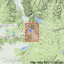
- Areal extent
- AAPG geologic province:
-
- Montana folded belt
Summary:
Not present in mapped area in central Beaverhead Co, MT, Montana folded belt province. Meagher and Park Shale probably eroded during local deformation. Wolsey Shale disconformably underlies Pilgrim? Dolomite.
Source: GNU records (USGS DDS-6; Denver GNULEX).
- Usage in publication:
-
- Meagher Limestone*
- Modifications:
-
- Mapped
- AAPG geologic province:
-
- Sweetgrass arch
Summary:
Meagher Limestone. Gray to light-gray, nodular, thin-bedded, locally platy; many crinkled beds; mottles of yellow and orange siltstone in fine-grained limestone matrix. Dark-gray shale bed, about 12 feet thick, about 6 feet above base. About 75 feet thick. Lies below Park Shale and above Wolsey Shale. Age is Middle Cambrian.
Source: Publication.
- Usage in publication:
-
- Meagher Limestone*
- Modifications:
-
- Areal extent
- AAPG geologic province:
-
- Montana folded belt
- Snake River basin
Summary:
Occurs in Henrys Lake Mountains, Gallatin Co, MT, Montana folded belt province and Fremont Co, ID, Snake River basin. Unit is 550 ft thick. Unconformably overlies Flathead Sandstone; underlies Park Shale. Middle Cambrian age.
Source: GNU records (USGS DDS-6; Denver GNULEX).
- Usage in publication:
-
- Meagher Dolomite*
- Modifications:
-
- Redescribed
- Dominant lithology:
-
- Dolomite
- AAPG geologic province:
-
- Montana folded belt
Summary:
Redescribed as a dolomite in Pioneer Mountains, Beaverhead Co, MT, Montana folded belt province. Meagher has been extensively dolomitized and lacks most of its original sedimentary features. Unit is usually light-gray in weathered outcrops and light- to medium-gray in fresh samples. Worm burrow features resulting in gray and yellow mottling of dolomite occurs in some beds. Possible stromatolite features are present in some outcrops. Worms and possible stromatolites suggest unit was deposited in a shallow intertidal or supratidal shelf lagoon environment. Thickness ranges from 20-60 m. Conformably overlies Wolsey Shale; conformably underlies Park Shale. Middle Cambrian age.
Source: GNU records (USGS DDS-6; Denver GNULEX).
For more information, please contact Nancy Stamm, Geologic Names Committee Secretary.
Asterisk (*) indicates published by U.S. Geological Survey authors.
"No current usage" (†) implies that a name has been abandoned or has fallen into disuse. Former usage and, if known, replacement name given in parentheses ( ).
Slash (/) indicates name conflicts with nomenclatural guidelines (CSN, 1933; ACSN, 1961, 1970; NACSN, 1983, 2005, 2021). May be explained within brackets ([ ]).