

- Usage in publication:
-
- McNamara formation
- Modifications:
-
- First used
- Dominant lithology:
-
- Argillite
- Quartzite
- Sandstone
- AAPG geologic province:
-
- Northern Rocky Mountain region
Summary:
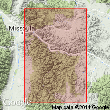
First published use as the third (from base) of five formations of Missoula group (first used) of Belt series. Intent to name not stated. Type section is along Blackfoot River in vicinity of McNamara's Landing, Missoula Co, MT in Northern Rocky Mountain region. Rests conformably on Hellgate formation (first used) of Missoula. Underlies Garnet Range formation (first used) of Missoula. Correlation chart. Columnar section. Section 3,000 ft thick measured in canyon of Blackfoot River east of town of Bonner extending for more than 1 mi east toward McNamara's Landing. Divisible into: lower member, 410 ft thick, composed of purple to green-gray, micaceous, sandy argillite, buff-weathering, with thin, sandy quartzite in upper part; middle member, 810 ft thick, composed of massive- to medium-bedded, pink-white, pink-green, gray-green quartzite that has some coarse-grained beds, some ripple-marked beds, and cross-beds; upper member, 1,780 ft thick, composed of gray, thin-bedded, argillitic sandstone at base, green, red, gray thin-bedded to massive to fine-banded argillite which has quartzitic, chert-like, and mud-cracked beds in middle, and maroon-gray, massive, medium- to coarse-grained, sandy quartzite at top. Several horizons of clay galls occur in upper part. Of Algonkian age.
Source: GNU records (USGS DDS-6; Denver GNULEX).
- Usage in publication:
-
- McNamara argillite*
- Modifications:
-
- Revised
- Dominant lithology:
-
- Siltstone
- Argillite
- Quartzite
- AAPG geologic province:
-
- Northern Rocky Mountain region
Summary:
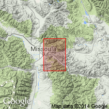
Is third from base (of five formations) of Missoula group of Belt series in Bonner quad, Missoula Co, MT in Northern Rocky Mountain region. Redescribed from McNamara argillite to McNamara formation. Contacts revised in that McNamara of this report is only the upper member of McNamara as defined by Clapp and Deiss (1931). Their middle member of McNamara is named Bonner quartzite; their lower member of McNamara is assigned to upper part of Miller Peak formation. The revised McNamara includes the rocks at McNamara's Landing, an abandoned community at junction of Camas and Blackfoot Rivers, 3.8 mi east of Bonner quad. As redescribed, consists of red and green, slightly metamorphosed, argillaceous siltstone and argillite, and some quartzite. The siltstone is well sorted, forms layers 1/16 in to 8 in thick, and is the most abundant rock type. Argillite consists of fine-grained sericite and chlorite. Quartzite is fine grained, red to pink, well sorted, and has small-scale cross-beds. Clay balls and chips 1/16 to 1 in thick and 1/8 to 2 in long are characteristic of formation. Balls are more abundant than chips. They are well rounded and are composed of very fine grained sericite and chlorite. Distribution of colors in clay balls suggests change after deposition. Is about 4,000 ft thick. Overlies Bonner quartzite (new); underlies Garnet Range formation (redescribed), both of Belt series. Precambrian age. Geologic map. Stratigraphic chart.
Source: GNU records (USGS DDS-6; Denver GNULEX).
- Usage in publication:
-
- McNamara Formation
- Modifications:
-
- Reference
- AAPG geologic province:
-
- Northern Rocky Mountain region
Summary:
Name Missoula Group has been applied to all rocks in the Precambrian Belt Supergroup above the carbonate (Siyeh Formation of Glacier National Park or Helena Formation of Helena area). These same rocks were designated Camp Creek Series by Walcott in 1906 but that name has been little used and is abandoned in favor of Missoula in this report. The Camp Creek section is designated a reference section [but section not described] for the Missoula. The reference section is located along crest of the ridge parallel to and northwest of Camp Creek in secs 22, 28, and 33, T20N, R12W, Lewis and Clark Range, Powell Co, MT in Northern Rocky Mountain region where the following formations of the Missoula are exposed (ascending order): Snowslip, Shepard, and Shields Formations, Bonner Quartzite, McNamara and Garnet Range Formations. Geologic map.
Source: GNU records (USGS DDS-6; Denver GNULEX).

- Usage in publication:
-
- McNamara Formation*
- Modifications:
-
- Overview
- AAPG geologic province:
-
- Northern Rocky Mountain region
Summary:
McNamara Formation (of Missoula Group of Belt Supergroup of Precambrian age) replaces use of Sloway Formation (a term abandoned) in the Northern Rocky Mountain region. Correlation with other units of the Belt in Northern Cascade Range-Okanagan province, Eastern Columbia basin, Idaho Mountains province, Snake River basin, and of the Purcell Supergroup of Alberta, and British Columbia, Canada shown on figs 4, 5, 7 and 13.
Source: GNU records (USGS DDS-6; Denver GNULEX).

- Usage in publication:
-
- McNamara Formation*
- Modifications:
-
- Areal extent
- Geochronologic dating
- AAPG geologic province:
-
- Northern Rocky Mountain region
Summary:
Pg. A6-A7 (table 1), A9 (fig. 3), A17-A18. McNamara Formation of Missoula Group of Belt Supergroup. Rocks previously included in upper part of †Ahorn Quartzite of Deiss (†Ahorn Sandstone of Mudge; abandoned). Consists of greenish-gray and gray sandy mudstone (siltstone) with many thin beds of sandstone and glauconitic sandstone; some maroon beds; load casts and salt casts. Thickness 0 to 575 feet. Overlies Bonner Quartzite (replaces lower part of †Ahorn); unconformably underlies Middle Cambrian Flathead Sandstone. [Age is Precambrian Y. Rubidium-strontium isotopic age of whole-rock samples is 1,110 +/-40 Ma (Z.E. Peterman, p. A10, fig. 4).]
Source: Publication.
- Usage in publication:
-
- McNamara Formation*
- Modifications:
-
- Age modified
- AAPG geologic province:
-
- Northern Rocky Mountain region
Summary:
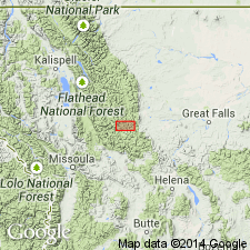
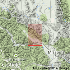
Is one of eleven formations of the Belt Supergroup mapped in report area. Age changed from Precambrian to Precambrian Y, the age term used for rocks that range in age from 1,600 to 800 m.y. old. Is about 4,000 ft thick. Lower contact with Bonner Quartzite and upper contact with Garnet Range Formation sharp and conformable. Mapped at south edge of quad in Mineral and Missoula Cos, MT in Northern Rocky Mountain region.
Source: GNU records (USGS DDS-6; Denver GNULEX).
- Usage in publication:
-
- McNamara Formation*
- Modifications:
-
- Paleomagnetics
- AAPG geologic province:
-
- Northern Rocky Mountain region
Summary:
Polarity zonation and direction indicate that the upper Swauger Quartzite and Lawson Creek Formation in ID correlate with the upper Mount Shields Formation, Bonner Quartzite, and lower McNamara Formation in MT, all in Northern Rocky Mountain region. McNamara assigned to the Proterozoic Y (previously Precambrian Y), the age designation for rocks of 1,600 to 900 m.y. old.
Source: GNU records (USGS DDS-6; Denver GNULEX).
For more information, please contact Nancy Stamm, Geologic Names Committee Secretary.
Asterisk (*) indicates published by U.S. Geological Survey authors.
"No current usage" (†) implies that a name has been abandoned or has fallen into disuse. Former usage and, if known, replacement name given in parentheses ( ).
Slash (/) indicates name conflicts with nomenclatural guidelines (CSN, 1933; ACSN, 1961, 1970; NACSN, 1983, 2005, 2021). May be explained within brackets ([ ]).