

- Usage in publication:
-
- McLeansboro formation*
- Modifications:
-
- Original reference
- Dominant lithology:
-
- Shale
- AAPG geologic province:
-
- Wisconsin arch
Summary:
Pg. 181. McLeansboro formation. Uppermost Pennsylvanian formation in Illinois. Conspicuously shale, but locally contains sandstones, limestones, and thin coals. Base defined by top of coal No. 6 [Herrin coal]. Thickness 919 to 1,155 feet.
Source: US geologic names lexicon (USGS Bull. 896, p. 1257).

- Usage in publication:
-
- McLeansboro formation*
- Modifications:
-
- Overview
- AAPG geologic province:
-
- Illinois basin
Summary:
McLeansboro formation. Recognized in Illinois and western Kentucky. Overlies Carbondale formation. In western Kentucky and southeastern Illinois underlies Henshaw formation. Is correlated by [David] White with upper part of Allegheny formation and with Conemaugh formation. Age is Pennsylvanian.
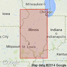
Named from McLeansboro, Hamilton Co., southern IL.
Source: US geologic names lexicon (USGS Bull. 896, p. 1257).
- Usage in publication:
-
- McLeansboro formation
- Modifications:
-
- Revised
- AAPG geologic province:
-
- Illinois basin
Summary:
Pg. 6-9. McLeansboro formation. Includes, in addition to coal units, the following members (ascending): Anvil Rock sandstone, Somerville limestone, Inglefield sandstone, St. Wendells limestone (new), Claypole Hills sandstone (new), Mumford Hills sandstone (new), Grayville limestone, Lawrenceville shale (new), New Haven limestone, Little Chain limestone (new), Little Wabash sandstone (new), and Henshaw or Dixon sandstone. [Age is Late Pennsylvanian.]
Source: US geologic names lexicon (USGS Bull. 1200, p. 2307).
- Usage in publication:
-
- McLeansboro group*
- Modifications:
-
- Revised
- AAPG geologic province:
-
- Illinois basin
Summary:
Pg. 36. McLeansboro group. Caseyville, Tradewater, Carbondale, and McLeansboro, considered formations in previous publications, are now given group status. [Age is Late Pennsylvanian.]
Source: US geologic names lexicon (USGS Bull. 1200, p. 2307).
- Usage in publication:
-
- McLeansboro group*
- Modifications:
-
- Revised
- AAPG geologic province:
-
- Illinois basin
Summary:
Pg. 50 (fig. 22), 114-122. McLeansboro group. Classified on cyclothemic basis. Includes (ascending) Sparland, Gimlet, Exline, and Trivoli cyclothems. Named members include Copperas Creek sandstone, Farmington shale, Gimlet sandstone, Lonsdale limestone, Exline limestone, Trivoli sandstone, and Trivoli limestone.
Source: US geologic names lexicon (USGS Bull. 1200, p. 2307).

- Usage in publication:
-
- McLeansboro group*
- Modifications:
-
- Revised
- AAPG geologic province:
-
- Illinois basin
Summary:
Pg. 8 (fig. 1), 36-41, 48-51 (table 1), 71-84, pl. 1. McLeansboro group. Group includes (ascending): Modesto, Bond, and Mattoon formations (all new). Formation name originally applied to all Pennsylvanian strata above No. 6 coal as described from coreholes of two diamond drillholes near McLeansboro. As herein redefined group includes all strata above top of Danville (No. 7) coal. Maximum thickness about 1,200 feet in Jasper County, but more than 1,600 feet of McLeansboro reported from test hole in western Kentucky. Overlies Kewanee group (new). Age is Late to Middle Pennsylvanian (Desmoinesian to Virgilian). Report presents new rock-stratigraphic classification of Pennsylvanian of Illinois. Cyclical classification is retained but is independent of rock-stratigraphic classification; includes rocks also assigned to (alphabetical): Babylon, Delwood, Grindstaff, Macedonia (part), Pope Creek, Pounds (part), Seville (part), and Tarter cyclothems.
Source: US geologic names lexicon (USGS Bull. 1200, p. 2307).

- Usage in publication:
-
- McLeansboro Group*
- Modifications:
-
- Areal extent
- AAPG geologic province:
-
- Illinois basin
Summary:
Used as McLeansboro Group [in accordance with Illinois Geological Survey usage]. Mapped undivided with Carbondale Formation. Used only in IL. Modesto Formation of McLeansboro Formation separately mapped. Age is Middle and Late Pennsylvanian.
Source: GNU records (USGS DDS-6; Reston GNULEX).
For more information, please contact Nancy Stamm, Geologic Names Committee Secretary.
Asterisk (*) indicates published by U.S. Geological Survey authors.
"No current usage" (†) implies that a name has been abandoned or has fallen into disuse. Former usage and, if known, replacement name given in parentheses ( ).
Slash (/) indicates name conflicts with nomenclatural guidelines (CSN, 1933; ACSN, 1961, 1970; NACSN, 1983, 2005, 2021). May be explained within brackets ([ ]).