

- Usage in publication:
-
- McGhee Peak formation
- Modifications:
-
- Named
- Dominant lithology:
-
- Conglomerate
- Sandstone
- Limestone
- AAPG geologic province:
-
- Pedregosa basin
Summary:
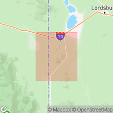
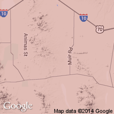
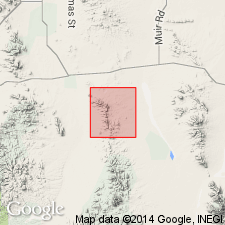
Named as the basal formation of the Bisbee Group for McGhee Peak in sec 34, T24S, R21W, Hidalgo Co, NM, Pedregosa basin. No type section designated. Measured section on north side of McGhee Peak in SW1/4 sec 34, T24S, R21W described. Geologic map included. Composition varies. Basal beds are poorly sorted conglomerate of rounded cobbles and pebbles of quartzite, limestone, chert, granite in a cemented quartz-sand matrix. Conglomerate is not present everywhere. Light-gray, fine-grained, well-indurated sandstone interbedded with black, very fine- to medium-grained, locally arenaceous limestone make up the rest of the formation. Limestone beds are more numerous near the top. Is 370 ft thick on McGhee Peak. May be about 600 feet thick. Basal contact and unconformity of considerable relief carved on Permian strata. Overlain conformably by Carbonate Hill limestone (new) of Bisbee. Is of Early Cretaceous age. Is a marine unit.
Source: GNU records (USGS DDS-6; Denver GNULEX).

- Usage in publication:
-
- McGhee Peak Formation*
- Modifications:
-
- Age modified
- AAPG geologic province:
-
- Pedregosa basin
Summary:
Is basal formation of Bisbee Group (Lower Cretaceous) in central Peloncillo Mountains, Hidalgo Co, NM in Pedregosa basin. Overlies erosional surface on Paleozoic rocks. Underlies Carbonate Hill Limestone (Aptian) of Gillerman (1958) of Bisbee Group. Is 370 to about 600 ft thick. Is generally comparable to 700 ft of strata above Glance Conglomerate in Bisbee Group (undivided) in Dos Cabezas and northern Chiricahua Mountains. [See fig. 5 for regional correlations.] Age refined to Aptian (Early Cretaceous) on basis of correlation.
Source: GNU records (USGS DDS-6; Denver GNULEX).
- Usage in publication:
-
- McGhee Peak Formation*
- Modifications:
-
- Overview
- AAPG geologic province:
-
- Pedregosa basin
Summary:
Mapped as basal formation of Bisbee Group in central Peloncillo Mountains, Hidalgo Co, NM in Pedregosa basin. McGhee Peak in sec 34, T24S, R21E, Hidalgo Co, NM, designated as type locality. Unconformably overlies lower half of Earp Formation (Lower Permian) of Naco Group at type; 3-4 km to southwest rests on Concha Limestone (Lower Permian) of Naco Group. Underlies Carbonate Hill Limestone. Is 150-225 m thick and composed of limestone, chert, quartz pebbles and cobbles, and alternating beds of shale, sandstone, and argillaceous limestone. Is Early Cretaceous age on basis of stratigraphic position dating.
Source: GNU records (USGS DDS-6; Denver GNULEX).
- Usage in publication:
-
- McGhee Peak Formation*
- Modifications:
-
- Areal extent
- AAPG geologic province:
-
- Pedregosa basin
Summary:
Formation names of the Lower Cretaceous Bisbee Group used in Bisbee area (Glance Conglomerate, Morita Formation, Mural Limestone, and Cintura Formation) can be distinguished in Peloncillo Mountains (Cochise Co, AZ and Hidalgo Co, NM in Basin-and-Range province and in Pedregosa basin. Are recognized for the first time in northern Animas Mountains. Formation names of Bisbee area were defined by Ransome in 1904 and take precedence over local terminologies defined later (Gillerman, 1958, whose names McGhee Peak Formation, Johnny Bull Sandstone, Still Ridge Formation, and Carbonate Hill Limestone are not used in this report). Is of Early Cretaceous age.
Source: GNU records (USGS DDS-6; Denver GNULEX).
For more information, please contact Nancy Stamm, Geologic Names Committee Secretary.
Asterisk (*) indicates published by U.S. Geological Survey authors.
"No current usage" (†) implies that a name has been abandoned or has fallen into disuse. Former usage and, if known, replacement name given in parentheses ( ).
Slash (/) indicates name conflicts with nomenclatural guidelines (CSN, 1933; ACSN, 1961, 1970; NACSN, 1983, 2005, 2021). May be explained within brackets ([ ]).