- Usage in publication:
-
- Mancos shale*
- Modifications:
-
- Original reference
- Dominant lithology:
-
- Shale
- AAPG geologic province:
-
- Paradox basin
Summary:
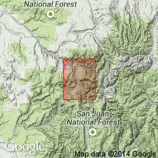
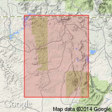
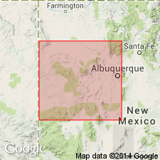
Mancos shale. Dark-gray or lead-colored shales, nearly always somewhat sandy. Contains thin calcareous layers which in places become almost limestones and are usually rich in fossils. Sand locally increases to form sandstone, but no limestone or sandstone layer is persistent and prominent enough to be traced far. Thickness 2,000 feet. Overlies Dakota formation and in Telluride quadrangle is overlain by Eocene San Miguel formation.
Named from characteristic occurrence in Mancos Valley and about town of Mancos, btw. La Plata Mountains and the Mesa Verde, [Montezuma Co.], western CO.
Source: US geologic names lexicon (USGS Bull. 896, p. 1276-1277).
- Usage in publication:
-
- Mancos shale*
- Modifications:
-
- Revised
- AAPG geologic province:
-
- Estancia basin
Summary:
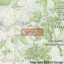
Pg. 594-598. Mancos shale. In central New Mexico, includes Tres Hermanos sandstone member, 150 feet thick, in lower part. Includes the rocks, mainly shale, above Dakota sandstone and below Mesaverde formation. [Age is Cretaceous.]
Source: US geologic names lexicon (USGS Bull. 1200, p. 2341-2346).
- Usage in publication:
-
- Mancos shale*
- Modifications:
-
- Revised
- AAPG geologic province:
-
- Paradox basin
Summary:
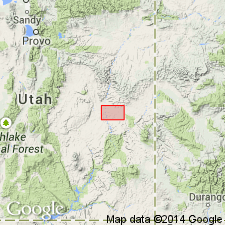
Pg. 128. Mancos shale near Green River, Utah, includes Ferron sandstone member (new), 50 to 100 feet thick, about 400 feet above base. Overlies Dakota sandstone. [Age is Cretaceous.]
Source: US geologic names lexicon (USGS Bull. 1200, p. 2341-2346).
- Usage in publication:
-
- Mancos shale*
- Modifications:
-
- Revised
- AAPG geologic province:
-
- San Juan basin
Summary:
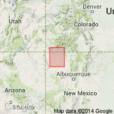
Pg. 10. The marine Mancos shale of southwestern Colorado and northwestern New Mexico has yielded faunas [ammonites] of, in ascending order, Greenhorn, Carlile, Niobrara, and Pierre age. It grades into underlying Dakota sandstone, and into overlying Mesaverde group, the boundary with which is arbitrarily fixed. Writer believes lower part of Mesaverde group on the San Juan represents time interval of part of Mancos shale of Animas River section. Thickness at type locality is 1,200 feet. It varies in thickness in southwestern Colorado, up to a maximum of 2,000 feet near Telluride.
Source: US geologic names lexicon (USGS Bull. 896, p. 1276-1277).
- Usage in publication:
-
- Mancos shale*
- Modifications:
-
- Revised
- AAPG geologic province:
-
- Paradox basin
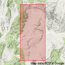
Summary:
Pg. 436-440. Mancos shale. In southern part of Wasatch Plateau, comprises five members (ascending): unnamed lower shale, Ferron sandstone, middle unnamed shale, Emery sandstone (new), and upper unnamed shale. Grades upward into Star Point sandstone (new) of Mesaverde group. In Castlegate quadrangle, the middle unnamed shale member contains in upper part a lenticular sandstone named by F.R. Clark (unpub. ms.) Garley Canyon sandstone member of Mancos. Passes by gradual transition into basal formation of Mesaverde group, Star Point sandstone. [Age is Cretaceous.]
Source: US geologic names lexicon (USGS Bull. 1200, p. 2341-2346).
- Usage in publication:
-
- Mancos shale*
- Modifications:
-
- Revised
- AAPG geologic province:
-
- Piceance basin
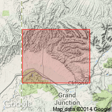
Summary:
Gradationally overlies Dakota sandstone. Consists of a main thick body of gray marine shale which is overlain in turn by Castlegate sandstone of Mesaverde group as far east as West Salt Creek near the CO-UT state border, Buck tongue of Mancos, Sego sandstone of Mesaverde group which is separated into a lower and an upper sandstone by the newly named Anchor Mine tongue of the Mancos. Upper contact of Mancos continues to rise stratigraphically east 600 ft into the Crested Butte-Anthracite region. Averages 3,000 ft thick in this region. Stratigraphic table; geologic map. Late Cretaceous age.
Source: GNU records (USGS DDS-6; Denver GNULEX).
- Usage in publication:
-
- Mancos shale*
- Modifications:
-
- Revised
- AAPG geologic province:
-
- San Juan basin
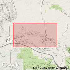
Summary:
Pg. 12-14; C.B. Hunt, 1936, USGS Bull. 860-B, p. 44. Mancos shale. In southern part of San Juan basin, New Mexico, includes Mulatto and Satan tongues (both new).
Source: US geologic names lexicon (USGS Bull. 1200, p. 2341-2346).
- Usage in publication:
-
- Mancos shale
- Modifications:
-
- Revised
- AAPG geologic province:
-
- San Juan basin
Summary:
Mancos shale. Discussion of large-scale intertonguing between marine Mancos and nonmarine Mesaverde strata in New Mexico, Arizona, and southwestern Colorado. Mancos shale crops out in almost unbroken line southward from Mesa Verde along western margin for distance of 180 miles to near Atarque. In addition to Mulatto and Satan tongues as defined by Sears (1934) and Hunt (1936), the Mancos includes Twowells sandstone lentil, Pescado tongue, and Horsehead tongue (all new). Pescado tongue splits Gallup member of Mesaverde into upper and lower parts. Horsehead tongue overlies Atarque member (new) of Mesaverde formation. Suggested that name Tocito sandstone lentil be dropped because it is correlative of Gallup sandstone member of Mesaverde and part of Dilco member of Mesaverde. There is probability that Tres Hermanos sandstone is a tongue of Dakota(?) sandstone. [Age is Cretaceous.]
Source: US geologic names lexicon (USGS Bull. 1200, p. 2341-2346).
- Usage in publication:
-
- Mancos shale*
- Modifications:
-
- Revised
- AAPG geologic province:
-
- San Juan basin
Summary:
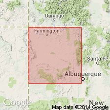
Mancos shale. In area of this report [eastern side of San Juan basin, Rio Arriba County, New Mexico], the Mancos comprises the following members (ascending): Graneros shale, Greenhorn limestone, Carlile shale, Niobrara calcareous shale, and unnamed shale member. Thickness about 2,060 feet. Overlies Dakota sandstone; underlies Hosta sandstone member of Mesaverde formation. Age is Late Cretaceous.
Source: US geologic names lexicon (USGS Bull. 1200, p. 2341-2346).
- Usage in publication:
-
- Mancos shale
- Modifications:
-
- Revised
- AAPG geologic province:
-
- San Juan basin
Summary:
Pg. 2149-2162. In revised nomenclature of Mesaverde group, San Juan basin, New Mexico, name Gallup sandstone as a formation in Mesaverde group will replace Gallup sandstone member, and in its northward extension, replace in its entirety the †Tocito sandstone lentil of Mancos shale (abandoned).
Source: US geologic names lexicon (USGS Bull. 1200, p. 2341-2346).
- Usage in publication:
-
- Mancos shale*
- Modifications:
-
- Revised
- AAPG geologic province:
-
- Orogrande basin
Summary:
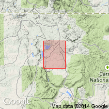
Pg. 181-197. Mancos shale. Report is reinterpretation of section of Cretaceous rocks in Alamosa Creek [now Alamocita Creek] valley area, Catron and Socorro Counties, New Mexico. Winchester's (1920) Bell Mountain sandstone at top of his Miguel formation is upfaultecl duplication of his Gallego sandstone member from which it was supposed to be separated by nearly 1,000 feet of beds. Winchester's names Miguel formation, Chamiso formation (for Mesaverde rocks overlying the Miguel), and Bell Mountain sandstone member are abandoned and stratigraphic names used in San Juan basin are extended to units recognized in [Alamocita Creek] valley. The marine shale tongue of Mancos shale (Pescaclo tongue of Pike, 1947) underlying Gallego sandstone member, now of Gallup sandstone, is shown to be of latest Carlile age, although it contains some species heretofore regarded as indicative of Niobrara age. Name D-Cross tongue of Mancos is herein proposed for this marine shale unit, which may be a somewhat higher and younger tongue than Pescado tongue at its type locality. Lower part of Gallup sandstone tongues out into Mancos shale in southeastern part of Mount Taylor coal field.
Source: US geologic names lexicon (USGS Bull. 1200, p. 2341-2346).
- Usage in publication:
-
- Mancos Shale*
- Modifications:
-
- Revised
- AAPG geologic province:
-
- San Juan basin
Summary:
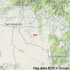
Divided into (ascending): Graneros shale member (base), Greenhorn Limestone Member, lower shale unit, Juana Lopez Member, middle shale unit, Cooper Arroyo Sandstone Member (new), El Vado Sandstone Member (new), and upper shale unit (top) in map area, Rio Arriba Co, NM, San Juan basin. Is 2,000 +/-ft thick. In general is poorly exposed so accurate measurement difficult to obtain. Measured sections of type sections of new members. Overlies Dakota Sandstone. Underlies Point Lookout Sandstone of Mesaverde Group. Of Late Cretaceous age.
Source: GNU records (USGS DDS-6; Denver GNULEX).
- Usage in publication:
-
- Mancos Shale*
- Modifications:
-
- Revised
- AAPG geologic province:
-
- San Juan basin
Summary:
Lower part divided in San Juan basin into two tongues: 1) Clay Mesa Shale Tongue (new name); and 2) Whitewater Arroyo Shale Tongue. Younger part of Mancos called main body. Assigned to the Late Cretaceous.
Source: GNU records (USGS DDS-6; Denver GNULEX).
- Usage in publication:
-
- Mancos Shale*
- Modifications:
-
- Biostratigraphic dating
- Geochronologic dating
- AAPG geologic province:
-
- Paradox basin
Summary:
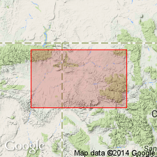
Mancos Shale. Sample collected from a bentonite bed within the EXITELOCERAS JENNEYI ammonite zone, in upper part of Mancos Shale, in northeast corner SE/4 NE/4 sec. 17, T. 48 N., R. 7 W., Montrose Co., CO. K-Ar age on biotite and sanidine 72.0 Ma (weighted mean). Age is Late Cretaceous (Campanian) following Cobban's ammonite zonation.
Source: Modified from GNU records (USGS DDS-6; Denver GNULEX).
- Usage in publication:
-
- Mancos B Formation
- Modifications:
-
- First used
- Dominant lithology:
-
- Claystone
- Siltstone
- Sandstone
- AAPG geologic province:
-
- Piceance basin
- Uinta basin
Summary:
First published use. Name commonly used in subsurface within Douglas Creek arch area of Piceance and Uinta basins of CO and UT. Name is also used in this report "because stratigraphic relationships to the type Emery are still unclear." [The Mancos B is considered an informal subsurface unit within Mancos Shale.] Type section designated as 2,349-2,830 ft interval in General Petroleum Douglas Creek No. 1 (sec. 24, T2S, R103W, Rio Blanco Co, CO). Consists of thin interbeds of claystone, siltstone, and fine sandstone. Divided into five units (ascending, A-E). Overlies with sharp contact shale or siltstone of lower Mancs Formation; underlies a prominent silt marker within Mancos Formation. Structure map, isopach maps, cross section. Late Cretaceous age.
Source: GNU records (USGS DDS-6; Denver GNULEX).
- Usage in publication:
-
- Mancos Shale*
- Modifications:
-
- Revised
- Reference
- AAPG geologic province:
-
- San Juan basin
Summary:
Divided into: Greenhorn Limestone, lower unit, Juana Lopez Member, middle unit, Tocito Sandstone Lentil (reinstated), El Vado Sandstone Member (areally extended into subsurface of San Juan basin; reference well designated), and upper unit. Of Late Cretaceous age.
Source: GNU records (USGS DDS-6; Denver GNULEX).
- Usage in publication:
-
- Mancos Shale*
- Modifications:
-
- Age modified
- AAPG geologic province:
-
- Paradox basin
- Uinta basin
Summary:
Divided in the Paradox basin into the: middle Cenomanian to middle Turonian Tununk Member, middle Turonian Ferron Sandstone Member, late Turonian, Coniacian to middle Santonian lower part of the Blue Gate Member, middle to late Santonian Emery Sandstone Member, late Santonian to middle Campanian upper part of the Blue Gate Member, and middle Campanian Buck Tongue. Name Blue Gate replaces Masuk Member on Wasatch Plateau. Garley Canyon (formerly a member of the Mancos) classified as a unit of bed rank at the base of the Emery. Palynomorphs identified in Emery in sec 36, T13S, R9E, Carbon Co in the Uinta basin.
Source: GNU records (USGS DDS-6; Denver GNULEX).
- Usage in publication:
-
- Mancos Shale
- Modifications:
-
- Revised
- AAPG geologic province:
-
- Paradox basin
Summary:
Divided into Tununk Shale (base), Ferron Sandstone, Blue Gate Shale, Muley Canyon Sandstone (newly named), and Masuk (top) Members in Henry Mountain region of Paradox basin. Only upper three members are discussed in this report. Underlies Tarantula Mesa Sandstone (newly named), a unit that was called Masuk Sandstone by Gilbert (1877) and Mesaverde by Hunt (1946). Is of Late Cretaceous, or Turonian, Coniacian, Santonian, and Campanian age. Contains deposits representative of interfingering marine, deltaic, and estuarine origin.
Source: GNU records (USGS DDS-6; Denver GNULEX).
- Usage in publication:
-
- Mancos Shale*
- Modifications:
-
- Areal extent
- AAPG geologic province:
-
- San Juan basin
Summary:
The basal unit of Mancos Shale, the Whitewater Arroyo Tongue separates the upper part of the Dakota Sandstone below from the overlying Twowells Tongue of the Dakota. The Twowells is overlain by the main body of the Mancos. Within the main body, the Bridge Creek Limestone Member (older) and the Juana Lopez Member (younger) are distinguished. The Bridge Creek is used as the datum for the cross sections in the area of the southwest part of the San Juan basin, NM.
Source: GNU records (USGS DDS-6; Denver GNULEX).
- Usage in publication:
-
- Mancos Shale*
- Modifications:
-
- Biostratigraphic dating
- AAPG geologic province:
-
- San Juan basin
Summary:
Is marine formation, lower part of which separates Dakota Sandstone from younger marginal marine to nonmarine units in the San Juan basin in west-central NM. Only the lower part is treated in this report. Overlies and intertongues with Dakota Sandstone. Lower part is overlain by Gallup Sandstone in most of study area. Lower part locally comprised of some of the following (alphabetically): Bridge Creek Limestone Beds, Clay Mesa Tongue, D-Cross Tongue, Juana Lopez Member, Pescado Tongue, Rio Salado Tongue, Semilla Sandstone Member, and Whitewater Arroyo Tongue. [See related remarks under specific units.] Lower part ranges in age from middle Cenomanian to early Coniacian (ammonite zones of ACANTHOCERAS AMPHIBOLUM-FORRESTERIA PERUANA). Figure 2 is stratigraphic nomenclature and correlation chart of middle Cenomanian to lower Coniacian rocks in west-central NM, spanning 20 ammonite zones.
Source: GNU records (USGS DDS-6; Denver GNULEX).
- Usage in publication:
-
- Mancos Shale
- Modifications:
-
- Revised
- AAPG geologic province:
-
- Paradox basin
Summary:
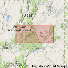
Stratigraphically restricted in the Henry basin, Garfield Co, UT (Paradox basin) to rocks between base of Tununk Shale Member and top of Blue Gate Shale Member. The overlying Muley Canyon and Masuk, formerly members of the Mancos, are removed from Mancos and assigned formation rank. They are designated Muley Canyon Sandstone and Masuk Formation. As thus restricted, Mancos is 970 to 1086 ft thick in report area. The Muley Canyon and Masuk are given formation status because of their distinct lithology and mappability. Stratigraphic charts. Of Late Cretaceous age--late Cenomanian, Turonian and Santonian. Upper Turonian and Coniacian shown as missing in this area.
Source: GNU records (USGS DDS-6; Denver GNULEX).
- Usage in publication:
-
- Mancos Group*
- Modifications:
-
- Age modified
- Biostratigraphic dating
- Revised
- AAPG geologic province:
-
- Uinta basin
- Green River basin
Summary:
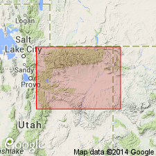
Raised in stratigraphic rank, in the Uinta basin and Greater Green River basin, from Current Creek, Wasatch Co, UT to Vermilion Creek, Moffat Co, CO where it is divided into: Mowry Shale (rank raised) of Albian age on basis of ammonite fossils; unnamed shale unit of Cenomanian? age; Frontier Formation (rank raised) and its Tununk Shale Member (geographically extended) of Turonian age; and the main body. The unnamed shale unit has Cenomanian foram fossils (listed). In the Frontier, the basal sandstone has an inoceramid fossil, the Tununk has ammonites (listed), the regressive coastal sandstone has OPHIOMORPHA burrows, PRIONOCYCLUS HYATTI and P. MACOMBI zone ammonites fossils. The main body is not completely discussed. On the north side of the Uinta Mountains, the term Mancos not used. The Mowry Shale and Frontier Formations are recognized. The term Hilliard Shale is applied to rocks equivalent to the main body of the Mancos Group of the southern side of the Mountains. Cross sections.
Source: GNU records (USGS DDS-6; Denver GNULEX).
For more information, please contact Nancy Stamm, Geologic Names Committee Secretary.
Asterisk (*) indicates published by U.S. Geological Survey authors.
"No current usage" (†) implies that a name has been abandoned or has fallen into disuse. Former usage and, if known, replacement name given in parentheses ( ).
Slash (/) indicates name conflicts with nomenclatural guidelines (CSN, 1933; ACSN, 1961, 1970; NACSN, 1983, 2005, 2021). May be explained within brackets ([ ]).

