- Usage in publication:
-
- Lupine formation*
- Modifications:
-
- Named
- Dominant lithology:
-
- Quartzite
- AAPG geologic province:
-
- Northern Rocky Mountain region
Summary:
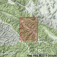
Named as one of five mapped units and as one of four newly named formations in the Missoula group of the Belt series for exposures along Lupine Creek, tributary to Trout Creek, sec 33, T16N, R26W, Mineral Co, MT in the Northern Rocky Mountain region. Type section (partial) measured at sec 34, T17N, R27W and sec 4, T16N, R27W, west side Blacktail Mountain where 2,750 ft is present. Type section for upper 300 ft is sec 18, T16N, R26W. Consists of vitreous to subvitreous, thin-, medium- to thick-bedded, fine- to medium-grained quartzite that is resistant to weathering, forming bold outcrops and prominent talus. Dusky red-purple argillite occurs as thin beds and as partings. Long thin ferrodolomitic quartzite lenses occur sporadically; the lenses are characteristics of the Lupine; they were not found in any other formation. A few isolated stromatolites. Overlies the newly named Spruce formation of the Missoula group; contact placed at base of grayish-purple argillite. Underlies the newly named Sloway formation of the Missoula, a gradational contact that is placed at top of thin dolomitic beds (Lupine) or at base of grayish-green argillite (Sloway). Is similar to Hellgate formation. Geologic map; mapped in south part of area. Of Precambrian age.
Source: GNU records (USGS DDS-6; Denver GNULEX).

- Usage in publication:
-
- Lupine Quartzite*†
- Modifications:
-
- Abandoned
Summary:
Abandoned in favor of Bonner Quartzite of Missoula Group of Precambrian Belt Supergroup. Was previously used in the Northern Rocky Mountain region of southwest MT.
Source: GNU records (USGS DDS-6; Denver GNULEX).
For more information, please contact Nancy Stamm, Geologic Names Committee Secretary.
Asterisk (*) indicates published by U.S. Geological Survey authors.
"No current usage" (†) implies that a name has been abandoned or has fallen into disuse. Former usage and, if known, replacement name given in parentheses ( ).
Slash (/) indicates name conflicts with nomenclatural guidelines (CSN, 1933; ACSN, 1961, 1970; NACSN, 1983, 2005, 2021). May be explained within brackets ([ ]).

