The National Geologic Map Database is migrating to a new infrastructure. We apologize for any service disruptions during this process.
|
|---|


- Usage in publication:
-
- Lueders limestone
- Modifications:
-
- Original reference
- Dominant lithology:
-
- Limestone
- AAPG geologic province:
-
- Permian basin
Summary:
Pg. 94, chart opp. p. 96. Lueders limestone. Top member of Wichita division. Has been identified by writer from a point south of Harrold, on Fort Worth and Denver City RR in Wilbarger County, past Seymour, across northwestern Throckmorton and southeastern Haskell Counties, to Ballinger, Runnels County. Persists to within a few miles of Red River. Thickness 20 feet in section [along the Texas and Pacific RR] from Abilene [Taylor County] to Sweetwater [Nolan County]. Around Abilene and perhaps southward beneath Callahan Divide, Lueders limestone is overlain by Abilene formation, which there forms top member of Wichita. [Age is Permian.]
Named from small town on Clear Fork of Brazos River, in eastern Jones Co., central northern TX.
Source: US geologic names lexicon (USGS Bull. 896, p. 1235).
- Usage in publication:
-
- Lueders formation
- Modifications:
-
- Revised
- AAPG geologic province:
-
- Permian basin
Summary:
Pg. 41-42. Lueders formation of Wichita stage. Over top of Paintrock [Paint Rock] formation is a series of rocks with a larger proportion of shale and marly impure limestones, which weather easily, except in upper part, which is formed by Ballinger limestones. The shales below these limestones are frequently marly and very fossiliferous; in fact they are coarse fossil conglomerates made up mainly of MYALINAS and other pelecypods with many gastropods and bryozoans. The limestones at Ballinger are quite fossiliferous, and the beds are relatively thick and massive, and mostly buff. The Lueders formation is here regarded as beginning with bed no. 142 and extending to top of bed no. 158 of general section [in bluffs of Colorado River, Runnels County, Texas]. As thus defined it has thickness of 194 feet. It is uncertain how Lueders formation as here used will check with section at Lueders, but according to Wrather they are in general equivalent. The Lueders formation as a whole naturally breaks into an upper and a lower part with rather distinct characteristics, and further study may necessitate its subdivision. [Underlies Arroyo formation (replaces Abilene formation of Wrather, 1917) of Wichita stage. Age is Permian.]
Source: US geologic names lexicon (USGS Bull. 896, p. 1235); supplemental information from GNU records (USGS DDS-6; Denver GNULEX).

- Usage in publication:
-
- Lueders formation
- Modifications:
-
- Revised
- AAPG geologic province:
-
- Bend arch
- Palo Duro basin
- Permian basin
Summary:
Pg. 169. Paint Rock beds of Drake are basal part of Lueders formation as defined in this report.
Source: US geologic names lexicon (USGS Bull. 896, p. 1235).

- Usage in publication:
-
- Lueders group
- Modifications:
-
- Revised
- AAPG geologic province:
-
- Bend arch
Summary:
Pg. 66 (fig. 1), 94. Lueders group. Rank raised to group. Includes (ascending) Paint Rock limestone, Maybelle limestone, and Lake Kemp formation. Overlies Bell Plains group (expanded); underlies Clear Fork group. Age is Permian. Report includes stratigraphic chart.
Source: US geologic names lexicon (USGS Bull. 1200, p. 2272-2273).

- Usage in publication:
-
- Lueders limestone
- Modifications:
-
- Revised
- Mapped
- AAPG geologic province:
-
- Bend arch
Summary:
Sheet 2. Lueders limestone. Described in Texas Colorado River Valley as a formation where, in Runnels County, it is about 225 feet thick. Consists mainly of very even limestone beds, 1 foot or a little less to about 3 feet thick; in part of section, these beds succeed one another with only an inch or two of intervening shale; in other parts, shale or marl between the limestones ranges in thickness to about 5 feet; limestones characterized by fine algal pellets or particles of type called OSAGIA. Overlies Talpa limestone member of Clyde formation; underlies Arroyo formation. No basis was found for recognizing any limestone beds of the Lueders as corresponding to Maybelle and Lake Kemp beds, respectively. "Paint Rock" limestone is considered a synonym for Talpa limestone. Age is Permian (Leonard?).
Source: Publication; US geologic names lexicon (USGS Bull. 1200, p. 2272-2273).
- Usage in publication:
-
- Lueders limestone*
- Modifications:
-
- Areal extent
- AAPG geologic province:
-
- Bend arch
Summary:
Pg. 276. Lueders limestone of Wichita group. In Brazos River Valley, Texas, consists of persistent alternating beds of limestone and shale whose thickness ranges from 75 feet in northwestern Callahan County to 50 feet in west-central Throckmorton County. Separated from underlying Talpa limestone member by unnamed shale unit 30 to 70 feet thick. Underlies Arroyo formation of Clear Fork group.
Source: US geologic names lexicon (USGS Bull. 1200, p. 2272-2273).

- Usage in publication:
-
- Lueders Formation
- Modifications:
-
- Mapped
- AAPG geologic province:
-
- Bend arch
- Palo Duro basin
- Permian basin
Summary:
Lueders Formation, top formation of Albany Group. Interbedded shale and limestone, 50 to 70 feet thick. Includes Lake Kemp and Maybelle Limestones [unranked]. Underlies Clear Fork Group (undivided) and overlies Talpa Formation of Albany. Equivalent to, and in places overlies, upper part of Waggoner Ranch Formation (new) of Wichita Group. Lueders Formation of earlier workers revised; lower part is transferred to underlying Talpa and upper contact is extended to include basal Arroyo Formation (not distinguished here). Age is Early Permian (Leonard).
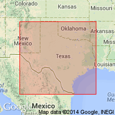
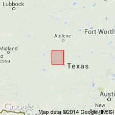
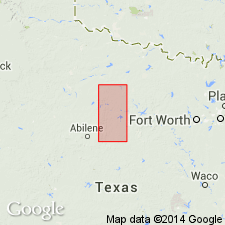
[Geographic extent arbitrarily placed; notable exposures south of Beaver Creek in Baylor, Haskell, Throckmorton, and Wilbarger Cos.]
Source: Publication.
For more information, please contact Nancy Stamm, Geologic Names Committee Secretary.
Asterisk (*) indicates published by U.S. Geological Survey authors.
"No current usage" (†) implies that a name has been abandoned or has fallen into disuse. Former usage and, if known, replacement name given in parentheses ( ).
Slash (/) indicates name conflicts with nomenclatural guidelines (CSN, 1933; ACSN, 1961, 1970; NACSN, 1983, 2005, 2021). May be explained within brackets ([ ]).