- Usage in publication:
-
- Lost Creek limestone
- Modifications:
-
- Named
- Dominant lithology:
-
- Limestone
- AAPG geologic province:
-
- Appalachian basin
Summary:
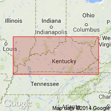
Named for Lost Creek, Breathitt Co., eastern KY. Exposed along crest of ridge between Lost Creek and Big Branch of Kentucky River, Buckhorn quad, just north of gap through which passes a road connecting these two streams. Consists of a thin limestone that differs markedly from all others in eastern KY. Badly broken in type area but large blocks show it to be at least 3.5 ft thick. Lower two-thirds is fossiliferous dolomitic limestone and upper third is a blue shelly limestone. Rock is very fossiliferous (fossils are listed). Lies 175 ft above Magoffin beds, nearly 130 ft above Saltlick beds, and 370 ft below Flint Ridge flint. [Age is Pennsylvanian.]
Source: GNU records (USGS DDS-6; Reston GNULEX).

- Usage in publication:
-
- Lost Creek limestone [unranked]
- Modifications:
-
- Overview
- AAPG geologic province:
-
- Appalachian basin
Summary:
Chart no. 6 (column 22, Kentucky River valley, eastern Kentucky, collated by H.R. Wanless and J.M. Weller); see also H.R. Wanless, 1939, GSA Spec. Paper 17, p. 91. Lost Creek limestone [unranked]. A limestone in Breathitt formation. Age is [Middle Pennsylvanian]; Alleghany; Desmoinesian; Westphalian C.
Source: Publication; US geologic names lexicon (USGS Bull. 1200, Wanless 1939 entry, p. 2237-2238).

- Usage in publication:
-
- Lost Creek limestone
- Modifications:
-
- Overview
- AAPG geologic province:
-
- Appalachian basin
Summary:
Unranked marine limestone in Breathitt Formation directly above Hindman coal. Strata assigned to Stoney Fork Member of Breathitt by Ping and Rice (1979). Here correlated with Boggs (Blunt Run) limestone in OH.
Source: GNU records (USGS DDS-6; Reston GNULEX).
For more information, please contact Nancy Stamm, Geologic Names Committee Secretary.
Asterisk (*) indicates published by U.S. Geological Survey authors.
"No current usage" (†) implies that a name has been abandoned or has fallen into disuse. Former usage and, if known, replacement name given in parentheses ( ).
Slash (/) indicates name conflicts with nomenclatural guidelines (CSN, 1933; ACSN, 1961, 1970; NACSN, 1983, 2005, 2021). May be explained within brackets ([ ]).

