

- Usage in publication:
-
- Lewis shale*
- Modifications:
-
- Original reference
- Dominant lithology:
-
- Shale
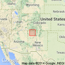
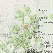
- AAPG geologic province:
-
- San Juan basin
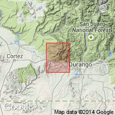
Summary:
Lewis shale. A series of more or less sandy shales and clays, of gray or drab color, very similar in character to Mancos shale. Includes, in varying abundance, thin calcareous lenses or concretions of impure limestone. Only 200 or 300 feet of formation now remains in this quadrangle, but in adjoining Durango quadrangle, the entire thickneas of 2,000 feet is exposed. Rests on Mesaverde formaton. It occurs as a band between the Mesaverde and Piedra [not deflned in this or any subsequent report by Cross; probably refers to deposits later called "Laramie formation" in this area] formations as far as these divisions of the Cretaceous have been traced in this part of Colorado. Is the "Sand Shale Group" of Holmes' general section of southwestern Colorado [which was defined as overlain by Pictured Cliffs sandstone]. In this quadrangle it is overlain by Pleistocene gravels. Its fossils [notably BACULITES ASPER] are ot Pierre age. [Age is Late Cretaceous.]
Named from occurrence at Fort Lewis, in La Plata Valley, [in sec. 3, T. 34 N., R. 11 W., Kline quadrangle, La Plata Co.], western CO.
Source: US geologic names lexicon (USGS Bull. 896, p. 1175-1176).
- Usage in publication:
-
- Lewis shale*
- Modifications:
-
- Areal extent
- AAPG geologic province:
-
- San Juan basin
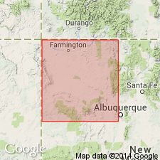
Summary:
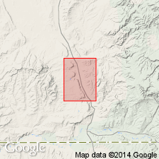
Thins southward in San Juan basin. Several mi south of Newcomb in southwest part of San Juan Co, NM in San Juan basin, underlying Cliff House sandstone and overlying Pictured Cliffs sandstone become an inseparable unit and Lewis has pinched out. The undivided sandstone body is called Pictured Cliffs because 1) of the long history of usage of that name, 2) it represents closing stages of marine deposition in the basin, 3) it is separated from Mesaverde group of the subsurface, and 4) it intertongues with Lewis shale and with Fruitland formation. Is of Late Cretaceous age. Simplified geologic map. Diagrammatic cross section.
Source: GNU records (USGS DDS-6; Denver GNULEX).
- Usage in publication:
-
- Lewis shale
- Modifications:
-
- Revised
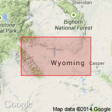
- AAPG geologic province:
-
- Green River basin
Summary:
Divided into three parts--lower shale unit, Dad sandstone member (new), and upper shale unit. The 1,000 to 1,400 ft series of sandstone and shale in the middle are named Dad sandstone member of Lewis shale. Lewis is more than 2,000 ft thick in Dad area where it overlies Mesaverde formation and underlies Lance formation. Ammonites identified. Of Late Cretaceous, Maestrichtian age.
Source: GNU records (USGS DDS-6; Denver GNULEX).
- Usage in publication:
-
- Lewis Shale*
- Modifications:
-
- Revised
- AAPG geologic province:
-
- Green River basin
Summary:
Underlies Foote Creek Formation (a new name) in Laramie and Carbon basins of Albany and Carbon Cos, WY, in the Greater Green River basin. Assignment of overlying rocks to Foote Creek is an areal restriction of the term Medicine Bow Formation, a term restricted to the Hanna basin in this report. Of Late Cretaceous age.
Source: GNU records (USGS DDS-6; Denver GNULEX).

- Usage in publication:
-
- Lewis Shale*
- Modifications:
-
- Principal reference
- Dominant lithology:
-
- Shale
- Siltstone
- Sandstone
- AAPG geologic province:
-
- Green River basin
Summary:
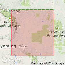
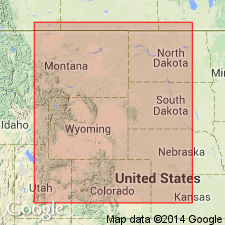
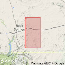
Retained in WY only because of established usage. Is neither an extension of nor same age as the Lewis Shale of southwest CO. Known in Laramie, Carbon, Hanna, and Great Divide basins, and in Rock Springs uplift of the Greater Green River basin, and in the Powder River, Bighorn, and Wind River basins. Consists of 2,200-2,600 ft of 1) dark-gray to olive-gray, silty to sandy shale that locally has fossiliferous limestone or siltstone concretions, 2) very fine to medium-grained, thin-bedded to massive, yellowish-gray to brown sandstone, and 3) yellowish-gray non-resistant siltstone. In the Hanna basin, a distinctive middle sandstone adopted as Dad Sandstone Member, originally named by Hale (1961). Principal reference section measured for the Dad Member at SW1/4 SW1/4 NW1/4 sec 27 to NW1/4 NE1/4 SW1/4 sec 28, T15N, R91W, Carbon Co. Reference section for the Lewis Shale measured at SW1/4 SW1/4 sec 13 and SE1/4 SE1/4 sec 14, T22N, R89W, Carbon Co. Overlies Almond Formation in report area, except for Laramie basin, where it rests on Pine Ridge Sandstone. Gradationally underlies Fox Hill Sandstone. Is a marine unit (ammonite fossils) of late Campanian and early Maestrichtian age. Correlation with other units of this age in south-central WY shown on Table 1.
Source: GNU records (USGS DDS-6; Denver GNULEX).
- Usage in publication:
-
- Lewis Shale*
- Modifications:
-
- Revised
- AAPG geologic province:
-
- San Juan basin
Summary:
Is the stratigraphically highest marine shale in the San Juan basin. Is generally a light- to dark-gray and black shale with interbeds of light-brown sandstone, sandy to silty limestone, calcareous concretions, and bentonite. Ranges from 0 ft thick in southwestern part of basin in San Juan Co, NM, to about 2,400 ft thick in northeastern part in Archuleta Co, CO. Several distinctive marker horizons in the subsurface discussed. The "Green Marker Horizon" near the base is characterized by low resistivity. Another bed in the upper part of the Lewis named the Huerfanito Bentonite Bed. The Huerfanito, traceable in the subsurface throughout the basin in northwest NM and southwest CO, represents a volcanic ash fall into the Lewis sea. Geologic map. Underlies Pictured Cliffs Sandstone. Late Cretaceous age.
Source: GNU records (USGS DDS-6; Denver GNULEX).
- Usage in publication:
-
- Lewis Shale*
- Modifications:
-
- Overview
- AAPG geologic province:
-
- Green River basin
Summary:
Correlation of Cretaceous Lewis from Hamilton area, CO, Greater Green River basin, with units in Pierre Shale in Kremmling and in Boulder areas, CO, shown on fig. 2.
Source: GNU records (USGS DDS-6; Denver GNULEX).
- Usage in publication:
-
- Lewis Shale*
- Modifications:
-
- Areal extent
- AAPG geologic province:
-
- Wind River basin
- Bighorn basin
Summary:
Part of Lewis Shale shown as equivalent to part of Meeteetse Formation in the east part of the Wind River basin and in the east part of the southern Bighorn basin of WY. Shown as Campanian in age and in the upper BACULITES REESIDEI to BACULITES ELIASI ammonite zones. Is a nonresistant unit. Lower contact with Teapot sharp because the Teapot is a very resistant unit. However, where Teapot is thin or poorly developed, the lower contact of the Lewis is not easily recognized. Cross sections. Correlation chart.
Source: GNU records (USGS DDS-6; Denver GNULEX).
- Usage in publication:
-
- Lewis shale
- Modifications:
-
- Revised
- AAPG geologic province:
-
- Powder River basin
Summary:
Also called "Lewis shale formation" in this report. Divided into three parts in western Campbell Co--a lower sand, the newly named Teckla sand member, and an upper gray, very fine grained calcareous sandstone. Teckla occurs only in the subsurface of the Powder River basin where it can be separated into a lower sand, the "Kara bentonitic shale" [bed], and an upper gray, very fine grained calcareous sandstone. Teckla occurs 414 ft below the top of the Lewis in the Teckla type section E-log diagrams (a reassignment--assigned to Pierre shale in Red Bird area). Correlation chart. Ammonites of latest Campanian age identified in the Kara. Lewis represents a major marine transgression from east to west. Teckla represents a minor marine regression. The upper and lower sandstones of the Teckla represent strand lines. Lewis ranges from Campanian (BACULITES REESIDEI) to Maestrichtian (BACULITES GRANDIS).
Source: GNU records (USGS DDS-6; Denver GNULEX).
- Usage in publication:
-
- Lewis Shale*
- Modifications:
-
- Areal extent
- AAPG geologic province:
-
- Powder River basin
Summary:
Identified on section B-B' in central (in subsurface) and western (on outcrop) parts of Powder River basin, WY. Is equivalent to the upper part of the Pierre Shale of the eastern part of the Powder River basin. Overlies Mesaverde Formation. Underlies Fox Hills Sandstone. Of Late Cretaceous age. Three other diagrams published: B-B' (OC-73), C-C' (OC-75), and D-D' (OC-76).
Source: GNU records (USGS DDS-6; Denver GNULEX).
- Usage in publication:
-
- Lewis Shale*
- Modifications:
-
- Areal extent
- Mapped 1:50k
- Dominant lithology:
-
- Shale
- Claystone
- Siltstone
- Sandstone
- AAPG geologic province:
-
- San Juan basin
Summary:
Is Upper Cretaceous Formation mapped as two units in San Juan and McKinley Cos, NM (San Juan basin). Main body is divisible into three parts: upper part is calcareous, sandy shale that contains light-brown sandstone beds 1-5 ft thick, and is transitional into overlying Pictured Cliffs Sandstone; middle part is light-gray to dark-olive or olive-gray claystone and siltstone that contains a few thin sandstone zones and scattered beds of sandy concretionary limestone; lower part is sandy and transitional into underlying Cliff House Sandstone. Calcareous concretions contain marine invertebrate fossils equivalent in age to middle part of Pierre Shale (Campanian) of eastern CO. Main body is about 100-115 ft thick. Tongue of Lewis Shale occurs within Cliff House Sandstone in northwest part of map area. Tongue is greenish-gray, slope-forming, thin-bedded siltstone, sandy shale, and shale; crops out near junction of Escavada and Chaco Wash and in Ah-shi-sle-pah Wash area. Thickens northward and joins main body of Lewis in subsurface. Thickness 0-90 ft. Along north side of Chaco Canyon, a conspicuous broad bench in the Cliff House separates two high sandstone cliffs; this bench is developed south of the pinchout and at the stratigraphic level of the tongue of Lewis Shale.
Source: GNU records (USGS DDS-6; Denver GNULEX).
- Usage in publication:
-
- Lewis Shale*
- Modifications:
-
- Biostratigraphic dating
- AAPG geologic province:
-
- Wind River basin
Summary:
Is a formation in Natrona Co, WY in Wind River basin. Collections of the ammonite genus RHAEBOCERAS from about 17 m above base of unit at USGS Mesozoic locality D3228 on northeast flank of Teapot dome indicate an early Maestrichtian (Late Cretaceous) age for part of Lewis. General stratigraphic position of RHAEBOCERAS includes the zones of BACULITES REESIDEI Elias and B. JENSENI Cobban.
Source: GNU records (USGS DDS-6; Denver GNULEX).

- Usage in publication:
-
- Lewis Shale*
- Modifications:
-
- Areal extent
- AAPG geologic province:
-
- Powder River basin
Summary:
Identified in the subsurface of the western Powder River basin (Converse, Niobrara, western Campbell, Johnson Cos, WY) where it overlies Mesaverde Formation and underlies Fox Hills Sandstone. Divided into an unnamed lower part, Teckla Sandstone Member, and an unnamed upper part. East of the pinchout of the Teckla, the equivalent sequence is assigned to the upper part of the Pierre Shale. Late Cretaceous age. [Shown on 22 cross sections in this OC series.]
Source: GNU records (USGS DDS-6; Denver GNULEX).
- Usage in publication:
-
- Lewis Shale*
- Modifications:
-
- Biostratigraphic dating
- AAPG geologic province:
-
- Green River basin
Summary:
Ammonite index fossil BACULITES CLINOLOBATUS collected by J.R. Gill from dolomite concretion in upper part of Lewis at locality D6415 in SE/4 NW/4 NW/4 sec 23, T21N, R101W, Sweetwater Co, WY near base of measured section 28 (plate 2), indicates early Maastrichtian age for upper part of Lewis. Study area is within Greater Green River basin.
Source: GNU records (USGS DDS-6; Denver GNULEX).
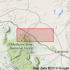
- Usage in publication:
-
- Lewis Shale*
- Modifications:
-
- Mapped 1:24k
- Dominant lithology:
-
- Shale
- AAPG geologic province:
-
- Green River basin
Summary:
Sheet 1 (geol. map). Lewis Shale. Gray marine shale. Divisible into two predominantly shale parts separated by the Dad Sandstone Member. North of Cherokee Creek, upper part of Lewis Shale and Dad Sandstone Member separately mapped; south of Cherokee Creek, Lewis Shale mapped undivided, due to poor exposure. About 850 feet of undivided Lewis Shale exposed in quadrangle. Age is Late Cretaceous. Report includes geologic map, measured sections, correlation chart, cross sections.
Source: Publication.
For more information, please contact Nancy Stamm, Geologic Names Committee Secretary.
Asterisk (*) indicates published by U.S. Geological Survey authors.
"No current usage" (†) implies that a name has been abandoned or has fallen into disuse. Former usage and, if known, replacement name given in parentheses ( ).
Slash (/) indicates name conflicts with nomenclatural guidelines (CSN, 1933; ACSN, 1961, 1970; NACSN, 1983, 2005, 2021). May be explained within brackets ([ ]).