

- Usage in publication:
-
- Lance Creek beds
- Ceratops beds†
- Modifications:
-
- Original reference
- AAPG geologic province:
-
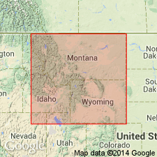
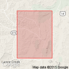
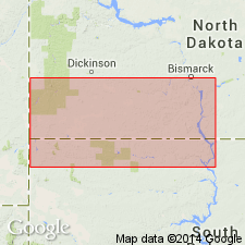
- Powder River basin
Summary:
Pg. 369-375. Lance Creek (Ceratops) beds. The name Ceratops beds cannot be used for these Wyoming deposits, and I give to them the above name, from the principal stream in the region where they are best represented, in Converse County, Wyoming. That these beds conformably overlie the Fox Hills in this region has been published by present writer, who spent nearly 4 full years collecting from them, and been abundantly corroborated by investigations of T.W. Stanton and F.H. Knowlton. [On p. 374 he calls these beds the Laramie (Lance Creek) beds of Converse County, Wyoming.] The beds are overlain by the Fort Union.
[See definition of †Ceratops beds.]
[Named from exposures on Lance Creek, Niobrara Co., WY (formerly a part of Converse Co.).]
Source: US geologic names lexicon (USGS Bull. 896, p. 1142).
- Usage in publication:
-
- Lance formation*
- Modifications:
-
- Adopted
- Age modified
- AAPG geologic province:
-
- Powder River basin
Summary:
Pg. 172-188. Lance formation ("Ceratops beds"). The name Lance formation has recently been adopted by the USGS for the "Ceratops beds" of eastern Wyoming and adjacent areas. It is an abbreviated form of "Lance Creek beds" which J.B. Hatcher applied to these deposits in 1903 (Amer. Geol., v. 31, p. 369), with the statement that the name is taken "from the principal stream in the region where they are best represented, in Converse County, Wyoming." At present one of most important points at issue is relationship of Lance formation to Laramie formation and to the conformable Cretaceous sequence beneath the Laramie. Some geologists hold that the Lance formation wherever it has been studied rests unconformably on the Laramie or some older formation, and that the unconformity beneath it represents a long complex epoch of elevation and erosion. In this paper evidence will be presented to show that in the rather widely distributed areas discussed there is a real transition from the marine Cretaceous Fox Hills sandstone into Lance formation and that sedimentation was practically continuous from the one into the other and probably on through the [overlying] Fort Union. If it is true that there is a transition with practically continuous sedimentation from Fox Hills sandstone into Lance formation in region discussed, then Lance formation includes or forms part of the Laramie.
[See also under Cannonball marine member of Lance formation.]
Source: US geologic names lexicon (USGS Bull. 896, p. 1142).
- Usage in publication:
-
- Lance formation*
- Modifications:
-
- Revised
- AAPG geologic province:
-
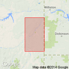
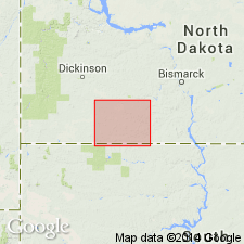
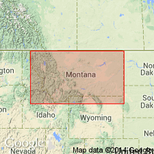
- Williston basin
Summary:
Pg. 189-198. Lance formation. In eastern Montana and southwestern North Dakota, includes Colgate sandstone member (new).
Source: US geologic names lexicon (USGS Bull. 1200, p. 2094-2097).
- Usage in publication:
-
- Lance formation*
- Modifications:
-
- Revised
- AAPG geologic province:
-
- Sioux uplift
Summary:
Pg. 249-250. Lance formation. In Cannonball River lignite field, North Dakota, includes Cannonball marine member (new), 250 to 300 feet thick, in upper part. Age is Eocene(?).
Source: US geologic names lexicon (USGS Bull. 1200, p. 2094-2097).
- Usage in publication:
-
- Lance formation*
- Modifications:
-
- Revised
- AAPG geologic province:
-
- Williston basin
Summary:
Pg. 527-547. Lance formation. In western part of North Dakota and South Dakota, comprises (ascending) unnamed lower part, Ludlow lignitic member (new), and Cannonball marine member.
Source: US geologic names lexicon (USGS Bull. 1200, p. 2094-2097).
- Usage in publication:
-
- Lance formation*
- Modifications:
-
- Revised
- AAPG geologic province:
-
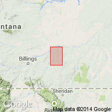
- Central Montana uplift
- Powder River basin
Summary:
Pg. 19-34. Lance formation. In Tullock Creek coal field, Montana, includes Tullock member (new), about 300 feet thick, in upper part.
Source: US geologic names lexicon (USGS Bull. 1200, p. 2094-2097).
- Usage in publication:
-
- Lance formation*
- Modifications:
-
- Revised
- AAPG geologic province:
-
- Williston basin
Summary:
Pg. 490, 491-493. Lance formation. Restricted to exclude Colgate sandstone which is allocated to member status in underlying Fox Hills sandstone. Comprises Hell Creek, Tullock, Ludlow lignitic, and Cannonball members. [Age is Late Cretaceous.]
Source: US geologic names lexicon (USGS Bull. 1200, p. 2094-2097).

- Usage in publication:
-
- Lance formation*
- Modifications:
-
- Age modified
- AAPG geologic province:
-
- Powder River basin
Summary:
Lance formation. The age of the Lance formation and its relation to true Laramie formation of Denver basin (of unquestioned Late Cretaceous age) are still disputed questions among American geologists, in view of which the USGS for many years tentatively classified Lance formation as Tertiary? (Eocene?). In consideration, however, of the accumulated evidence of a large amount of additional field work, extending over a period of many years, this age designation was modified as follows, in Dec. 1935: (1) The Hell Creek and Tullock deposits (previously classified as members of Lance formation) were raised to formation rank; (2) the age of Hell Creek formation was changed to Late Cretaceous; (3) the age of Tullock formation was changed from Tertiary(?) to Late Cretaceous or Eocene; (4) in areas in Montana and northeastern Wyoming where the Hell Creek and Tullock are not recognizable, the age of the Lance was changed to Late Cretaceous, except where Eocene fossils are found above Cretaceous fossils, in which case the age of the Lance is to be Cretaceous and Eocene; (5) the age of the Lance in other parts of Wyoming (outside northeastern part of State) is to be Late Cretaceous, no Eocene flora having been reported from these areas; (6) the age of Arapahoe formation was changed to Late Cretaceous; and (7) the age of the Dawson arkose and Denver formation was changed to Late Cretaceous and Eocene(?).
Named from exposures on Lance Creek, Niobrara Co., WY (formerly a part of Converse Co.). Recognized in WY (widespread), MT (widespread), western ND and SD, and northwestern CO.
Source: US geologic names lexicon (USGS Bull. 896, p. 1142).
- Usage in publication:
-
- Lance formation
- Modifications:
-
- Biostratigraphic dating
- Age modified
- AAPG geologic province:
-
- Powder River basin
Dorf, Erling, 1940, Relationship between floras of type Lance and Fort Union formations: Geological Society of America Bulletin, v. 51, no. 2, p. 213-235.
Summary:
Pg. 213-236. Discussion of relationship between floras of type Lance and Fort Union formations. Paleobotanical evidence supports known vertebrate evidence in placing boundary between true Lance and "Fort Union" at base of nondinosaur-bearing Tullock, Ludlow, or Bear formations or their equivalents; that is, at top of Triceratops-bearing Hell Creek or Lance formations as originally defined. Such a view is not contradicted by marine invertebrates of Cannonball beds, which interfinger with the Ludlow and the lower "Fort Union." In proposed revision, Lance formation (equivalent to Hell Creek formation) is restricted to Upper Cretaceous; Tullock formation (equivalent to Ludlow formation and Cannonball marine member) is basal formation of Paleocene Fort Union group. Lance overlies Fox Hills sandstone.
Source: US geologic names lexicon (USGS Bull. 1200, p. 2094-2097).
- Usage in publication:
-
- Lance Formation*
- Modifications:
-
- Age modified
- AAPG geologic province:
-
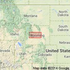
- Wind River basin
Summary:
At Waltman locality, T36N, R87W, Natrona Co, WY, Wind River basin, upper few feet contain a spore and pollen assemblage (CLASSOPOLLIS) of earliest Paleocene age. This is thickest surface section in basin and contact zone is transitional with overlying Fort Union Formation. Upper contact placed where lithology changes from predominantly gray and tan shale, claystone, and sandstone below to predominantly white sandstone above. In most places contact with Fort Union around margins of basin is erosional and (or) an angular unconformity. Throughout study area, except at Waltman, author assigns Lance a Late Cretaceous age in report.
Source: GNU records (USGS DDS-6; Denver GNULEX).
- Usage in publication:
-
- Lance Formation
- Modifications:
-
- Overview
- AAPG geologic province:
-
- Green River basin
Summary:
Exposed in a crescent-shaped belt of outcrops 56 km long and 10 km wide along east flank, Rock Springs uplift, Sweetwater Co, WY in the Greater Green River basin. Ranges from 85 to 222 m thick. Stratigraphic sections. Is lithologically heterogeneous, laterally and vertically. Overlies Upper Cretaceous Fox Hills Sandstone. Underlies the Paleocene Fort Union Formation. Contains an extensive vertebrate fauna (amphibians, reptiles, mammals, fish), gastropods, pelecypods; faunas listed. Information attained indicates deposition in a warm, subtropical, lowland floodplain environment during latest Cretaceous, Maastrichtian time.
Source: GNU records (USGS DDS-6; Denver GNULEX).
- Usage in publication:
-
- Lance Formation*
- Modifications:
-
- Age modified
- Biostratigraphic dating
- AAPG geologic province:
-
- Powder River basin
Summary:
Microstratigraphy of new Cretaceous-Tertiary boundary clay site at Dogie Creek, Niobrara Co, WY in southeastern Powder River basin demonstrates palynological break coincides with base of kaolinitic claystone layer within Lance Formation, 4-7 cm beneath lowest lignite in Paleocene Fort Union formation. Typical Cretaceous palynomorph assemblage occurs below claystone. Claystone yields fern spores but no Cretaceous pollen. "Magic" layer above claystone yields shocked quartz grains and highest iridium anomaly. All samples above claystone yield palynomorphs of Tertiary age. Age of Lance refined to Maestrichtian (Late Cretaceous) and Paleocene (Tertiary) at this locality.
Source: GNU records (USGS DDS-6; Denver GNULEX).
- Usage in publication:
-
- Lance Formation*
- Modifications:
-
- Revised
- AAPG geologic province:
-
- Green River basin
Summary:
Upper boundary is placed at base of overlying unnamed Cretaceous and Tertiary sandstone unit along eastern flank of Washakie basin and southeastern flank of Great Divide basin, Carbon and Sweetwater Cos, WY in Greater Green River basin. Divides Lance Formation into lower and upper zones. Upper zone underlies and intertongues with unnamed Cretaceous and Tertiary sandstone unit. An unconformity at base of upper zone of unnamed Cretaceous and Tertiary sandstone unit marks Cretaceous-Tertiary boundary. Palynological samples indicate latest Maastrichtian and earliest Paleocene are missing, rocks below unconformity are Late Cretaceous (Maastrichtian) age, and rocks above unconformity are early Paleocene age. Previous surface and subsurface studies by other workers have placed Cretaceous-Tertiary boundary and contact between Lance and Fort Union at various stratigraphic positions as defined in this report, including: 1) base of upper zone of Lance; 2) base of lower or middle zones of unnamed Cretaceous and Tertiary sandstone unit; 3) at conglomerate horizon at base of upper zone of unnamed sandstone unit; or 4) at top of upper zone of unnamed sandstone unit. Geologic map. Correlation diagram. Measured sections. Fossil list. Late Cretaceous age.
Source: GNU records (USGS DDS-6; Denver GNULEX).

- Usage in publication:
-
- Lance Formation*
- Modifications:
-
- Areal extent
- AAPG geologic province:
-
- Powder River basin
Summary:
Identified in the subsurface of the Powder River basin, WY, where it overlies Fox Hills Sandstone. Is equivalent to the Hell Creek Formation, which also overlies Fox Hills, in MT. Of Late Cretaceous age. [This nomenclature shown on 22 cross sections in this OC series.]
Source: GNU records (USGS DDS-6; Denver GNULEX).
- Usage in publication:
-
- Lance Formation*
- Modifications:
-
- Age modified
- Biostratigraphic dating
- AAPG geologic province:
-
- Wind River basin
Summary:
Samples collected near Lance-Fort Union Formation contact from Shotgun Butte area, Wind River Reservation, Fremont Co, WY, Wind River basin, yielded sparse palynomorph assemblages and cannot be dated definitively. Species present range in age from Late Cretaceous through early Tertiary. One sample (locality D7753-A) yielded a few poorly preserved specimens of MOMIPITES, suggesting that it may be earliest Paleocene in age. Though sparse recovery makes age determination uncertain, the implication is that uppermost Lance near Shotgun Butte may be earliest Paleocene age.
Source: GNU records (USGS DDS-6; Denver GNULEX).
- Usage in publication:
-
- Lance Formation*
- Modifications:
-
- Revised
- Dominant lithology:
-
- Mudstone
- Siltstone
- Shale
- AAPG geologic province:
-
- Green River basin
Summary:
Pg. 2-3, sheet 1 (figs. 1-3, geol. map), sheet 2. Lance Formation. Divided into (ascending) lower member and Red Rim Member (new). Lower member, about 1,675 feet, consists of an overall coarsening-upward succession of gray and yellow-brown mudstone, siltstone, and carbonaceous shale, with subordinate amounts of thin lenticular sandstone; a few coals are present mainly in basal 100 feet. Red Rim Member, about 685 feet, consists mainly of sandstones separated by relatively thin layers of silty shale, carbonaceous shale, and mudstone. Unconformably underlies China Butte Member (new) of Fort Union Formation; conglomerate at base of China Butte marks regional unconformity separating Tertiary from Cretaceous age rocks. Overlies sharply, and locally intertongues with Upper Cretaceous Fox Hills Sandstone. Age is Late Cretaceous. Report includes geologic map, measured sections, correlation chart, cross sections.
Source: Publication.
For more information, please contact Nancy Stamm, Geologic Names Committee Secretary.
Asterisk (*) indicates published by U.S. Geological Survey authors.
"No current usage" (†) implies that a name has been abandoned or has fallen into disuse. Former usage and, if known, replacement name given in parentheses ( ).
Slash (/) indicates name conflicts with nomenclatural guidelines (CSN, 1933; ACSN, 1961, 1970; NACSN, 1983, 2005, 2021). May be explained within brackets ([ ]).