- Usage in publication:
-
- Kope Formation
- Modifications:
-
- Named
- Dominant lithology:
-
- Shale
- Limestone
- AAPG geologic province:
-
- Cincinnati arch
Summary:
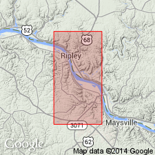
Named for Kope Hollow, Brown Co., OH. Composed of shale and much lesser fossiliferous limestone. Composite thickness is 73.5 m. Underlain by Point Pleasant Formation; overlain by unnamed unit. Correlated with the Eden in the Cincinnati, OH, area.
Source: GNU records (USGS DDS-6; Reston GNULEX).
- Usage in publication:
-
- Kope Formation
- Modifications:
-
- Revised
- AAPG geologic province:
-
- Cincinnati arch
Summary:
The Geological Survey of Ohio recognizes the Cincinnati Group proposed by Meek and Worthen (1865), but at this time retains it as an informal term. The unit will be formally reinstated as a lithostratigraphic term after revision of its lower boundary and minor lithologic redescription of its units are completed. The ten formations included in the group are the (ascending) Clays Ferry Formation, the Kope Formation, the Fairview Formation, the Miamitown Shale, the Grant Lake Limestone, the Arnheim Formation, the Waynesville Formation, the Liberty Formation, the Whitewater Formation, and the Drakes Formation. Six members have been identified in the course of field mapping: the Point Pleasant Tongue of the Clays Ferry, the informal Bellevue, Corryville, Mount Auburn, and Straight Creek members of the Grant Lake Limestone, and the Preachersville Member of the Drakes Formation. The Backbone Creek and Elk Creek beds are recognized as excellent stratigraphic marker beds.
Source: GNU records (USGS DDS-6; Reston GNULEX).
- Usage in publication:
-
- Kope Formation*
- Modifications:
-
- Overview
- Age modified
- AAPG geologic province:
-
- Cincinnati arch
Summary:
The Kope Formation in north-central KY and southwestern OH consists of fossiliferous shale interbedded with medium bedded, fossiliferous limestone and siltstone. In southeastern IN, the Kope consists of bluish- to brownish-gray clay-shale and minor limestone. Fossils include brachiopods, bryozoans, crinoids, trilobites, and mollusks. Thickness is 150 to 280 feet. In KY and OH unit conformably overlies the Point Pleasant Member of the Clays Ferry Formation but becomes unconformable northwestward; conformably underlies and intertongues with the Fairview Formation. In Indiana the Kope conformably underlies the Dillsboro Formation. The Kope is of Late Ordovician, Edenian age, but locally may be Maysvillian.
Source: GNU records (USGS DDS-6; Reston GNULEX).
- Usage in publication:
-
- Kope Formation
- Modifications:
-
- Overview
- AAPG geologic province:
-
- Cincinnati arch
Summary:
The Kope-Fairview-Bellevue succession is the first of three major progradational units that compose the Cincinnatian Series in the Cincinnati, OH, area. Each succession is interpreted as a mixed siliciclastic-carbonate ramp. The Kope Formation, consisting of approximately 80 percent calcareous and argillaceous shale and 20 percent coarse to fine-grained limestones and siltstones, is the most distal facies of the ramp complex. The Kope averages 60 m in thickness. The Grand Avenue Member is recognizable along the Ohio River and consists of 3 to 4 m of interbedded shale and limestone similar to the overlying Fairview Formation. The Grand Avenue becomes indistinguishable 20 km to the north. The Kope thickens northward (up to 110 m) and becomes less fossiliferous and increasingly carbonaceous. Fossil assemblages are characterized by small brachiopods; thin, branching trepostome bryozoans; trilobite and crinoidal species; and minor bivalves. Unit is time transgressive. Age shown as Late Ordovician (Edenian and Maysvillian) for the most part, but also as late Middle Ordovician (Champlainian) locally in southwestern OH, where it interfingers with the underlying Point Pleasant Tongue of the Clays Ferry Formation and with the Utica Shale.
Source: GNU records (USGS DDS-6; Reston GNULEX).
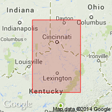
- Usage in publication:
-
- Kope Formation*
- Modifications:
-
- Overview
- AAPG geologic province:
-
- Cincinnati arch
Summary:
Nautiloid fauna of Kope Formation in OH and IN and of Clays Ferry Formation in KY are most similar to coeval Utica Shale of NY and Whitby Formation of southern Ontario.
Source: GNU records (USGS DDS-6; Reston GNULEX).
For more information, please contact Nancy Stamm, Geologic Names Committee Secretary.
Asterisk (*) indicates published by U.S. Geological Survey authors.
"No current usage" (†) implies that a name has been abandoned or has fallen into disuse. Former usage and, if known, replacement name given in parentheses ( ).
Slash (/) indicates name conflicts with nomenclatural guidelines (CSN, 1933; ACSN, 1961, 1970; NACSN, 1983, 2005, 2021). May be explained within brackets ([ ]).

