

- Usage in publication:
-
- Kayenta formation*
- Modifications:
-
- First used
- Dominant lithology:
-
- Sandstone
- Shale
- AAPG geologic province:
-
- Paradox basin
- Black Mesa basin
- Plateau sedimentary province
Summary:
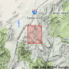
First good published description of Kayenta formation as the middle formation of Glen Canyon group. Type locality is about a mile north of Kayenta, Navajo Co, AZ in the Black Mesa basin, and about 20 miles south of Monument Valley-Navajo Mountain region, San Juan Co, UT in Paradox basin, and Coconino Co, AZ, Plateau sedimentary province. Intent to name not stated. Name Todilto limestone of Todilto Park was misapplied in earlier reports to rocks of this unit. Consists mostly of irregularly bedded, fine- to coarse-grained, purplish-red to buff sandstone; some gray to purplish-red, usually sandy, shale; gray, sandy fossiliferous limestone a few inches thick; and conglomerate or grit with small pebbles of quartz and sandstone in a sandy matrix. Some sandstone beds are cross-bedded and range from a few inches to tens of ft thick. Ranges in thickness from 140 ft in west side Piute Canyon to 225 ft thick in Horse Canyon. Readily distinguished from underlying cliff-forming Wingate sandstone, basal formation of Glen Canyon, and overlying Navajo sandstone, upper formation of Glen Canyon. Character of bedding used as basis for selection of contacts. Mapped along Colorado River and south in UT, San Juan Co; extends into adjacent AZ. Geologic map. Cross sections. Fluviatile deposit. Presence of UNIOS indicate fresh water. Jurassic? age. Stratigraphic column.
Source: GNU records (USGS DDS-6; Denver GNULEX).
- Usage in publication:
-
- Kayenta formation*
- Modifications:
-
- Revised
- AAPG geologic province:
-
- Great Basin province
- Plateau sedimentary province
Summary:
Kayenta formation intertongues with the Navajo sandstone. In the Kanab area, Kane Co, UT and Coconino Co, AZ in the Plateau sedimentary province, the Tenney Canyon tongue (first used) of the Kayenta separates the overlying Lamb Point tongue (first used) of the Navajo from the main body of the Navajo. In the Cedar City area, Iron Co, UT in the Great Basin province, the Cedar City tongue (named) of the Kayenta separates the Shurtz sandstone tongue (named) of the Navajo from the main body of the Navajo. The lower part of the Kayenta underlies the Shurtz. Kayenta changes in lithologic character from west to east; it is primarily red-brown siltstone and mudstone with a few layers of gray siltstone in southern UT and northern AZ, whereas it is primarily sandstone near Kayenta, northeastern AZ. Assigned a Jurassic? age. [No stratigraphic figures.]
Source: GNU records (USGS DDS-6; Denver GNULEX).
- Usage in publication:
-
- Kayenta formation*
- Modifications:
-
- Areal extent
- AAPG geologic province:
-
- Black Mesa basin
- Paradox basin
- Plateau sedimentary province
- San Juan basin
Summary:
Pg. 3 (fig. 2), 17-19, pls. 1, 2. Kayenta formation of Glen Canyon group. At type locality, is represented by sandstone facies typical of unit throughout most of Colorado Plateau; to southwest of type locality, increases in silt content. Thickness: 55 feet at Rock Point (Apache Co., northeastern AZ) near its eastern limit; 144 feet at Kayenta (Navajo Co., northeastern AZ); 466 feet at Gap (Coconino Co., northeastern AZ) where it includes many silty units that are tongues of silty facies; 678 feet along Ward Terrace (Coconino Co., northeastern AZ). In eastern half of Navajo country, conformably overlies Wingate sandstone (Lukachukai member); in western half of country, conformably overlies Moenave formation. Intertongues with basal part of overlying Navajo sandstone. Contains tritylodontids; study of these fossils is incomplete, but they seem to be closest to Old World forms generally referred to Upper Triassic. Assigned to Lower Jurassic(?).
[GNC remark (ca. 1966, US geologic names lexicon, USGS Bull. 1200, p. 1978): The USGS currently designates the age of the Kayenta Formation as Late Triassic(?) on basis of study now in progress.]
Source: Publication; US geologic names lexicon (USGS Bull. 1200, p. 1977-1978).
- Usage in publication:
-
- Kayenta formation*
- Modifications:
-
- Age modified
Summary:
Age changed from Early Jurassic? to Late Triassic?. Is in part equivalent to Moenave formation. Intertongues with overlying Navajo sandstone. Carnivorous dinosaur, fresh-water pelecypods, and a tritylodont reptile found 8-10 ft below top of formation suggest correlation with Starmberg series of South Africa and Lufeng series of Chiva which are considered of Keuper age.
Source: GNU records (USGS DDS-6; Denver GNULEX).
- Usage in publication:
-
- Kayenta formation*
- Modifications:
-
- Overview
- AAPG geologic province:
-
- Great Basin province
Summary:
Lower unnamed member and Cedar City tongue of Kayenta formation of Glen Canyon group mapped in north-central and west-central part of quad, Iron Co, UT, in the Great Basin province. These two parts of the Kayenta are separated by the map unit Shurtz sandstone tongue of the Navajo sandstone. [This is the first paper to show Cedar City as a mapped unit.] Lower member overlies Springdale sandstone member of the Moenave formation. Lower member is 275 to 420 ft thick; it consists of light-gray to light-brown siltstone, reddish-brown silty mudstone, and dark-reddish-brown mudstone that form a slope beneath the Shurtz. The lower member has undulating or ripple-marked surfaces; fluvial origin suggested. Cedar City tongue forms a strike valley, is ripple-marked, has mudstone-pellet layers, is a shallow-water deposit. [Lithologic description same as Averitt and others, 1955.] Assigned a Jurassic? age.
Source: GNU records (USGS DDS-6; Denver GNULEX).
- Usage in publication:
-
- Kayenta Formation*
- Modifications:
-
- Areal extent
- AAPG geologic province:
-
- Great Basin province
Summary:
The part of the stratigraphic section in the Great Basin province of southwest UT and southern NV formerly considered to be the Chinle Formation includes rocks correlated with and assigned to the Chinle, Moenave, and Kayenta Formations of the Glen Canyon Group. The Chinle-Glen Canyon contact is an erosion surface that marks a hiatus in southern NV and southwestern UT that is occupied to the east by the Owl Rock and Church Rock Members of the Chinle. Of Triassic? age.
Source: GNU records (USGS DDS-6; Denver GNULEX).
- Usage in publication:
-
- Kayenta Formation*
- Modifications:
-
- Overview
- AAPG geologic province:
-
- Great Basin province
- Plateau sedimentary province
- Black Mesa basin
Summary:
Intertongues with overlying Navajo Sandstone and underlying Moenave Formation. Navajo, Kayenta, and Moenave belong to the Glen Canyon Group. Tentatively assigned to the Sinemurian, Pliensbachian, and Toarcian, or Early Jurassic on basis of identification of Early Jurassic palynomorphs from the Whitmore Point Member of Moenave beneath the Kayenta. [Age retained as Late Triassic?]. Kayenta extends from Washington Co, UT, Great Basin province east across Kane Co, UT and into Coconino Co, AZ, Plateau sedimentary province and farther east to Apache Co, AZ in Black Mesa basin on cross section. Correlation chart. [Cedar City and Tenney Point Tongues of Kayenta not discussed.]
Source: GNU records (USGS DDS-6; Denver GNULEX).
- Usage in publication:
-
- Kayenta Formation
- Modifications:
-
- Age modified
- AAPG geologic province:
-
- Plateau sedimentary province
Summary:
Horn-like scutes have been found in the Kayenta Formation at several localities in the Rock Head quad, Coconino Co, AZ in the Plateau sedimentary province, that match an obscure ornithisician dinosaur of the Early Jurassic of southwest England. These scutes [pictured] belonged to SCELIDOSAURUS. Possible late Hettangian or Sinemurian age suggested for lower part of the Kayenta. Along with palynomorphs in the Moenave Formation and magnetostratigraphic studies, the Early Jurassic age established for several parts of the group is assigned to the entire Glen Canyon Group. Formations of the Glen Canyon are thought to be--Wingate, Hettangian; Moenave, Hettangian and Sinemurian; Kayenta, Sinemurian and Pliensbachian; Navajo, Pliensbachian or Toarcian--all stages of the Early Jurassic. [Members of formations in Glen Canyon Group not discussed.]
Source: GNU records (USGS DDS-6; Denver GNULEX).

- Usage in publication:
-
- Kayenta Formation*
- Modifications:
-
- Areal extent
- AAPG geologic province:
-
- Great Basin province
Summary:
A lower member of Kayenta Formation mapped in east-central Lincoln Co., NV in the Great Basin province where it overlies Springdale Sandstone Member, upper member of Moenave Formation. Is older than an unnamed Tertiary sedimentary rock and tuff unit. About 30 m exposed. Consists of vermilion silty shale with a few thin gray dolomite beds of lacustrine origin about 10 m above base. Of Early Jurassic age.
Source: GNU records (USGS DDS-6; Denver GNULEX).
For more information, please contact Nancy Stamm, Geologic Names Committee Secretary.
Asterisk (*) indicates published by U.S. Geological Survey authors.
"No current usage" (†) implies that a name has been abandoned or has fallen into disuse. Former usage and, if known, replacement name given in parentheses ( ).
Slash (/) indicates name conflicts with nomenclatural guidelines (CSN, 1933; ACSN, 1961, 1970; NACSN, 1983, 2005, 2021). May be explained within brackets ([ ]).