

- Usage in publication:
-
- Junction Creek sandstone member*
- Modifications:
-
- Named
- Dominant lithology:
-
- Sandstone
- AAPG geologic province:
-
- San Juan basin
Summary:
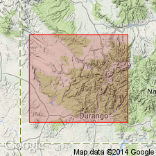
Named as a member of Morrison formation for exposures opposite Animas City Mountain between Junction Creek and the Animas River, La Plata Co, CO in San Juan basin. No type locality designated. Is 60 ft thick at Piedra Cliffs, 300 to 500 ft thick at East Mancos, 300 ft thick at Stoner and on the lower Dolores River, 165 ft thick at Black Ledge north of McElmo Creek, and 2 ft thick at Cascade Creek. Composed of massive, cross-bedded, whitish sandstone. Divisible into a lower, more horizontally banded part and an upper part with large scale diagonal bedding. Partial measured section described near Durango at Animas City Mountain, La Plata Co, San Juan basin. Overlies Wanakah marl member (revised and redefined); underlies an upper part of Morrison not described. Beds of Wanakah type overlie Junction Creek. Contact with overlying sequence placed at base of purple-red, plastic clays. Thought to correlate with Bluff sandstone member of Morrison in southeast UT. Assigned to the Late Jurassic.
Source: GNU records (USGS DDS-6; Denver GNULEX).
- Usage in publication:
-
- Junction Creek sandstone*
- Modifications:
-
- Revised
- AAPG geologic province:
-
- San Juan basin
- Paradox basin
Summary:
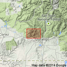
Removed from Morrison formation as a member and raised to formation rank in La Plata mining district, which is within La Plata Mountains of southwest CO. Replaces upper La Plata sandstone of local usage. Comparative nomenclature chart; geologic map. Thickness ranges from about 200-500 ft. Overlies marl member (formerly part of Morrison) of Wanakah formation; underlies a stratigraphically restricted Morrison formation (revised). Similar lithologically to Entrada sandstone. Forms smooth cliffs. Toward west end of Jackson Ridge, near Lady Stafford mine, Junction Creek interfingers with shaly beds of Morrison and below Red Arrow mine several lenticular sandstone layers that are prominent in Morrison merge with Junction Creek making it thicker here than in most other areas. Mapped (geologic map) along east edge, southwest and west part of area in La Plata Co, CO in the San Juan basin and in adjacent Montezuma Co, CO in the Paradox basin. Of Late Jurassic age.
Source: GNU records (USGS DDS-6; Denver GNULEX).
- Usage in publication:
-
- Junction Creek Member*
- Modifications:
-
- Revised
- AAPG geologic province:
-
- Piceance basin
Summary:
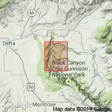
Reduced in stratigraphic rank in the Black Canyon area, Delta Co, CO in the Piceance basin, to Junction Creek Member, Middle Member of Wanakah Formation. Is a discontinuous, fine-grained, friable, highly cross-bedded, light-gray to light-yellowish-gray, eolian sandstone, that overlies and underlies unnamed parts of the Wanakah. Mapped in Smith Fork area in northwest part of quad. Thought to have been deposited on partly desiccated floor of evaporitic Wanakah basin. Assigned to the Late Jurassic.
Source: GNU records (USGS DDS-6; Denver GNULEX).
- Usage in publication:
-
- Junction Creek Sandstone*
- Modifications:
-
- Mapped 1:24k
- Revised
- Dominant lithology:
-
- Sandstone
- AAPG geologic province:
-
- Piceance basin
Summary:
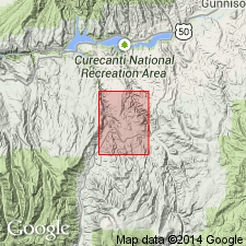
Is Upper Jurassic formation mapped locally; present only on Tolvar Peak Gunnison Co, CO, (Piceance basin). [Revised: elevated to formation rank rather than member of Wanakah Formation as mapped by Hansen, 1968]. Rests unconformably on Precambrian granite of Tolvar Peak. Map unit described as white to yellowish-gray, fine- to medium-grained, locally cross-bedded, probably eolian, quartzose sandstone; commonly silicified and quartzitic.
Source: GNU records (USGS DDS-6; Denver GNULEX).
- Usage in publication:
-
- Junction Creek Sandstone*
- Modifications:
-
- Overview
- AAPG geologic province:
-
- San Juan basin
- Paradox basin
Summary:
Lies in San Juan and Paradox basins above the J-5 unconformity which separates rock of Middle Jurassic San Rafael Group below from Upper Jurassic rocks. Imlay (1980) who reported Junction Creek below the J-5 is in error. Is the eastward and northeastward extension in southwestern CO of the Bluff Sandstone Member, basal member of the Morrison in part of Four Corners area. Thick crossbed sandstone sets indicate eolian environment. Thin, flat-laminated beds are interdunal deposits, or where contorted are local sabka deposits. Much of the sand was probably derived from Salt Wash Member of Morrison to the west. Of Late Jurassic age.
Source: GNU records (USGS DDS-6; Denver GNULEX).
- Usage in publication:
-
- Junction Creek Sandstone*
- Modifications:
-
- Overview
- Age modified
- AAPG geologic province:
-
- San Juan basin
- Paradox basin
Summary:
Lower unit of the Junction Creek Sandstone in the San Juan and Paradox basins, CO probably correlates with the Horse Mesa Member (new) of Wanakah Formation, San Juan basin, northeast NM. Age of Junction Creek revised from Late Jurassic to Middle and Late Jurassic on basis of correlation of unit B of Junction Creek with unit B of Bluff Member, basal member of Morrison. Unit A of Junction Creek is pre-Morrison age.
Source: GNU records (USGS DDS-6; Denver GNULEX).
- Usage in publication:
-
- Junction Creek Sandstone*
- Modifications:
-
- Areal extent
- AAPG geologic province:
-
- Piceance basin
Summary:
A persistent, light-gray to light-brown, cross-bedded, eolian-type sandstone, 15-55 m thick that was formerly mapped by Hedlund and Olson (1975) and Hansen (1968) in Gunnison Co, CO in the Piceance basin, as Junction Creek Sandstone or as Junction Creek Sandstone of Wanakah Formation was misidentified. The sandstone is not Junction Creek. It is a sandstone within the Morrison Formation and is mapped with Morrison in this report, Gunnison Co, CO, Piceance basin.
Source: GNU records (USGS DDS-6; Denver GNULEX).
- Usage in publication:
-
- Junction Creek Sandstone*
- Modifications:
-
- Areal extent
- AAPG geologic province:
-
- Paradox basin
- San Juan basin
Summary:
Name has not been consistently applied to the same stratigraphic interval everywhere. Distribution map. Occurs south of report area in a bean-shaped area from west of Dolores east to the La Plata Mountains, Montezuma Co, CO in the Paradox basin and at several localities on the Piedra River in Archuletta Co, CO in the San Juan basin. Name has been used at Ouray and along the Gunnison River in the western Black Canyon. Author believes the eolian sandstone called Junction Creek in the western Black Canyon is an eolian sandstone of limited extent that lies stratigraphically about 90 ft above base of Upper Jurassic Morrison Formation. Extension of the name into the Gunnison area is tenuous. Thins eastward from the La Plata Mountains (300-500 ft) to 25 ft on the Piedra River. Near Durango Junction Creek, is of early Morrison age; base may be older.
Source: GNU records (USGS DDS-6; Denver GNULEX).
- Usage in publication:
-
- Junction Creek Sandstone
- Modifications:
-
- Not used
Summary:
Some of the nomenclature assigned to Jurassic rocks in the western Black Canyon at the Smith Fork of the Gunnison River, Gunnison Co., CO, Piceance basin is revised. Rocks previously assigned to the upper part of the Wanakah Formation are reassigned to the lower part of the Morrison Formation of Late Jurassic age. In previous reports on this area, Wanakah was thought to underlie Salt Wash Member of Morrison. In this report, the name Tidwell Member of Morrison is applied to the former upper Wanakah. Tidwell is divisible into (ascending): bed A, lower gypsiferous beds, and upper beds. Tidwell overlies beds of Sawpit at top of Wanakah beneath the J-3 unconformity and underlies Salt Wash Member. The unit "bed at Smith Fork" which lies in the middle part of the upper beds of the Tidwell replaces use of name Junction Creek Sandstone for the 73 ft thick, gray to white, fine grained, cross-bedded sandstone. The bed at Smith Fork pinches out southward; it is not present at South Smith Fork measured section; it dips under younger rocks less than 1 mi east of Smith Fork measured section. Cross section.
Source: GNU records (USGS DDS-6; Denver GNULEX).
- Usage in publication:
-
- Junction Creek Sandstone*
- Modifications:
-
- Age modified
- AAPG geologic province:
-
- Paradox basin
Summary:
Is reassigned to only the Upper Jurassic Series in contrast to the earlier interpretation of Condon and Huffman (1988) that it was both Middle and Upper Jurassic. Overlies the Wanakah Formation (Middle Jurassic) above the J-5 unconformity; top intertongues with the overlying Morrison Formation (Upper Jurassic). Thickness ranges from 13 ft at locality Dolores River E (section no. 12) to 406 ft in the Parker and McCune drillhole (section no. 23); differences in thickness are attributed to intertonguing at top of formation that account for change in position of upper contact.
Source: GNU records (USGS DDS-6; Denver GNULEX).
For more information, please contact Nancy Stamm, Geologic Names Committee Secretary.
Asterisk (*) indicates published by U.S. Geological Survey authors.
"No current usage" (†) implies that a name has been abandoned or has fallen into disuse. Former usage and, if known, replacement name given in parentheses ( ).
Slash (/) indicates name conflicts with nomenclatural guidelines (CSN, 1933; ACSN, 1961, 1970; NACSN, 1983, 2005, 2021). May be explained within brackets ([ ]).