

- Usage in publication:
-
- Joana limestone*
- Modifications:
-
- Named
- Dominant lithology:
-
- Limestone
- AAPG geologic province:
-
- Great Basin province
Summary:
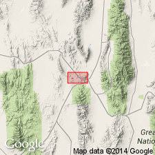
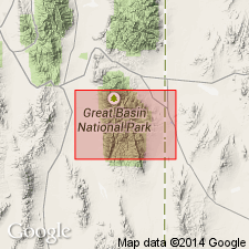
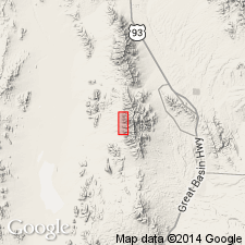
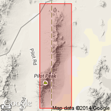
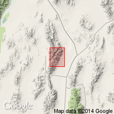
Named for the Joana mine on south side of Robinson Canyon about 2 mi above Ely, White Pine Co, NV in the Great Basin province. No type locality designated. Forms rugged knobs and cliffs in lower part of Robinson Canyon. Geologic map. Mapped as a unit above the Pilot shale (new) and below the Chainman shale (new) in the southeast and northwest parts of the mapped area. Is 250 ft thick in east part of area and about 400 ft thick near Pilot Knob in central-west part of area. Consists of uniformly massive blue-gray limestone. Some chert nodules. Fragments of crinoids and a single coral are all the fossils found. Mississippian age.
Source: GNU records (USGS DDS-6; Denver GNULEX).
- Usage in publication:
-
- Joana limestone*
- Modifications:
-
- Overview
- Areal extent
- Biostratigraphic dating
- AAPG geologic province:
-
- Great Basin province
Summary:
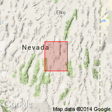
Unit extended to area east of Eureka, NV (Packer Basin, Tollhouse Canyon, Diamond Mountains, Pancake Range). Joana limestone is dense porcelaneous limestone, coarsely crystalline, sandy crinoidal limestone that is locally somewhat conglomeratic, nodular cherty limestone, black platy shale, thin quartzite or sandstone beds, and subordinate black chert. Contact with underlying Pilot shale is gradational; contact with overlying Chainman shale is sharp. Age of Early Mississippian based on brachiopods, corals and gastropods.
Source: GNU records (USGS DDS-6; Menlo GNULEX).
- Usage in publication:
-
- Joana limestone
- Modifications:
-
- Overview
- Areal extent
- Biostratigraphic dating
- AAPG geologic province:
-
- Great Basin province
Summary:
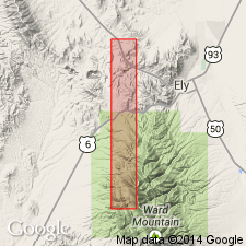
Detailed sections measured within Ely 15' quad, 1) on south wall of Robinson Canyon (sec.18 T16N R63E; near type locality; 290 ft), and 2) six mi northwest of Ely, NV (178 ft); Dutch John Mountain, NV (300 ft); Conger Spring anticline, UT (250 ft). Additional sections measured at Hamilton, NV (190 ft); Bristol Pass, NV (305 ft); North Burbank anticline, UT (180 ft); Bristol Spring anticline, UT (80 ft). Contacts with both overlying Chainman shale and underlying Pilot shale are conformable and gradational. Joana limestone is thin-bedded to massive, dark to medium gray, clastic to crystalline limestone that contains 5 to 10 % black and brown chert in thin bands and irregular blebs and nodules. Weathered surfaces have raspy to "meringe" texture. Based on fossil content (endothyrid foraminifers, echinoderms, corals, brachiopods, and gastropods) age is Early Mississippian (Kinderhookian and early Osagean).
Source: GNU records (USGS DDS-6; Menlo GNULEX).
- Usage in publication:
-
- Joana limestone
- Modifications:
-
- Overview
- AAPG geologic province:
-
- Great Basin province
Summary:
Two measured reference sections for Ely area. Maximum thickness is 990 ft. Joana consists of a basal, massive, cliff-forming member, a middle, relatively thin-bedded and argillaceous, bench-forming member, and an upper, medium to thick-bedded, cliff-forming member. Fossil list included.
Source: GNU records (USGS DDS-6; Menlo GNULEX).
- Usage in publication:
-
- Joana Limestone*
- Modifications:
-
- Areal extent
- AAPG geologic province:
-
- Great Basin province
Summary:
Extended into report area (southern Snake Range, eastern NV and Burbank Hills, western UT). Estimated thickness is 400 ft (no complete section in report area). Age is Mississippian.
Source: GNU records (USGS DDS-6; Menlo GNULEX).
- Usage in publication:
-
- Joana Limestone*
- Modifications:
-
- Revised
- AAPG geologic province:
-
- Great Basin province
Summary:
Joana Limestone stratigraphically restricted to massive, cliff-forming limestone (excludes upper thin- to thick-bedded, slope-forming limestone) in report area (Lincoln Co, NV). Fossil list included. Age is Early Mississippian.
Source: GNU records (USGS DDS-6; Menlo GNULEX).
- Usage in publication:
-
- Joana limestone*
- Modifications:
-
- Biostratigraphic dating
- AAPG geologic province:
-
- Great Basin province
Summary:
Endothyrid foraminifers indicate an age of late Kinderhookian and Osagean (zones 7 and 8 of Mamet and Skipp (1970)) [Early Mississippian].
Source: GNU records (USGS DDS-6; Menlo GNULEX).
- Usage in publication:
-
- Joana Limestone*
- Modifications:
-
- Areal extent
- AAPG geologic province:
-
- Great Basin province
Summary:
Unit is shown in Needle Range, UT, and Buckhorn Canyon, Dugway Range, UT.
Source: GNU records (USGS DDS-6; Menlo GNULEX).
- Usage in publication:
-
- Joana Limestone*
- Modifications:
-
- Areal extent
- AAPG geologic province:
-
- Great Basin province
Summary:
Unit is extended into the southern Pilot Range, UT and NV, and Silver Island Mountains, UT. Age is Early Mississippian.
Source: GNU records (USGS DDS-6; Menlo GNULEX).
- Usage in publication:
-
- Joana Limestone*
- Modifications:
-
- Revised
- AAPG geologic province:
-
- Great Basin province
Summary:
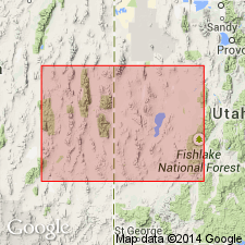
Underlies the newly named Delle Phosphatic Member, basal member of Chainman Shale in Needle Range, Beaver Co, UT and of Woodman Formation in Deep Creek Mountains of Juab and Tooele Cos, UT in the Great Basin province. Upper surface is a hardground formed at the top of the Joana. Correlation of Joana with other lithostratigraphic units in Great Basin province and on Wasatch uplift, UT, and in Snake River basin, ID, shown on correlation chart. Assigned an Early Mississippian, or Kinderhookian and Osagean age.
Source: GNU records (USGS DDS-6; Denver GNULEX).
- Usage in publication:
-
- Joana Limestone*
- Modifications:
-
- Mapped 1:24k
- Dominant lithology:
-
- Limestone
- Dolomite
- Chert
- AAPG geologic province:
-
- Great Basin province
Summary:
Is Lower Mississippian (Osagean and Kinderhookian) formation mapped in northern part of the Mountain Home Range in western Millard Co, southwestern UT (Great Basin province). Overlies Pilot Shale (Kinderhookian and Famennian) and overlain by Delle Phosphatic Member (Meramecian and Osagean) of the Chainman Formation (Mississippian). Map unit described as massive bluish-gray, cliff-forming bioclastic limestone; commonly fossiliferous, rugose corals and crinoid debris being most abundant. Where folded, calcite veins are common. Includes 5 to 10 percent chert as bedded nodules and perhaps 15 percent dolomite that weathers olive gray where mottled within limestone beds. Joana is 140 m thick on hogback on east flank of Mountain Home Range. Apparently greater thickness on upper overthrust plate may be caused by tectonic repetition of beds. Abnormal thinning of Joana in section 19, T25S, R19W is caused by attenuation faulting.
Source: GNU records (USGS DDS-6; Denver GNULEX).
- Usage in publication:
-
- Joana Limestone*
- Modifications:
-
- Areal extent
- AAPG geologic province:
-
- Great Basin province
Summary:
Unit extended into Goshute-Toano Range, NV. Age is Mississippian.
Source: GNU records (USGS DDS-6; Menlo GNULEX).

- Usage in publication:
-
- Joana Limestone*
- Modifications:
-
- Mapped 1:24k
- Dominant lithology:
-
- Limestone
- Dolomite
- Chert
- AAPG geologic province:
-
- Great Basin province
Summary:
Is Lower Mississippian (Osagean and Kinderhookian) formation mapped in southern part of the Mountain Home Range in western Millard and Beaver Cos, southwestern UT (Great Basin province). Overlies Pilot Shale (Kinderhookian and Famennian) and overlain by Delle Phosphatic Member (Meramecian and Osagean) of the Chainman Formation (Mississippian). Map unit described as massive bluish-gray, cliff-forming bioclastic limestone; commonly fossiliferous, rugose corals and crinoid debris being most abundant. Where folded, calcite veins are common. Includes 5 to 10 percent chert as bedded nodules and approximately 15 percent dolomite that weathers olive gray where mottled within limestone beds. Joana is 140 m thick on hogback on east flank of Mountain Home Range. Greater apparent thickness on upper overthrust plate may be caused by tectonic repetition of beds. Abnormal thinning of Joana along west flank of range is caused by brittle attenuation faulting.
Source: GNU records (USGS DDS-6; Denver GNULEX).
- Usage in publication:
-
- Joana Limestone*
- Modifications:
-
- Areal extent
- AAPG geologic province:
-
- Great Basin province
Summary:
Unit is extended into Cherry Creek Range, NV. Age is Early Mississippian.
Source: GNU records (USGS DDS-6; Menlo GNULEX).
- Usage in publication:
-
- Joana Limestone*
- Modifications:
-
- Areal extent
- AAPG geologic province:
-
- Great Basin province
Summary:
(advance copy). Unit geographically extended into east Pahranagat Range and Jumbled Hills, Utah. Age is Early Mississippian.
Source: GNU records (USGS DDS-6; Menlo GNULEX).
- Usage in publication:
-
- Joana Limestone*
- Modifications:
-
- Areal extent
- AAPG geologic province:
-
- Great Basin province
Summary:
Unit is extended into Crater Island of Silver Island Mountains. Age is Early Mississippian.
Source: GNU records (USGS DDS-6; Menlo GNULEX).
- Usage in publication:
-
- Joana Limestone*
- Modifications:
-
- Areal extent
- AAPG geologic province:
-
- Great Basin province
Summary:
Unit extended into southern Silver Island Mountains, UT. Age is Mississippian.
Source: GNU records (USGS DDS-6; Menlo GNULEX).
For more information, please contact Nancy Stamm, Geologic Names Committee Secretary.
Asterisk (*) indicates published by U.S. Geological Survey authors.
"No current usage" (†) implies that a name has been abandoned or has fallen into disuse. Former usage and, if known, replacement name given in parentheses ( ).
Slash (/) indicates name conflicts with nomenclatural guidelines (CSN, 1933; ACSN, 1961, 1970; NACSN, 1983, 2005, 2021). May be explained within brackets ([ ]).