

- Usage in publication:
-
- Jefferson formation*
- Modifications:
-
- Original reference
- Dominant lithology:
-
- Limestone
- AAPG geologic province:
-
- Montana folded belt
- North Western Overthrust
Summary:
Jefferson limestones. Brown and black crystalline limestones, 640 feet thick. Underlie Three Forks shales and conformbly overlie Gallatin formation. Well exposed in hills on both sides of Missouri River just below junction of the Three Forks of the Missouri, and on both sides of the Jefferson a few miles above its mouth, in Three Forks quadrangle, southwestern Montana. Fossils.
[Jefferson limestone (also Jefferson dolomite) adopted by the USGS. Age is Middle Devonian. Recognized in Montana, western Wyoming, southeastern and south-central Idaho, northern Idaho, and northern Utah.]
Source: US geologic names lexicon (USGS Bull. 896, p. 1041).
- Usage in publication:
-
- Jefferson limestone
- Modifications:
-
- Revised
- AAPG geologic province:
-
- Montana folded belt
- North Western Overthrust
Summary:
Pg. 41-45. Jefferson limestone. In Flathead, Powell, and Lewis and Clark Counties, northwestern Montana, subdivided into (ascending) White Ridge limestone, Glenn Creek shale, Coopers Lake limestone, Lone Butte limestone, and Spotted Bear limestone members. Total thickness 110+ to 1,100+ feet. Unconformably overlies Devils Glen dolomite; unconformably underlies Madison limestone. Age is considered Middle Devonian based on fossils.
Source: US geologic names lexicon (USGS Bull. 1200, p. 1916-1917); supplemental information from GNU records (USGS DDS-6; Denver GNULEX).
- Usage in publication:
-
- Jefferson dolomite*
- Modifications:
-
- Areal extent
- AAPG geologic province:
-
- Wasatch uplift
Summary:
Pg. 19, pls. 1, 6. Jefferson dolomite. In Randolph quadrangle, Jefferson dolomite consists of about 1,200 feet of massive, fine-grained, dark-colored dolomite, which weathers to characteristic brown. Overlies Laketown dolomite and underlies Three Forks limestone; both contacts conformable. Age is Middle Devonian.
Source: US geologic names lexicon (USGS Bull. 1200, p. 1916-1917).
- Usage in publication:
-
- Jefferson limestone*
- Modifications:
-
- Age modified
- Biostratigraphic dating
- AAPG geologic province:
-
- Bighorn basin
- Montana folded belt
- North Western Overthrust
- Wasatch uplift
- Yellowstone province
Summary:
Chart, p. 1768-1769. Jefferson limestone. Recognized in northeastern Utah, northwestern and western Wyoming, southwestern Montana, and Idaho. Age is Late Devonian (Frasnian; Finger Lakes and Chemung stages) based on fossils. Faunas suggest that in southwestern Montana, Yellowstone region, and northeastern Utah, the Jefferson should be correlative with SPIRIFER ARGENTARIUS to PACHYPHYLLUM zone of Devils Gate limestone. To northwest in Flathead and Lewis and Clark National Forest, faunas identified from the Cooper Lake limestone member of Deiss (1933, p. 41-43) suggest a Chemung age.
[See also G.H. Girty, USGS Ann. Rpt. 19, pt. 3, p. 539-600 (Yellowstone Park); E.M. Kindle, Bull. Amer. Paleo., v. 4, no. 20, p. 8-10, 16, 17; and C.P. Ross, 1934, GSA Bull., v. 45, no. 5, p. 960.]
Source: Publication; US geologic names lexicon (USGS Bull. 1200, p. 1916-1917).
- Usage in publication:
-
- Jefferson formation
- Modifications:
-
- Areal extent
- AAPG geologic province:
-
- Montana folded belt
Summary:
Pg. 9 (fig. 3), 10-14. Jefferson formation. In Three Forks area, formation consists of dark-colored limestone in lower part and dark-colored dolomite in upper part. Unconformably overlies Dry Creek shale; underlies Three Forks formation. Age is Middle and [Late] Devonian.
Source: US geologic names lexicon (USGS Bull. 1200, p. 1916-1917).
- Usage in publication:
-
- Jefferson dolomite*
- Modifications:
-
- Areal extent
- AAPG geologic province:
-
- Idaho Mountains province
Summary:
Pg. 1107-1108. Jefferson dolomite. In Borah Peak quadrangle, Idaho, Jefferson dolomite is about 1,000 feet thick, overlies Laketown dolomite and underlies Grand View dolomite. [Age is Late Devonian.]
Source: US geologic names lexicon (USGS Bull. 1200, p. 1916-1917).
- Usage in publication:
-
- Jefferson formation
- Modifications:
-
- Revised
- AAPG geologic province:
-
- Central Montana uplift
- North Western Overthrust
- Sweetgrass arch
Summary:
Pg. 1407-1410, 1411-1412, 1415-1418. Jefferson formation. In central Montana, composed of an upper dolomite member, including some anhydrite or evaporite-solution breccia, and lower dense limestone member. In Three Forks area, breccia zone and overlying nonresistant shale of Three Forks formation are imperfectly exposed or entirely covered. To facilitate mapping, it would be more logical to revise Peale's (1893) classification and assign the breccias and associated shales to the Three Forks; but where the breccias are well exposed, as in type section, their genetic and lithologic relationships with main body of dolomite below are clear. Thickness 715 feet at Logan. Term Potlatch is applicable throughout Sweetgrass area subsurface and its use is recommended over Three Forks and Jefferson for that area.
Source: US geologic names lexicon (USGS Bull. 1200, p. 1916-1917).
- Usage in publication:
-
- Jefferson limestone*
- Modifications:
-
- Areal extent
- AAPG geologic province:
-
- Bighorn basin
Summary:
Jefferson limestone. Recognized in Shoshone River Canyon, 5 miles west of Cody, and in subsurface of Oregon Basin field, Park County, Wyoming. Thickness 20 feet. Overlies Bighorn dolomite; underlies Threeforks(?) Formation. Fossils. Age is Devonian.
Source: Modified from GNU records (USGS DDS-6; Denver GNULEX).
- Usage in publication:
-
- Jefferson formation*
- Modifications:
-
- Revised
- AAPG geologic province:
-
- Wasatch uplift
Summary:
Pg. 1130 (table), 1139-1141. Jefferson formation. In Logan quadrangle, Utah, subdivided into (ascending) Hyrum dolomite and Beirdneau sandstone member (both new). Thickness as much as 2,120 feet. Overlies Water Canyon formation (new); underlies Madison formation. Fossils. Age is Late Devonian (Senecan and Chautauquan?).
Source: US geologic names lexicon (USGS Bull. 1200, p. 1916-1917); supplemental information from GNU records (USGS DDS-6; Denver GNULEX).
- Usage in publication:
-
- Jefferson formation*
- Modifications:
-
- Areal extent
- AAPG geologic province:
-
- Montana folded belt
Summary:
Jefferson formation. Author re-examines key sections in Horseshoe Hills, between Logan and Dry Creek, Gallatin County, Montana. Overlies Maywood formation (replaces Dry Creek shale). Age is Devonian.
Source: Modified from GNU records (USGS DDS-6; Denver GNULEX).
- Usage in publication:
-
- Jefferson formation
- Modifications:
-
- Areal extent
- AAPG geologic province:
-
- Montana folded belt
- Snake River basin
Summary:
Jefferson formation. Recognized in area south of Boulder batholith and west of Yellowstone National Park, in Beaverhead, Madison, and Gallatin Counties, southwesternmost Montana. Divided into (ascending): (1) limestone member (very limited distribution, where present is a few feet to few tens of feet thick); and (2) dolomite member, 150 to 600 feet thick, commonly 300 feet. Unconformably overlies: Hasmark formation in most of study area; Red Lion formation in northern and northwestern margins of area; Bighorn dolomite in eastern margin of area; and Flathead sandstone and Beltian rocks northwest of Dillon, Beaverhead County. Correlates with Jefferson and Grandview dolomites of central Idaho. Age is considered Late Devonian, though a Middle Devonian fauna identified (J. Mann, pers. commun., 1949) from Jefferson beds in Gravelly Range, Madison County.
Source: Modified from GNU records (USGS DDS-6; Denver GNULEX).
- Usage in publication:
-
- Jefferson formation
- Modifications:
-
- Areal extent
- AAPG geologic province:
-
- Wasatch uplift
Summary:
Pg. 1719. Jefferson formation. In northeastern Utah (Leatham Hollow, Cache County) unconformably underlies Leatham formation (new). Age is Devonian.
Source: Modified from GNU records (USGS DDS-6; Denver GNULEX).
- Usage in publication:
-
- Jefferson(?) limestone
- Modifications:
-
- Areal extent
- AAPG geologic province:
-
- Bighorn basin
Summary:
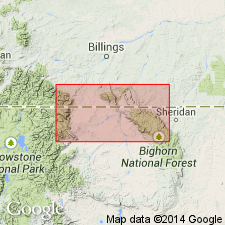
Jefferson(?) limestone. Thickness 91 feet. Overlies Beartooth Butte formation; underlies Three Forks shale. Correlation with Devonian rocks at nearby localities shown on plate 1. Fossils (impression of BOTHRIOLEPIS plate, HOLOPTYCHIUS sp.? tooth, and fish scales probably from DIPTERUS JOHNSONII). Age is considered Late Devonian, though part may be Middle Devonian. Isopach map of post-Beartooth Butte shown on plate 2.
Measured section in Cottonwood Canyon (in sec. 34, T. 57 N., R. 93 W.), Bighorn Mountains, Big Horn Co., WY.
Source: Modified from GNU records (USGS DDS-6; Denver GNULEX).
- Usage in publication:
-
- Jefferson formation
- Modifications:
-
- Areal extent
- AAPG geologic province:
-
- Montana folded belt
Summary:
Pg. 1388-1390 (table 1), 1396, 1397. Jefferson formation. In Bridger Range, Gallatin County, Montana, consists of light- and dark-brown, thick-bedded dolomite, dolomitic limestone, and limestone with a few intercalated yellow and pale pink dolomitic siltstone beds. Carbonates are petroliferous. Breccias are found at several horizons, as are beds containing small algal colonies. Locally includes a pale-yellow, 0.5- to 15-foot-thick calcarenite at top. Thickness 497 to 620 feet. The solution breccia and shale unit, previously considered upper part of Jefferson, is transferred to overlying Three Forks formation (following Sloss and Laird, 1947). Overlies Maywood(?) formation with gradational contact. Age is Late Devonian (citing Cooper and others, 1942, GSA Bull., v. 53).
Source: Publication.
- Usage in publication:
-
- Jefferson dolomite*
- Modifications:
-
- Areal extent
- AAPG geologic province:
-
- Montana folded belt
Summary:
Jefferson dolomite. Mostly dark-gray, granular-weathering, fetid, well-bedded dolomite. Cannot be subdivided into lower limestone and upper dolomite members as has been done at Three Forks by Sloss and Laird (1947). Thickness 620 to 730 feet. Conformably overlies Maywood formation; conformably underlies Three Forks shale. Age is Late Devonian.
Source: Modified from GNU records (USGS DDS-6; Denver GNULEX).
- Usage in publication:
-
- Jefferson group*
- Modifications:
-
- Revised
- Areal extent
- AAPG geologic province:
-
- Williston basin
- Central Montana uplift
- Sweetgrass arch
- Montana folded belt
- Powder River basin
Summary:
Pg. 2314-2322. Jefferson group. Sloss and Laird (1947) in effect redefined the Jefferson to include at top a breccia and shale unit that Peale (1893) described as reddish- and brownish-yellow calcareous shale and mapped at base of overlying Three Forks formation. The two units that resulted from Sloss and Laird's revision are cartographically impractical because both the breccia zone and the overlying shales of the Three Forks are rarely visible. In present report, term Jefferson formation is used as defined by Peale and not as redefined by Sloss and Laird. Jefferson is raised to group status in subsurface of Williston basin and central Montana east of 111 deg. meridian. Includes all beds overlying Souris River and underlying the Three Forks. Divided into Duperow formation and overlying Birdbear formation (new). Age is Late Devonian.
Source: US geologic names lexicon (USGS Bull. 1200, p. 1916-1917).
- Usage in publication:
-
- Jefferson formation
- Modifications:
-
- Revised
- AAPG geologic province:
-
- Montana folded belt
Summary:
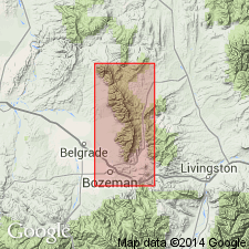
In southern Beartooth region, including areas of Cinnabar Mountain, Crowfoot Ridge, Mill Creek, and Cooke City, previous workers have assigned rocks comprising Jefferson or Darby formation of this report to Three Forks formation. Name Darby formation used rather than Jefferson in southern Beartooth-Yellowstone Park area where carbonate section of Jefferson becomes more shaly and sandy. Upper 50-90 ft of Jefferson, consisting of light colored dolomite which is recognizable through most of area, has been correlated with Birdbear formation of Williston basin by Sandberg and Hammond (1958). Within study area, which includes southern part of Montana folded belt province, there is a general southeasterly thinning of Jefferson toward Yellowstone National Park. Maximum thickness shown on isopach map is 784 ft. Fossiliferous. Tentative identifications of ATRYPA, CYRTOSPIRIFER, AUACELLA, PRODUCTELLA, GRAMMYSIA and PALEONEILO about 75 ft below top of Jefferson in Hyalite Canyon south of Bozeman suggests that these beds may be upper Chemung equivalents and upper age limit may be younger than given by Cooper et al (1942). Conformably and gradationally overlies Maywood formation; underlies Potlatch member of Three Forks in western part of area and carbonate member of Three Forks in eastern part. Correlation chart. Isopach map. Several measured sections in cross sections. Devonian age.
Source: GNU records (USGS DDS-6; Denver GNULEX).
- Usage in publication:
-
- Jefferson Formation
- Modifications:
-
- Areal extent
- AAPG geologic province:
-
- Montana folded belt
Summary:
Extends unit into northwest part of Garnet Range in west-central MT, Montana folded belt province. Divided into lower limestone and dolomite member, middle dolomite member, and an upper limestone member. Unit is about 1700 ft thick in map area. Occurs mostly in northern Granite Co part of mapped area. Best exposed along Rattler Gulch; from here strikes northwest to Tenmile Creek. Also outcrops west of Mount Baldy in Mount Baldy syncline; along Bearmouth anticline; and in northeast part of map area at Top O Deep. Conformably overlies Maywood Formation; unconformably underlies Three Forks Formation? (mapped with Jefferson). Geologic map. Cross sections. Stratigraphic chart. Fossil list. Late Devonian (Fingerlakesian) age.
Source: GNU records (USGS DDS-6; Denver GNULEX).
- Usage in publication:
-
- Jefferson Formation*
- Modifications:
-
- Mapped
- AAPG geologic province:
-
- Montana folded belt
Summary:
Jefferson Formation. Alternating dolomites and light-colored limestone; dolomites are black-weathering, highly fetid, and smell of petroleum. Thickness 750 feet. Underlies Upper Devonian-Lower Mississippian Three Forks Formation. Unconformably overlies Upper Cambrian Red Lion Formation [in places map unit includes rocks belonging to Upper(?) Devonian Maywood Formation]. Age is Late Devonian.
[Study area in Lewis and Clark and Jefferson Counties, Montana.]
Source: Publication.
- Usage in publication:
-
- Jefferson dolomite*
- Modifications:
-
- Areal extent
- AAPG geologic province:
-
- Montana folded belt
Summary:
Was Peale's (1893) Jefferson dolomite or limestones. Is thickest (about 650 ft) in Milligan Creek area, sec 10, T1N, R1W, Jefferson Co, MT, Montana folded belt province. Is 650 ft thick (measured) in sec 9, T1S, R1W. Lies between Maywood formation beneath and Three Forks shale. Has Amphiphora and coral fossils. Assigned a Late Devonian age. Is a marine deposit probably laid down in shallow water. Geologic map.
Source: GNU records (USGS DDS-6; Denver GNULEX).
- Usage in publication:
-
- Jefferson Limestone
- Modifications:
-
- Areal extent
- AAPG geologic province:
-
- Montana folded belt
Summary:
Within mapped area, thickness ranges from 315 ft in northeastern part to 450 ft in northwestern part; is 400 ft thick in southwest. Quad is in Montana folded belt province. Conformably overlies Maywood Formation; conformably underlies Three Forks Shale. Mapped undivided with Maywood, Three Forks and Sappington Formation. Coelenterates AMPHIPORA and STROMATOPORA are fairly common; corals and poorly preserved brachiopods occur sparingly. Late Devonian age.
Source: GNU records (USGS DDS-6; Denver GNULEX).
- Usage in publication:
-
- Jefferson Formation*
- Modifications:
-
- Revised
- AAPG geologic province:
-
- Wasatch uplift
Summary:
Pg. S4-S6, S27-S30; see also USGS Geol. Quad. Map GQ-185, 1963. Jefferson Formation. In Blacksmith Fork Canyon and southward along mountain front to Hyrum Canyon, Cache County, Utah, includes Williams' (1948) Hyrum Dolomite Member (at bottom) and Beirdineau Sandstone Member (at top). Thickness 1,300 to 1,600 feet. Unconformably overlies Water Canyon Formation; underlies Leatham Formation. "Contact Ledge" of Williams (1948, p. 1141) is topmost bed of Jefferson. Age is Late Devonian. (Adopted by the USGS.)
Section measured in sec. 1, T. 10 N., R. 1 E.
Source: Publication; Changes in stratigraphic nomenclature, 1964 (USGS Bull. 1224-A, p. A12)
- Usage in publication:
-
- Jefferson Dolomite*
- Modifications:
-
- Mapped
- AAPG geologic province:
-
- Wasatch uplift
Summary:
Jefferson Dolomite. Divided into (ascending) Hyrum Dolomite Member, 850 feet thick, and Beirdneau Sandstone Member, 1,650 feet thick; both separately mapped. Overlies Laketown Dolomite (Middle and Upper Silurian). Underlies Recent sediments (underlies Lower Mississippian Lodgepole Limestone in northeasternmost corner of study area). Age is Late Devonian.
[Notable exposures in Fish Creek Range, Caribou and Bannock Cos., southeastern ID.]
Source: Publication.
- Usage in publication:
-
- Jefferson Formation*
- Modifications:
-
- Principal reference
- Revised
- AAPG geologic province:
-
- Bighorn basin
- Central Montana uplift
- Montana folded belt
- Sweetgrass arch
- Williston basin
- Yellowstone province
Summary:
Pg. N4-N7; 1962, Billings Geol. Soc. Gdbk., 13th Ann. Field Conf., p. 47-50. Jefferson Formation. Divided into (ascending): (1) lower member, dolomite and limestone, 470 feet thick; and (2) Birdbear Member, dolomite, 70 feet thick. Underlies Three Forks Formation; overlies Maywood Formation. Age is Late Devonian.
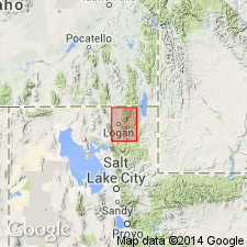
Type section: on north bank of Gallatin River at Logan, in S/2 SE/4 sec. 25, T. 2 N., R. 2 E., Gallatin Co., southwestern MT [approx. Lat. 45 deg. 53 min. 25 sec. N., Long. 111 deg. 25 min. 30 sec. W., Logan 7.5-min quadrangle].
Source: Publication.
- Usage in publication:
-
- Jefferson Formation
- Modifications:
-
- Revised
- AAPG geologic province:
-
- Wasatch uplift
Summary:
Jefferson Formation. In miogeosyncline of northeastern Utah and southeastern Idaho (Bear River and Wasatch Ranges), term Beirdneau Formation (previously Beirdneau Sandstone Member of Jefferson) is applied to the light-colored sandy Devonian carbonates above the dark saccharoidal fetid dolomite of the Jefferson. [See also 1966 entry under Beirdneau.]
Source: Publication.
- Usage in publication:
-
- Jefferson Formation*
- Jefferson Group*
- Modifications:
-
- Areal extent
- AAPG geologic province:
-
- Bighorn basin
- Green River basin
- Montana folded belt
- Powder River basin
- Williston basin
- Yellowstone province
Summary:
Jefferson Formation; Jefferson Group (subsurface). In Absaroka Range and Beartooth Mountains, Park County, Jefferson Formation divisible into lower member, 255+ to 285 feet, and Birdbear Member, 25+ to 30 feet; total thickness 285+ to 310+ feet. Where Birdbear is absent, as in Shoshone Canyon, near Absaroka Range, and in Bighorn Mountains, thickness up to 200+ feet. [In subsurface of Bighorn basin, Jefferson Group divisible into (ascending) Duperow and Birdbear Formations.] In most measured sections, unconformably overlies Beartooth Butte Formation and unconformably underlies Madison Limestone or Mississippian and Devonian dark shale unit. Age is Late Devonian.
Source: Modified from GNU records (USGS DDS-6; Denver GNULEX).
- Usage in publication:
-
- Jefferson Formation
- Modifications:
-
- Revised
- AAPG geologic province:
-
- Great Basin province
Summary:
Pg. 789. Jefferson Formation. In Box Elder County, northeastern UT, and Oneida County, southeastern Idaho, Jefferson Formation divided into (ascending): Samaria Limestone Member (new), limestone with minor orthoquartzite, sandstone, and siltstone, thickness 597 feet; and Hyrum Member. Unconformably overlies Water Canyon Formation. Underlies Beirdneau Formation. Age is probably Middle and Late Devonian.
Source: US geologic names lexicon (USGS Bull. 1520, Samaria entry p. 268-269); supplemental information from GNU records (USGS DDS-6; Denver GNULEX).
- Usage in publication:
-
- Jefferson Dolomite*
- Modifications:
-
- Mapped
- AAPG geologic province:
-
- Idaho Mountains province
Summary:
Jefferson Dolomite. Consists of dark-gray dolomite; somewhat thicker bedded than overlying Grand View Dolomite. Recognized north of Mackay, Custer County, Idaho. Age is Middle and Late Devonian.
Source: GNU records (USGS DDS-6; Denver GNULEX).
- Usage in publication:
-
- Jefferson Dolomite*
- Modifications:
-
- Mapped
- AAPG geologic province:
-
- Sweetgrass arch
Summary:
Jefferson Dolomite. Includes (descending): (1) Birdbear Member, light-gray, thin-bedded, finely crystalline dolomite, 60 feet thick, stands as a ridge; (2) middle part, gray to very dark-gray, moderately to coarsely crystalline dolomite, 170 feet thick; and (3) basal part, light-gray to gray, thin- to medium-bedded, locally massive, finely crystalline limestone, contains abundant seams of black chert, nodules of algae and cup corals, 100 feet thick. Formation thins northward, thickness 250 to 350 feet. Lies above Maywood Formation and below Three Forks Formation. Age is Late Devonian.
Source: Publication.

- Usage in publication:
-
- Jefferson Formation*
- Modifications:
-
- Areal extent
- AAPG geologic province:
-
- Montana folded belt
- Sweetgrass arch
Summary:
Pg. A30-A33, pls. Jefferson Formation. Mainly dark dolomite. Divided into two members, lower member and Birdbear Member (citing Sandberg, 1965, USGS Bull. 1194-N). Thickness 625 to 810 feet; near all thickness variations is in lower member. Age is early Late Devonian (Frasnian) based on fossils, upper ELEUTHEROKOMMA cf. E. REIDFORDI to CYRTOSPIRIFER zone.
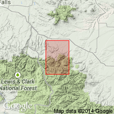
Well exposed along north-south-trending ridges around Gibson Reservoir, in Sun River Canyon area, Sawtooth Range, Lewis and Clark National Forest, Teton and Lewis and Clark Cos., northwestern MT.
Source: Publication.
- Usage in publication:
-
- Jefferson Formation*
- Modifications:
-
- Areal extent
- AAPG geologic province:
-
- Snake River basin
Summary:
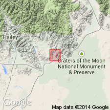
Jefferson Formation. In Blaine County, Idaho, consists of (ascending): (1) gray, poorly sorted dolomite breccia and sandy dolomite conglomerate overlain by laminated sandy dolomite and dolomitic sandstone, 83 feet; (2) dark-gray silty dolomite, 156 feet; (3) gray finely crystalline dolomite, 115 feet; (4) black finely crystalline dolomite, 75 feet; (5) banded brown to black, finely to medium-crystalline, medium-bedded to massive dolomite, 260 feet; and (6) yellow, medium to coarsely crystalline, vuggy dolomite. Lies above Carey Dolomite (contact not exposed); underlies Picabo Formation. Fossils (conodonts). Age is Middle and Late Devonian (Givetian and Fammenian).
Source: Modified from GNU records (USGS DDS-6; Denver GNULEX).
- Usage in publication:
-
- Jefferson Formation*
- Modifications:
-
- Overview
- AAPG geologic province:
-
- Montana folded belt
- Idaho Mountains province
- Sweetgrass arch
Summary:
Divided into a lower member 88 m thick of Frasnian, Late Devonian age and the overlying Birdbear Member 10 m thick of Frasnian and Frasnian? age in stratigraphic section near Monarch in the Little Belt Mountains, Cascade Co, MT on the Sweetgrass arch. The upper part of the lower member and the Birdbear Member are in the polygnathid conodont zone or biofacies. Birdbear in ID is early Famennian. Birdbear in MT is likely late Frasnian. Birdbear of ID may correlate with Logan Gulch Member of Three Forks Formation of western MT. Jefferson of report area is in the Montana folded belt and Idaho Mountains provinces, and on the Sweetgrass arch.
Source: GNU records (USGS DDS-6; Denver GNULEX).
- Usage in publication:
-
- Jefferson Formation*
- Modifications:
-
- Areal extent
- AAPG geologic province:
-
- Idaho Mountains province
Summary:
Pg. 8, 25-26, 114-117. Jefferson Formation. In Gilmore mining district, Lemhi County, Idaho, divisible into 6 informal members (ascending): (1) dark-colored dolomite, 320 feet (excludes Middle Devonian basal channel sandstone of earlier reports); (2) light-colored dolomite, 225 feet; (3) fossiliferous (AMPHIPORA) dolomite, 597 feet; (4) light-colored limestone with interbeds of sandstone and minor dark-gray dolomite, 375 feet; (5) dolomite and minor sedimentary breccia, 640 feet; and (6) limestone and limestone sedimentary breccia, 550+ feet. Members 1 to 3 contained most of ore mined in the Gilmore (Texas) mining district. Total thickness 2,700+ feet. Overlies Silurian Laketown Dolomite; underlies Devonian Three Forks Formation. Age is Middle and Late Devonian in Lemhi Range.
Source: Publication.
- Usage in publication:
-
- Jefferson Dolostone*
- Modifications:
-
- Mapped
- AAPG geologic province:
-
- Montana folded belt
Summary:
Jefferson Dolostone. Thin-to thick-bedded, black, brown, dark-gray and light-gray, petroliferous, medium-crystalline to coarsely crystalline dolostone. Upper 15+ m is thick- to massive-bedded, gray dolostone solution breccia (Birdbear Member). Thickness about 110 m. Unconformably overlies Ordovician Bighorn(?) Dolostone. Unconformably underlies Upper Devonian and Mississippian(?) Three Forks Formation. Age is Late Devonian.
Source: Publication.
For more information, please contact Nancy Stamm, Geologic Names Committee Secretary.
Asterisk (*) indicates published by U.S. Geological Survey authors.
"No current usage" (†) implies that a name has been abandoned or has fallen into disuse. Former usage and, if known, replacement name given in parentheses ( ).
Slash (/) indicates name conflicts with nomenclatural guidelines (CSN, 1933; ACSN, 1961, 1970; NACSN, 1983, 2005, 2021). May be explained within brackets ([ ]).