

- Usage in publication:
-
- Jefferson City limestone
- Dominant lithology:
-
- Limestone
- AAPG geologic province:
-
- Ozark uplift
Summary:
Pg. 331, 373, 375. Jefferson City limestone. Magnesium limestones, 175 feet thick, underlying Roubidoux or Saccharoidal sandstone [not Roubidoux, but St. Peter sandstone] and overlying Moreau sandstone [Roubidoux formation] in central Missouri. Forms top part of Gasconade limestone [an early broad usage of Gasconade]. [Age is Early Ordovician (Beekmantown).]
[Named from exposures at Jefferson City, Cole Co., MO.]
Source: US geologic names lexicon (USGS Bull. 896, p. 1041-1042); supplemental information from GNU records (USGS DDS-6; Denver GNULEX).
- Usage in publication:
-
- Jefferson City limestone
- Modifications:
-
- Contact revised
- Areal extent
- AAPG geologic province:
-
- Ozark uplift
Summary:
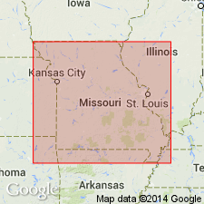
Jefferson City limestone. Conformably overlies St. Elizabeth formation (new); unconformably underlies Pacific sandstone (new). Exposed in Miller County, Missouri, north and south of Osage River. Thickness up to 200 feet; averages 100 feet south of river and 60 feet north of river. Age is Cambrian and Ordovician.
Source: Modified from GNU records (USGS DDS-6; Denver GNULEX).
- Usage in publication:
-
- Jefferson City formation
- Modifications:
-
- Areal extent
- AAPG geologic province:
-
- Appalachian basin
Summary:
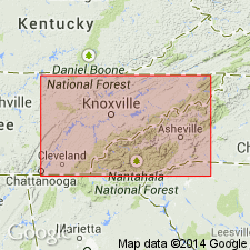
Pg. 474 (table 1), 484-486. Jefferson City formation. Geographically extended into eastern Tennessee where classified as formation in Knox dolomite. Occupies interval between top of Nittany and base of Cotter-Powell beds. Consists of 55 to 400 feet of thin- to heavy-bedded, dove- and dark- to brownish-gray fine-grained limestone and extremely light- to dark-green fine-grained to dense dolomite. Thin greenish-blue siliceous shales present on some bedding planes; coarse edgewise limestone conglomerates present locally. [Age is Early Ordovician.]
Source: US geologic names lexicon (USGS Bull. 1200, p. 1917-1918).

- Usage in publication:
-
- Jefferson City dolomite*
- Jefferson City limestone
- Modifications:
-
- Overview
Summary:
Until 1911 the name Jefferson City limestone was applied to all rocks in Missouri underlying "Saccharoidal sandstone" and overlying Roubldoux formation, and it has been thus applied in some later reports. In 1911 (GSA Bull., v. 22, pl. 27) E.O. Ulrich defined Jefferson City limestone as indicated by following succession (downward): St. Peter sandstone; Everton; unconformity; Yellville limestone; unconformity; Jefferson City; Roubidoux. According to A.H. Purdue and H.D. Miser, 1916 (USGS Eureka Springs-Harrison folio, No. 202, p. 5), the Jefferson City limestone of Ulrlch's 1911 report cited above included Cotter dolomite and Jefferson City dolomite of present nomenclature; and in 1912 Ulrich determined that his Cotter dolomite is younger than Jefferson City dolomite at its type locality, and restricted Jefferson City to the beds beneath the Cotter. This is present commonly accepted definition. [See also under †Jefferson City group.]
Source: US geologic names lexicon (USGS Bull. 896, p. 1041-1042).
- Usage in publication:
-
- Jefferson City group
- Modifications:
-
- Revised
- AAPG geologic province:
-
- Ozark uplift
Summary:
Pg. 15, 17-32. Jefferson City group. Term Jefferson City has had many usages in the literature since originally defined by Winslow. Term should be dropped from the literature because of this. It is retained in this report as group term for following reasons: (1) a boundary between Rich Fountain and Theodosia formations (both new) is present within those beds originally defined as Jefferson City by Winslow; (2) predominant usage of them by most writers since Winslow has been in sense of group, even though it has not been defined as such; (3) term too well established in Missouri stratigraphic literature to be disposed of especially when beds involved are essentially same as those of previous usage. Underlies Cotter formation; unconformably overlies Roubidoux formation. [Age is Early Ordovician.]
Source: US geologic names lexicon (USGS Bull. 1200, p. 1917-1918).

- Usage in publication:
-
- Jefferson City formation
- Modifications:
-
- Areal extent
- AAPG geologic province:
-
- Ozark uplift
Summary:
Pg. 52 (fig. 2), 59-62. Term Jefferson City formatton used in this report [pyrite deposits of Missouri] in its older, unrestricted sense to include all dolomite beds above top of Roubidoux formation. [Age is Early Ordovician.]
Source: US geologic names lexicon (USGS Bull. 1200, p. 1917-1918).
- Usage in publication:
-
- Jefferson City formation
- Modifications:
-
- Not used
- AAPG geologic province:
-
- Appalachian basin
Summary:
Pg. 23. Kingsport limestone replaces Jefferson City formatton as used by Oder (1934). Jefferson City, Cotter, and Powell are names of formations exposed in Missouri and Arkansas, and there is no possibility that they can be traced into Appalachian Valley.
Source: US geologic names lexicon (USGS Bull. 1200, p. 1917-1918).
- Usage in publication:
-
- [Cotter Dolomite and Jefferson City Dolomite, undifferentiated]
- Modifications:
-
- Overview
- AAPG geologic province:
-
- Central Kansas uplift
- Nemaha anticline
- Chautauqua platform
Summary:
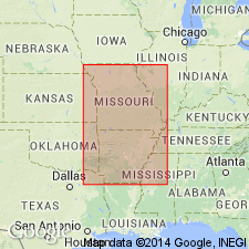
(Paleozoic Era; [Cambrian through Mississippian Systems] by E.D. Goebel, p. 13.) Jefferson City Dolomite and Cotter Dolomite. Because the Cotter Dolomite and Jefferson City Dolomite recognized in outcrops are not distinctly separable in the subsurface on lithologic criteria, they are treated as a unit. They consist mainly of coarsely granular, cherty dolomite. The upper part of the sequence includes much oolitic chert which becomes white and decreases in volume toward the base where white, tripolitic chert becomes abundant. These rocks unconformably underlie different formations, such as the St. Peter Sandstone on the flank of the Southeast Nebraska arch, the Chattanooga Shale on the Chautauqua arch, and Pennsylvanian rocks on parts of the Central Kansas uplift and Nemaha anticline. The Jefferson City Dolomite probably is conformable on the Roubidoux Formation. The Cotter-Jefferson City sequence ranges in thickness from 0 feet in northern Kansas to more than 650 feet in Cowley County in southern Kansas. Age is Late Cambrian to Early Ordovician.
Source: Publication.
- Usage in publication:
-
- Jefferson City Dolomite
- Modifications:
-
- Areal extent
- Overview
- AAPG geologic province:
-
- Ozark uplift
Summary:
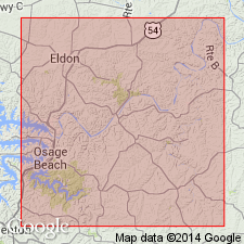
Ordovician (Canadian) Jefferson City Dolomite crops out along irregular faulted belt along western edge of quad. Mapping of Canadian rocks in southeastern MO is based on character of residual soils; Jefferson City yields distinctive residuum of red to yellow plastic clay containing abundant fragments of porous, partly oolitic chert. Contact with underlying Roubidoux Formation is probably unconformable (M.A. Middendorf, Missouri Division of Geology and Land Survey, written commun., 1989).
Source: GNU records (USGS DDS-6; Reston GNULEX).

- Usage in publication:
-
- Jefferson City Dolomite*
- Modifications:
-
- Areal extent
- AAPG geologic province:
-
- Illinois basin
- Ozark uplift
Summary:
Jefferson City Dolomite of Early Ordovician (Canadian) age occurs in MO and IL in the subsurface and in MO at the surface. Also mapped undivided with Cotter Dolomite.
Source: GNU records (USGS DDS-6; Reston GNULEX).

- Usage in publication:
-
- Jefferson City Dolomite*
- Modifications:
-
- Areal extent
- AAPG geologic province:
-
- Ozark uplift
Summary:
Ordovician (Canadian) Jefferson City, Cotter, Powell, and Smithville Dolomites not mapped consistently between adjacent 7.5-minutes quads within Paducah quad. All consist of more or less silty, sandy, and cherty dolomite. Indistinguishable in subsurface except possibly through study of insoluble residues. Sequence in subsurface is equivalent to Shakopee Dolomite in IL and KY.
Source: GNU records (USGS DDS-6; Reston GNULEX).

- Usage in publication:
-
- Jefferson City Dolomite*
- Modifications:
-
- Areal extent
- AAPG geologic province:
-
- Upper Mississippi embayment
- Illinois basin
Summary:
Early Ordovician (Canadian) Jefferson City Dolomite mapped undivided with Cotter Dolomite in subsurface in Upper Mississippi embayment of MO and Illinois basin in IL.
Source: GNU records (USGS DDS-6; Reston GNULEX).
- Usage in publication:
-
- [Cotter Dolomite and Jefferson City Dolomite, undifferentiated]
- [Cotter Formation and Jefferson City Formation, undifferentiated]
- Modifications:
-
- Overview
- AAPG geologic province:
-
- Ozark uplift
Summary:
Pg. 3. The Jefferson City consists of light to dark tan, fine-grained, crystalline dolostone and considerable chert with some rare thin beds of sandstone, shale, and oolite. Few fossils are known from the "Jeff City". The Jefferson City Dolomite unconformably overlies Roubidoux Formation. This lower contact is not exposed in Arkansas. The Jefferson City Formation has not been successfully differentiated from the Cotter Formation in Arkansas. Present in northern Arkansas, Ozark Plateaus; Missouri. Age is Early Ordovician.
Named for exposures at Jefferson City, Cole Co., MO (Winslow, 1894).
Source: Publication.
For more information, please contact Nancy Stamm, Geologic Names Committee Secretary.
Asterisk (*) indicates published by U.S. Geological Survey authors.
"No current usage" (†) implies that a name has been abandoned or has fallen into disuse. Former usage and, if known, replacement name given in parentheses ( ).
Slash (/) indicates name conflicts with nomenclatural guidelines (CSN, 1933; ACSN, 1961, 1970; NACSN, 1983, 2005, 2021). May be explained within brackets ([ ]).