The National Geologic Map Database is migrating to a new infrastructure. We apologize for any service disruptions during this process.
|
|---|


- Usage in publication:
-
- Jagger Bend bed
- Modifications:
-
- Original reference
- Dominant lithology:
-
- Limestone
- Clay
- AAPG geologic province:
-
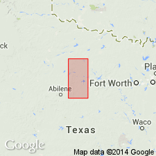
- Bend arch
Summary:
Pg. 421, 426. Jagger Bend bed in Albany division. To south, mostly alternating flaggy, smooth limestone, carbonaceous shaly limestone, and carbonaceous clay, 25 to 75 feet thick. Fossiliferous. To north carbonaceous nature not so apparent. Member of Albany division [Albany is uppermost of 5 Carboniferous divisions of Cummins, 1891]. Underlies Valera bed and overlies Bed No. 8 (50 to 75 feet of clay). Age is possibly Permian.
[Named from westward loop, Jagger Bend, of Colorado River, located a short distance southwest of Leaday, Coleman Co., central TX.]
Source: Publication; US geologic names lexicons (USGS Bull. 896, p. 1038; USGS Bull. 1200, p. 1907).

- Usage in publication:
-
- Jagger Bend limestone member
- Modifications:
-
- Revised
- AAPG geologic province:
-
- Bend arch
Summary:
Pg. 195. Jagger Bend limestone is a member of Belle Plains formation (middle formation of Wichita group). Underlies Valera shale member and overlies "bed No. 8" shale of Drake. [Age is Permian.]
Source: US geologic names lexicon (USGS Bull. 896, p. 1038).

- Usage in publication:
-
- Jagger Bend Limestone
- Modifications:
-
- Revised
- AAPG geologic province:
-
- Bend arch
Summary:
Pg. 66 (fig. 1). Jagger Bend limestone of Belle Plains group. Rank raised to formation in Belle Plains group. [Age is Permian.]
Source: US geologic names lexicon (USGS Bull. 1200, p. 1907).

- Usage in publication:
-
- Jagger Bend limestone member*
- Modifications:
-
- Revised
- AAPG geologic province:
-
- Bend arch
Summary:
Sheet 2. Jagger Bend limestone member of Belle Plains formation. Mostly dark-blue-gray medium-grained hard even layers that contain abundant minute vermicular foraminiferal debris; lowermost limestone bed is rather conspicuous yellow-brown limestone 2 to 3 feet thick; other beds mostly weather gray; thin shales between the limestones are dark blue to brownish and clayey. Thickness about 85 feet. Underlies Valera shale member; overlies Voss shale member. Age is Early Permian (Leonard?).
Source: Publication; US geologic names lexicon (USGS Bull. 1200, p. 1907).
- Usage in publication:
-
- Jagger Bend limestone member*
- AAPG geologic province:
-
- Bend arch
Summary:
Pg. 274, pls. 11, 12. Jagger Bend limestone member of Belle Plains formation. Geographically extended into Brazos River Valley. Thickness 60 to 120 feet. Overlies Voss shale member; underlies Valera shale member, boundary not distinct. [Age is Permian.]
Source: Publication; US geologic names lexicon (USGS Bull. 1200, p. 1907).
For more information, please contact Nancy Stamm, Geologic Names Committee Secretary.
Asterisk (*) indicates published by U.S. Geological Survey authors.
"No current usage" (†) implies that a name has been abandoned or has fallen into disuse. Former usage and, if known, replacement name given in parentheses ( ).
Slash (/) indicates name conflicts with nomenclatural guidelines (CSN, 1933; ACSN, 1961, 1970; NACSN, 1983, 2005, 2021). May be explained within brackets ([ ]).