

- Usage in publication:
-
- Hell-to-Finish Formation
- Modifications:
-
- Overview
- AAPG geologic province:
-
- Pedregosa basin
Summary:
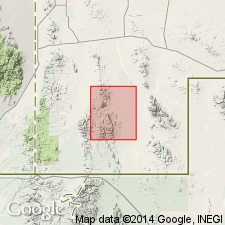
Recognized in Gillespie Creek, Animas Mountains, Hidalgo Co, NM in Pedregosa basin but mapped with overlying U-Bar Formation. Unconformably overlies Earp Formation and conformably underlies U-Bar Formation in a measured section 769 ft thick on Gillespie Creek in sec 34, T30S, R18W, and secs 3 and 4, 9 and 10, T31S, R18W. Age presumed to be Early Cretaceous because of its transitional contact with U-Bar.
Source: GNU records (USGS DDS-6; Denver GNULEX).
- Usage in publication:
-
- Hell-to-Finish Formation
- Modifications:
-
- Named
- Dominant lithology:
-
- Shale
- Mudstone
- Siltstone
- AAPG geologic province:
-
- Pedregosa basin
Summary:
Named for exposures (type section) near Hell-to-Finish tank, south end of Big Hatchet Mountains, NE1/4 NW1/4 sec 11, T32S, R15W, Hidalgo Co, NM, Pedregosa basin. Is 1,274 ft thick in type measured section. Rests on irregular erosion surface cut on Permian Concha Limestone; is transitional upward into U-Bar Formation (new). Consists chiefly of red, red-brown, and green shale; red, weakly indurated mudstone; red, red-brown, gray and green arkosic siltstone that has calcareous cement. Basal 40 ft is a well indurated, coarsely cross-bedded conglomerate of light-gray chert granules and pebbles, and a few limestone and dolomite pebbles and cobbles derived from erosion of the underlying Concha. Dark gray sandy limestone and chert sandstone present in lower part. Resistant gray arkose, gray shale, and limestone present as thin beds in upper part. Assigned an Early (pre-Aptian?) Cretaceous age on basis of relations with overlying U-Bar. Abundant fossils (pelecypods) occur in upper part.
Source: GNU records (USGS DDS-6; Denver GNULEX).

- Usage in publication:
-
- Hell-to-Finish Formation*
- Modifications:
-
- Overview
- AAPG geologic province:
-
- Pedregosa basin
Summary:
Is lowest Lower Cretaceous unit in Big Hatchet and Animas Mountains, Hidalgo Co, NM in Pedregosa basin. Overlies Permian rocks in Animas Mountains and is of extremely variable thickness. Is 1,274 ft thick in Big Hatchet Mountains. Underlies U-Bar Formation (Aptian and Albian). Is correlated with basal part of Howells Ridge Formation in Little Hatchet Mountains. [See fig. 5 for regional correlations.] Deposited as coastal-plain sediments. Age is Neocomian and Aptian (Early Cretaceous) on basis of correlation.
Source: GNU records (USGS DDS-6; Denver GNULEX).
- Usage in publication:
-
- Hell-to-Finish Formation
- Modifications:
-
- Areal extent
- AAPG geologic province:
-
- Pedregosa basin
- Basin-and-Range province
Summary:
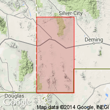
Extended to Little Hatchet Mountains in the Pedregosa basin and Basin-and-Range province, Hidalgo and Grant Cos, NM, to replace parts of the Broken Jug Limestone and Howells Ridge Formation as previously mapped [an excellent thing to do]. Contact with underlying unnamed Cretaceous is gradational. Contact with overlying U-Bar Formation is gradational and is difficult to locate; is chosen at level where limestone (U-Bar) predominates. Divisible into a lower part of red clastic rocks and limestone conglomerate, and an upper part of arkose and gray shale. About 6,000 ft thick. Is of Early Cretaceous age. Geologic map. Cross sections.
Source: GNU records (USGS DDS-6; Denver GNULEX).
- Usage in publication:
-
- Hell-to-Finish Formation
- Modifications:
-
- Areal extent
- AAPG geologic province:
-
- Pedregosa basin
Summary:
Shown as basal formation of Bisbee Group in Big Hatchet Peak quad of Pedregosa basin. Is of Early Cretaceous age.
Source: GNU records (USGS DDS-6; Denver GNULEX).

- Usage in publication:
-
- Hell-to-Finish Formation*
- Modifications:
-
- Mapped 1:24k
- Revised
- Dominant lithology:
-
- Shale
- Siltstone
- Sandstone
- Limestone
- AAPG geologic province:
-
- Pedregosa basin
Summary:
Hell-to-Finish Formation of Bisbee Group. Mapped in Big Hatchet Mountains, Hidalgo County, southwestern New Mexico. Restricted; basal conglomerate of Zeller (1965) is separately mapped as Glance Conglomerate; basal redbeds of Zeller (1965) in Big Horn Canyon area seem to be mostly Tertiary and are included in Oligocene Little Hat Top Conglomerate. Consists of shale, siltstone, sandstone, and sparse thin beds of limestone. Mostly poorly indurated; shale poorly exposed. Chiefly pale yellowish brown, some brownish gray and greenish gray, and rarely reddish brown. Sandstone includes quartz and arkosic beds. Limestone is light-gray to orange-gray, fine-grained, contains small shell fragments. Thickness at least 1,300 feet (400 m). Overlies with fault-contact Glance Conglomerate; underlies U-Bar Limestone. Age is Early Cretaceous.
Source: Publication.
For more information, please contact Nancy Stamm, Geologic Names Committee Secretary.
Asterisk (*) indicates published by U.S. Geological Survey authors.
"No current usage" (†) implies that a name has been abandoned or has fallen into disuse. Former usage and, if known, replacement name given in parentheses ( ).
Slash (/) indicates name conflicts with nomenclatural guidelines (CSN, 1933; ACSN, 1961, 1970; NACSN, 1983, 2005, 2021). May be explained within brackets ([ ]).