The National Geologic Map Database is migrating to a new infrastructure. We apologize for any service disruptions during this process.
|
|---|


- Usage in publication:
-
- Harlan sandstone*
- Modifications:
-
- Named
- Dominant lithology:
-
- Sandstone
- Shale
- Coal
- AAPG geologic province:
-
- Appalachian basin
Summary:
Named as topmost formation in Coal Measures in Bigstone Gap coal field of VA and KY. Named for Harlan Co., southeastern KY. Consists of mainly white, coarse sandstone with sandy shale and thin coals; includes massive sandstone at base is 100 ft thick. Thickness is 880 ft. Overlies Wise formation. [Age is Pennsylvanian.]
Source: GNU records (USGS DDS-6; Reston GNULEX).
- Usage in publication:
-
- Harlan sandstone, formation
- Modifications:
-
- Revised
- AAPG geologic province:
-
- Appalachian basin
Summary:
Harlan sandstone (or formation) is uppermost division of Pennsylvanian in Black Mountains, Harlan and Letcher Cos., KY, and Wise and Lee Cos., VA. Overlies Wise formation. Includes massive cliff-forming conglomeratic sandstone at base (probably Campbell's original Harlan sandstone). Base commonly stated to be 5 to 50 ft above High Splint coal. Although it contains shales and coals, the formation has commonly been called Harlan sandstone. May be lower Allegheny in age.
Source: GNU records (USGS DDS-6; Reston GNULEX).

- Usage in publication:
-
- Harlan Formation
- Modifications:
-
- Areal extent
- AAPG geologic province:
-
- Appalachian basin
Summary:
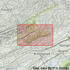
Harlan Formation occurs in the extreme western portion of Wise Co. near the VA-KY boundary. It crops out along the upper slopes of Little Black Mountain, Road, Bluff, and Ninemile spurs in the Appalachia quad. and along Rogers Ridge in the Flat Gap quad. Unit has a maximum preserved thickness of 600 ft. Consists primarily of light- to medium-gray, fine- to medium-grained sandstone with some interbedded medium-gray shale and siltstone. Includes as many as 6 or 7 coal beds. Age shown as Middle Pennsylvanian.
Source: GNU records (USGS DDS-6; Reston GNULEX).

- Usage in publication:
-
- Harlan Formation*, Sandstone*
- Modifications:
-
- Overview
- AAPG geologic province:
-
- Appalachian basin
Summary:
Harlan Formation (or Sandstone) is uppermost Pennsylvanian formation in VA. Used in VA and KY. Equivalent to the uppermost part of Breathitt Formation in KY.
Source: GNU records (USGS DDS-6; Reston GNULEX).
For more information, please contact Nancy Stamm, Geologic Names Committee Secretary.
Asterisk (*) indicates published by U.S. Geological Survey authors.
"No current usage" (†) implies that a name has been abandoned or has fallen into disuse. Former usage and, if known, replacement name given in parentheses ( ).
Slash (/) indicates name conflicts with nomenclatural guidelines (CSN, 1933; ACSN, 1961, 1970; NACSN, 1983, 2005, 2021). May be explained within brackets ([ ]).