The National Geologic Map Database is migrating to a new infrastructure. We apologize for any service disruptions during this process.
|
|---|


- Usage in publication:
-
- Hanover shales
- Modifications:
-
- Original reference
- AAPG geologic province:
-
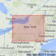
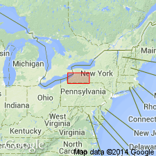
- Appalachian basin
Summary:
Pg. 76. Hanover shales (nom. nov.). Name is from exposures in town of Hanover, Chautauqua County, western New York, and is here used in place of †Silver Creek (preoccupied). Excellent exposures in Walnut and Silver Creek Ravines. Equivalent to upper part of Hatch shale and flags of eastern sections. [Age is Late Devonian.]
Source: US geologic names lexicon (USGS Bull. 896, Silver Creek entry p. 1998).
- Usage in publication:
-
- Hanover shales
- Modifications:
-
- Areal extent
- AAPG geologic province:
-
- Appalachian basin
Summary:
Pg. 157. Hanover shales much younger than Hatch shales and = Wiscoy shales. Disconformably overlie Angola shales and disconformably underlie Dunkirk black shale. [Age is Late Devonian.]
Source: US geologic names lexicon (USGS Bull. 896, Silver Creek entry p. 1998).

- Usage in publication:
-
- Hanover shale
- Modifications:
-
- Revised
- AAPG geologic province:
-
- Appalachian basin
Summary:
Pg. 69. [In this table Chadwick seems to have restricted Hanover shale, because he gave following as succession in Chautauqua County, western New York (downward): Dunkirk shale; Hanover shale; Pipe Creek shale; hiatus(?) equivalent to Nunda sandstone; and Angola shale; and correlated Hanover and Pipe Creek shales with Wiscoy shale.]
Source: US geologic names lexicon (USGS Bull. 896, Silver Creek entry p. 1998).

- Usage in publication:
-
- Hanover shale
- Modifications:
-
- Areal extent
- AAPG geologic province:
-
- Appalachian basin
Summary:
Pg. 149. Hanover shale (formerly Silver Creek shale), is highest member of Portage group on Lake Erie. Has been traced continuously into Wiscoy shale of Genesee Valley. [Age is Late Devonian.]
Source: US geologic names lexicon (USGS Bull. 896, Silver Creek entry p. 1998).

- Usage in publication:
-
- Hanover shale
- Modifications:
-
- Overview
- AAPG geologic province:
-
- Appalachian basin
Summary:
Hanover shale. Named from exposures in town of Hanover, Chautauqua Co., western NY. Age is Late Devonian.
See †Silver Creek shale Hartnagel (1912) and Chadwick (1919, 1923, and 1924) entries.
Source: US geologic names lexicon (USGS Bull. 896, p. 907).
- Usage in publication:
-
- Hanover shale
- Modifications:
-
- Principal reference
- AAPG geologic province:
-
- Appalachian basin
Summary:
(No. 2, p. 91-107, Sept. 1933; No. 3, p. 189-204, Oct. 1933; No. 5, p. 348-360, Dec. 1933.) Pg. 96, 98, 193, 198, 199, 357. Hanover shale overlies Pipe Creek shale and underlies Dunkirk shale (Canaseraga sandstone). Traceable from Lake Erie to Genesee River, where, still overlain by the Dunkirk, it becomes main mass of Wiscoy shale. Basal part of Wiscoy = Pipe Creek shale. [Age is Late Devonian.]
Source: US geologic names lexicon (USGS Bull. 896, p. 907).
- Usage in publication:
-
- Hanover shale
- Modifications:
-
- Revised
- AAPG geologic province:
-
- Appalachian basin
Summary:
Pg. 352. Hanover shale. Included this shale in Chemung group. Present in Chautauqua County, western New York. [Age is Late Devonian.]
Source: US geologic names lexicon (USGS Bull. 896, p. 907).

- Usage in publication:
-
- Hanover shale
- Modifications:
-
- Revised
- Areal extent
- AAPG geologic province:
-
- Appalachian basin
Summary:
Hanover shale. In western and central New York, includes Pipe Creek shale member at base. Eastward, intertongues with siltstone of Wiscoy sandstone. Underlies Dunkirk shale; overlies Angola shale in west and Nunda sandstone in east. [Age is Late Devonian.]
Source: US geologic names lexicon (USGS Bull. 1200, p. 1667).
- Usage in publication:
-
- Hanover shale
- Modifications:
-
- Revised
- Areal extent
- AAPG geologic province:
-
- Appalachian basin
Summary:
Hanover shale. In area between Dunkirk, Chautauqua County, and Franklin Gulf, Erie County, New York, Hanover shale underlies Dunkirk, member of Perrysburg formation (new). [Age is Late Devonian.]
Source: US geologic names lexicon (USGS Bull. 1200, p. 1667).
- Usage in publication:
-
- Hanover shale member
- Modifications:
-
- Revised
- AAPG geologic province:
-
- Appalachian basin
Summary:
Pg. 10 (fig. 1). Hanover shale considered member of Chemung formation. [Age is Late Devonian.]
Source: US geologic names lexicon (USGS Bull. 1200, p. 1667).
- Usage in publication:
-
- Hanover shale
- Modifications:
-
- Revised
- AAPG geologic province:
-
- Appalachian basin
Summary:
Hanover shale. Overlies Angola shale member of West Falls formation (new). [Age is Late Devonian.]
Source: US geologic names lexicon (USGS Bull. 1200, p. 1667).
- Usage in publication:
-
- Hanover shale member*
- Modifications:
-
- Revised
- AAPG geologic province:
-
- Appalachian basin
Summary:
Hanover shale member of Java formation. Redefined as member of Java formation (new). Consists largely of medium to medium-greenish-gray slightly calcareous shale and blocky weathering mudrock. East of central Wyoming County, New York, Wiscoy sandstone member of Java separates Hanover member from Dunkirk shale member of Perrysburg. [Age is Late Devonian.]
Source: US geologic names lexicon (USGS Bull. 1200, p. 1667).
- Usage in publication:
-
- Hanover Shale Member
- Modifications:
-
- Age modified
- AAPG geologic province:
-
- Appalachian basin
Summary:
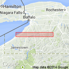
Hanover Shale Member of Java Formation is uppermost unit in area containing fossils of the Frasnian Stage. Unit is 28 m thick and composed primarily of green-gray mudstone with accessory discrete thin black shale beds and zones of small calcareous, phosphatic and pyritic nodules. Usually very bioturbated, but contains few shelly fossils. The Hanover changes eastward into siltier, upslope deposits of the Wiscoy Member southeast of the type section at Java Village. Fossils include a mixture of benthic and pelagic fossils, goniatites and carbonized driftwood fragments. Small rugose corals and crinoid ossicles also occur. The Frasnian-Famennian stage boundary position has been tentatively placed several meters below the top of this unit by Kirchgasser (pers. comm. 1989).
Source: GNU records (USGS DDS-6; Reston GNULEX).

- Usage in publication:
-
- Hanover Shale Member*
- Modifications:
-
- Areal extent
- AAPG geologic province:
-
- Appalachian basin
Summary:
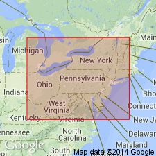
Hanover Shale Member of the Java Formation extended from southwestern NY into western PA, eastern OH, western WV, eastern KY, and the subsurface of western VA, and northeastern TN.
Source: GNU records (USGS DDS-6; Reston GNULEX).
- Usage in publication:
-
- Hanover Shale Member*
- Modifications:
-
- Biostratigraphic dating
- AAPG geologic province:
-
- Appalachian basin
Summary:
Pg. 164-166. Hanover Shale Member of Java Formation of West Falls Group. Intensely bioturbated green-gray silty pyritic shale interbedded with argillaceous carbonate beds, calcareous nodules, and organic-rich laminated shales. Underlies Dunkirk Shale of Canadaway Group; contact placed at massive black shale of the Dunkirk. Overlies Pipe Creek Shale Member of Java Formation. Lower part carries conodonts ANCYRODELLA CURVATA (Branson and Mehl) (late form), ANCYROGNATHUS ASYMMETRICUS (Ulrich and Bassler), POLYGNATHUS DECOROSUS Stauffer, and PALMETOLEPIS BOGARTENSIS (Stauffer), the latter defining the base of Montagne Noire (MN) zone 13 of Klapper (1989). Upper part carries conodonts PALMATOLEPIS DELICATULA DELICATULA Branson and Mehl, P. DELICATULA PLATYS Ziegler and Sandberg, P. SUBPERLOBATA Branson and Mehl, and ANCYROGNATHUS sp. A, indicating Middle TRIANGULARIS zone. Age is Late Devonian (latest Frasnian to earliest Famennian; conodont biozones MN 13 to Middle TRIANGULARIS).
Source: Publication.
For more information, please contact Nancy Stamm, Geologic Names Committee Secretary.
Asterisk (*) indicates published by U.S. Geological Survey authors.
"No current usage" (†) implies that a name has been abandoned or has fallen into disuse. Former usage and, if known, replacement name given in parentheses ( ).
Slash (/) indicates name conflicts with nomenclatural guidelines (CSN, 1933; ACSN, 1961, 1970; NACSN, 1983, 2005, 2021). May be explained within brackets ([ ]).