The National Geologic Map Database is migrating to a new infrastructure. We apologize for any service disruptions during this process.
|
|---|


- Usage in publication:
-
- Gunsight limestone member
- Modifications:
-
- Original reference
- Dominant lithology:
-
- Limestone
- AAPG geologic province:
-
- Bend arch
Summary:
Pg. 133-145. Gunsight limestone member, top member of Gunsight formation. Forms a continuous ledge where not obscured by overlying sands and conglomerates. Easily recognized where shale above and below are well exposed, because contains [spiny coral] LOPHPOPHYLLUM PROFUNDUM VARRADICOSUM and small forms of [brachiopod] PRODUCTUS LONGISPINUS. [Age is Late Pennsylvanian.]
[Named from Gunsight, Stephens Co., TX.]
Source: US geologic names lexicon (USGS Bull. 896, p. 890); supplemental information from GNU records (USGS DDS-6; Denver GNULEX).

- Usage in publication:
-
- Gunsight limestone member
- Modifications:
-
- Areal extent
- Dominant lithology:
-
- Limestone
- Shale
- AAPG geologic province:
-
- Bend arch
Summary:
Pg. 24, 31; Univ. Texas Bull., no. 2132, p. 126, 127-137, charts, etc. Gunsight limestone. A member of Graham formation (of Cisco group) in Brazos River Valley. Is CAMPOPHYLLUM bed of Drake. Varies somewhat in different counties, but usually consists of two thin limestone layers separated by 20 to 60 feet of yellow shale. Overlies South Bend shale and underlies Wayland shale. [In sections given in this report the upper limestone is 1 to 20 feet thick, the lower limestone 1 to 12 feet thick, and the separating beds 1 to 60 feet thick.] [Age is Pennsylvanian.]
[Recognized in Brown, Coleman, Eastland, Jack, McCulloch, Stephens, and Young Cos., central and central northern TX.]
Source: US geologic names lexicon (USGS Bull. 896, p. 890); supplemental information from GNU records (USGS DDS-6; Denver GNULEX).

- Usage in publication:
-
- Gunsight Limestone
- Modifications:
-
- Areal extent
- Dominant lithology:
-
- Limestone
- AAPG geologic province:
-
- Bend arch
- Fort Worth syncline
Summary:
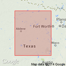
Mapped as a single line [as an unranked unit] in Thrifty and Graham Formations (mapped undivided) of Cisco Group in the southeastern part of the mapped area. Called "Lower Gunsight Limestone." Present in four widely separated exposures--correlation between exposures is imprecise, being based solely on stratigraphic position: a) in southern Young Co, TX on Bend arch, 1-3 ft thick; b) northwest of Jacksboro, Jack Co, TX on Fort Worth syncline, 1-3 ft thick; c) immediately east of State Route 148, Jack Co, 1-5 ft thick; and d) immediately east and west of State Route 59, eastern Jack Co, 2-5 ft thick. Of Virgil age (Late Pennsylvanian). Geologic map.
Source: GNU records (USGS DDS-6; Denver GNULEX).

- Usage in publication:
-
- [Gunsight Limestone, unranked]
- Modifications:
-
- Mapped 1:250k
- Dominant lithology:
-
- Limestone
- AAPG geologic province:
-
- Fort Worth syncline
Summary:
Pamphlet [p. 10-11]. Lower Gunsight Limestone [unranked] in Thrifty and Graham Formations, [undifferentiated] of Cisco Group. Light-gray, fine-grained, thin-bedded to wavy-nodular, sparsely fossiliferous, thickness 2 to 5 feet. Lies in middle part of Thrifty and Graham Formations, [undifferentiated], above Bunger Limestone [unranked] and below ls1 unit [probably = ls unit in lower part of Markley Formation of Bowie Group]. Age is Late Pennsylvanian (Virgilian).
[Mapped in Jack Co., central northern TX; western edge of map sheet. Rocks previously (1967 ed. of map) included in "Graham and Caddo Creek Formations, undivided." See also Hentz, 1988, and adjacent Wichita Falls-Lawton sheet, Texas Geol. Atlas, 1987.]
Source: Publication.
For more information, please contact Nancy Stamm, Geologic Names Committee Secretary.
Asterisk (*) indicates published by U.S. Geological Survey authors.
"No current usage" (†) implies that a name has been abandoned or has fallen into disuse. Former usage and, if known, replacement name given in parentheses ( ).
Slash (/) indicates name conflicts with nomenclatural guidelines (CSN, 1933; ACSN, 1961, 1970; NACSN, 1983, 2005, 2021). May be explained within brackets ([ ]).