

- Usage in publication:
-
- Gardner dolomite*
- Modifications:
-
- Original reference
- Dominant lithology:
-
- Dolomite
- AAPG geologic province:
-
- Great Basin province
- South Western Overthrust
Summary:
Gardner dolomite. Is recognized as distinct formation because it contains a great variety of recognizable fossils, most of which were found on spur west of Gardner Canyon. Tower and Smith (1899) included these rocks in Godiva limestone. Formation consists chiefly of fine-grained gray to dark bluish-gray dolomite; small chert nodules in some beds; a few beds of black dense carbonaceous limestone interstratified. Top is mapped at base of lowest exposed black cherty beds of Pine Canyon limestone. At or near top is 100 feet of black highly carbonaceous and pyritic shaly limestone. Thickness 435 to 700 feet. Overlies Victoria quartzite. Age is Early Mississippian. Fossils are of Madison age, G.H. Girty says.
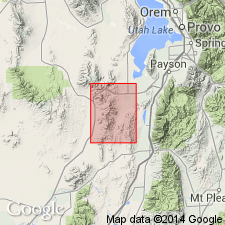
[Gardner Canyon is south of Eureka, in secs. 18 and 19, T. 10 S., R. 2 W., Eureka 7.5-min quadrangle, Tintic district, Juab Co., central northern UT.]
Source: US geologic names lexicon (USGS Bull. 896, p. 801).
- Usage in publication:
-
- Gardner dolomite
- Modifications:
-
- Revised
- AAPG geologic province:
-
- Great Basin province
- South Western Overthrust
Summary:
Pg. 1505. Gardner dolomite. Restricted to exclude beds now known to contain an Upper Devonian fauna. These beds are included in underlying Pinyon Peak limestone. The restricted Gardner is about 535 feet thick and contains lower Mississippian fossils in its basal bed.
Source: US geologic names lexicon (USGS Bull. 1200, p. 1470-1471).
- Usage in publication:
-
- Gardner dolomite
- Modifications:
-
- Not used
- AAPG geologic province:
-
- Great Basin province
- South Western Overthrust
Summary:
Pg. 14. Name Madison limestone is preferred to name Gardner dolomite for rocks of [Early] Mississippian age in East Tintic Mountains inasmuch as Gardner dolomite, as originally defined by Loughlin (1919), erroneously included some beds of Late Devonian age, and name was essentially restricted in its usage to East Tintic Mountains. Term Madison will be used as group name to include two new formations in report currently being prepared. Names have not been officially adopted by the USGS, and, hence, are not used in present report.
Source: US geologic names lexicon (USGS Bull. 1200, p. 1470-1471).
- Usage in publication:
-
- Gardner dolomite
- Modifications:
-
- Revised
- AAPG geologic province:
-
- Great Basin province
Rigby, J.K., 1958, Geology of the Stansbury Mountains, [Utah]: Utah Geological Society, Guidebook to the geology of Utah, no. 13, p. 1-134.
Summary:
Pg. 38 (fig. 5), 40-43. Gardner dolomite. Described in Stansbury Mountains, Tooele County, central northern Utah, where it consists of a lower member 200 to 650 feet thick and an upper member 475 to 1,110 feet thick. Underlies Pine Canyon formation; overlies Pinyon Peak limestone. Report states that U.S. Geological Survey has revised Mississippian nomenclature in Tintic district, but because names have not been officially proposed, term Gardner is used in essentially same sense as applied by Lovering and others (1949, Econ. Geol. Mon. 1). Gardner, as used in present report, includes all the Madison group of Morris (1957) except the upper cherty beds, which are separately mapped as basal unit of Pine Canyon formation.
Source: US geologic names lexicon (USGS Bull. 1200, p. 1470-1471).
- Usage in publication:
-
- Gardner dolomite
- Modifications:
-
- Revised
- AAPG geologic province:
-
- Wasatch uplift
- Great Basin province
Summary:
Pg. 38-43, 46 (fig. 10), 155-157, pl. 1. Gardner dolomite. Described in southern Oquirrh Mountains where it is about 812 feet thick and consists of two members: lower, 344 feet thick, chiefly dolomite; and upper, 468 feet, chiefly limestone with some chert at top. Lower member includes Gilluly's (1932, USGS Prof. Paper 173) Jefferson(?) dolomite; upper member includes approximately lower half of Gilluly's (1932) Madison. Disconformably overlies Opex formation (upper part of Lynch of Gilluly); stratigraphically above Stansbury formation; underlies Pine Canyon limestone which here includes some of upper strata of what Gilluly mapped as Madison. Described and mapped in Fivemile Pass and North Boulter Mountains quadrangles where it consists of lower and upper member. Name is used in preference to Madison.
Source: US geologic names lexicon (USGS Bull. 1200, p. 1470-1471).

- Usage in publication:
-
- Gardner dolomite†
- Modifications:
-
- Abandoned
- AAPG geologic province:
-
- Great Basin province
- South Western Overthrust
Summary:
Pg. 89. †Gardner dolomite. Most of beds assigned to upper part of Gardner dolomite by Loughlin (Lindgren and Loughlin, 1919, p. 39-40) are reassigned to Gardison limestone (new), except for the "black highly carbonaceous and pyritic shaly limestone," which is placed at base of overlying Deseret limestone. Remainder of Gardner is reallocated to the Victoria, Pinyon Peak, and Fitchville formations. [See Deseret, Fitchville, Gardison, Pinyon Peak, and Victoria.]
Source: Publication.
For more information, please contact Nancy Stamm, Geologic Names Committee Secretary.
Asterisk (*) indicates published by U.S. Geological Survey authors.
"No current usage" (†) implies that a name has been abandoned or has fallen into disuse. Former usage and, if known, replacement name given in parentheses ( ).
Slash (/) indicates name conflicts with nomenclatural guidelines (CSN, 1933; ACSN, 1961, 1970; NACSN, 1983, 2005, 2021). May be explained within brackets ([ ]).