- Usage in publication:
-
- Gardison limestone*
- Modifications:
-
- First used
- Dominant lithology:
-
- Dolomite
- Limestone
- AAPG geologic province:
-
- Great Basin province
Summary:
First published use as a name in the East Tintic Mountains, Juab Co, UT in the Great Basin province. Areal extent not clearly stated. Was included in Gardner Dolomite previously. Same rocks in Wasatch Range called Madison Limestone. Overlies Fitchville Formation (first used). Underlies Deseret Limestone. Basal 20-50 ft are coarse-grained, cross-bedded, black clastic dolomite which are overlain by 200 to 250 ft of banded blue-gray, fine-grained fossiliferous limestone in beds 2-4 in thick with 1/4 to 1/2 in partings of tan to brownish-gray weathering silty dolomite. Upper part [thickness not stated] consists of massive cliff-forming dolomite and limestone beds containing lenses and pods of white chert. Top of formation placed at base of black carbonaceous shale. Contains abundant Early Mississippian brachiopods, gastropods, and corals. Correlation chart. Cross section.
Source: GNU records (USGS DDS-6; Denver GNULEX).

- Usage in publication:
-
- Gardison limestone*
- Modifications:
-
- Named
- Dominant lithology:
-
- Limestone
- AAPG geologic province:
-
- Great Basin province
- Wasatch uplift
Summary:
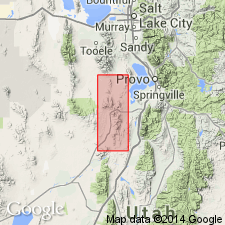
Named for Gardison Ridge, northern part of East Tintic Mountains, Tooele and Utah Cos, UT, in Great Basin province and Wasatch uplift. Type locality measured on Rattlesnake Spur near north end of Gardison Ridge in NE1/4 sec 1, T9S, R3W, Utah Co, Wasatch uplift. Is 497.8 ft thick at type where it conformably overlies Fitchville formation (new) and conformably underlies Deseret limestone. Consists of very dark gray, blue-gray to black, fine-, medium- to coarse-grained limestone that may be massive and fossiliferous. Ranges from about 450 to 550 ft thick. Replaces use of name Gardner dolomite, a term abandoned in this report. Contains well-preserved corals, brachiopods, and corals. Is equivalent to Madison limestone and to Joana limestone. Of Early Mississippian age. Geologic map. Cross sections.
Source: GNU records (USGS DDS-6; Denver GNULEX).

- Usage in publication:
-
- Gardison Limestone*
- Modifications:
-
- Areal extent
- AAPG geologic province:
-
- Great Basin province
Summary:
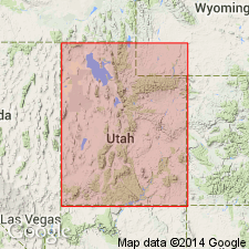
Topache Limestone abandoned. Rocks formerly assigned to Topache in the Star Range, Beaver Co, UT in the Great Basin province are reassigned to the Devonian and Mississippian Fitchville Formation, Mississippian Gardison and Deseret Limestones, and Humbug Formation.
Source: GNU records (USGS DDS-6; Denver GNULEX).

- Usage in publication:
-
- Gardison Limestone*
- Modifications:
-
- Revised
- AAPG geologic province:
-
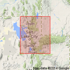
- Wasatch uplift
Summary:
Underlies a new unit named Delle Phosphatic Member, basal member of Deseret Limestone in Ophir Canyon, Oquirrh Mountains, Salt Lake Co, UT on the Wasatch uplift. Upper surface is a hardground formed on the Gardison. Correlation of Gardison with other lithostratigraphic units on Wasatch uplift and in Great Basin province, UT, and in Snake River basin, ID, shown on correlation chart. Of Osagean age.
Source: GNU records (USGS DDS-6; Denver GNULEX).
For more information, please contact Nancy Stamm, Geologic Names Committee Secretary.
Asterisk (*) indicates published by U.S. Geological Survey authors.
"No current usage" (†) implies that a name has been abandoned or has fallen into disuse. Former usage and, if known, replacement name given in parentheses ( ).
Slash (/) indicates name conflicts with nomenclatural guidelines (CSN, 1933; ACSN, 1961, 1970; NACSN, 1983, 2005, 2021). May be explained within brackets ([ ]).

