

- Usage in publication:
-
- Gallatin formation*
- Modifications:
-
- Original reference
- Dominant lithology:
-
- Limestone
- Shale
- AAPG geologic province:
-
- Montana folded belt
Summary:
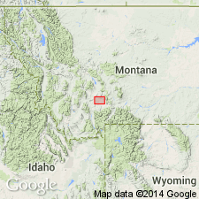
(See also USGS Three Forks folio, no. 24, 1896.) Gallatin formation. Mainly calcareous, 835 feet thick. In vicinity of Three Forks, Montana, divided into (descending): (1) Pebbly limestones (light colored, laminated, yellowish brown at base, dove-colored at top with dark-blue layers), 145 feet; (2) Dry Creek shales (brownish yellow, red, and pink, with shaly calcareous sandstones), 30 feet; (3) Mottled limestones, 260 feet (massive-bedded, the lower 20 to 25 feet being laminated, light-gray or brownish); (4) OBOLELLA shales, 280 feet (more calcareous than arenaceous; soft shaly beds with few thin limestone bands, dark greenish in lower part, lighter in upper part); (5) Trilobite limestones, 120+ feet (thin-bedded dark-gray central part massive). Conformably overlain by Jefferson limestone and rests on Flathead shales. [In Bull. 110 mapped on both sides of Gallatin River near Gallatin, Montana. In Three Forks and Livingston folios is mapped in parts of Gallatin Range, southeastern part of Three Forks quadrangle and western part of Livingston quadrangle. Gallatin Range extends into northwestern corner of Yellowstone Park.]
Source: US geologic names lexicon (USGS Bull. 896, p. 793-794).
- Usage in publication:
-
- Gallatin limestone*
- Modifications:
-
- Principal reference
- Revised
- Dominant lithology:
-
- Limestone
- AAPG geologic province:
-
- Yellowstone province
Summary:
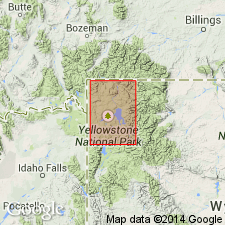
Gallatin limestone. Named for typical occurrence in Gallatin Range [the southern extension of which is in northwest corner of Yellowstone Park], where it forms upper part of Cambrian series and is 110 feet thick. It is essentially a series of limestones, more massively bedded than those of underlying Flathead formation and forms first prominent limestone bluff that rises above the Archean areas. Lowest bed is massive mottled black and gray limestone 50+ to 100 feet thick. Above this mottled limestone the rocks are more thinly bedded and carry Upper Cambrian fossils. Is overlain by Jefferson limestone. [Since base of Gallatin limestone is here drawn at base of mottled limestone, this definition of Gallatin is a restriction of Peale's 1893 definition. In 1918 the beds between base of †Mottled limestone and top of Flathead quartzite were named Gros Ventre formation. The Gallatin limestone as now (ca. 1936) generally accepted is overlain by Jefferson limestone and underlain by Gros Ventre formation and is considered to be wholly of Late Cambrian age.]
Source: US geologic names lexicon (USGS Bull. 896, p. 793-794).
- Usage in publication:
-
- Gallatin formation
- Modifications:
-
- Revised
- AAPG geologic province:
-
- Wind River basin
- Yellowstone province
Summary:
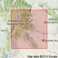
Pg. 124-127. Gallatin formation. In Wind River Mountains and Owl Creek-Bridger uplift, formation is subdivided to include: (1) Du Noir member (new), massive, gray limestone with brown oolites, averages 40 feet; (2) middle shaly member, gray with beds of pebbly glauconitic limestone and nodular argillaceous limestone, 30 to 35 feet; (3) upper limestone, 195 feet. Total maximum thickness about 300 feet. Overlies Gros Ventre formation. Underlies "Big Horn" formation. Fossiliferous. Age is Late Cambrian.
Measured sections: (1) in divide between Teton and Death Canyons, Teton Co.; (2) along Warm Creek; (3) Crow Creek Canyon; (4) Wind River Canyon; and (5) Dry Creek, Fremont Co., northwestern WY.
Source: US geologic names lexicon (USGS Bull. 1200, p. 1456-1457); supplemental information from GNU records (USGS DDS-6; Denver GNULEX).

- Usage in publication:
-
- Gallatin formation
- Modifications:
-
- Not used
- AAPG geologic province:
-
- Bighorn basin
- Wind River basin
Summary:
Pg. 1091-1105. Gallatin formation. Terms Du Noir and Gallatin not applicable to Wind River section [northwestern, Wyoming], which is herein divided into Depass formation and Boysen formation (new).
Source: US geologic names lexicon (USGS Bull. 1200, p. 1456-1457).
- Usage in publication:
-
- Gallatin limestone*
- Modifications:
-
- Not used
- AAPG geologic province:
-
- Bighorn basin
- Central Montana uplift
- Montana folded belt
- Yellowstone province
Summary:
Pg. 541-555; 1938, GSA Proc. 1937, p. 275-276. Gallatin limestone. Term Gallatin eliminated; its use in any sense other than original definition of Peale is invalid and confusing. Replaced with (ascending) Maurice, Snowy Range, and Grove Creek formations (all new).
Source: US geologic names lexicon (USGS Bull. 1200, p. 1456-1457).
- Usage in publication:
-
- Gallatin formation*
- Modifications:
-
- Mapped
- AAPG geologic province:
-
- Wind River basin
Summary:
Gallatin formation. In Boysen area, Fremont County, central Wyoming, consists of 455 feet of limestone and limestone-pebble conglomerate with lesser amounts of limy siltstone and shale. Contact between Gallatin and overlying Gros Ventre is placed at base of prominent cliff-forming limestone about 87 feet thick; the contact thus placed is approximately at base of Gallatin as used by Miller (1936) and is about 60 feet above contact between Depass and Boysen formations of Deiss (1938). Underlies Bighorn dolomite. In southern Big Horn Mountains, Gallatin underlies Madison formation. Age is Cambrian.
Source: US geologic names lexicon (USGS Bull. 1200, p. 1456-1457).
- Usage in publication:
-
- Gallatin formation
- Modifications:
-
- Areal extent
- AAPG geologic province:
-
- Wind River basin
Summary:
Pg. 1374. Gallatin formation. Comprises three subdivisions (ascending): Du Noir limestone, Dry Creek shale, and Sage limestone. [Age is Late Cambrian.]
Source: US geologic names lexicon (USGS Bull. 1200, p. 1456-1457).
- Usage in publication:
-
- Gallatin group
- Modifications:
-
- Revised
- AAPG geologic province:
-
- Bighorn basin
- Green River basin
- Wind River basin
- Yellowstone province
Summary:
Gallatin group. Rank raised to group (see note 23). Includes (ascending) Du Noir limestone, Dry Creek shale, and Sage limestone. It should be noted that Dry Creek shale in most exposures is thin and rarely mappable and should be most commonly regarded as member of Sage limestone. Age is Late Cambrian (Croixan; Dresbachian to Trempealeauian; CEDARIA to SAUKIA trilobite zones).
Source: Publication; US geologic names lexicon (USGS Bull. 1200, p. 1456-1457).
- Usage in publication:
-
- Gallatin group
- Modifications:
-
- Revised
- AAPG geologic province:
-
- Green River basin
- Wind River basin
- Yellowstone province
Summary:
Pg. 38, 39 (fig. 1), 40 (fig. 2), 41. Gallatin group. In southwestern Wyoming (Teton, Sublette, Fremont, and Lincoln Counties), divided into (ascending) Du Noir limestone and Open Door limestone (new; includes Dry Creek shale member at base). Age is Late Cambrian (Croixan; Dresbachian to Franconian; CEDARIS to TAENICEPHALUS (CONASPIS) trilobite zones).
Source: Publication.
- Usage in publication:
-
- Gallatin Group*
- Modifications:
-
- Revised
- AAPG geologic province:
-
- Bighorn basin
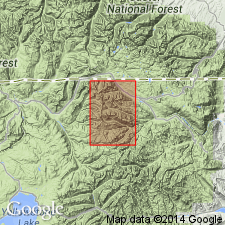
Summary:
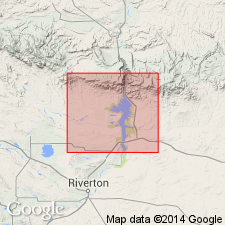
Rank raised to group; includes in ascending order, Pilgrim Limestone and Snowy Range and Grove Creek Formations. Map covers part of Beartooth Mountains in northwest WY within Bighorn basin. Late Cambrian age.
Source: GNU records (USGS DDS-6; Denver GNULEX).
- Usage in publication:
-
- Gallatin Limestone*
- Modifications:
-
- Revised
- AAPG geologic province:
-
- Wind River basin
Summary:
Gallatin Limestone divided into Du Noir Limestone Member (base) and Open Door Limestone Member (top). Usage in this paper represents a change in stratigraphic rank used by Shaw (1955) for Gallatin (from group), and Du Noir and Open Door (from formation). Gallatin forms cliffs above shale slopes of Gros Ventre Formation and is separated from the overlying Bighorn Dolomite by an erosional unconformity. The formation is 265 to 365 ft thick in the Wind River Range, 235 to 455 ft thick in the Washakie Range, Owl Creek, and southern Bighorn Mountains, 209 ft thick along south edge of Wind River basin. The Du Noir described as a cliff-forming, thin-bedded, glauconitic and oolitic limestone with some flat-pebble conglomerate. The Open Door has a lower soft, green-gray shale with minor thin-bedded, gray limestone, and an upper gray, thin-bedded to massive limestone and a few flat-pebble conglomerates. The members can be traced in the Washakie Range, along the south side of the Owl Creek Mountains, and into the southern Bighorn Mountains of WY in the Wind River basin. The boundary between the APHELASPIS and ELVINIA zones nearly corresponds to the Du Noir-Open Door contact. Is a marine deposit of Late Cambrian age. Cross sections.
Source: GNU records (USGS DDS-6; Denver GNULEX).
- Usage in publication:
-
- Gallatin Group*
- Modifications:
-
- Revised
- AAPG geologic province:
-
- Bighorn basin
Summary:
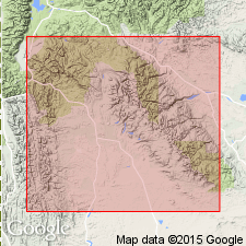
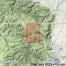
Revised in that Grove Creek reduced to member rank and assigned to Snowy Range Formation of Gallatin. Gallatin in map area consists of Snowy Range and underlying Pilgrim Limestone. Map is in area of Beartooth Mountains in northwest WY, Bighorn basin. Late Cambrian age.
Source: GNU records (USGS DDS-6; Denver GNULEX).
- Usage in publication:
-
- Gallatin Group*
- Modifications:
-
- Areal extent
- AAPG geologic province:
-
- Bighorn basin
- Montana folded belt
- Yellowstone province
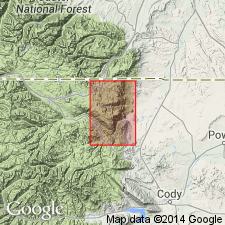
Summary:
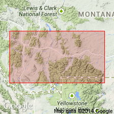
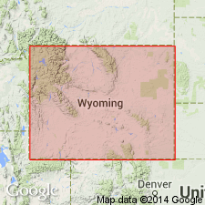
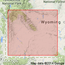
Extended into area around northeast boundary of Yellowstone National Park, Park Co, WY and Park Co, MT, Yellowstone province, Bighorn basin and Montana folded belt province. Gallatin in map area consists of Snowy Range Formation and underlying Pilgrim Limestone. Late Cambrian age.
Source: GNU records (USGS DDS-6; Denver GNULEX).
For more information, please contact Nancy Stamm, Geologic Names Committee Secretary.
Asterisk (*) indicates published by U.S. Geological Survey authors.
"No current usage" (†) implies that a name has been abandoned or has fallen into disuse. Former usage and, if known, replacement name given in parentheses ( ).
Slash (/) indicates name conflicts with nomenclatural guidelines (CSN, 1933; ACSN, 1961, 1970; NACSN, 1983, 2005, 2021). May be explained within brackets ([ ]).