- Usage in publication:
-
- Frozen Sandstone Member*
- Modifications:
-
- Original reference
- Dominant lithology:
-
- Sandstone
- Siltstone
- AAPG geologic province:
-
- Appalachian basin
Summary:
Pg. C46-C49. Frozen Sandstone Member of Breathitt Formation. Consists chiefly of medium- to light-gray fine- to medium-grained calcareous micaceous highly cross-bedded sandstone that contains carbonized plant fragments along bedding planes. Contains interbeds of shaly siltstone that thicken locally. Thickness 25 to 60 feet; 55 feet at type section. Base about 80 to 100 feet above base of Breathitt. Overlain by thick sequence of shale, sandstone, clay, and interbedded coals. To northwest, appears to merge laterally with Lee Formation. Age is Middle Pennsylvanian.
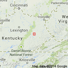
Type section: roadcut exposures in newly opened highway [KY Route 15] along right bank of North Fork of Kentucky River, 0.3 mi north-northeast of the Frozen Creek Post Office, [Jackson 7.5-min quadrangle, 1961 ed., photorevised 1978], Breathitt Co., eastern KY.
[Additional locality information from USGS historical topographic map collection TopoView, accessed October 20, 2013.]
Source: US geologic names lexicon (USGS Bull. 1350, p. 278).

- Usage in publication:
-
- Frozen Sandstone Member*
- Modifications:
-
- Areal extent
- AAPG geologic province:
-
- Appalachian basin
Summary:
Frozen Sandstone Member of Breathitt Formation. Sandstone in lower part of Breathitt Formation below the Lower Elkhorn or Vires coal bed and above Betsie Shale Member of Breathitt Formation. (Shown at same level in section as the Wheelersburg and Dixie coals; the Grayson sandstone bed (informal) of Lee Formation of Whittington and Fern (1967) in Princess district = Caywood [Cawood] Sandstone Member of Breathitt Formation in Upper Cumberland River district, and are higher in section than the Frozen Sandstone Member.) Age is Middle Pennsylvanian.
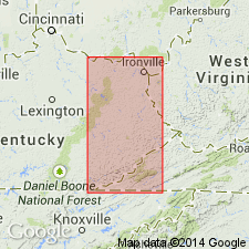
Recognized in Hazard district, eastern KY.
Source: Publication.

- Usage in publication:
-
- Frozen Sandstone Member
- Modifications:
-
- Areal extent
- AAPG geologic province:
-
- Appalachian basin
Summary:
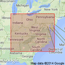
Corr. chart. Frozen Sandstone Member of Pikeville Formation of Breathitt Group. Sandstone. [Recognized locally in Hazard district, eastern Kentucky.] Lies in lower part of Pikeville Formation between Crummies Member above and Betsie Shale Member below. Capped by Little Eagle (Wheelersburg, Dixie) coal bed. Equivalent to Caywood [Cawood] sandstone member (informal) of Pikeville [in Upper Cumberland River district, southeastern Kentucky]; upper part equivalent to the Lower Petros Sandstone, an unranked unit in Slatestone Formation of Tennessee. Age is late Early Pennsylvanian (Westphalian; early, but not earliest Atokan).
[Frozen Sandstone Member lies between Eagle and Mason coals, which Peppers (1996, GSA Memoir 188, pl.) placed in basal part of Westphalian B, MICRORETICULATISPORITES NOBILIS-FLORINITES JUNIOR (NJ) miospore assemblage zone of western Europe. Eble and others (2009, Kentucky Geol. Survey, ser. XII, Spec. Pub. 10, figs. 5.1, 5.2) placed the underlying Betsie Shale Member at the Langsettian/Duckmantian (Westphalian A/B) boundary, in uppermost part of the underlying RADIIZONATES ALIGERENS (RA) miospore assemblage zone of western Europe.]
[See also Chesnut, 1997 (revised Oct. 12, 1999), Stratigraphy of the coal-bearing strata of the Eastern Kentucky coal field, available online through the Kentucky Geol. Survey (http://www.uky.edu/KGS/coal/coalcorrel.htm). Shows Cawood Sandstone Member = Grayson sandstone and higher in section than (descending) Wheelersburg or Dixie coal, and Frozen Sandstone.]
Source: Publication.
For more information, please contact Nancy Stamm, Geologic Names Committee Secretary.
Asterisk (*) indicates published by U.S. Geological Survey authors.
"No current usage" (†) implies that a name has been abandoned or has fallen into disuse. Former usage and, if known, replacement name given in parentheses ( ).
Slash (/) indicates name conflicts with nomenclatural guidelines (CSN, 1933; ACSN, 1961, 1970; NACSN, 1983, 2005, 2021). May be explained within brackets ([ ]).

