- Usage in publication:
-
- Fish Haven dolomite*
- Modifications:
-
- Original reference
- Dominant lithology:
-
- Dolomite
- AAPG geologic province:
-
- Wasatch uplift
Summary:
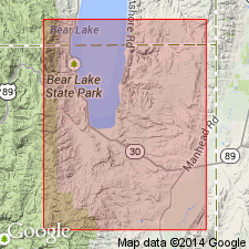
Pg. 407, 409. Fish Haven dolomite. Medium-bedded bluish dolomite, 500 feet thick. Underlies Laketown dolomite and overlies (unconformably?) Swan Peak quartzite. [Age is Late Ordovician (Richmond).]
[Named from exposures on Fish Haven Creek, Bear Lake Co., southern ID. (Creek enters Bear Lake about 2.5 mi north of UT-ID State line, in T. 16 S., R. 5 E., St. Charles 7.5-min quadrangle.) Extends into northeastern and western (Gold Hill district, see Nolan's USGS Prof. Paper. 177, 1935) UT.]
Source: US geologic names lexicon (USGS Bull. 896, p. 733).
- Usage in publication:
-
- Fish Haven dolomite*
- Modifications:
-
- Areal extent
- AAPG geologic province:
-
- Great Basin province
Summary:
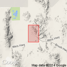
Pg. 17-21, pl. 1. Fish Haven dolomite. Described in Thomas Range, Juab County, Utah, where it is 280 to 303 feet thick; overlies Swan Peak formation and underlies Floride dolomite (new). [Age is Late Ordovician.]
Source: US geologic names lexicon (USGS Bull. 1200, p. 1354-1355).
- Usage in publication:
-
- Fish Haven dolomite*
- Modifications:
-
- Areal extent
- AAPG geologic province:
-
- Wasatch uplift
- Great Basin province
Summary:
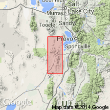
Ranges from 270 to 350 ft thick. One section 344+ ft thick measured on spur east-northeast of Pinyon Peak in W1/2 sec 34, T9S, R2W, Utah Co, Wasatch uplift, and second section 285 ft thick in N1/2 NE1/4 sec 13, T10S, R3W, Juab Co, in main Tintic district, Great Basin province. At both localities Fish Haven disconformably overlies Opohonga limestone and conformably underlies Bluebell dolomite. Some of the rocks assigned to Fish Haven in this report were assigned to lower one-third of Bluebell dolomite by Lindgren and Loughlin (1919). The Fish Haven-Opohonga placed at top of Leopard skin marker bed, a medium blue-gray mottled light blue-gray, coarsely crystalline, massive cliff-forming dolomite 96 ft thick in section one (above) and 11 ft thick in section two (above). Basal beds of Bluebell are medium to fine grained, blue to gray dolomite. Contains a fauna of Late Ordovician, Richmond age. Geologic map. Cross sections.
Source: GNU records (USGS DDS-6; Denver GNULEX).
- Usage in publication:
-
- Fish Haven Dolomite
- Modifications:
-
- Revised
- AAPG geologic province:
-
- Idaho Mountains province
Summary:
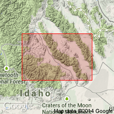
Follows Sloss (1954) by extending name from southeast ID into central Idaho, Idaho Mountains province into the southern Lemhi Range. Overlies Kinnikinic Quartzite and underlies Laketown Dolomite. A new member, Lost Creek Member, distinguished at base. Measured section of the Fish Haven and its new member described in Bear Canyon on west side above Little Lost River valley in SW1/4 sec 6, T11N, R26E. Silicified brachiopods identified. Is 1,202 ft thick in measured section. Zero isopach probably passes between Lemhi and Beaverhead Ranges. Of Ordovician, probably Late, but is minimum age has not been determined. Correlation chart. Block diagram. Cross sections.
Source: GNU records (USGS DDS-6; Denver GNULEX).
- Usage in publication:
-
- Fish Haven dolomite*
- Modifications:
-
- Areal extent
- AAPG geologic province:
-
- Great Basin province
Summary:
Found in the Thomas and Dugway Ranges, UT, Great Basin province. Occurs along east side of Spor Mountain, in Fandangle Canyon, small fault blocks in Dugway Range. Section 303 ft thick measured in NE1/4 NE1/4 sec 3, T13S, R12W. Section 226 ft thick measured 3,000 ft southwest of peak 6,755, south-central Dugway Range. At both localities Fish Haven overlies Swan Peak formation and underlies Floride dolomite. Averages 290 ft thick. Composed of a lower two-thirds of slope-forming thin- to medium-bedded, gray to black smooth-weathering dolomite and limestone and an upper one-third of massive ledge-forming black dolomite with dark gray mottling. Corals identified. Fossil list. Of Late Ordovician age. Geologic map. Stratigraphic sections.
Source: GNU records (USGS DDS-6; Denver GNULEX).
- Usage in publication:
-
- Fish Haven Dolomite*
- Modifications:
-
- Areal extent
- AAPG geologic province:
-
- Snake River basin
- Great Basin province
- Wasatch uplift
Summary:
Occurs in southeast ID, within parts of Snake River basin, Great Basin province, and Wasatch uplift. Correlative with Upper Ordovician Bighorn Dolomite in western WY; Bighorn represents all of Ordovician in western WY. [Authors use Fish Haven in ID and Bighorn in WY.] Fish Haven overlies Swan Peak Quartzite; underlies Laketown Dolomite. Isopach map and generalized section.
Source: GNU records (USGS DDS-6; Denver GNULEX).
- Usage in publication:
-
- Fish Haven Dolostone
- Modifications:
-
- Revised
- Redescribed
- Dominant lithology:
-
- Dolostone
- AAPG geologic province:
-
- Wasatch uplift
- Great Basin province
Summary:
First published use of Keller's (1963) subdivision of Fish Haven into three members which are, in ascending order: Paris Peak, Deep Lakes, and Bloomington Lake Members. Redescribes unit from dolomite, a mineral term, to dolostone, a rock term. Measured section in Tony Grove Lake area in Bear River Range, northeastern Cache Co, UT, Wasatch uplift, and in Lakeside Mountains area, northeastern Tooele Co, UT, Great Basin province. Overlies Swan Peak Formation. Disconformably underlies Laketown Dolostone (redescribed). Age in north-central UT probably late Late Ordovician based on fossil corals.
Source: GNU records (USGS DDS-6; Denver GNULEX).
- Usage in publication:
-
- Fish Haven Dolomite*
- Modifications:
-
- Areal extent
- AAPG geologic province:
-
- Great Basin province
Summary:
Areally extended into the southern Dog Valley Mountain area, west-central UT in the Great Basin province, where it overlies the Middle Ordovician Eureka Quartzite and underlies the Middle and Late Silurian Laketown Dolomite. Assigned a Late Ordovician age.
Source: GNU records (USGS DDS-6; Denver GNULEX).
- Usage in publication:
-
- Fish Haven Dolomite
- Modifications:
-
- Age modified
- Biostratigraphic dating
- AAPG geologic province:
-
- Wasatch uplift
Summary:
Early Silurian (Llandoverian) conodonts found in uppermost part of Fish Haven Dolomite at Tony Grove Lake, northern Cache Co, UT, Wasatch uplift. Mixed Ordovician and Silurian conodont association occurs in uppermost 4 m of Fish Haven and lowermost 1.5 m of overlying Laketown Dolomite. Ordovician-Silurian systemic boundary placed at base of mixed conodont association, 161 m above base of Fish Haven. Lithology and mixed conodont association indicate presence of a disconformity at base of mixed association. Overlies Swan Peak Quartzite, probably disconformably. Underlies Laketown Dolomite. Fossil list. Late Ordovician (latest Edenian) to Early Silurian (Llandoverian) age.
Source: GNU records (USGS DDS-6; Denver GNULEX).
- Usage in publication:
-
- Fish Haven Dolomite
- Modifications:
-
- Revised
- AAPG geologic province:
-
- Great Basin province
Summary:
Reexamination Lakeside Mountains section of Budge, Sheehan (1980) resulted in revision of contact between Fish Haven and overlying Laketown Dolomites, division of Fish Haven into 3 members, and modification of thickness Paris Peak Member of Fish Haven. Lakeside Mountains section located near Delle, UT, NE1/4 SE1/4 sec 32, T2N, R8W, Tooele Co, Great Basin province. Contact between Fish Haven-Laketown raised from between units 15 and 16 to between units 18 and 19 of Budge and Sheehan. Boundary changed because: 1) lithology upper part unit 18 similar to upper part Bloomington Lake Member of Fish Haven at type section, Bear River Range, ID; and 2) unit 19 contains Silurian brachiopod VIRGIANA UTAHENSIS, common in Tony Grove Lake Member of Laketown. Fish Haven at Lakeside Mountains section divided into, in ascending order, Paris Peak, Deep Lakes, Bloomington Lakes Members. Paris Peak incorrectly described as 10 ft (3 m) thick by Budge and Sheehan (their unit 1) as they measured only upper part unit. Re-measuring Paris Peak shows it 41.1 m thick. Units 2-15 of Budge and Sheehan assigned to Deep Lakes Member, 62.9 m thick; units 16-18 reassigned from Tony Grove Lake to Bloomington Lake, 73.4 m thick. Revised Fish Haven at Lakeside Mountains 177.4 m thick versus 65.9 m of Budge, Sheehan. Overlies Swan Peak Quartzite; disconformably underlies Laketown Dolomite. Stratigraphic chart. Late Ordovician (Cincinnatian and Richmondian) age.
Source: GNU records (USGS DDS-6; Denver GNULEX).
- Usage in publication:
-
- Fish Haven Dolomite
- Modifications:
-
- Not used
Summary:
Name Saturday Mountain Formation of Middle and Late Ordovician and Early Silurian age applied in this report to rocks in Lemhi Range, Lemhi Co, central ID in the Idaho Mountains province between the Kinnikinic Quartzite below and the Laketown Dolomite above. These same rocks have been called Fish Haven by Churkin (1962). The Lost River Member assigned to the Fish Haven by Churkin is reassigned to the Saturday Mountain Formation as its basal member. Rocks called Saturday Mountain represent an eastern carbonate facies, and are more closely related to and occupy the same stratigraphic position as Saturday Mountain of Bayhorse quad. Relation to Fish Haven Dolomite of southeast ID not known. Of Ordovician age.
Source: GNU records (USGS DDS-6; Denver GNULEX).
- Usage in publication:
-
- Fish Haven Dolostone*
- Modifications:
-
- Redescribed
- Dominant lithology:
-
- Dolostone
- AAPG geologic province:
-
- Wasatch uplift
Summary:
Is formation mapped in northwest Caribou Co, southeastern ID in Wasatch uplift. Above Middle Ordovician Swan Peak Quartzite; below Lower Mississippian Lodgepole Limestone. Formerly called Fish Haven Dolomite in this area; redescribed from dolomite to dolostone. Map unit consists of light-gray to medium-brownish-gray, knobby, locally cherty, finely to coarsely crystalline dolostone; strongly petroliferous odor. One area of outcrop in and near SW1/4 sec 20, T5S, R38E. Leatham (1985) has identified Early Silurian conodonts in the Fish Haven, which had formerly been assigned a Late Ordovician age. Thickness unknown, but probably greater than 190 m (630 ft) (Hladky, 1986). Age is Late Ordovician and Early Silurian.
Source: GNU records (USGS DDS-6; Denver GNULEX).
- Usage in publication:
-
- Fish Haven Dolostone*
- Modifications:
-
- Areal extent
- AAPG geologic province:
-
- Great Basin province
Summary:
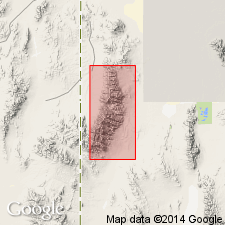
Extended into northern Deep Creek Mountains, south of Gold Hill, Tooele Co, UT, Great Basin province. Mapped undivided with overlying Laketown Dolostone. Lower part of Laketown and all of Fish Haven consist of thin- to thick-bedded dolostone with light-gray and dark-gray laminations. Overlies Chokecherry Dolomite. Late Ordovician age.
Source: GNU records (USGS DDS-6; Denver GNULEX).
- Usage in publication:
-
- Fish Haven Dolostone*
- Modifications:
-
- Redescribed
- Dominant lithology:
-
- Dolostone
- AAPG geologic province:
-
- Great Basin province
Summary:
Is redescribed as dolostone. The name "dolostone" is used for rocks composed predominantly of the mineral "dolomite" on Figure 2 and throughout this chapter, although in the literature it has been common practice to use dolomite rather than dolostone in formal names of dolomitic formations and members. Occurs in stratigraphic column for north-central UT (Great Basin province). Unconformably above Swan Peak Formation (Middle Ordovician); unconformably below Laketown Dolostone (redescribed) (Lower Silurian). Assigned to Cincinnatian Series (Upper Ordovician) and perhaps Llandoverian (Lower Silurian) after Leatham (1985) and Kellogg (in press).
Source: GNU records (USGS DDS-6; Denver GNULEX).
For more information, please contact Nancy Stamm, Geologic Names Committee Secretary.
Asterisk (*) indicates published by U.S. Geological Survey authors.
"No current usage" (†) implies that a name has been abandoned or has fallen into disuse. Former usage and, if known, replacement name given in parentheses ( ).
Slash (/) indicates name conflicts with nomenclatural guidelines (CSN, 1933; ACSN, 1961, 1970; NACSN, 1983, 2005, 2021). May be explained within brackets ([ ]).

